Each spring I enjoy getting out to snowshoe areas newly re-accessible after the snow melts out on the lower elevation access roads. This weekend then my dog Kodi and I met up with Summitpost�er Alexei and his friend Brett south of Randle, WA, for an off-trail summit of Sunrise Peak in the Dark Divide of Gifford Pinchot National Forest. I hit the road early from the Portland area and met up with them a bit before 7 AM in Randle where they�d spent the previous night. Soon we were caravanning south out of town on Forest Road 23. For a forest road the driving was superb as the stretch we traveled was all paved. Only when we turned onto the spur road did things get more interesting.
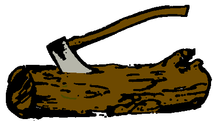
Before the spur�s first bend we sprung upon a small group of elk alarmed with morning visitors. They briefly assessed the vehicles and quickly resolved that the woods were a far better place to be and were out of sight before we reached their avenue of escape. Further ahead a few downed limbs were easily passed by driving along the shoulder of the gravel road, but then we reached a cross-work of two trees which my Subaru would�ve passed under okay, but Alexei and Brett in Brett�s work van had no chance of clearing. I quickly learned of Brett�s resourcefulness as he popped an axe out from his extensive tool collection and set to to work. The first tree was quickly a non-issue and was cleared, but to me the second was going to be more work than it was worth. Undeterred, Brett started again and within ten minutes had chipped enough wood away so that Alexei and I could push the tree, snapping the fallen stand at its new weak point and off to the side.
We drove some more, pausing once to clear some rocks off the road, and ultimately stopped a bit short of the goal �trailhead� by a snow pile just thick and hard enough to keep us from plowing through. We packed up and set out under a still gray and overcast morning sky.
Our route followed the road for under a quarter mile before we turned uphill where Alexei led along an animal trail he spotted paralleling a clearcut. After a steep 600 feet we crested back on the now snow covered spur road which had swung to north and back to meet us. I took the next turn at lead bushwhacking through some medium sized trees whose limbs were loaded with water. It was definitely worthwhile having my rain shell and pants on! Soon we hit a saddle where we donned our snowshoes. We started to get glimpses of blue and window-openings of trees which made us hopeful visibility would improve.
Alexei leading on the animal trail

Cresting on the road


Glimpses of hope


It was fun to run across the summer trailhead turnout where the trail signs were sticking out above the snow. I�m sure it will be a few months yet before anyone will be driving to that point. Our route now generally followed the same terrain as the trail. In fact further up where we turned west for Sunrise Peak we found a short stretch which was completely melted out. A brief but enticing view south of the Dark Divide ridge line opened in the gray, and to the west we could finally appreciate the last big stretch remaining to hit our goal.
Summer trailhead turnout


Kodi and Alexei along the melted out trail

Remnant cornice and clearing view of the ridge line (note Alexei on left, can you spot Kodi?  ) )

Teaser glimpse south

With mild temperatures and the sun beating on the overhead clouds the snow was really softening up. We stopped and one-by-one traversed the steepest portion of the ridge (where on the return I opted to use my ice axe). About 200 feet below the summit the south and west slope of the peak was completely melted out, so we stashed our snowshoes and scrambled the rest of the way ultimately running across the summer trail again.

Cloud ceiling getting higher


Sunrise Peak ahead

Scramble around to the west side, then on up to the summit

Finding the trail again


By the time we got to the summit�s lookout site the cloud ceiling had risen considerably opening views all around us. It was striking and beautiful; nearby Jumbo Peak and Dark Mountain to the south layered with white; Hat Rock, McCoy Peak, Mt Margaret and others further away to the west and southwest. The summit of Mt St Helens and Mt Adams were still hidden. Oddly enough the drainage east of Sunrise Peak seemed to act like a vacuum holding in clouds and largely blocking views in that direction. Only after a good 45 minute break when Alexei started down did it open up (thanks for moving along Alexei)!
View down on the ridge we took

McCoy Peak, Mt Margaret backcountry in the distance to the left


Dark Mountain (left, further away) and Jumbo Peak (right) bathed with snow

More peaks to the southwest


The snow under the exposed sun was super slushy on the return. Alexei said I was doing some telemark snowshoeing as I slid from foot to foot on the soft snow. Our return was slow while taking in the sights we hadn't been able to see going up.
Looking back to Sunrise


Brett and Goat Rocks Range


The return presented the most mysterious and captivating puzzle for the day. Near the summer trailhead Brett and Alexei spotted a single set of footprints in the snow along the stretch of forest road just west of our day's route. The tracks were headed towards Sunrise Peak and we could discern prints further away heading up the slopes away from the road. They had not been there that morning. Who else was out there? It seemed strange we had not heard, seen, or met them. Guessing they would have passed where we first crested on the road it was surprising to not find signs that anyone had passed there at all, so clearly they�d come in a different way. We gained a little more insight when we reached our cars and saw two sets of tire tracks through the (now softened) snow pile that had blocked our way. They must have driven in further on the road and started north of where we had.

Returning under summer like skies, Spud Hill on the right

Mystery foot prints

The now domineering Sunrise Peak

Kodi finds a quiet place for a short rest

Back along the steep animal trail


For me the trip was the definition of great day out: great workout, great views, great adventure, and great, great people. I�m looking forward to meeting up with Alexei and Brett again!
Our route to the peak

| 