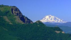
Table Mountain
From Oregon Hikers Field Guide
- Hikes to this location:
- Table Mountain Loop Hike (TH | <— —> | LOG)
- Table Mountain from Bonneville Hike (TH | <— —> | LOG)
- Weather forecast: NWS/NOAA
- Maps: Oregon Hikers Maps Google Maps
- Latitude, Longitude: 45.68948, -121.97811
- Elevation: 3417 feet
Description
One of the tallest and most distinct landmarks in the Columbia River Gorge, and perhaps one of the most difficult to climb on the Washington side, due to it's long 15 mile round trip ascent. This has long been a popular climb, due to the the inviting nature of it's distinct, triangular rocky face, it's proximity to the PCT for through-hikers, and the magnificent 360-degree view from the summit.
It is situated on the Washington side of the Gorge near Cascade Locks and acts as a centerpiece, dividing the 'East' side and the 'West' side of the Gorge. When you reach the summit of Table Mountain, be sure to see the southern-most and northern-most ends of the ridgeline - connected by a ribbon of well-traveled footpath.
This waypoint is at the southern end of the summit plateau, at the top of 1500 foot sheer cliff straight down. Real estate in this area is at a premium, so be aware of your footing and be conscientious of other hikers. This vantage affords you great views of the Columbia River from east to west. Look for a fantastic perspective of the v-shaped Eagle Creek Gorge extending from the Bonneville Dam way below you way out towards Mount Hood, which will be peaking over the southern horizon on a clear day.
This viewpoint also gives you the best view of the original Bridge of the Gods, the ancient land-bridge reported by Native Americans, actually a massive landslide that sheared off much of Table Mountain and Greenleaf Peak. While earlier studies indicated the damming of the Columbia by this landslide may have occurred around 1100 A.D., more recent evidence suggests that it may have been the result of the catastrophic earthquake of 1700, the last "big one" unleashed by the Cascadia Subduction Zone. Far below, the man-made current-day Bridge of the Gods seems minuscule relative to its natural counterpart. What is also quite evident from this spot is the number of small pothole like lakes that dot the flat lands along this partial land-bridge.
Following the left-hand side of the aforementioned "V" of Eagle Creek is Ruckel Ridge extending up to the top of the Benson Plateau, with Chinidere Mountain off in the distance. The somewhat triangular front of the forward face of the plateau somewhat resembles the face of Table Mountain, where you happen to be!
The northern end or "back end" of Table Mountain is where the true summit lies at 3417 feet. It offers better views of points east and north. On a clear day you will see Mount Rainier and Mount Saint Helens to the north and Mount Adams to your east. Just to your east is your neighbor Greenleaf Peak. Beyond it upriver, Wind Mountain and Dog Mountain are visible. To your southwest is your neighbor on the other side, Hamilton Mountain, although your perspective of it is dominated more by Hardy Ridge to its south.
In the springtime, this is a great place for wildflower lovers. While perhaps not as grandiose as the displays on Silver Star Mountain and Dog Mountain, there are a few peak weekends between May and June every year where they are out in force. In fact, until recently hikers could short cut the hike up to this summit by taking the "Eastway Trail" - one where you were literally surrounded by blooms, but the DNR have closed the steep trail in the interest of protecting the flora and the rapidly eroding soil.
More Links
- Table Mountain (Summit Post)
- Table Mountain (Washington Trails Association)
- Table Mountain (Skamania County, Washington) (Wikipedia)


