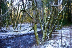
Step Creek Loop Hike
From Oregon Hikers Field Guide
- Start point: Reehers Camp Trailhead
- End point: Gales Creek Trail-Round Top Road Junction
- Trail log:
- Hike Type: Loop
- Distance: 7.6 miles
- Elevation gain: 860 feet
- High Point: 1425 feet
- Difficulty: Moderate
- Seasons: All year
- Family Friendly: No
- Backpackable: No
- Crowded: No
Contents |
Hike Description
The Step Creek Loop has been a work in progress but the Northwest Trail Alliance for several years now and, in the past, included a section of Rice Road to connect with the Gales Creek Trail. Finally, in 2017, Step Creek became a singletrack loop in and of itself serving hikers, bikers, and horses. This hike begins on the Gales Creek Trail and takes you across the alder-shaded Nehalem, crossing the now very overgrown Tillamook Bay Railroad to arrive at the junction with the Step Creek Trail. The loop actually begins near Plenty Big Creek; the description below follows it counter-clockwise as it winds in and out of drainages and then above Step Creek. New trail links repurposed but brushy logging roads to fashion the course. Four sturdy bridges have been built to support horse traffic. It should be noted that there are Timber Sale postings all around the trail, so you might be inconvenienced by nearby logging, and sections of the trail could be closed altogether during logging operations. As of 2017, most maps, including those posted at the Reehers Camp Trailhead show the old Step Creek Trail alignments. However, confusing side trails have been properly decommissioned and, as long as you stick to the main trail, you will find yourself back where you started.
Hike down an old road bed from the trailhead and then along the course of the Nehalem River shaded by Douglas-fir, red alder, and western red-cedar with an understory of sword fern, Oregon grape, and salmonberry. Soon enough, the trail rises to the Nehalem River bridge on Cochran Road. The Gales Creek-Triple C Trail Junction is across the road. Cross the bridge and pick up the Gales Creek Trail where it rises off a blocked-off logging road to the left.
Head downstream above the Nehalem and then cross a footbridge over an unnamed creek. The trail rises on a slope of Douglas-fir, Oregon grape, mossy vine maples, and salal. You will see some larger Douglas-firs just before you cross the tracks of the abandoned Port of Tillamook Bay Railroad. Wind up from the tracks, dip, and then rise to the Gales Creek-Step Creek Trail Junction, where you go left.
The sign states that Rice Road, the end of the Step Creek Trail, is 1.7 miles. Drop to a road bed, walk 15 yards to the right, and resume the trail. Traverse up in a Douglas-fir plantation. Switchback up to an old road bed at the crest of a hill and then switchback down twice. The trail now drops down an decommissioned, alder-lined road. Plenty Big Creek runs to the right. At a junction in the road, switchback down to the right (Keeping straight will take you on the old route of the Step Creek Trail, which leads back to the Nehalem River). Cross Plenty Big Creek on a footbridge and head up to reach another road bed above a slope of mossy alders.
Now Step Creek itself is running down to your left. Cross a footbridge over a tributary and pass through a road cutting. Continue upward above Step Creek until the road curves to the right up the hillside. If you are doing this as an in and out, this is a good point to turn back, but not before you take a game trail into the woods and down a short slope to the large boggy meadow on Step Creek’s east bank.
Continue up the road grade. Just before the Step Creek Trail-Rice Road Junction, a new trail segment branches off to the right at a well-marked junction, first dropping in shady Douglas-fir/alder woods and then winding up the slope to a logging spur. You'll cross one creek on a footbridge on this section. Hike out 0.3 miles to Rice Road and then go right to reach Round Top Road. Keep right here for about 50 yards to the Gales Creek Trail-Round Top Road Junction. Head down the Gales Creek Trail on a gentle slope in a thinned forest, crossing a road and then winding along a bench. Switchback down into dense forest, cross another road, and rise to the Gales Creek-Step Creek Trail Junction. Return to Reehers Camp from here.
Maps
Fees, Regulations, etc.
- Share trail with mountain bikers
Trip Reports
- Search Trip Reports for Step Creek Loop Hike
- Gales Creek – Step Creek – the Triple C
- 1/1/13 Four Trails From Reehers Camp (Tillamook StateForest)
Related Discussions / Q&A
- Search Trail Q&A for Step Creek Loop Hike
- New Stretch of Step Creek Trail
Guidebooks that cover this hike
- Riding Northwest Oregon Horse Trails by Kim McCarrel
- Afoot & Afield: Portland/Vancouver by Douglas Lorain (Describes old alignment)
- 50 Hikes in the Tillamook State Forest by the Tillamook State Forest Committee, Columbia Group Sierra Club (Describes old alignment)
More Links
- Step Creek Trail (MTB Project)
- Step Creek Trail (Trail Forks)
- Step Creek Trail (Hike Mondays)
- Tillamook Burn (Oregon Encyclopedia)
Contributors
- bobcat (creator)


