Luckiamute Wetland Hike
From Oregon Hikers Field Guide
- Start point: South Luckiamute Trailhead
- End Point: West Luckiamute Pond
- Trail Log:
- Hike Type: In and out
- Distance: 1.1 miles
- Elevation gain: 45 feet
- High Point: 180 feet
- Difficulty: Easy
- Seasons: All year
- Family Friendly: Yes
- Backpackable: No
- Crowded: No
|
Contents |
Description
The southern section of the Luckiamute Landing State Natural Area, about 300 acres, currently hosts a short trail to West Pond and a little beyond. The master plan calls for a more extensive trail system that leads to the banks of the Willamette. Extensive replanting of former agricultural land is underway on this site of the former Vanderpool farm. This section is most notable for its population of western pond turtles (Actinemys marmorata), classified as a sensitive species in Oregon primarily because the young are a favorite meal of invasive bullfrogs; few of the turtles grow to maturity. There are a number of beautiful large oaks in this area as well, and a string of ponds and sloughs run along an old river channel. This hike can be done in conjunction with the longer Luckiamute Landing Hike, in the larger northern section of the state park.
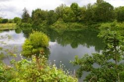
The trail heads down a road track and past a gate. Tall oaks line the crest here and woodpeckers flit about. The road track crosses an open area and then bends left, passing some nesting boxes. Swallows dip and swoop across this area in the spring. Pass under a grove of lichen-draped oaks. At a junction, a road leads right down to a deep slough choked with water plantain. Keep on the main track. Bushes of wild rose and poison oak line this old jeep road. Reach the West Pond and head up the west side of the pond around to its north end. A sign asks visitors not to approach the pond as this is western pond turtle nesting habitat. From a distance, you can see turtles basking on fallen trees on a sunny day. The track becomes a path that leads across a field blooming with cluster lilies in spring. It drops down into a thicket to the edge of a water lily-covered slough. Return the way you came.
Fees, Regulations, etc.
- No fee
- Dogs on leash
- Obey signs not to approach the West Pond too closely
- Port-a-potty at trailhead
Maps
Trip Reports
- Search Trip Reports for Luckiamute Wetland Hike
Related Discussions / Q&A
- Search Trail Q&A for Luckiamute Wetland Hike
Guidebooks that cover this hike
- Wild in the Willamette edited by Lorraine Anderson with Abby Phillips Metzger
- The Willamette River Field Guide by Travis Williams
More Links
- Luckiamute Landing State Natural Area (Oregon State Parks)
- Luckiamute State Natural Area Master Plan (Oregon State Parks)
- Luckiamute State Natural Area (Willamette River Initiative)
- "A Hidden Treasure at the Luckiamute State Natural Area" (Itemizer-Observer)
Page Contributors
- bobcat (creator)


