#777 Devil Canyon Trail Exploration - Sept 14, 2008

Discussions and Trip Reports for off-trail adventures and rediscovering lost trails
pablo
Posts: 1451
Joined: May 28th, 2008, 10:03 pm

#777 Devil Canyon Trail Exploration - Sept 14, 2008

Post by pablo » September 15th, 2008, 8:04 pm

(question: Is it Devil or Devils? I see both on maps).

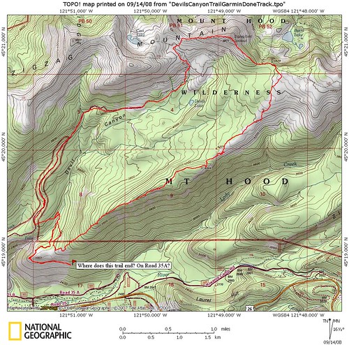
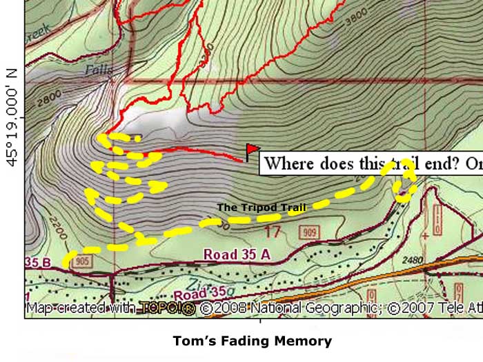
As happens frequently on Portland Hikers, a trip report is posted generating comments and observations leading others to do the hike or some variation or find some place nearby to go. So it was with this visit to the abandoned #777 Devils Canyon Trail. First JeffW posted this trip report on a loop to East Zigzag Mtn and Burnt Lake, I observed and commented on the Devils Canyon Trail that appears on JeffW's map but is missing from my newer version of the Government Camp Quad as seen here. Splintercat pointed out that yes this is a lost trail and on the list for TKO trail proposals. I checked my U of O map collection and found the #777 trail designation and its final appearance on the 1966 MHNF forest map. That's all I needed. The route would be Burnt Lake trail from the western trailhead, to East Zigzag Mtn for some views, then down the hill beyond the intersection with Burnt Lake trail, then west into the brush and a search for remnants of the #777.

Access to the western Burnt Lake Trailhead is via the very rough and rocky FR27/Enola Hill Rd. Coming from Portland, drive past Rhododendron and after about a mile and a half look to the left for the FR27 road sign. Go left on from 26 to FR27 and enjoy the brief bit of pavement before hitting the long rocky switchbacks that take you up the hill. There were passenger cars at the trailhead so it is done, just have to drive slowly and carefully - my ride was a motorcycle suited for this kind of travel.

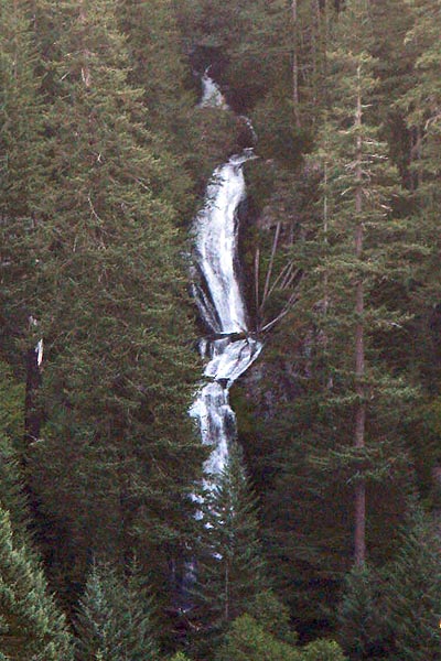
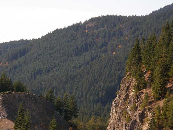
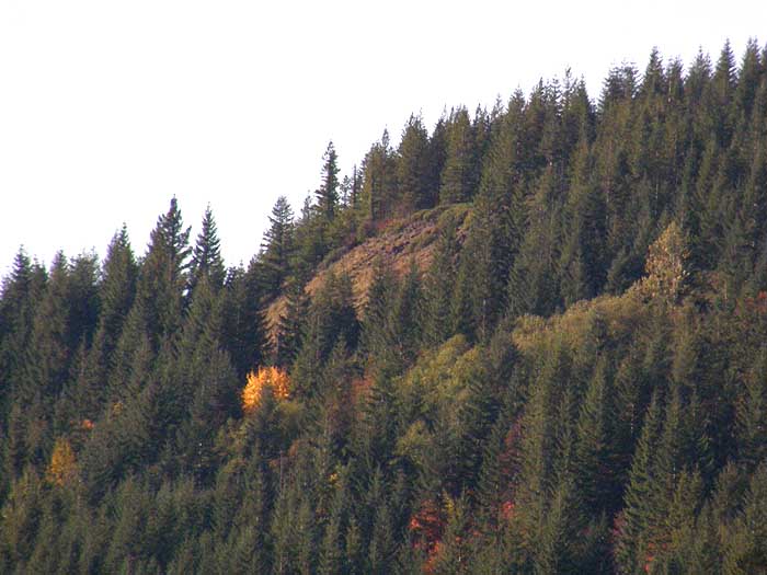
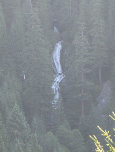
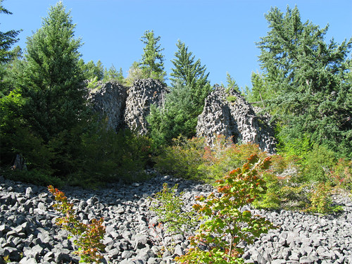
There's a nice rock outcropping a ways up Enola Hill Rd. that provides a nice view of Devil Canyon Falls. Apologies for the poor photo quality - best I could get.

Image

I parked at the trailhead got my wilderness permit properly attached to my pack and headed up the hill. The hike up the Burnt Lake trail was uneventful, met a group of backpackers coming down and I was pleasantly surprised to find lots of trail-side huckleberries. While I could have bypassed it, I took the route up East Zigzag Mtn. for some big views and I was not disappointed.

Image

Image

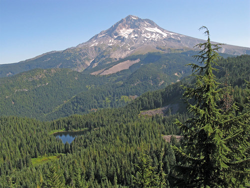
I have to admit, after seeing the sparse green meadows on Hood from the bare ridge on East Zigzag I just about scuttled my lost trail plans to go for the green and the big views on Hood.

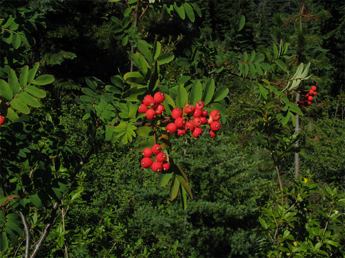
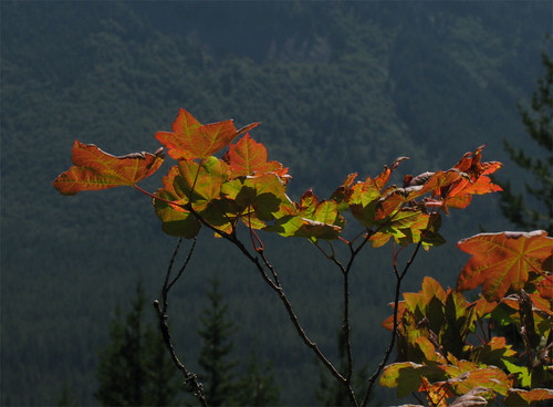
Lots of wild flowers on East Zigzag, some bright red berries, I should know what they are, they don't look edible.

Image

I arrived at the Burnt Lake intersection and while taking snapshots of the signage, a real USFS Ranger came up the trail from Burnt Lake, my first one. Good thing I was properly tagged as he was checking for permits. Very nice visit we chatted about various trail things and went our separate ways.

A little ways south on the Zigzag trail I turned west to begin the hunt for the #777. The going was easy through the top section with sparse trees, huckleberries, beargrass, and pretty little meadows. I landed on a fairly large opening where there was a post on the ground that looked like it might have been a trail marker but nothing definite like an obvious path or maintenance. From the age of the young trees it's pretty clear this upper part was burned clean 40-60 years ago and was slowly coming back. I followed as nearly as I could the trail markings on the map which took me southwest to the edge of the ridge going west. Here I started to see signs of trail maintenance. Looks like after the burn there were lots of standing snags and I'm guessing as a preemptive strike against the snags falling on the trail, they were cut down if near the trail. Not a logging operation, the snags were left where they fell and in one case a cut snag fell on the trail for which a path was cut through the log . The snag likely fell in the wrong direction and landed on the trail rather than down the hill. Here's the spot with a chunk cut out of the snag that fell on the trail.

Image

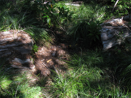
So there was a trail through here. At one point for about a quarter of a mile I kept running into a dry creek bed and since it was so close to my track for the #777 I wonder if the creek bed was actually the trail as can happen sometimes where a trail creates a channel for standing water. Eventually the creek went over the edge of the ridge.

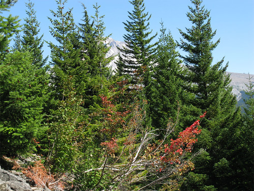
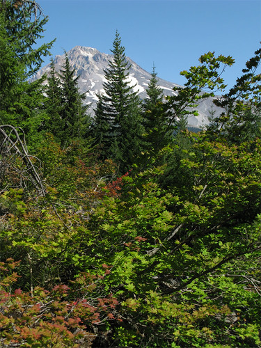
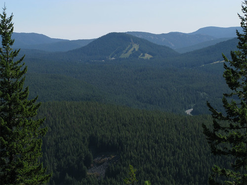
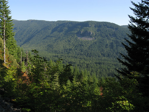
As TKO has this as a possible trail to include in the 20 year plan, I thought I'd do quick evaluations of viewpoints along the ridgeline. When this trail was actively used some years ago I imagine Mount Hood was in view for most of it's length but the second growth trees effectively block that item at every opportunity. Like here:

Image

A little better here:

Image

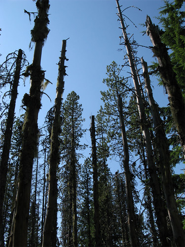
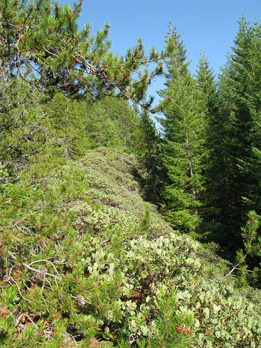
Ran into a stand of lodgepole pine. Did not look healthy.

Image

On the exposed slopes to the south vine maple is turning to fall colors.

Image

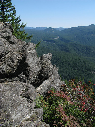
The further down the ridge line I went the worse the brush got, going from gentle huckleberries to dense thickets of rhododendron interspersed with vine maple. Pretty tough going in sections. Still, there were enough rock outcroppings for some nice views east to Multipor Mountain. I could see traffic on highway 26 as it snaked its way up the valley towards Government Camp.

Image

Image

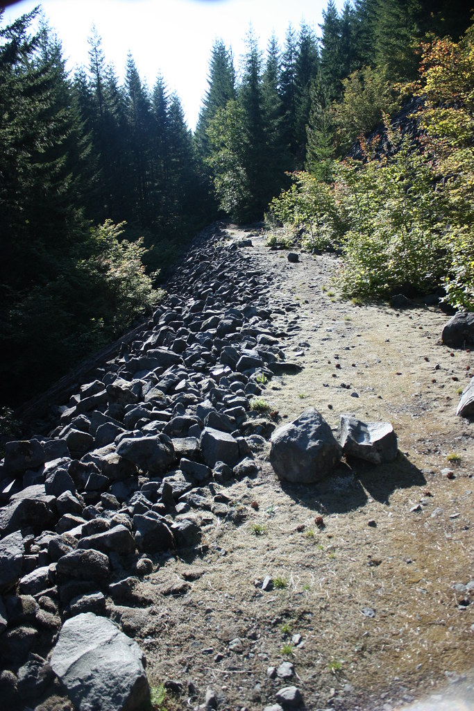
As I made my way towards the end of the ridge I passed through a unit showing signs of selective thinning of trees, so I figured any remnant of trail through there would be obliterated by the logging operation so I pretty much gave up on finding anything left of the #777. It was around 4:00PM when I made the turn north to meet with Devils Creek. I turned the corner, still following the trail as on the map when I ran into - ta-dum - 'the trail' - ta-dum. I followed it to the creek as it was clearly a piece of the #777 matching perfectly with the map. I then backtracked this obviously well maintained, flagged, and blazed section of trail to as far as I could given the time. There was no blowdown, easy to follow up to a certain point where the trail just stopped. What? I looked around and saw a corridor that looked inviting so I proceeded. Eventually it turned to a decommissioned logging road with a clear trail - the only problem was instead of going up the hill, it started to go down. This was no faint path but fairly used. I came to the point of the ridge where I ran into a nice thicket of red barked manzanita heading up the ridge line, very pretty.

Image

The views from the manzanita patch towards Hunchback Mountain are pretty decent. I kept going down the road and came to a neat rock outcropping - likely good views from up top if you can stand the exposure.

Image

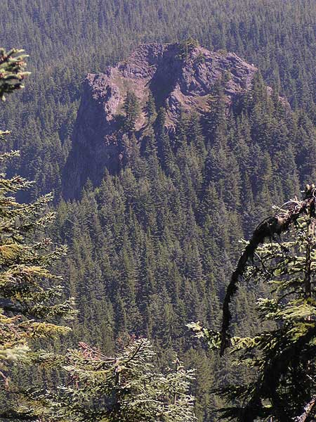
At the same spot I turned south and spied an interesting rock bluff on Tom Dick and Harry Mtn. and wondered if it was from the same formation as the outcropping above me.

Image

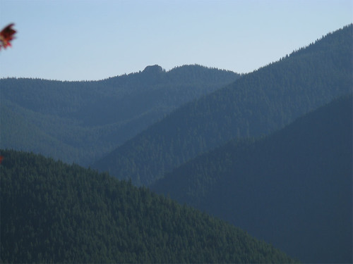
Way off in the distance, the wart-like projection of High Rock showed itself on the horizon.

Image

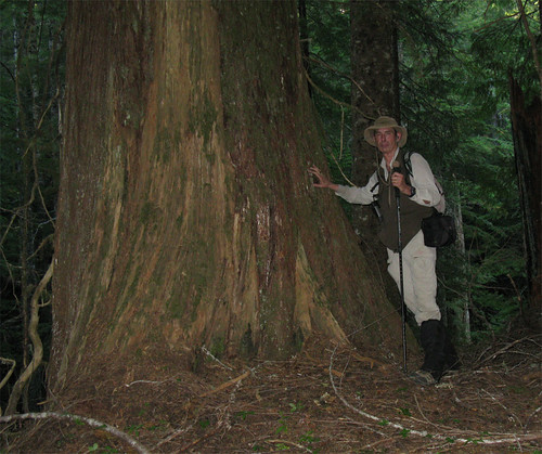
I could go no further as the day was ending so I reluctantly backtracked the trail to Devils Creek. Like I hadn't seen enough for one day I came across some old timers by the trail, a little grove of old growth red cedar and Doug fir - worthy of human-tree comparisons. Red cedar:

Image

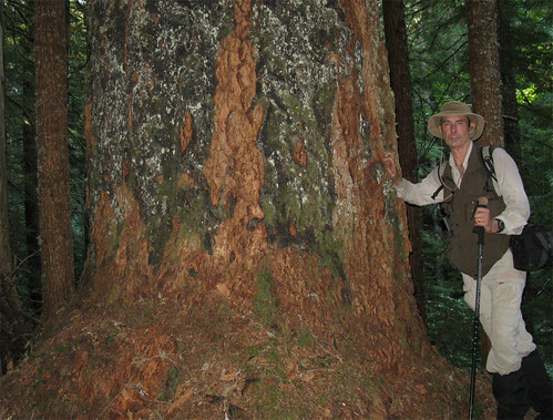
Big fire scarred Doug fir.

Image

Enough for me, I'll likely return to learn more about the unknown trail to follow it all the way down. As this is clearly maintained by locals I have doubts about posting a reference to it. It looks like it gives early and Enola-Hill-free access to the higher trails straight from 26 and would be a great trail to use for this purpose.

A reinvigorated #777 trail would be quite a project - enough rock outcroppings and talus slopes for views to the south. The slope is not bad so going straight up the ridge line is a possibility.

About 12 miles, 2600' feet.

Image
The future's uncertain and the end is always near.

User avatar
NWJeff
Posts: 40
Joined: September 2nd, 2008, 5:13 pm
Location: Hillsboro

Re: #777 Devil Canyon Trail Exploration - Sept 14, 2008

Post by NWJeff » September 15th, 2008, 9:34 pm

Fascinating bushwhack, Paul. You have me interested now. I didn't even realize this trail was abandoned since it was marked on my old map software. I guess I will be sure to keep the old version loaded on my computer after I get the new version installed so I can keep an eye out for these oldies.

I need to go back and get familiar with your route.

One question, after you went off the Burnt Lake trail and appear to have been mostly on the ridge did you come across any creeks or springs for water? Or was it pretty much dry until getting back down to Devils Creek?

User avatar
Splintercat
Posts: 8333
Joined: May 28th, 2008, 10:03 pm
Location: Portland
Contact:

Re: #777 Devil Canyon Trail Exploration - Sept 14, 2008

Post by Splintercat » September 15th, 2008, 10:54 pm

Wow! Great recon, Paul! That is really going to be helpful in developing the TKO concept. I'll send you a link to the working proposal, offline.

The area you've explored on the west end (near the falls) is Devils Hill, and the trail you came upon is probably an updated version of the Tripod Trail -- a route that begins at the little viewpoint loop, from the end of Road 35A. If you park at the end of 35A, and follow a path up the little creek canyon, you'll eventually come to the upper of two rocky bluffs, and views of Mount Hood. The trail climbs down the lower bluff along a series of ledges, but is a bit harder to find, there. The Tripod Trail (as it was called in the 70s) branches off the loop trail in the forest, just short of the upper viewpoint. I haven't been up there in year, but at one time, the Tripod Trail traversed the canyon wall above 35A/35B, then joined an old logging track that switchbacked up to the top of Devils Hill. You might have come across a new alignment - these trails are maintained by cabin owners, and thus the foot traffic you noticed.

Your photo of the knob looks like it might be what I call the Devils Tooth - I posted this on an earlier thread that you started about the Salmon Fin (many other names) and the various monoliths that pop up around the Salmon-Huck. This is the Devils Tooth from the trail to Devils Peak:

Image

It's located in the saddle between Devils Peak and the various high points to the east, toward Veda Butte (the Wolf Camp Butte area). Another intriguing destination..!

You are right about the burn on Zigzag Mountain, and as the topos show, it was still fairly open as recently as the 1960s. Here's a 1933 view from Devils Peak, and it stretches from West Zigzag to Hood - so you can see that there wasn't much timber back then!

Image

Devils Hill can be seen below Mt. St. Helens. The open terrain in the foreground is the ridge that the Cool Creek Trail follows.

Hopefully, you don't mind, but I did a bit of photoshop work on your Devil Canyon Falls image to help with the glare - still plenty of water, there, for early September, but much less fearsome than in spring runoff!

Image

Thanks for exploring the area, Paul - that's super helpful info for our TKO work!

Tom :)

User avatar
Splintercat
Posts: 8333
Joined: May 28th, 2008, 10:03 pm
Location: Portland
Contact:

Re: #777 Devil Canyon Trail Exploration - Sept 14, 2008

Post by Splintercat » September 15th, 2008, 11:08 pm

Okay, more map butchery -- this is the Tripod Trail, at least as it appears in my memory! I last hiked this almost exactly 30 years ago, sometime in 1978. The traverse portion was a push through deep ferns, and the switchback portion was along an old logging skid. The switchbacks might have been broader - you might have been on one -- or cabin owners may have rebuilt the trail outside the clearcut area, given how quickly it was filling in with alder and brush.

Image

The name "Tripod Trail" came from the impromptu cairns that marked the route - three sticks tied at the top, forming a tripod 3-4 feet high. Worked great, and much to Jamie and Jeff's chagrin, I even tried a bit of this up in the Owl Point area (with poor success!)

One more tidbit, Paul: the viewpoint at Devils Hill can be seen from Highway 26, just below the rock fin created by the first large road cut after you leave the valley floor, heading east. I think you curled below it, and might have passed a route to the top - not sure.

Tom

pablo
Posts: 1451
Joined: May 28th, 2008, 10:03 pm

Re: #777 Devil Canyon Trail Exploration - Sept 14, 2008

Post by pablo » September 16th, 2008, 6:51 pm

NWJeff wrote:Fascinating bushwhack, Paul. You have me interested now. I didn't even realize this trail was abandoned since it was marked on my old map software. I guess I will be sure to keep the old version loaded on my computer after I get the new version installed so I can keep an eye out for these oldies.

I need to go back and get familiar with your route.

One question, after you went off the Burnt Lake trail and appear to have been mostly on the ridge did you come across any creeks or springs for water? Or was it pretty much dry until getting back down to Devils Creek?
Totally dry until Devils Creek, I carried 3 quarts.

--Paul
The future's uncertain and the end is always near.

pablo
Posts: 1451
Joined: May 28th, 2008, 10:03 pm

Re: #777 Devil Canyon Trail Exploration - Sept 14, 2008

Post by pablo » September 16th, 2008, 7:14 pm

Splintercat wrote:Wow! Great recon, Paul! That is really going to be helpful in developing the TKO concept. I'll send you a link to the working proposal, offline.
Thx...
Splintercat wrote: The area you've explored on the west end (near the falls) is Devils Hill, and the trail you came upon is probably an updated version of the Tripod Trail -- a route that begins at the little viewpoint loop, from the end of Road 35A. If you park at the end of 35A, and follow a path up the little creek canyon, you'll eventually come to the upper of two rocky bluffs, and views of Mount Hood. The trail climbs down the lower bluff along a series of ledges, but is a bit harder to find, there. The Tripod Trail (as it was called in the 70s) branches off the loop trail in the forest, just short of the upper viewpoint. I haven't been up there in year, but at one time, the Tripod Trail traversed the canyon wall above 35A/35B, then joined an old logging track that switchbacked up to the top of Devils Hill. You might have come across a new alignment - these trails are maintained by cabin owners, and thus the foot traffic you noticed.
I imagine locals have carved trails in all sorts of interesting places here and I'm definitely returning to this area for more explorations.
Splintercat wrote: Your photo of the knob looks like it might be what I call the Devils Tooth - I posted this on an earlier thread that you started about the Salmon Fin (many other names) and the various monoliths that pop up around the Salmon-Huck.
Now that I look at the map my claim that it is High Rock is unsupported I'll go with your ID.
Splintercat wrote: You are right about the burn on Zigzag Mountain, and as the topos show, it was still fairly open as recently as the 1960s. Here's a 1933 view from Devils Peak, and it stretches from West Zigzag to Hood - so you can see that there wasn't much timber back then!

Devils Hill can be seen below Mt. St. Helens. The open terrain in the foreground is the ridge that the Cool Creek Trail follows.
Thanks for the most interesting historical photo, easy hiking along those ridges back then and great views.
Splintercat wrote: Hopefully, you don't mind, but I did a bit of photoshop work on your Devil Canyon Falls image to help with the glare - still plenty of water, there, for early September, but much less fearsome than in spring runoff!
No problem...
Splintercat wrote: Thanks for exploring the area, Paul - that's super helpful info for our TKO work!

Tom :)
It was a great day, thanks for the lead on this one. The western end of the #777 is just back down the road a bit from the Burnt Lake TH right in a big bend in the road. The TH is marked with a blue ribbon on a sugar pine and a couple of small rock cairns. You can see the path go up the short embankment from the road - on the way I saw it and wondered if there was a trail there. Getting across Devils Creek is easy, there is a choice of several large logs across the creek and the trail is easy to follow on both sides.

--Paul
The future's uncertain and the end is always near.

User avatar
fettster
Posts: 1720
Joined: May 28th, 2008, 10:03 pm
Location: Hillsboro, OR

Re: #777 Devil Canyon Trail Exploration - Sept 14, 2008

Post by fettster » September 17th, 2008, 9:02 am

Quite the interesting post, brings back good memories from my first hike near Mt Hood up to EZZ Lookout. I recall pulling off alongside the road and getting a glimpse of those falls, though I never knew the name until now. I remember driving that bumpy road in my long Chevy Lumina quite well. What do you think of the prospects of snowshoeing up the "Devils Canyon Trail" ridge to get some views from near EZZ?

pablo
Posts: 1451
Joined: May 28th, 2008, 10:03 pm

Re: #777 Devil Canyon Trail Exploration - Sept 14, 2008

Post by pablo » September 17th, 2008, 9:35 pm

fettster wrote:Quite the interesting post, brings back good memories from my first hike near Mt Hood up to EZZ Lookout. I recall pulling off alongside the road and getting a glimpse of those falls, though I never knew the name until now. I remember driving that bumpy road in my long Chevy Lumina quite well. What do you think of the prospects of snowshoeing up the "Devils Canyon Trail" ridge to get some views from near EZZ?
The slope is very nice so I don't think there'd be avalanche problems so I think it would be a good showshoe route. Getting there might be a problem as the start of the ridge is at 3000'. I really want to know more about that trail down to 26 - the slope along there is pretty steep but it might not get a lot of snow in normal years.
The future's uncertain and the end is always near.

User avatar
Splintercat
Posts: 8333
Joined: May 28th, 2008, 10:03 pm
Location: Portland
Contact:

Re: #777 Devil Canyon Trail Exploration - Sept 14, 2008

Post by Splintercat » October 25th, 2008, 10:23 am

Paul, a bit more recon on this area: I don't think I mentioned it in my previous post, but the little loop I've shown at the end of 35A is an easy-to-follow trail that visits two rocky viewpoints above the Zigzag River (called High Rocks and Low by cabin owners). The Tripod Trail starts where the loop trail enters the woods at the edge of High Rocks. The easiest way to find the trail to High Rocks is to park at the end of Road 35 A, and follow the obvious path that heads straight and slightly left from the end of the road, paralleling a small creek. The Low Rocks return path is somewhat etched into rock, and easy to follow - but a bit harder to spot.

Also, I stopped along US 26 the other day to get some photos of what I call Devils Hill -- and what I believe to be the manzanita ridgeline in your photo. When I zoomed way in on these photos, there were, indeed, manzanita along the upper margin of the open slope. Back in the 1970s, the Tripod Trail headed for this viewpoint, though the clearcut below the viewpoint was much less recovered back then.

Here are a couple photos - first, showing the Laurel Hill cut for reference, then a zoom of the Devils Hill viewpoint:

Image

Image

-Tom

pablo
Posts: 1451
Joined: May 28th, 2008, 10:03 pm

Re: #777 Devil Canyon Trail Exploration - Sept 14, 2008

Post by pablo » October 25th, 2008, 2:39 pm

Splintercat wrote:Paul, a bit more recon on this area: I don't think I mentioned it in my previous post, but the little loop I've shown at the end of 35A is an easy-to-follow trail that visits two rocky viewpoints above the Zigzag River (called High Rocks and Low by cabin owners). The Tripod Trail starts where the loop trail enters the woods at the edge of High Rocks. The easiest way to find the trail to High Rocks is to park at the end of Road 35 A, and follow the obvious path that heads straight and slightly left from the end of the road, paralleling a small creek. The Low Rocks return path is somewhat etched into rock, and easy to follow - but a bit harder to spot.

Also, I stopped along US 26 the other day to get some photos of what I call Devils Hill -- and what I believe to be the manzanita ridgeline in your photo. When I zoomed way in on these photos, there were, indeed, manzanita along the upper margin of the open slope. Back in the 1970s, the Tripod Trail headed for this viewpoint, though the clearcut below the viewpoint was much less recovered back then.

Here are a couple photos - first, showing the Laurel Hill cut for reference, then a zoom of the Devils Hill viewpoint:

[...]

-Tom
Tom,

Thanks for the info on 35a - I was hoping it was OK to park there.

That does look like the manzanita ridgeline I visited and if in the first picture you just posted, you follow those three dots of yellow maple trees up to a rock outcropping (in my report, the next picture after the manzanita ridge photo), this is where I followed a well constructed road - this is just beyond the ridge and runs along the base of the rock outcropping:

Image

--Paul
The future's uncertain and the end is always near.

Post Reply