Labor Day Timberline Loop

This forum is used to share your experiences out on the trails.
Post Reply
User avatar
drm
Posts: 6152
Joined: May 28th, 2008, 10:03 pm
Location: The Dalles, OR
Contact:

Labor Day Timberline Loop

Post by drm » September 5th, 2017, 6:33 pm

Did the loop on Labor Day weekend and did it in the CCW direction - opposite of the direction most people do it. This way we were not competing with the holiday weekend crowds for campsites and we got the hardest parts (with the most altitude changes) done the first day. We also went farther that first day, with our mileages being 17, 15 and 10 miles, according to a GPS reading. The weather was hot and smoky from wildfires in the region, but the first day was not as smoky.

I lost some photos because of a problem with my camera (which may get retired with a hammer soon) and also because it just got too hazy and smoky on the second and third days to justify a lot of photos.

Starting from the Timberline Lodge (one of two places were you can drive to the trail), this was the view of Mt. Hood as we descended a thousand feet to the White River
Image

After climbing back up that thousand feet, the trail is relatively flat while crossing the Mt Hood Meadows ski area for a few miles, with some decent views of the mountain
Image

It's late in the year for wildflowers, but here were some western pasque flowers, otherwise known as hippie heads
Image

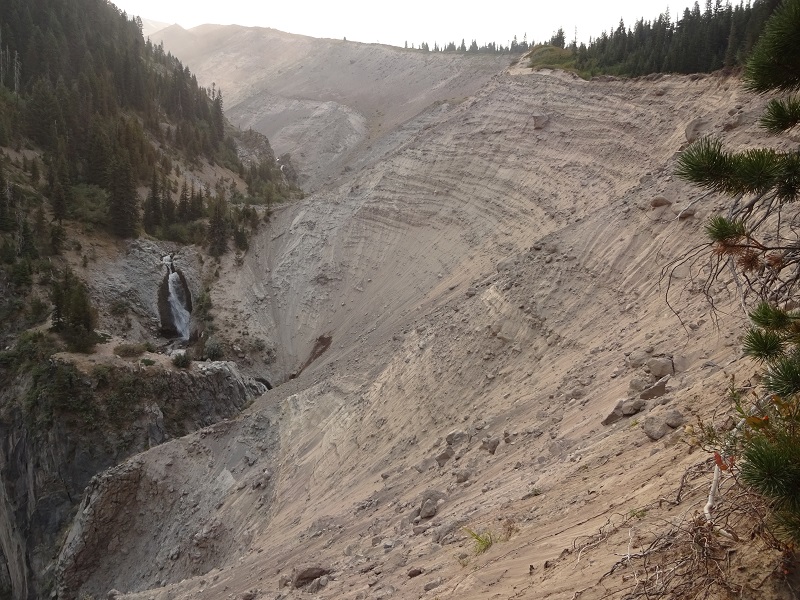
The waterfall in Heather Canyon, at the far end of the ski area
Image

And Betsy crossing branches at the lip of the falls
Image

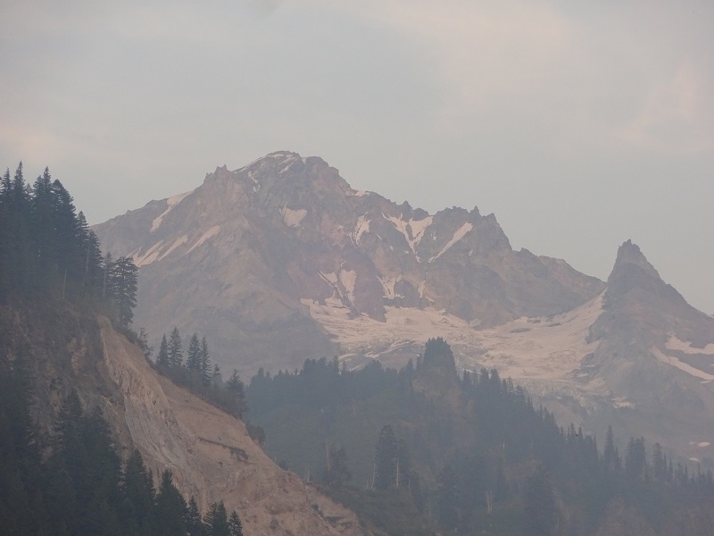
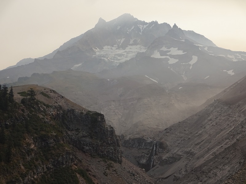
With Heather at the left, we see the larger Clark Canyon that it is a part of
Image

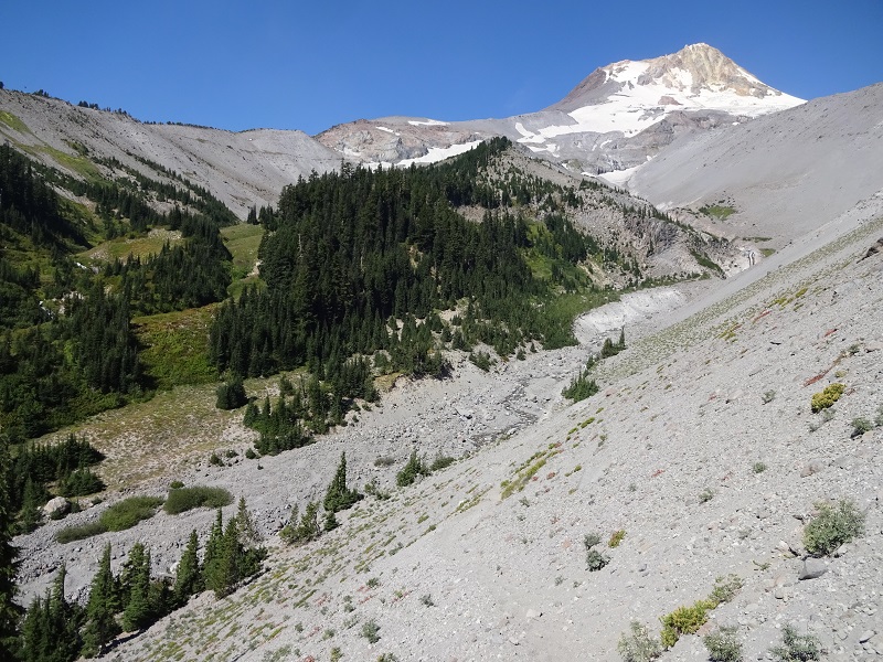
This is Newton Canyon, with Gnarl Ridge on the far side. The trail loops around the high point, called Lamberson Butte, and then follows the ridge line, for the longest climb of the day: 1700 feet.
Image

The trail is quite pleasant while looping around Lamberson Butte
Image

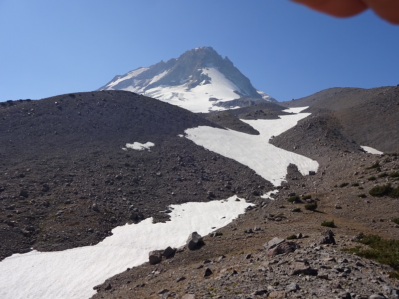
Then gets quite stark above, here at about 6600 feet on Gnarl Ridge
Image

This is taken at the Timberline High Point at 7300 feet, where there area few small campsites and some streams
Image

Approaching the High Point
Image

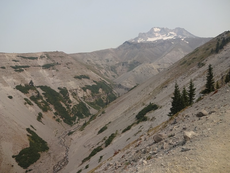
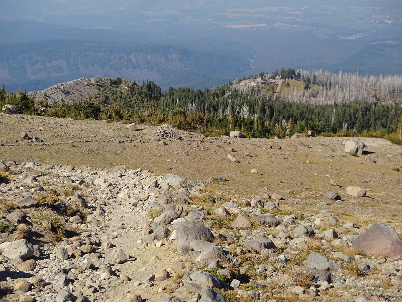
Even more stark north of the High Point, with Mt Adams in the distance (Adams would not be visible the next day)
Image

Finally, Cloud Cap Inn in the distance. The trail passes through the nearby car campground
Image

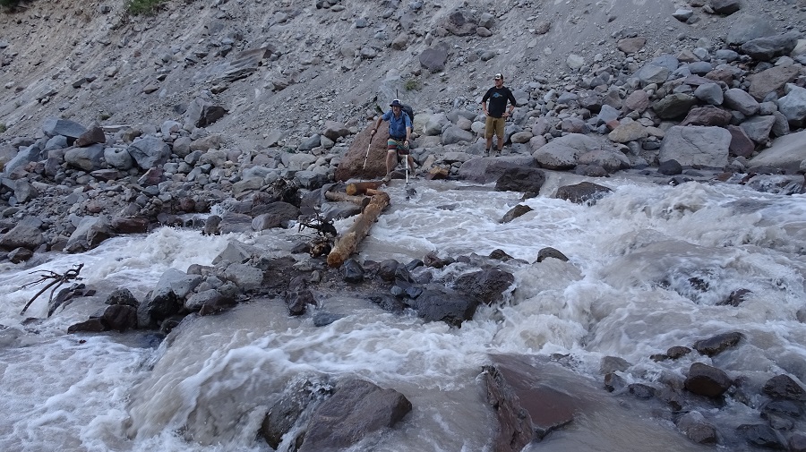
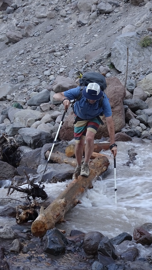
After dealing with the long drop to cross the Eliot Creek (a tricky crossing on logs - many preferred to wade, photos lost due to my !@^$*# camera) and climb back up, we camped near Compass Creek, both of the campsites near there being open. It was an 11 hour day and we were beat. The next had minimal elevation change by comparison but with the wildfire smoke having moved in, I took fewer pics.

Here is a gorgeous cascade that shows the different flavor of the hiking from the previous day's alpine terrain
Image

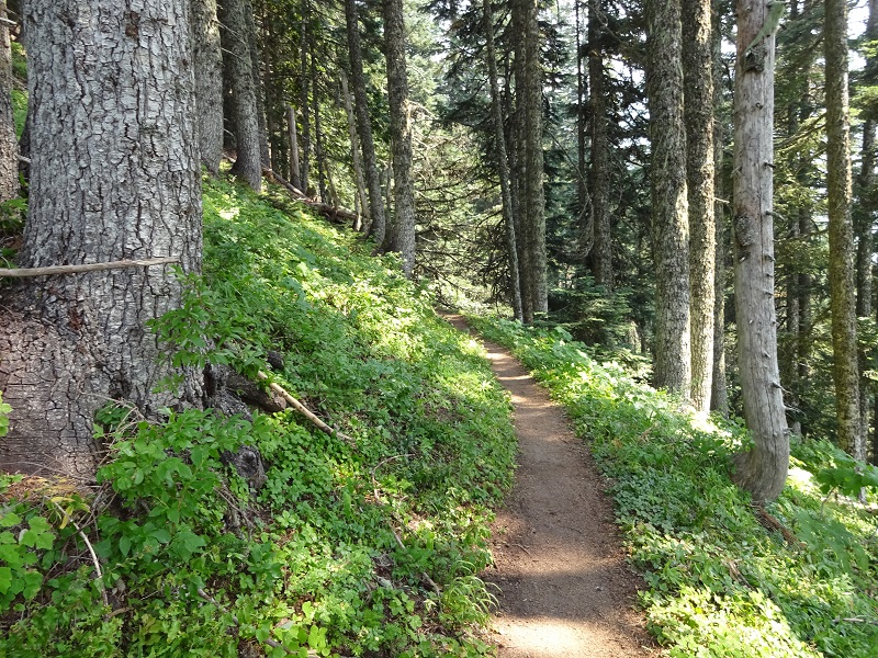
And a nice shaded trail to protect from the relentless heat of the heatwave
Image

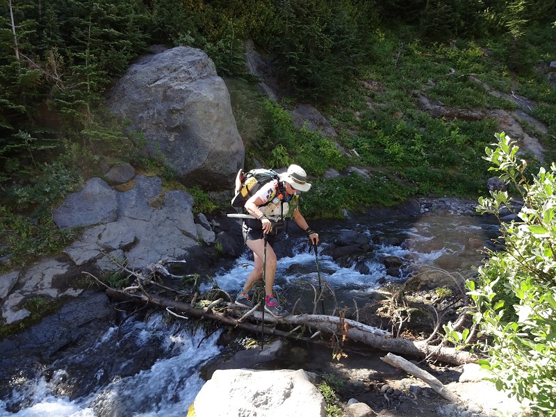
This led to the Muddy Fork, the only crossing that required a wade, about knee deep
Image

Soon after, we crossed the Sandy River on a log and you can see the effect of the smoke
Image

Immediately after crossing the Sandy, we entered the canyon of Rushing Water Creek and were thrilled to find all the camps still available. It's a deep canyon of thick forest and lush undergrowth and the temperature dropped by 10 degrees in a matter of seconds. Unlike the previous day, after 15 relatively easier miles, we got in at 4:30 and had time to relax, while the CW herd was crowding into Cloud Cap campground or around the stone hut above.

The last day started with the biggest climb of the trip, about 2000 feet. But it was almost completely shaded and a nice gradual gain first thing in the morning.

Eventually you get a great view of the chasm that the Sandy River descends
Image

Still smoky, but this part of the hot hike had fabulous huckleberries, which really help make up for the weather
Image

In the final push to get back to the Timberline Lodge, the biggest obstacle is Zigzag Canyon, but a few miles later, we were done.
Image

bb12creek
Posts: 5
Joined: February 15th, 2013, 12:05 pm

Re: Labor Day Timberline Loop

Post by bb12creek » September 8th, 2017, 1:36 pm

Hey Dean,

That's me and my wife in the photo you posted of the Muddy Fork crossing. We were leap frogging a bit on Sunday around the north side of the mountain. We ended up camping at the overused sites about a quarter mile shy of the Sandy.

I've actually read some of your blog before and it looks like we share an interest for canoeing. I've done a lot of trips in eastern Canada's sub arctic.

Wish I knew you were you when we ran into each other. Quite the crowds out there. The only other time I hiked around Hood was in July of 2009 I think. Lots of snow and very few people.

Cheers

User avatar
adamschneider
Posts: 3716
Joined: May 28th, 2008, 10:02 pm
Location: SE Portland
Contact:

Re: Labor Day Timberline Loop

Post by adamschneider » September 8th, 2017, 3:01 pm

drm wrote:did it in the CCW direction - opposite of the direction most people do it.
Why do most people do it clockwise? Is it to get the boring parts between Paradise Park and Bald Mountain out of the way early?

User avatar
drm
Posts: 6152
Joined: May 28th, 2008, 10:03 pm
Location: The Dalles, OR
Contact:

Re: Labor Day Timberline Loop

Post by drm » September 12th, 2017, 6:28 am

Okay, I got some pics from my friend of the Eliot crossing as it was on Labor Day. With the heat now passed, the water is probably a lot lower.

Eliot Ck, you need to hop some rocks with water running over them after the logs
Image

That's me starting out
Image

That log was wet, but not slippery. A guy who had just crossed told me it was "tacky."
Image

User avatar
retired jerry
Posts: 14417
Joined: May 28th, 2008, 10:03 pm

Re: Labor Day Timberline Loop

Post by retired jerry » September 12th, 2017, 7:09 am

"With the heat now passed, the water is probably a lot lower."

Now is probably the perfect time to do Timberline trail

If anyone passes me, say hi :)

User avatar
drm
Posts: 6152
Joined: May 28th, 2008, 10:03 pm
Location: The Dalles, OR
Contact:

Re: Labor Day Timberline Loop

Post by drm » September 12th, 2017, 7:56 am

retired jerry wrote:Now is probably the perfect time to do Timberline trail
Really - now. Next week the water will be up again with potential major rains! (starting some time Sunday)

User avatar
retired jerry
Posts: 14417
Joined: May 28th, 2008, 10:03 pm

Re: Labor Day Timberline Loop

Post by retired jerry » September 12th, 2017, 8:12 am

Probably will be good after any major rains.

Post Reply