
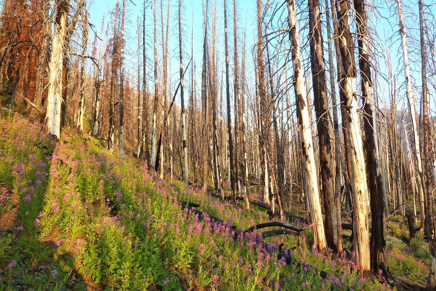
So: finally hitting the trail for an alpine start of 4pm, we headed down Hurricane Creek. I hadn't been here since 4th of July, 2015, which apparently was right before a big fire broke out in the area. Sacajawea (highest point in the Wallowas) looms ahead.

It took us a few tries, but we located the crossing of Hurricane Creek to access the abandoned Thorp Creek trail.

Higher on the Thorp trail, we determined that we would have to drop a lot to cross Thorp Creek and gain the N ridge of Sac. Due to the lateness of the day, we decided to bag this part of the plan and continue up the trail. The N ridge looks like a blast though, so we'll save it for another day.


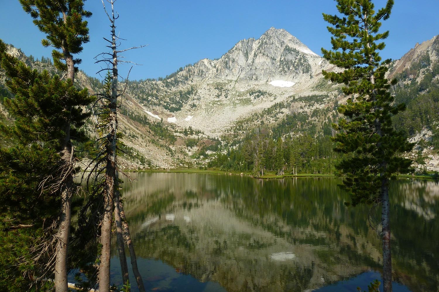
We pitched camp in the basin under the E face of Sac. Packing up the next morning.

Let's take a closer look. Really cool basalt intrusions up there. I've done Sac twice before, but never from this side.

New hiking companion on my pack. Never seen a jumping spider with such red legs before!


Foot of the east(ish) ridge of Sac - as Brad noted, there is a user trail all the way up this thing.


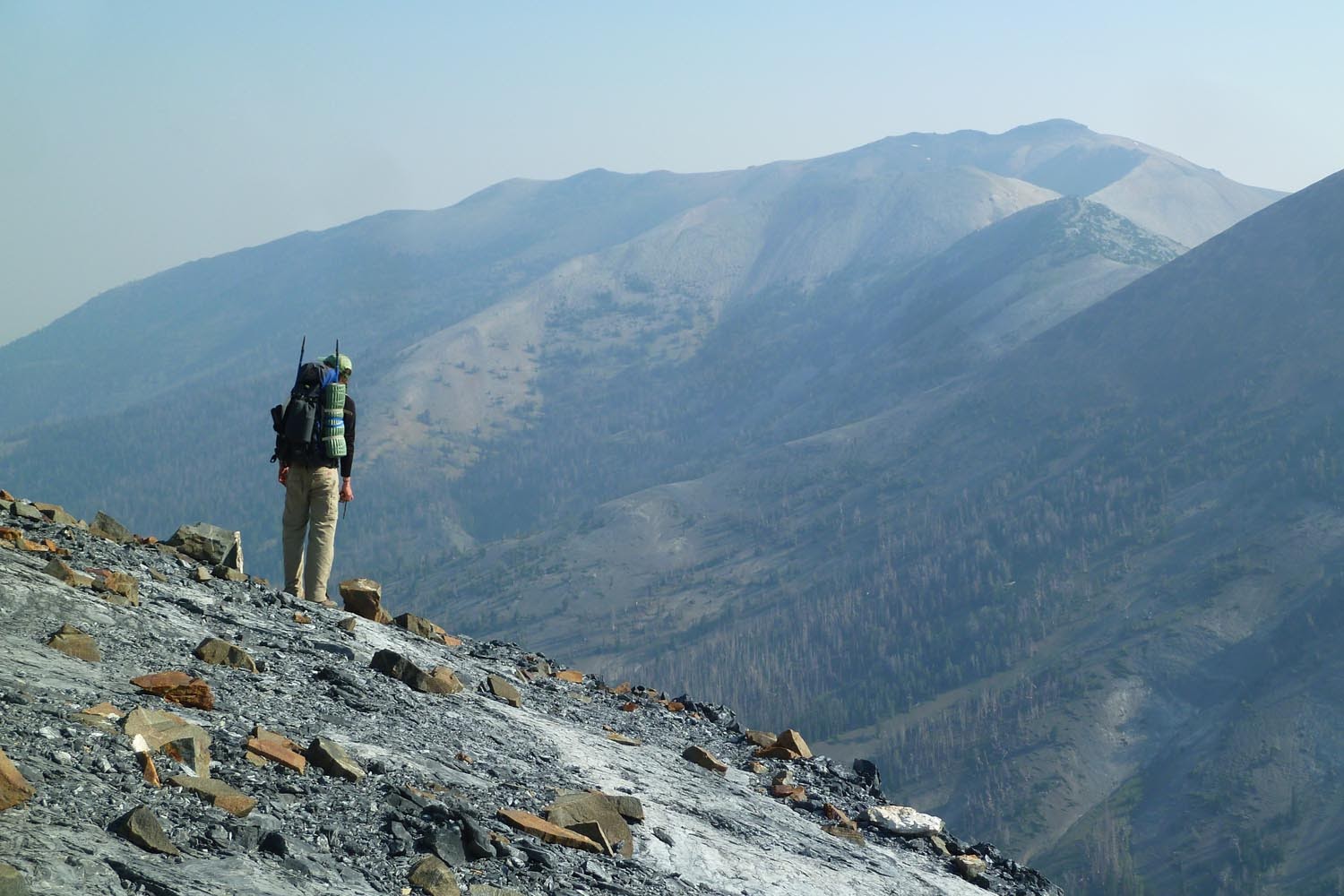
Chief Joseph in the distance. The smoke from the wildfires in BC was pretty bad. Though it never affected our breathing, the whole trip had hazy views.
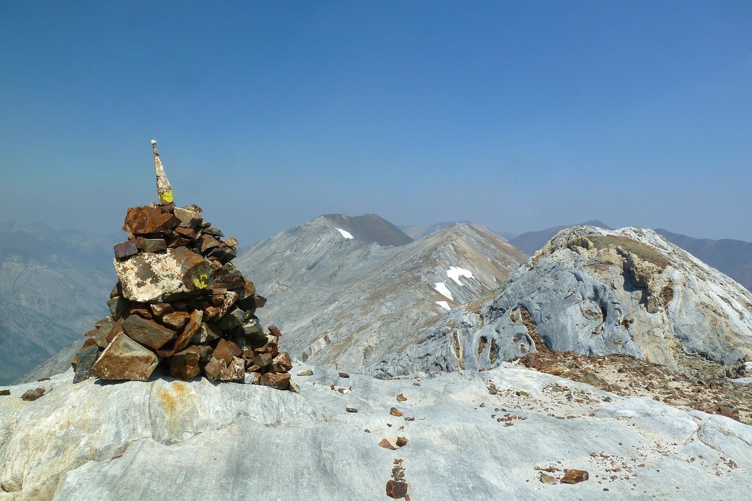
Ridgetop to the summit of Sac.

Matterhorn

Ben and I met up with our friend John Darme (or, as he prefers, Jean D'arme) on the way over the ridge. (Ben is actually in this pic, just highly camouflaged.)

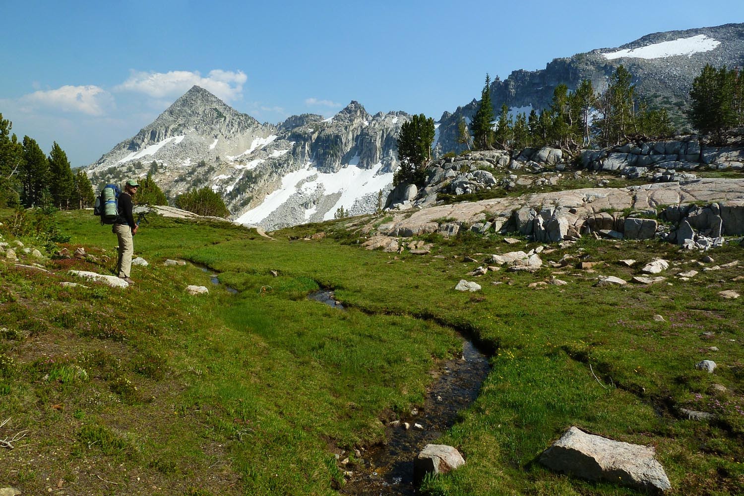
On the other side, slopes of Pt 9775, looking back at Sac.

And now heading up the north ridge of the Matterhorn. (9775 and Sac behind.)

Sac in the waaay background.
We dropped down the "trail" off Matterhorn to the tarn east of the summit, then headed SE cross country.
"Bosterson Gap" in the background. This does not need to be named after me, so we're calling it the Razz Gap.

Heading up towards Razzberry Mountain (on maps, Pt 9314).

Slopes of Razzberry leading to the summit.

Here's a funny story about Razzberry Mountain. These snow slopes cover what is likely the easiest route up the east side of Razzberry Mountain. I went up a crack/mantle climber's right of the snow. Ben declined to follow, so I continued up alone. There was a mountain goat prowling around the summit. Unlike Alpine Lakes or the Olympics, goats in the Wallowas are generally pretty shy, so I expected it to skedaddle. I saw it run off the summit block, so I continued up a few granite shelves, and then, looking up, found that the goat was EIGHT FEET UP ON THE SHELF ABOVE ME. Like literally sticking its goaty head over the shelf, looking down at me, saying, "durrr, where'd you come from?" Not being fond of getting gored by goats, at this point I decided to abort Razzberry Mountain. Coming back down, I decided to skip downclimbing the crack and instead try my luck at the narrowest 20 or so ft of snow between rock ledges. The snow was extra soft, which is why I'd skipped it on the way up. Trying to heel plunge down, I planted both feet in the snow, stood up, and promptly slipped and started sliding. I felt it happening, and it was slow-ish and "controlled" (this is what I'm telling myself), so I slid down until the flat of my leg slammed into the rock below and I stopped. Great, I'm unhurt, didn't bounce over this rock and land and break things on the rocks below it. Exactly as I "planned." (Kids, don't try this at home.) Razzberry Mountain will have to wait till another day. We descended to the packs and then sidehilled over to the saddle between it and Craig Mountain. This also doesn't need to be named after anyone (sorry Bruce), so we called it the Razzberry Gap, and the lake below Razzberry Lake.

We pitched camp at the lake. The bugs were annoying. But despite smoke to the east, there was nice light on Razzberry in the morning.
We continued off trail down the hill. Ben was in the lead and decided to skip a grassy bench below, and instead take us over the south shoulder of the ridge and down this steep gully.

Below this, we sidehilled for a bit until we caught a very nice game trail heading west at around 7800 ft. We followed this to a wide plateau, whereupon we attained the abandoned Razz Lake trail that runs up from the Lakes Basin. Faced with a choice between climbing up to the Razz Lakes and poking around or going down to the Lakes Basin and climbing Eagle Cap, we opted for the latter. After setting up shop at a very crowded Mirror Lake, we finally roused ourselves from lethargy and headed up the trail to Horton Pass, which was snow-covered at the top.

Farther on the Eagle Cap spur trail. From this angle, it looks like a jumbo sized version of Tanner Butte, don't'cha think? I hadn't been up here since 2009.

Up top, looking over at Glacier Peak.

We made a little friend. He took off down a vertical piece of granite, so we named him Chipmunk Down.

Glacier Lake below Ben.

Boot skiing on the way back down.


Back at Mirror Lake for dinner.

The bugs in the Lakes Basin were pretty bad. It's lovely with snowmelt creeks and lots of flowers, but everything is basically in the "late spring" stage, so it might be another month before all the annoying mosquitos and biting flies vanish. Also, people are morons - we saw at least 2 fires in the "fires prohibited" area. (Maybe they were confused by the quotation marks?
Next morning, we packed up and hoofed it out down Hurricane Creek. I've only ever been up to the Echo Lake junction before. We passed the interesting cabin Brad and Bruce (B&B?) found.


That thing has a hell of a good swimming hole on the river right next to it. And views of the impressive W face ramparts of the Matterhorn.

On the way out, Ben's nose pricked up and he rooted around until he discovered a trove of wild alpine strawberries! They were a delightful delicacy on such a hot and dry trail.

We got back to the car at 2pm and then hit the road back home. Hopefully the smoke will clear out of the Wallowas soon! Hat tip to Brad and Bruce for some really rugged off trail sections - we were impressed you guys went from Thorp all the way to the Lakes Basin on the same day. Strong work, you two!


