"No Wind on Wind...surprises all around"
4/8/17
Miles: 2.3
Time: 1 hrs, 20 min
Avg MPH: 1.8
Elev Min: 835'
Elev Max: 1,907'
Total Ascent: 990'
Elev Change: 880'
Temp: 50
Other hikers: 19
Longest time without seeing a hiker: 1 hour
Wildlife: None
Opening Shot: Looking west from the summit of Wind Mountain
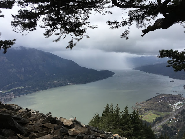
Once again I cheated death (I might be exaggerating a bit) by assuming my GPS was directing me correctly...when am I going to REALLY learn? I promise that I'm going to turn over a new leaf. I approached Wind Mountain from the east and my GPS directed me to take Bergen Road...which was fine. Then it was a quick left on Girl Scout Road which wasn't paved but was fine. Then it quickly changed to steep dirt, 1-laner with potholes. It wasn't bad, but I did drop it into 4WD just to be sure I didn't slip on the steep, wet dirt. I saw the trailhead and pulled out into a siding that had space for only 3 cars which surprised me. (Stay tuned at the end of the post to hear the rest of the story.) I was also surprised to see a snow drift just barely encroaching on the road above. I was only at 835' in elevation so I guessed that the snow must have avalanched off the steep slope and accumulated in a very large drift that has just taken time to melt-off. Still...I was very surprised.
I started up the path which was easy to notice. I was additionally surprised at how good the condition of the trail tread was on this not so popular trail that is called "Wind" Mountain and that I was there on the day after one of the biggest wind storms of the decade in Portland. I was pleasantly surprised...very little if any mud too.
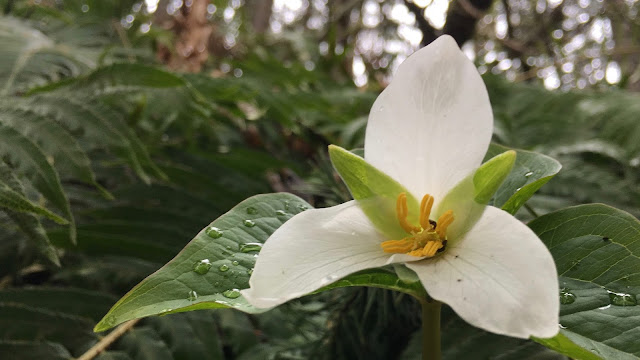
The Western Trillium was just starting to bloom.
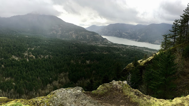
About 1/2-way to the top near the major switchback there was a short spur-trail that dropped steeply about 50 yards to the top of a knife-edged cliff. This was the first view from the start. You can see Dog Mountain shrouded with clouds on the top and on down the eastern direction of the Columbia.
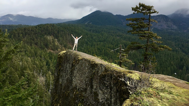
I couldn't pass up photo-bombing my scenic picture to the north on the top of the cliff point. This was the first time I used my new app called "Photo Timer+" for the iPhone. I LOVE this simple app. It's the only one I've ever found that allows me to set a timer for longer than 10 seconds...which seems like such a basic thing that people would want the capability to do. No longer do I have to run at a dead (no pun intended) sprint to precarious perches to get there before the camera goes off. You can set time increments of :03, :05, :10, :15, :30, 1:00, or 3:00. I used the ":30" for this one. You can also have it take 1, 2, 3, 5, or 10 pictures all at once which is great to assure a good shot. I highly recommend it.
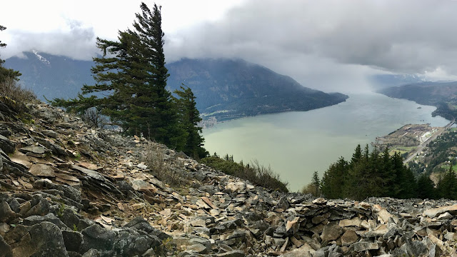
There were a couple of other short talus crossings that provided views before getting to the top. There were great views west to Portland. You can see snow on the Oregon side of the Gorge on the left of this picture which I think is about where Nick Eaton Ridge is on the other side. You can also see the Tribal "spirit quest" pit in the lower right corner of this picture. There are bunch of them up here that were constructed from 200-1,000 years ago by youth who would come up here and spend the night seeking their guardian spirit.
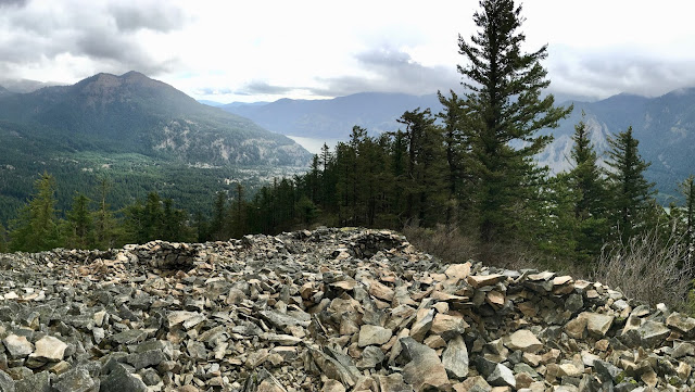
This is on the other side of the summit with Dog Mountain cleared off on top and three more spirit quest pits in the shale. Notice too that there is no snow on the much higher Dog Mountain and I saw none on Wind Mountain. Now you can better understand my surprise to see snow at the trailhead.
On the way down I saw all of the 19 people I saw for the hike. Once again I was surprised to see three of the four groups with young kids with them...and young kids at that. Not that hiking with young kids surprised, me, but the numbers of them did. One couple had four young kids/friends with them and the mom was carrying an infant in a sling on the front of her. I love the dedication to get out and hike!
As I finished my hike I reflected that I was so surprised that there was not a single blowdown on this trail after the big storm...or even left over from winter as it's still early season. I got back to my car and thought I'd continue up the road to see if there was more parking ahead as I only saw one other car at the trailhead which didn't reconcile with all the people I saw. I motored up only about 100 yards before I popped out on a very nicely graded and large...parking lot, next to...a nice asphalt road. Oops, I guess I should have turned up the aptly named "Wind Mountain Road" instead...who'd a thunk!
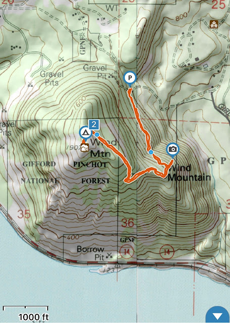
Below is my topo map with track and elevation profile. The "camera" is where that cliff overlook was located.

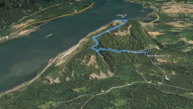
Here is my track on Google Earth, again, you can see that cliff overlook part.
And finally, my GPS track for download if desired:
http://gpsfly.org/a/7009
Favorite experience of the day:
Finding that cool spur trail to the cliff overlook
Least favorite experience of the day:
Not realizing the best way to get to the trailhead
Mike (aka GoalTech)
www.GoalTechHikes.com
@goaltechhikes (Instagram)