Who: Me (Born2BBrad) & Patrick (TFF buddy)
When: 3/19/16
Where: Cottonwood Canyon State Park (CCSP) in north central Oregon
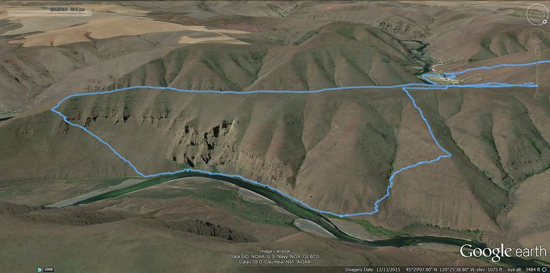
Route: Day use parking lot, Sage Steppe Trail, up the Gooseneck Trail, Gooseneck Ridge, down to the Pinnacles Trail, ridge spur back up to Gooseneck Ridge, down a steep and scrambly ridge spur back to the Pinnacles Trail, Murtha Ranch Trail, day use parking lot
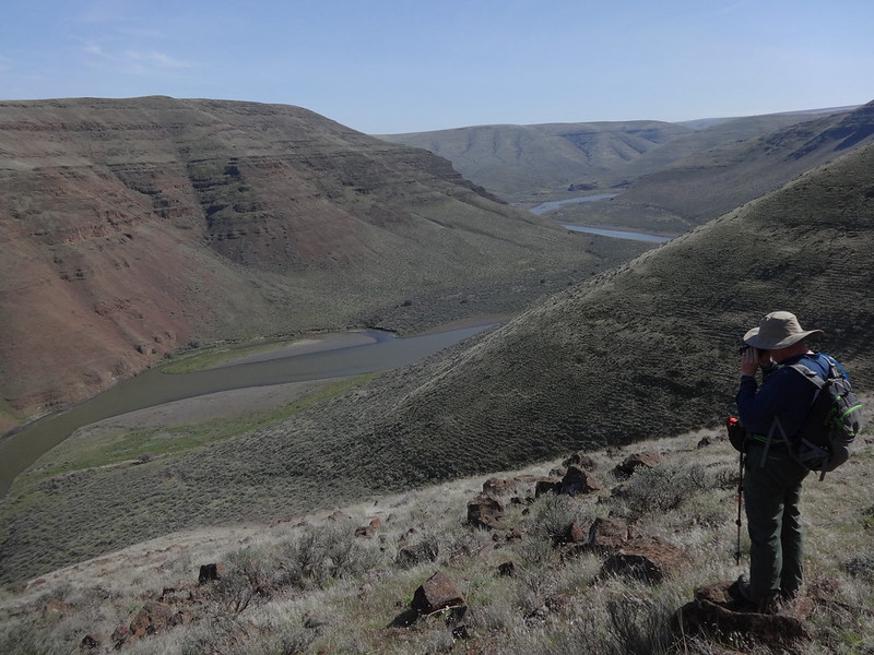
Opening picture:
Stats:
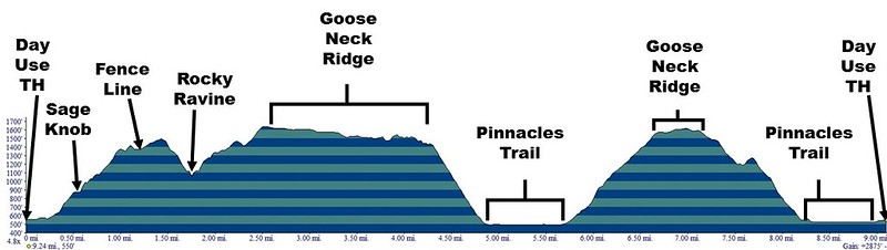
• Mileage: 10 miles
• Elevation Gain: 3000’
• Other people passed: 2
• Drive time from Portland: Approximately 2 hrs 15 min
• Rattlesnakes: 0, Ticks: 0, Bighorn sheep: 12
There have been a few trip reports about Cottonwood Canyon State Park (CCSP) within the last few years. I finally got around to checking it out last Saturday (3/12) with my wife, Dawn, and our dogs, Buddy and Timmy. We did the Lost Corral Trail, then briefly went off trail up into the hills. It made me realize the possibilities for wandering there.
So back I went the very next week. I have this thing where I keep going back to places several times to fully explore what an area has to offer. I may go back next week too.
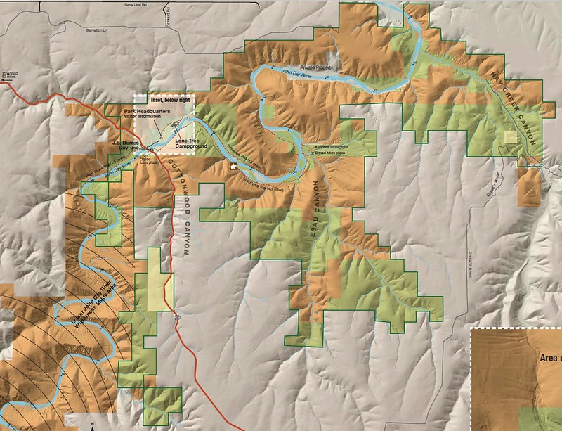
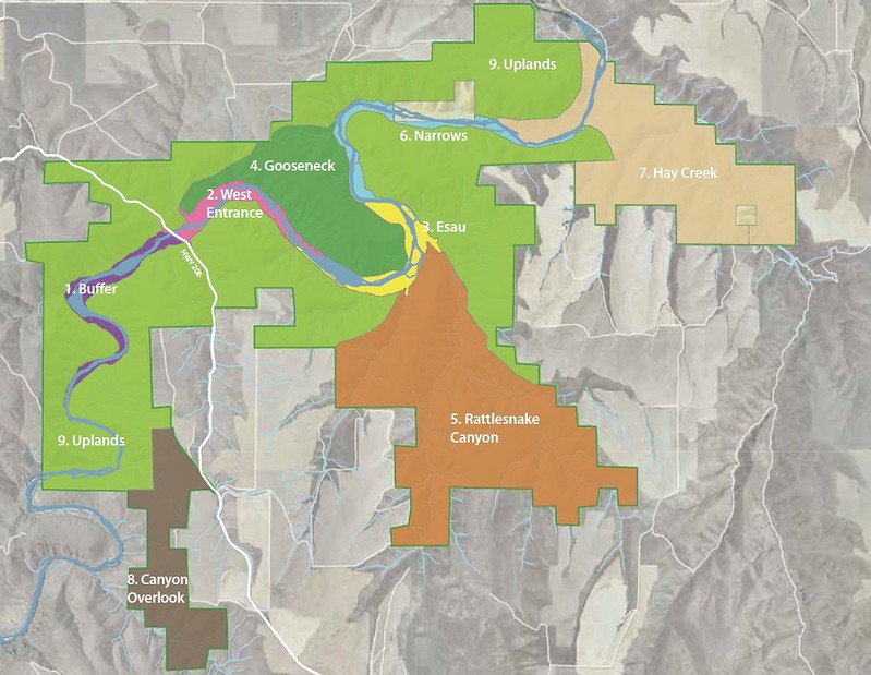
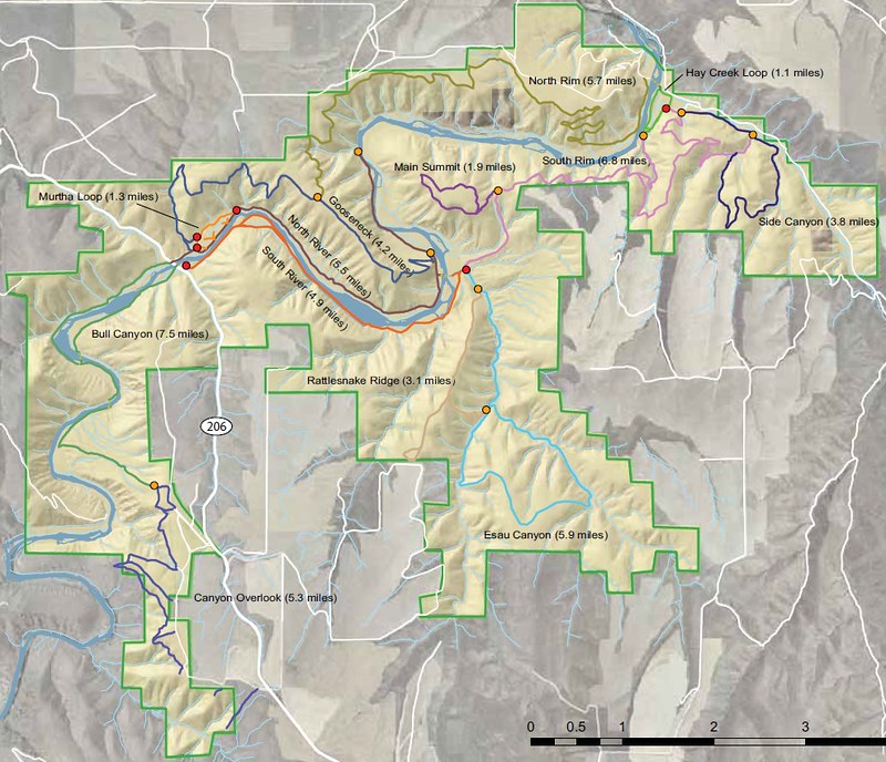
Before I get into the details of the trip, here are some links, maps and CCSP information:
• Website run by CCSP Ranger Spangler. I found this website to have the best overall information
• Official CCSP state website
• CCSP Wikipedia page
• Management zones and trail (existing and planned) maps
• Online Brochure
• Link to a 208 page PDF of the CCSP master plan
• Link to GPS track of existing and planned trails and CCSP border. Note: This was created by me, based on the map that had existing and planned trails. It is not official or 100% accurate. It can help you explore now, before all the trails are built, and help you keep off private land.
Map showing state park (green) land, BLM (orange) land and park boundary (green line):
Map of management zones:
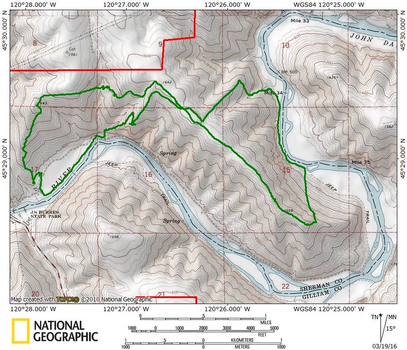
Map of existing and planned trails:
Elevation profile for this trip:
Tracks in Nat Geo for this trip:
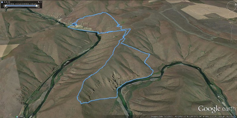
Trip overview in Google Earth:
Google Earth (west side):
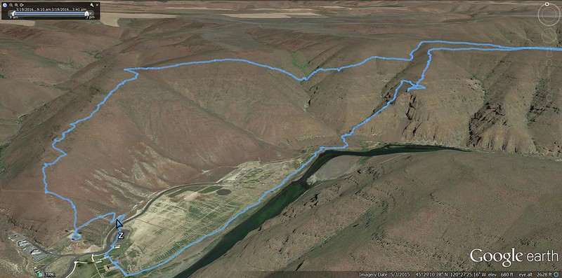
Google Earth (east side):
A couple of the websites noted above have extensive information about CCSP including the history and creation of the park, so I won’t go into too much detail. Wikipedia has a good synopsis:
“In 2008, the Western Rivers Conservancy, a non-profit organization based in Portland, bought the land from a cattle-ranching family, the Murthas, who had owned it since the 1930s. The conservancy was able to borrow money from the Wyss Foundation to make a quick purchase possible. Later, Western Rivers offered to sell the land to the Oregon Parks and Recreation Department (OPRD) to create a state park. OPRD agreed and paid Western Rivers what the non-profit had paid the Murthas, $7.86 million.”
Here is some other important information to be aware of:
• Size: 8,000 acres of state land plus 8,000 acres of BLM land. Second largest state park in Oregon after Silver Falls State Park.
• Elevation ranges from 500’ to Canyon Overlook at 1920’.
• 16 miles of the John Day River run through the park.
• There are 21 car and 7 hiker/biker designated camp sites.
• Hunting is allowed within the park, outside of the developed camping area.
• Backpack camping is allowed in the park. It’s unclear if it’s OK to camp on state land, but anywhere on BLM land is allowed.
• Overnight parking is allowed at J S Burres State Park, across the bridge on the south side of the John Day River.
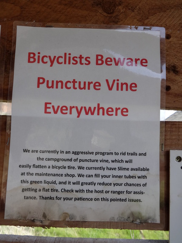
• Bicycles are allowed on the two river trails. Beware of the puncture vine. More on that later.
• Wildlife include bighorn sheep, elk, mule deer, coyotes, otters, rattlesnakes and many species of birds. The area claims the largest herd of bighorn sheep in Oregon.
• Fishing on the John Day River is a popular activity. Steelhead, salmon, trout and bass are some of what you can fish for.
• It can be roasting hot in summer and bitter cold in winter. It would be best to avoid hiking in the area during those times.
• Water availability is scarce away from the John Day River at all times of the year. Prepare accordingly.
• There is no fee to park in the day use area. That was a pleasant surprise.
• Within CCSP, the John Day River is the dividing line between Sherman (west) and Gilliam (east) counties.
---------------------------------------------------
And now for the feature presentation!
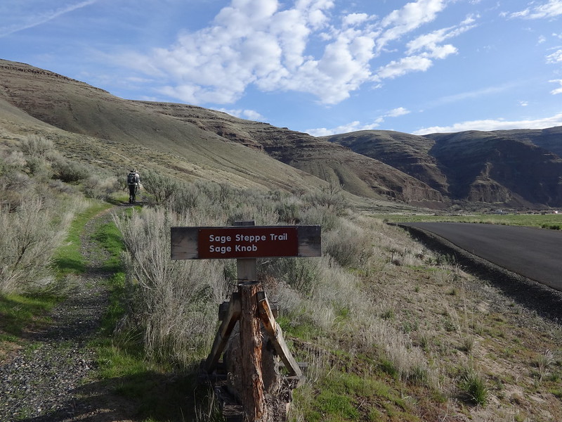
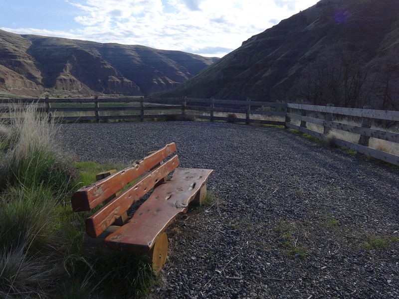
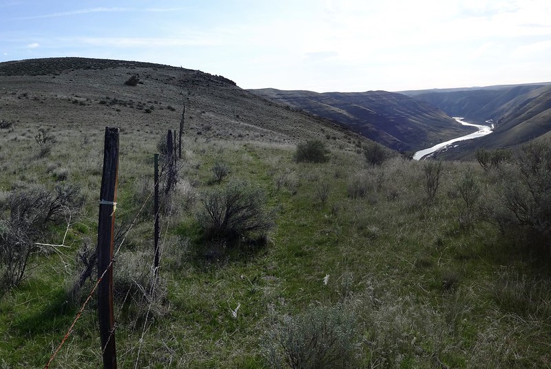
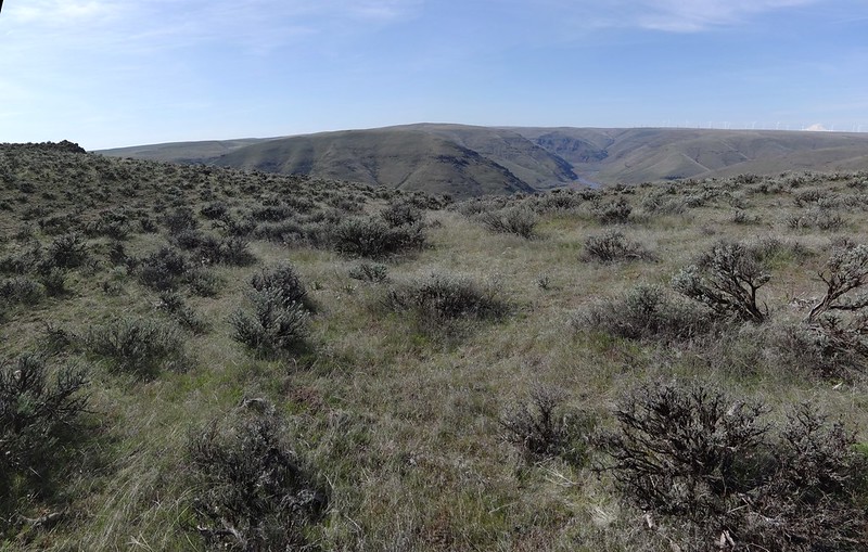
Directly across from the day use parking lot is the Sage Steppe Trail. This 0.2 mile trail leads to a viewpoint with some railing and two benches. This trail also leads to the Gooseneck Trail. The Gooseneck Trail is one of the trails on the trail plan map. It is not an official trail, but it does have a discernable tread for the first couple of miles. The trail goes up a ridge into the hills to a barbed wire fence at the boundary of CCSP and private property.
The start of the Sage Steppe Trail:
Viewing area at Sage Knob:
The Gooseneck Trail starts here:
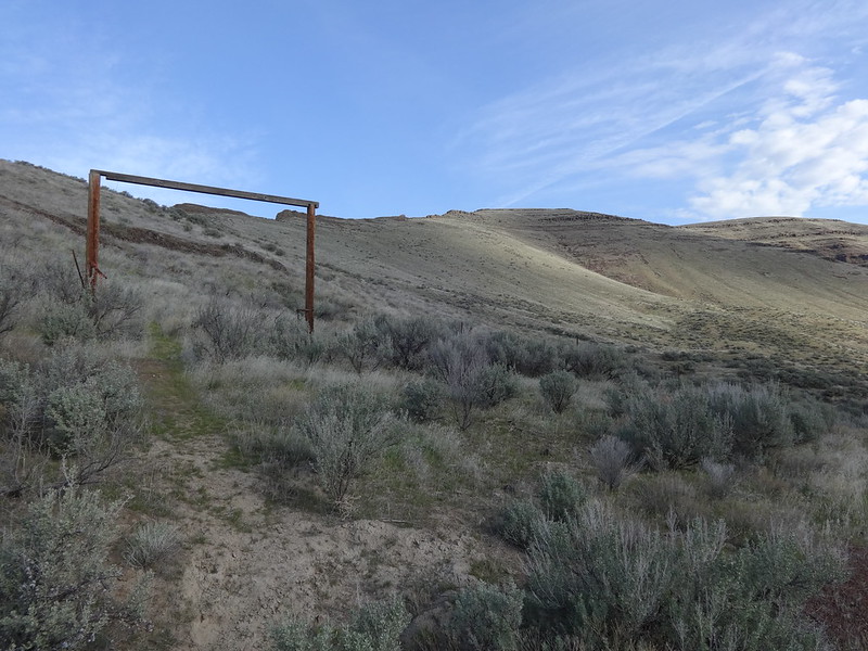
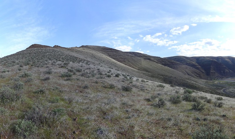
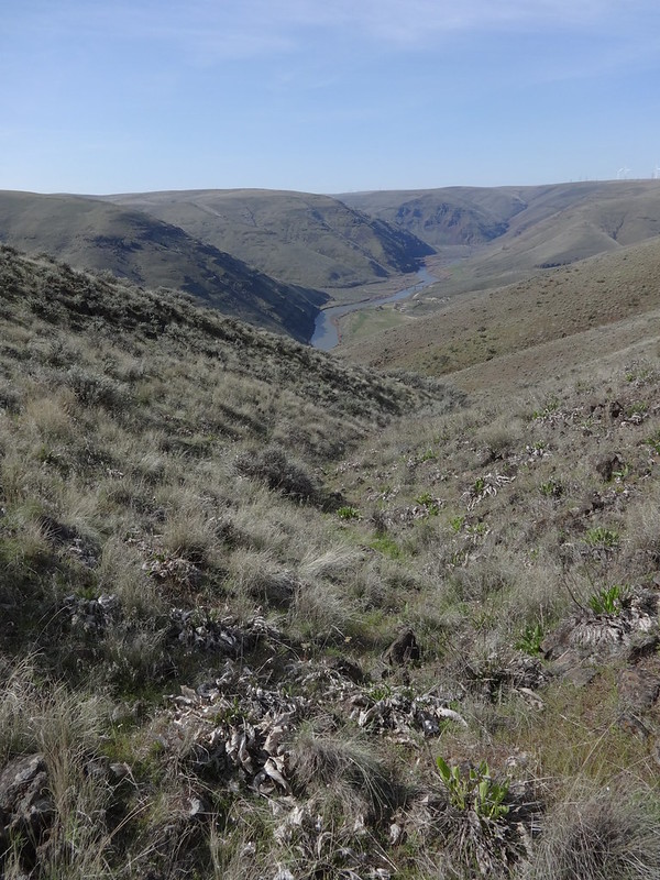
Those hills are where we were headed:
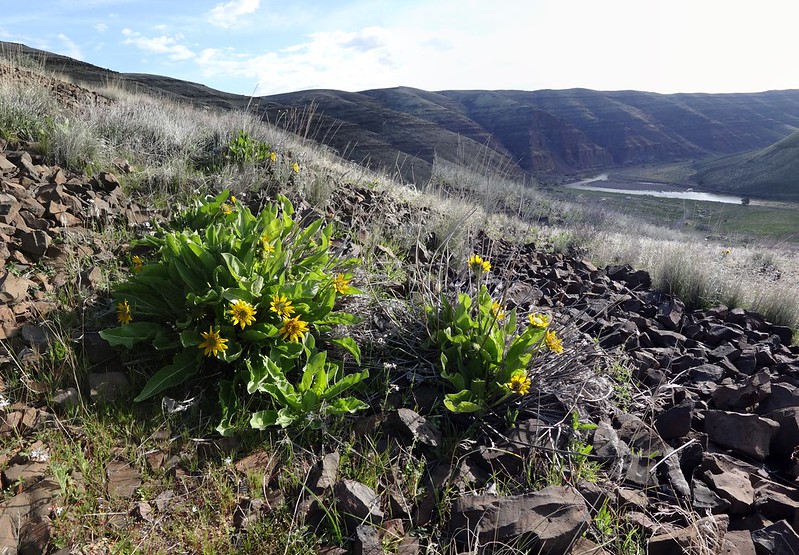
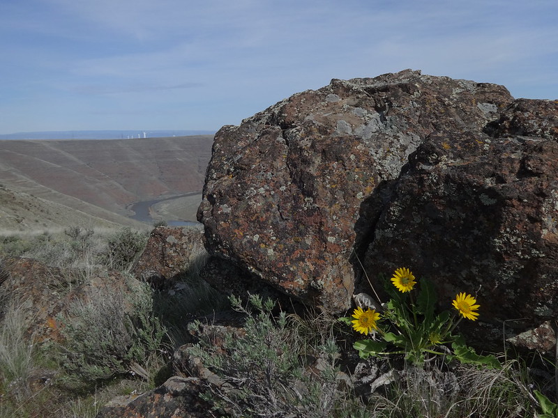
Balsamroot flowers are just starting to come out:
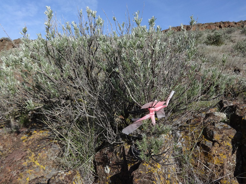
Many places along the Gooseneck Trail have various types of flagging to help stay on the tread. Because the trail braids, and because at times everything looks like a trail, it wasn’t always easy to stay on the trail. Not that it really mattered.
Example of some of the flagging:
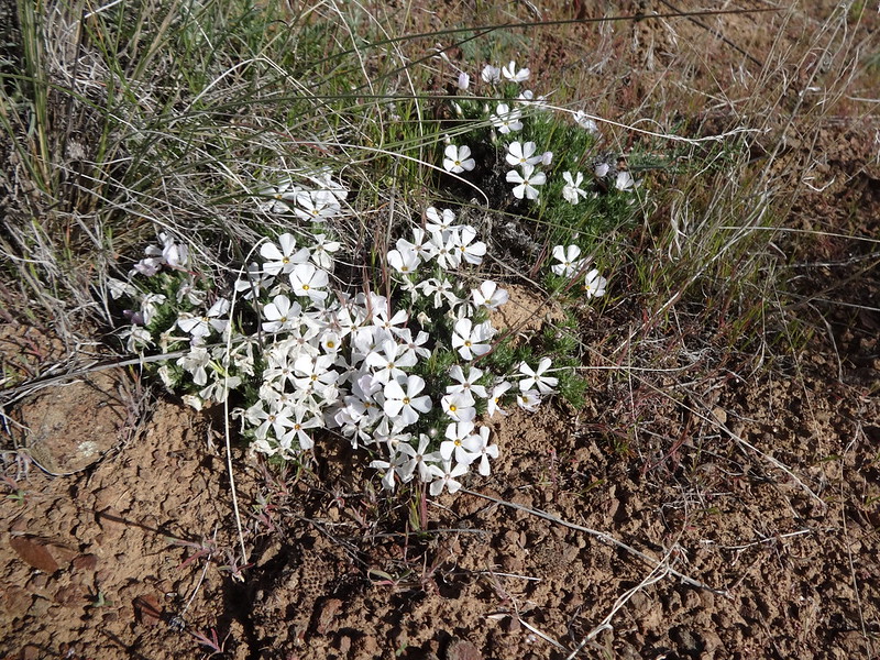
Phlox was just starting to bloom:
Looking back down the ridge:
The boundary between CCSP and private land:
This was a hike where I could see my car much of the way:
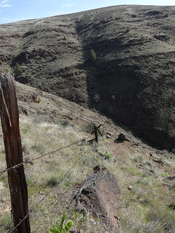
The Gooseneck Trail follows the fence line straight down this steep ravine:
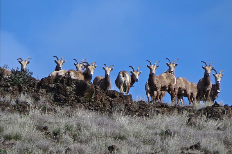
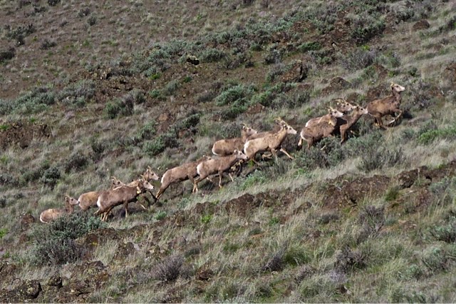
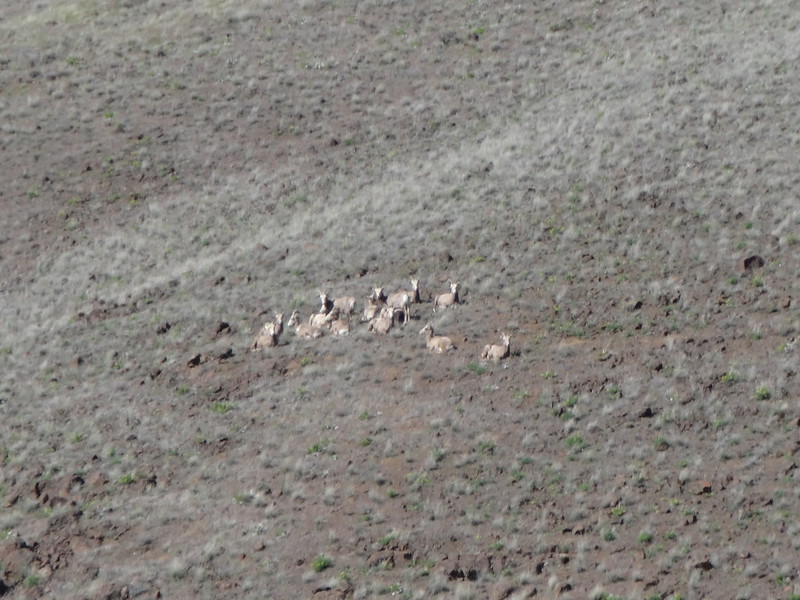
After climbing back out of the ravine, we came across a gently graded gully. Rather than follow the Gooseneck Trail on my GPS, we took the much gentler path up the gully, with Patrick leading the way. Looking ahead, I saw a herd of animals watching us very closely. We stopped to take many pictures, which helped identify them as female bighorn sheep. They eventually ran away after several minutes. We would come across this herd four more times.
The gully we went up:
Bighorn sheep eyeing us warily (photo by Patrick):
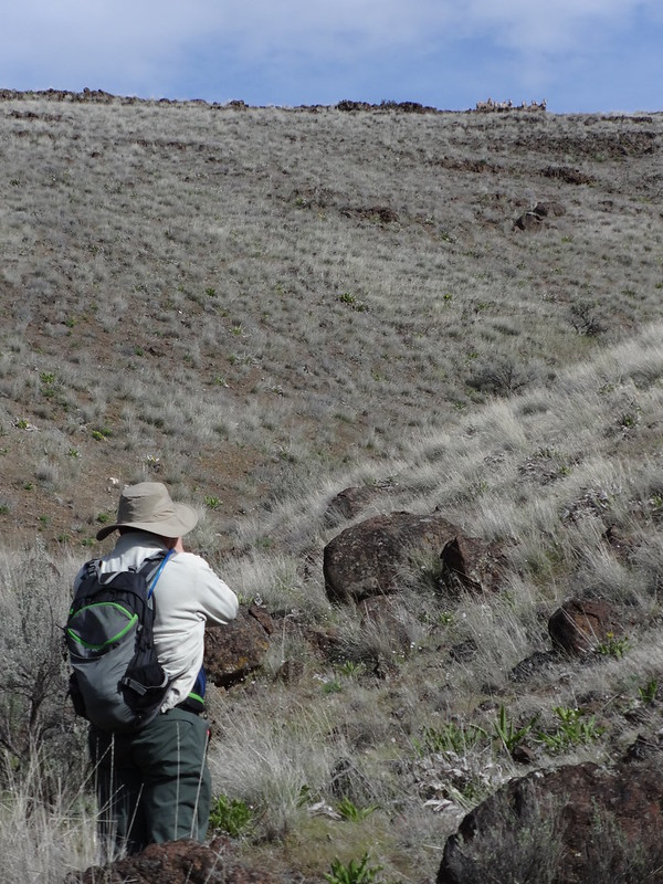
Patrick taking a picture of the bighorn sheep (upper right):
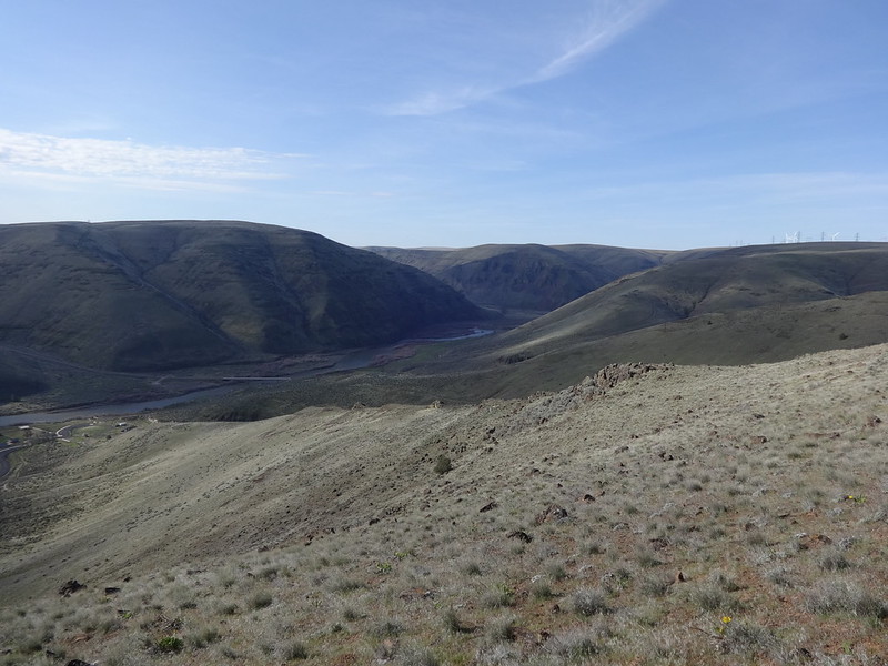
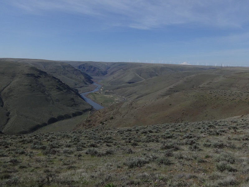
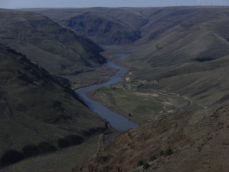
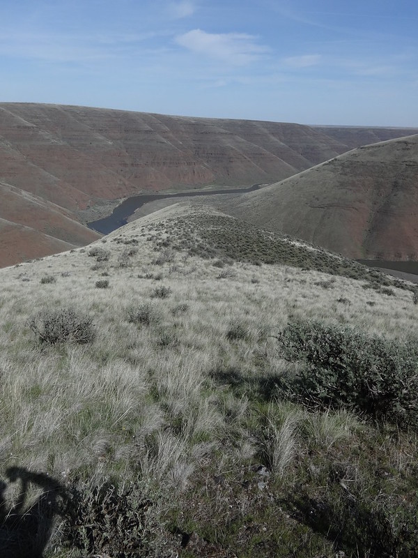
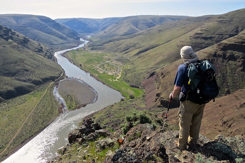
Eventually the gully lead to Gooseneck Ridge. Gooseneck Ridge is not an official name, it’s what I am calling it because of the trail name and because the area where the John Day River makes a wide bend is known as the Gooseneck. I could call it Awesome Brad Ridge, but Gooseneck sounds better.
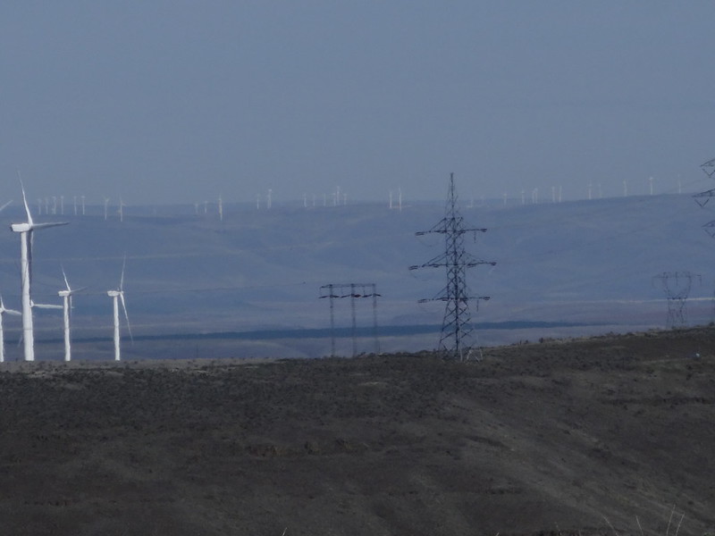
Windmills and Mt. Hood from Gooseneck Ridge:
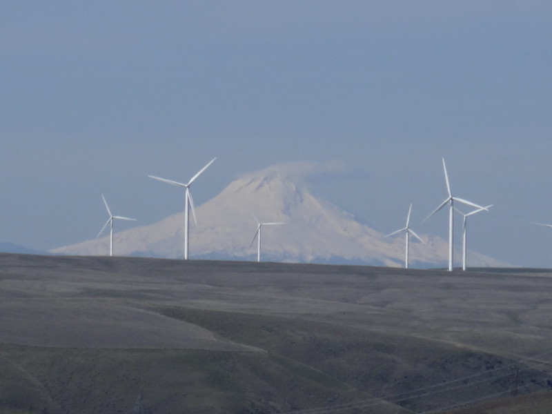
Some interesting information about all the windmills in Sherman County is that each household gets $590 every year from wind energy generation. Land owners get $6,000 a year for each windmill. I guess you could call it…. a windfall for county residents. Ba dum bum, cymbal crash! Hey, that was not a bad pun!!!
Looking SW from Gooseneck Ridge
There’s the bighorn sheep again. They probably think we’re following them (photo by Patrick):
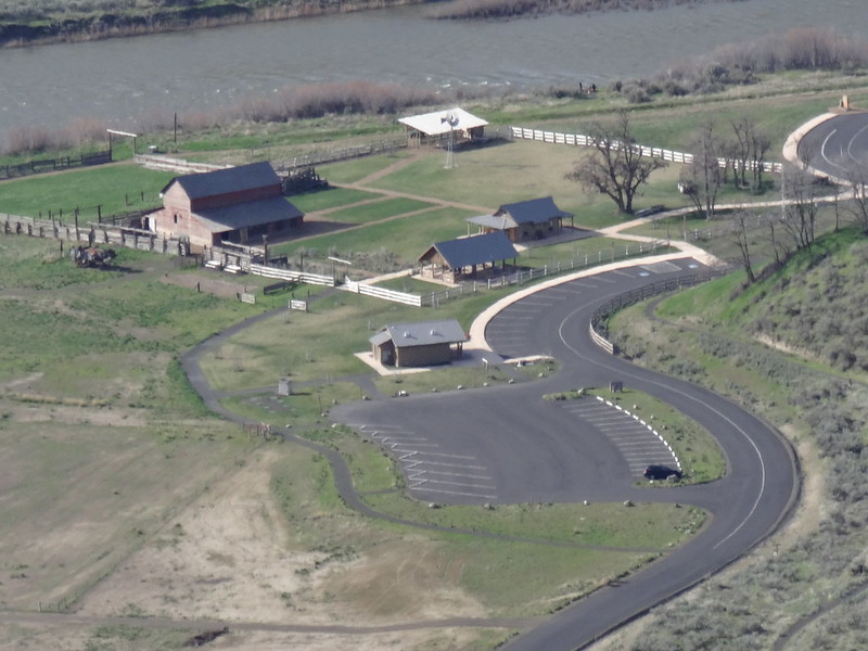
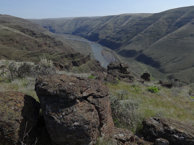
The John Day River, CCSP and Hwy 206 bridge:
Lots of places to pitch a tent up here, but it could get very windy:
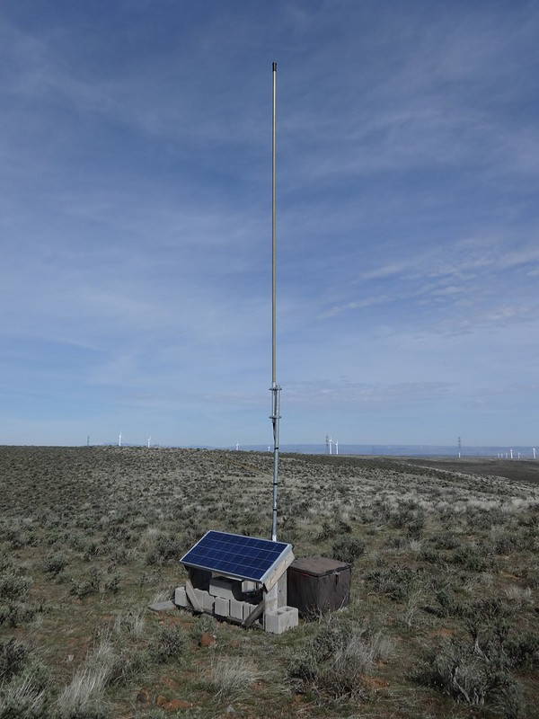
Some sort of antenna up on Gooseneck Ridge:
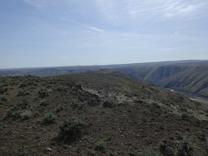
This picture gives some visualization of what Gooseneck Ridge looks like:
Amazingly, even the Columbia River can be seen from Gooseneck Ridge:
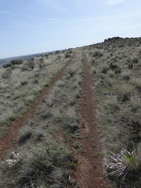
An old road follows Gooseneck Ridge for quite a ways:
Photogenic balsamroot and rock backdrop:
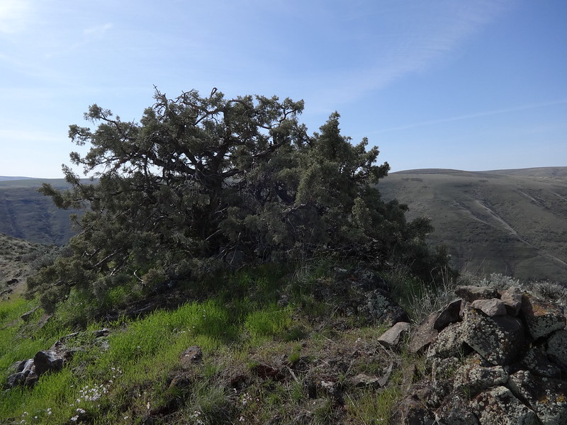
Lonesome juniper tree up on the ridge:
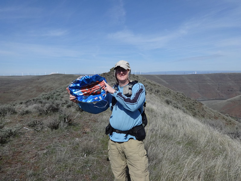
A Spider-Man balloon for Jerry to add to his collection:
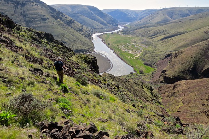
Continuing down Gooseneck Ridge:
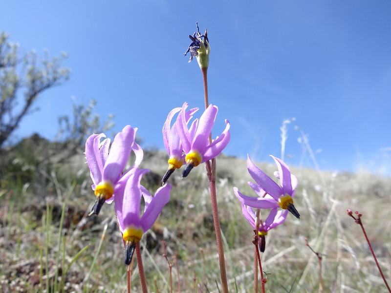
Some shooting starts along the way. Now I have the Bad Company song stuck in my head:
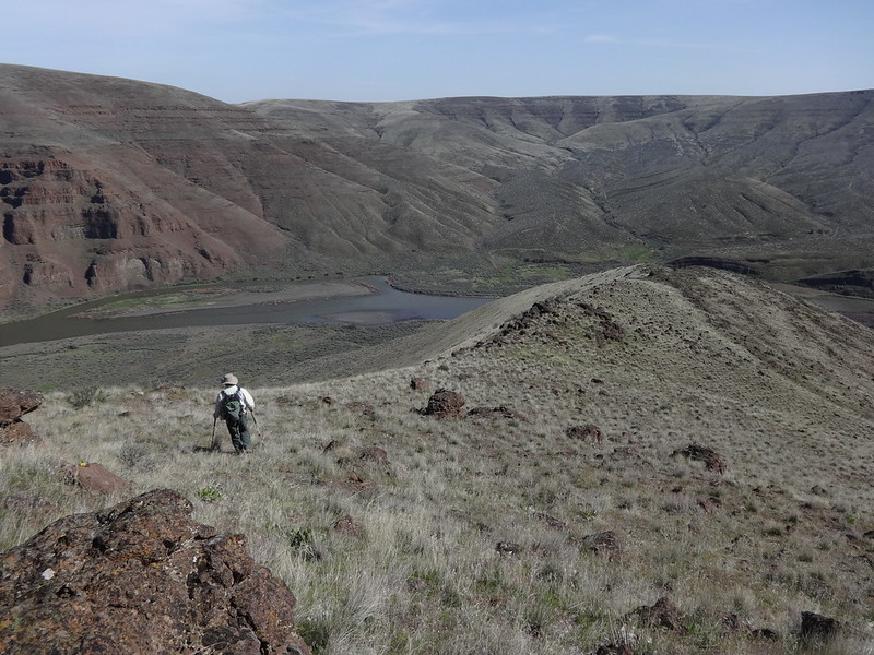
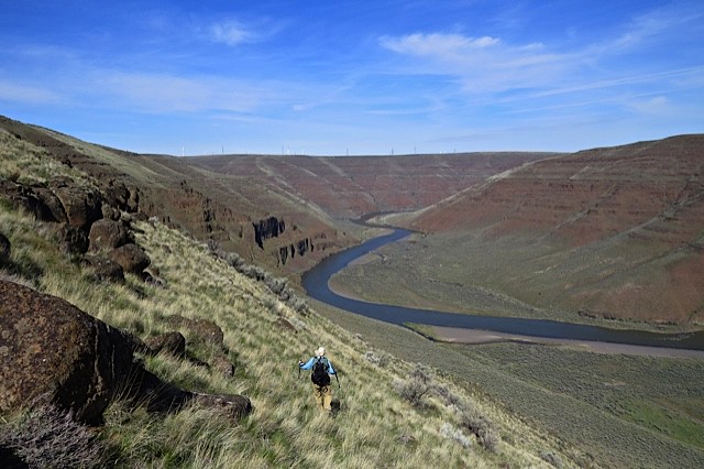
Angling our way down to the Pinnacles Trail (photo by Patrick):
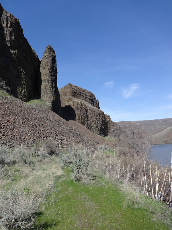
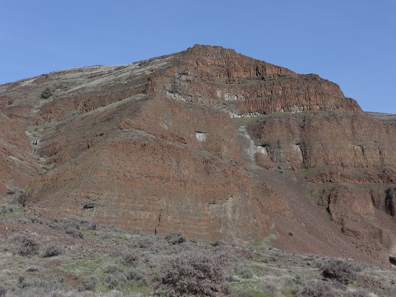
Is this why it’s called the Pinnacles Trail?
We followed this game trail up a ridge spur back to Gooseneck Ridge:
View from the ridge spur:
Looking back at the ridge spur:
The ridge spur eventually led to a barbed wire fence and an old gate:
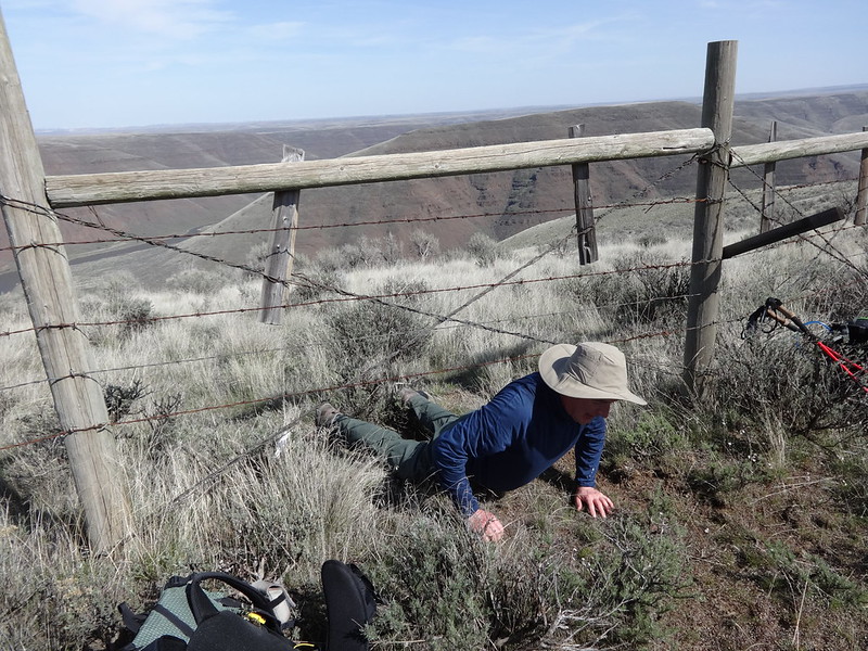
Note: Unlike the fence near the beginning of the Gooseneck Trail, this fence was not a dividing line between CCSP and private land. It runs through CCSP for a long distance within the park. I imagine there are many fences inside the park from when the land was in use by the Murtha family. That’s why it’s important to be aware of the boundary between CCSP and private land. You can’t assume a fence is the boundary, or that a fence will exist on the boundary line.
Back on the west side of Gooseneck Ridge, we came across these girls again:
Rather than retracing our route back on the Gooseneck Trail, we had decided to try and come up with a route down to the Pinnacles Trail, using another ridge spur. Using my GPS, one of them looked like it had possibilities, although cliffs were on one side. So down we went. It was a case where we could not see below each steppe. There was a concern we would cliff out and have to go all the way back up. Fortunately, after each new steppe, a route through presented itself. Eventually we made it down to the Pinnacles Trail. It’s a route I would not recommend for anyone afraid of heights, someone who is klutzy or not sure-footed. Hiking poles are a must.
Reaching one of the steppes, one way was too cliffy:
It’s not as bad as it looks. Really (photo by Patrick):
See. As long as you pick your steps carefully, it’s perfectly safe. Really (photo by Patrick):
Here is a wider shot of what the ridge spur looks like:
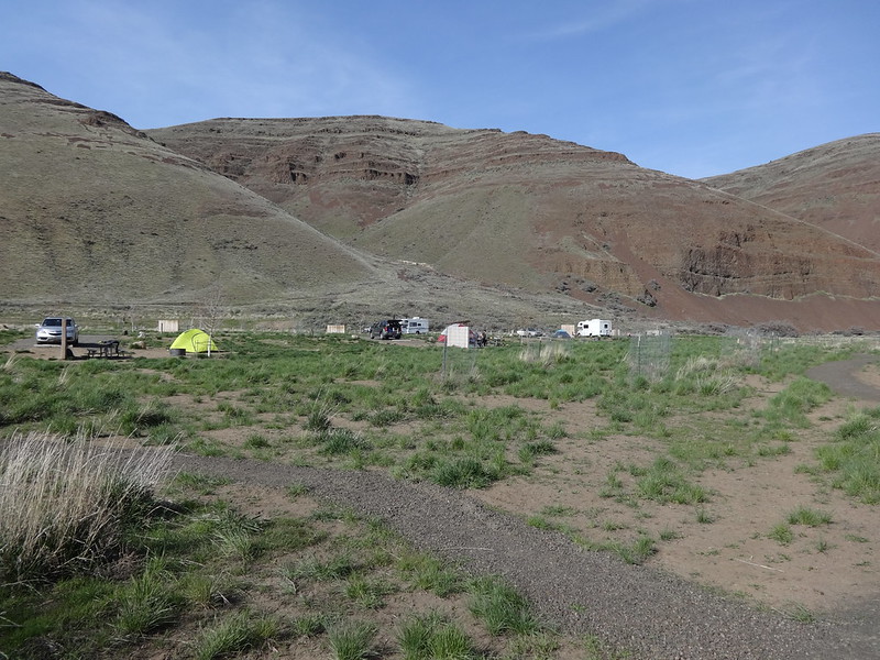
There were quite a few people camping:
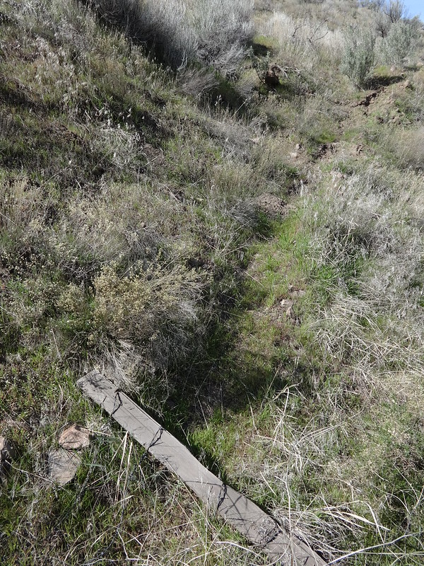
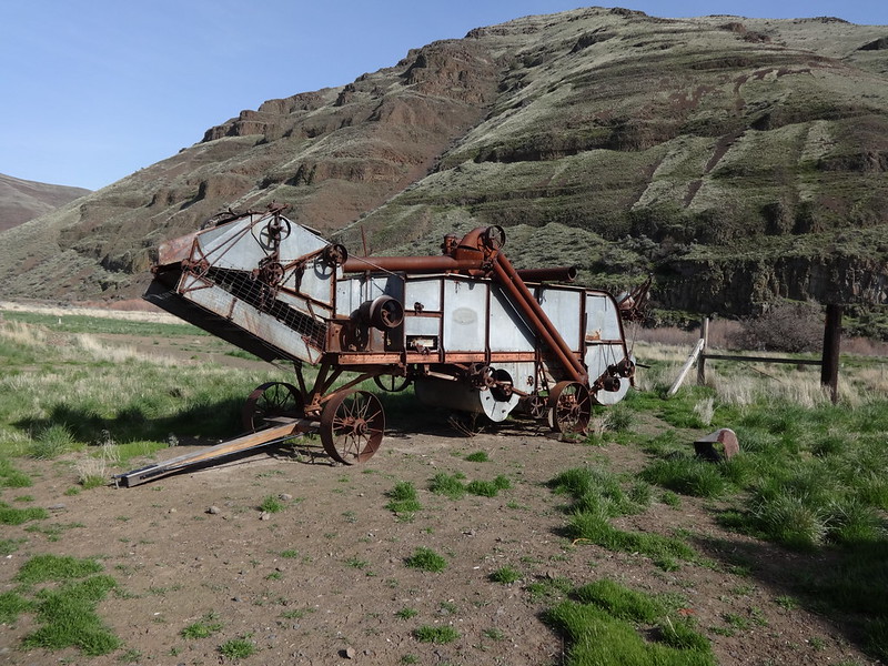
Cool piece of old farming equipment:
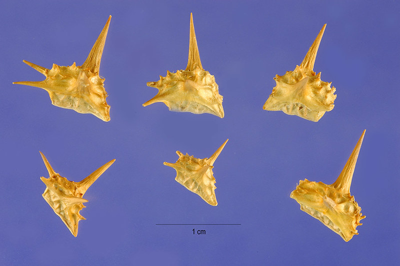
Finally getting back to the puncture vine. An idea was brought up about doing some kind of bike and hike, using either of the two river trails. Then research found that an invasive plant called puncture vine is prevalent in the park. Puncture vine has small fruits that break up into nutlets, also called burrs. These nutlets easly puncture the tubing of a bicycle tire. Before I attempt a bike and hike there, I’ll have to install some tubing protection to my tires first. Having to walk a bike back several miles does not sound fun.
Puncture vine warning:
Puncture vine nutlet:
Link to all the pictures on Flickr: https://www.flickr.com/photos/54959080@ ... 5968739952
Patrick is sending me some of his pictures. I’ll edit this trip report with some of those in a day or so.
Hike away!
Brad