Boundry Trail at MSH
-
tbritt2112
- Posts: 42
- Joined: April 18th, 2017, 3:18 pm
Boundry Trail at MSH
Hello everyone. I live in NC and will be at MSH the weekend of May 12th. Ive heard they have had better than average snow there this winter. Do you all think the BT from Johnston Ridge Observatory will be open going towards Harrys Ridge? Ive been checking the Volcano Cam and it looks like the snow is melting. I know I will be there early in the season, but I have a training class out there and thats the hand Ive been dealt. Thanks.

Re: Boundry Trail at MSH
There will almost certainly be at least some snow along the trail, but that may not be the biggest obstacle.
Often, the road to JRO itself isn't open until just a day or two before the May 18 eruption anniversary.
Often, the road to JRO itself isn't open until just a day or two before the May 18 eruption anniversary.
Karl
Back on the trail, again...
Back on the trail, again...
-
tbritt2112
- Posts: 42
- Joined: April 18th, 2017, 3:18 pm
Re: Boundry Trail at MSH
Thank you. Yes, JRO opens on May 13th this year. Im really hoping that enough snow has melted so that I can hike at least half way to Harrys Ridge. I live 3000 miles away and am hoping to get lucky.
Re: Boundry Trail at MSH
Oh cool, so they've set an opening date.  Well, it's sure possible. Especially if you're okay with some snow travel. But the route is fully exposed, so any sun between now and then will work in your favor, and it's been wind-blown all winter so the snowpack there is already lower than in many place.
Karl
Back on the trail, again...
Back on the trail, again...

Re: Boundry Trail at MSH
As Karl said, it's really just an issue of comfort with snow travel: you will almost assuredly run into at least a little, but it should definitely be doable (and open: I don't think the trail is ever officially "closed").
The only real obstacle I can think of is a sort of steep, side-hilly section by Devil's Elbow, but I thought I heard something about them building a bypass (?).
The only real obstacle I can think of is a sort of steep, side-hilly section by Devil's Elbow, but I thought I heard something about them building a bypass (?).
Re: Boundry Trail at MSH
Right, we've gone up mid-winter from the Hummocks.RobinB wrote:As Karl said, it's really just an issue of comfort with snow travel: you will almost assuredly run into at least a little, but it should definitely be doable (and open: I don't think the trail is ever officially "closed").
That'd be nuts with snow, yep!RobinB wrote:The only real obstacle I can think of is a sort of steep, side-hilly section by Devil's Elbow, but I thought I heard something about them building a bypass (?).
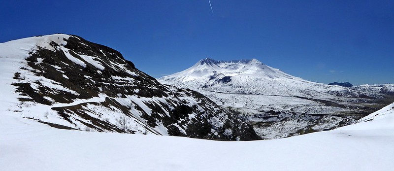
Trail out to Devils Elbow, looking south, highlighed by snow along ridge. March 2016.

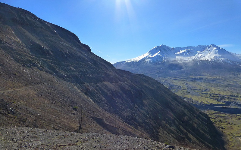
Devils Elbow bypass will roughly follow the (circled) cyan track here.
Karl
Back on the trail, again...
Back on the trail, again...
-
tbritt2112
- Posts: 42
- Joined: April 18th, 2017, 3:18 pm
Re: Boundry Trail at MSH
Thank you for the replies, the pic and the map. The pic of Devils Elbow section with snow is not something I want to see when I get up there! Just beyond that section, isn't there an area that's flat and makes for a good observation point? If I can make it to that point, I will be happy. Beautiful trail looking right into the crater.
Re: Boundry Trail at MSH
Possible that section may still be holding a bit of snow. More likely, parts of it may have slid out over the winter. Either way, knowing you can get around it by just cutting straight across offers a good avoidance option.tbritt2112 wrote:The pic of Devils Elbow section with snow is not something I want to see when I get up there!
Yeah, the view from the end is as close as you can get to the crater and still see into it.tbritt2112 wrote:Just beyond that section, isn't there an area that's flat and makes for a good observation point? If I can make it to that point, I will be happy. Beautiful trail looking right into the crater.
The view from Harry's Ridge is quite similar, just a bit higher so you get a better wide view too.
If the traverse looks good, no reason not to go for it!
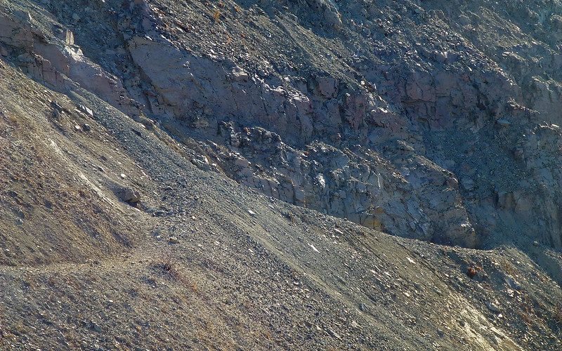
Scan traverse for slide sections as shown here. (Photo: Feb 2015)
Three, maybe four, slides across trail visible here. (Photo: Feb 2015)
Karl
Back on the trail, again...
Back on the trail, again...
-
tbritt2112
- Posts: 42
- Joined: April 18th, 2017, 3:18 pm
Re: Boundry Trail at MSH
Those are great pics. Thanks. The snow up there seems to vary greatly. The March 2016 pics shows plenty of snow while the 2 from February 2015 shows none at all. What do you think is the best site to monitor the weather at MSH? I use these two.
http://forecast.weather.gov/MapClick.ph ... PkxWtIrLIV
https://weather.com/weather/today/l/060301:13:US
The temps between the two can be off by as much as ten degrees, especially the day time high temps.
http://forecast.weather.gov/MapClick.ph ... PkxWtIrLIV
https://weather.com/weather/today/l/060301:13:US
The temps between the two can be off by as much as ten degrees, especially the day time high temps.
-
adamschneider

- Posts: 3716
- Joined: May 28th, 2008, 10:02 pm
- Location: SE Portland
- Contact:
Re: Boundry Trail at MSH
The first one is an interpolated "point" forecast that takes elevation into account, the second is for an indeterminate area somewhere near Mt. St. Helens. To further muddy the waters, here's the NWS zone forecast, which is helpful because it lists freezing levels: http://forecast.weather.gov/MapClick.php?zoneid=WAZ019tbritt2112 wrote:http://forecast.weather.gov/MapClick.ph ... 4599609375
https://weather.com/weather/today/l/060301:13:US
The temps between the two can be off by as much as ten degrees, especially the day time high temps.
Overall, I always trust weather.gov over weather.com. The Weather Channel doesn't have local employees who specifically know Pacific Northwest weather; the National Weather service does.