Sparklehorse and Lily did us a huge favor by heading out Friday morning for Anthony Lake to reserve us a car camping site. Jeff and I had to work that morning and finally caught up to them in Baker City a bit before 6 PM for a quick bite. The Elkhorn Crest trail is a point-to-point hike which we decided to tackle north to south. There are two options for the south trailhead, and we opted for the one with more driving, but much better road conditions. After dropping off Sparklehorse’s vehicle, we made it around to camp at Anthony Lake on the north end around 10 PM.
Day 1 - Elkhorn Crest (AKA, Anthony Lake) TH to Summit Lake, 10 miles
Saturday we packed up and got on the trail around 9:30 AM. The low clouds bunching up on the mountains had us a little worried. After a few stop-n-go misfires we finally got a rhythm going for the climb up to Angell Pass at 8200 feet. I think we were all mesmerized by the GRANITE rock we saw, very reminiscent of the nearby Wallowa Range or the Enchantments in Washington. As we broke above the trees we had a great view of the Antone Creek drainage and Van Patten Peak, whose western face was just starting to light up in the morning sun. The menacing clouds we saw at camp were clearing up nicely. Once we reached the pass we officially entered the North Fork John Day Wilderness.

Early meadow

Climbing

Inviting and trail-less meadow along Antone Creek

Van Patten Peak and Antone Creek drainage

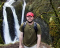
The four amigos rally to Angell Pass
Another half mile brought us to Dutch Flat Saddle. Dutch Flat Lake sat below us to the east and Crawfish Meadow to the northwest. Two backpackers, the only two we saw for the entire day(!), gave us a heads up on how much colder sleeping on the east side of the crest had been compared to the west. They were a little jealous we had a car shuttle ready for us on the south end. They had done nearly the whole thing as an in-and-out.

Dutch Flat Lake

Dutch Flat Saddle, North Fork John Day Wilderness

Crawfish Meadow
We continued south, the trail gradually sketching a heartbeat profile between 7700 and 8200 feet elevation. At such elevations the views were outstanding and rarely obstructed; Cunningham Saddle and Nip-and-Tuck Pass at 7800 feet; and then Lost Lake Saddle at 8100. Sloans Ridge above the North Fork of the John Day River showed evidence of recent fires to the west, while Lost Lake and the North Powder River drainage to the east stole our breathe away. As quiet as the trail was (we briefly spotted a hiker up ahead before Nip-and-Tuck, otherwise no-one else), we were surprised at the lack of animals. Ground squirrels and birds were our only other company.

Cunningham Cove and fire scars on Sloans Ridge

A look back to Cunningham Saddle

Nip-and-Tuck Pass, 7800'

Beautiful Lost Lake and North Powder River drainage

Our small footed buddies
Mt Ruth had been in view since before Nip-and-Tuck Pass. I wondered how the trail was going to traverse her east side, but in fact the crest trail swung us over to her western face. The temperature was warming up, and for this one stretch I wished I hadn’t forgotten my sunglasses back at the car with the sun beaming off the light colored rock. Lily was quick on the draw with her camera, and we gave her the nickname “One-shot” as she has such a skill at framing and capturing those magical moments in time.

North Fork John Day River along west flank of Mt Ruth

8600' Mt Ruth


Nearing Cracker Saddle

Strawberry Mountain to the southwest
As we neared Cracker Saddle we saw, “What!?”….hmmmm, yes, we saw cows. We couldn’t believe it, but a look at the map helped shed some light; part of the land around this saddle is not in wilderness protection. Technically I think the cattle had crossed over into the wilderness, but apparently free range grazing is okay around there.

Huh?
A warning about Cracker Saddle. This junction and the next one about 300 yards further on are confusing. I highly recommend you read Aimless’ directions from the post made last year. They were invaluable. I marked this photo with a green arrow to help highlight the first part of the correct route as well.

Cracker Saddle junction confusion
Our final push for the day took us a mile and half off the main trail to our stop for the night at Summit Lake. Wow, what a pretty lake! Maybe more so than the others in the group, but I was just amazed there was no one else there when we arrived. A holiday weekend and we had the lake to ourselves. Our camp maestro Jeff got a most welcome fire going in the fire ring as we finished dinner. When the fire finally died down so did our desire to stay out in the cold.

Mt Ruth and North Powder drainage on side trail to Summit Lake

Summit Lake
Day 2 – Summit Lake to Twin Lakes, 13 miles
At 7250 feet it got pretty cold overnight. The temperature in my tent the next morning read 34 degrees. Sparklehorse’s thermometer hung outside the tent recorded a low of 27. At least the air had stayed calm. Lily and I had both brought hardboiled eggs along for breakfast. She had the absolutely ingenious idea of re-warming them again in hot water. Great! After numbly eating my first cold egg, it was pure pleasure to watch the steam come off the second egg as I cracked off the shell. Sparklehorse even talked me into some instant hot coffee. I’m not a coffee drinker, but it seemed to hit the spot that chilly morning. Even though mosquitoes were not a problem, somehow barking spiders had hunkered down and survived the cold, popping out for several surprise appearances.
The patch of overhead blue was taken over completely by clouds by the time we packed up and headed out, the peaks above the lake now shrouded in gray. As we retraced the 1.5 miles back to the main crest trail, minute ice crystals flashed in a few short sun breaks. On the main trail we could see frost deposited by the clouds on the higher elevations, but any precipitation held off. With several layers on for warmth, the overcast sky, and the red-tinted landscape, it all combined to make the day feel much more like fall rather than late summer.

Clark's Nutcracker, common along the crest trail


Mt Ruth from the south, Cracker Saddle (at left)

Western Union Basin
While the trail took us south, we had to make several half circles back to the north as we contoured around a couple drainages. As we rounded one, Lily spotted a structure a couple hundred feet off trail. Much to our amusement it was an old phone with a sign stating “Local calls to God only.” Sparklehorse dialed it up for a brief conversation. To the southeast we finally got a real glimpse of Rock Creek Butte, the tallest peak in the range at 9106 feet.

Local calls to God only

Lily and distant Rock Creek Butte
Little by little the clouds broke up as we progressed south, the sun warming us more and more in tandem. Our wilderness experience was broke once more with the view of an active mine below the trail, while four or five gunshots rang out from what must have been some nearby target practice. As Jeff and I led the way we were oblivious to a couple deer that Sparklehorse was fortunate to spot while following behind us.

Buckeye Mine
Contrary to the day before, the trail kept a fairly constant grade up, topping out at 8400 feet along the flanks of Rock Creek Butte. Also contrary the early part of the trail, there was now a lot less granite and seemed to be more volcanic in nature. By mid-afternoon we found we still had over 4.5 miles to go. We decided to split up, with Jeff and I pushing ahead to locate and stake out a good campsite and get a start on the normal camp site chores.

Rock Creek drainage

Jeff leads the way

Walking the crest
The trail turned towards the east as we rounded Rock Creek Butte, with full views of the Sumpter Valley to the south. As we rounded yet another corner, below us patches of white stomped upwards, mountain goats! We knew there was a population in the range, and to finally see them was a great thrill. They eyed us cautiously as they ascended, and as we continued to approach decided that was enough and kicked it into high gear up to the summit of Rock Creek Butte. I think if I could choose to be an animal, a mountain goat would be right up there on the list. It was especially satisfying for Jeff and I as we hadn’t see any of these creatures the last time we’d been to the Enchantments.


Sumpter Valley

A rare spring near the crest trail

Goat!

A little too close for comfort...the goats make a quick exit.

Away to the summit

Steep eastern slope of Rock Creek Butte
At long last Jeff and I rounded another corner and the spectacular Twin Lakes came into view, our home for the evening. Down below we could see a fisherman trying his luck on the smaller upper lake. We walked the three-quarters or so of a mile towards Elkhorn Peak, then descended the mile and 400 feet to the lakes. There were numerous camp sites to be found, and even though another group was already setup between the two lakes, we had plenty of options.

Twin Lakes await (photo by Jeff S)

Summer skies, Ironside Mountain to the south
Within a half hour or so we could hear Sparklehorse and Lily traversing the trail above. They’d found our little bread crumbs we left behind to confirm the way (I’ll let Jeff or Sparklehorse share some pictures). That night was not any warmer. Sparklehorse recorded a low of 23 degrees. For some reason though I seemed to have slept the best that night of the group.

Sparklehorse and Lily descend to camp
Day 3 – Twin Lakes to south TH on Forest Road 030, ~3.2 miles.
Our journey was pretty much done after a big first day and even longer second day, so our mood was a little more casual on the third. After breakfast Lily and Jeff took a short hike back up to the crest trail to reclaim a lost lens cap and get some morning overlook shots of the lakes. I slowly followed partway up, but was quickly distracted by some distinct “cheeps” along a trailside rock field. I stood still and within a moment a pika ventured out onto its perch 50 feet or so below me. Not long after another came out to answer its calls just eight feet away from me. I kept still and we eyed each other for three or four minutes, each wondering what may happen next. Man are they cute creatures. No denying that!

Pika

Dictionary cute


Lily and Jeff descending back to camp, Rock Creek Butte upper right
As we packed up to leave, one final surprise was in store as seemingly out of nowhere I spotted a goat and its kid across the lake. We all got some shots as the two slowly perused the rocky slope for second breakfast.

Twin Lakes camp

Breakfast for two
Our descent took us through some final meadows before heading into the woods where we found welcoming ponderosa pine and ripening huckleberries.


Descent to the trailhead

Almost there
I must say this was a fantastic trip and am even better group to go with. For such a beautiful area on a holiday weekend the area was astonishingly quiet. If you haven’t been there I’d say GET IT ON the list!
-Fettster