Yesterday, I hiked the PCT out and back from Lolo Pass to Buck Peak. Except for four major blowdowns between the Lost Lake trail junction and Buck Peak, the PCT was in excellent condition. Outbound, I came across a 3-person USFS crew working on the trail (according to their sign, stimulus money at work) – by the time I returned they had removed at least one large tree from across the trail (Thanks!). A few patches of snow – some large – lingered in the shade, particularly where the trail had a northern exposure, but none of these were an obstacle (they’ll probably be missed as snowcone material once things really heat up).
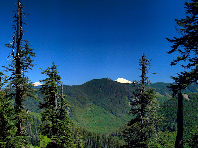
Aside from being a very pleasant section of the PCT, this trail (and Buck Peak) offer big views of many of the NW’s major summits. Early on, I had a view of Adams and Rainier,
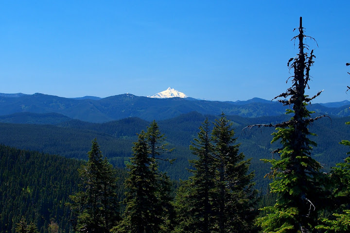
and then of Jefferson.
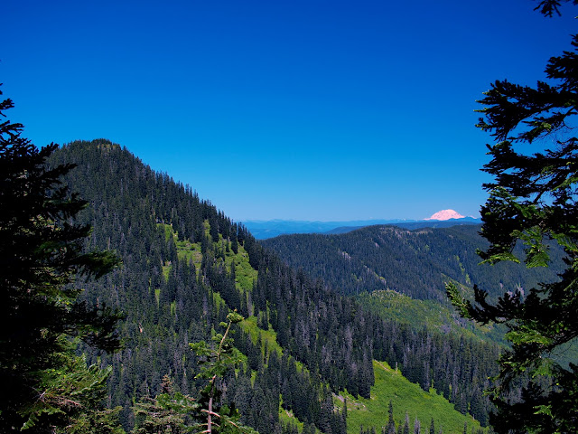
After about 6 mi, Buck Peak (left) and Rainier (right) came into view,
and I was soon on the summit of Buck.
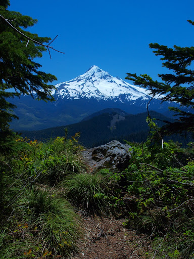
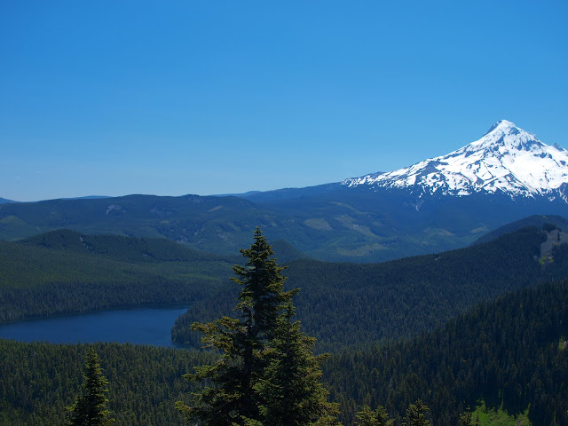
From there, I had views of Hood,
and Lost Lake. They don’t show in the photos, but several large avalanches had swept down the N face of Hood on to the Reid Glacier and there were also signs of numerous rock falls and slides. It all looked very unstable and immensely dangerous.
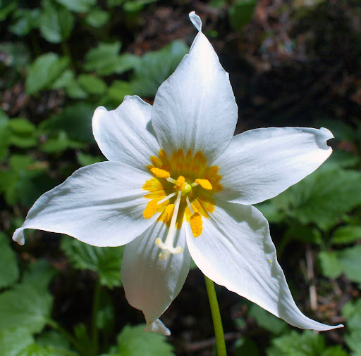
Flowers seem to have peaked in this area, but there were a lot of avalanche lillies along parts of the trail,
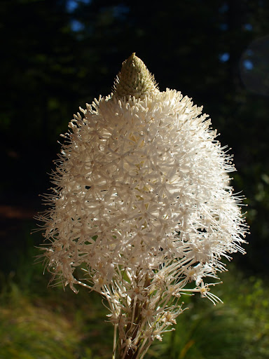
and also some bear grass blooms.
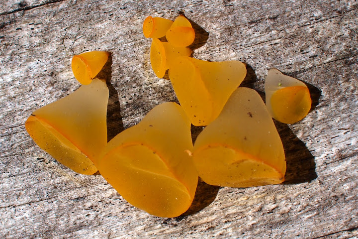
These little fungi look like “gummy bears” at a distance and finely crafted glass sculptures up close.
From Lolo Pass to Buck Peak and back is 16 mi with a total gain is 2600’ - but the PCT is so comfortably graded that this gain is hardly noticeable. I just strolled along the excellent tread enjoying the forest and the occasional big view. In addition, a stiff breeze blew the whole day, which swept the bugs aside and kept temperatures very comfortable for hiking. Another great day in the woods – certainly beats working!
Buck Peak 06-July-2010
Re: Buck Peak 06-July-2010
Nice pictures! Jane and I did this on a foggy day once, so it's nice to see what we would have seen.
- Splintercat
- Posts: 8333
- Joined: May 28th, 2008, 10:03 pm
- Location: Portland
- Contact:
Re: Buck Peak 06-July-2010
Thanks, Van - nice angle on Indian Mountain in that Adams/Rainier view, too. How was the spur trail to Buck Peak? I recall it being rather brushy... but maybe it was "stimulated" too?
Tom
Tom
Re: Buck Peak 06-July-2010
OneSpeed wrote:Nice pictures! Jane and I did this on a foggy day once, so it's nice to see what we would have seen.
10/2006, but my bear tracks pic disappeared! I'll look for that later, it was a neat hike!:
http://www.portlandhikers.org/archive/view/8802
Re: Buck Peak 06-July-2010
Spur trail was in OK shape - it had been brushed out for most of its length. Don't know who's responsible for doing that.Splintercat wrote:Thanks, Van - nice angle on Indian Mountain in that Adams/Rainier view, too. How was the spur trail to Buck Peak? I recall it being rather brushy... but maybe it was "stimulated" too?
Tom
-
- Posts: 62
- Joined: October 20th, 2008, 4:21 pm
Re: Buck Peak 06-July-2010
I'm so glad to hear that the spur trail to Buck Peak has been brushed out. Good question and thanks for your reply.
barb
barb