
“Into the Fire”
6/23/18
Rating: 3 Stars
Miles: 14.1
Time: 7 hrs, 40 min
Avg MPH: 1.8
Elev Min: 300’
Elev Max: 4,100’
Total Ascent: 4,160’
Steps: 33,000
Flights of Stairs: 396
Time Up: 3:30am
Sleep Hours: 5
Start Time: 5:00am
Temp Low: 45 (60 at trailhead)
Temp High: 70
Other hikers: 24
Male:Female hikers: 54%/46%
Longest time without seeing a hiker: 5:40
Wildlife: Birdsong, Hawk, Yellow Butterfly
Parking Permit Required: Yes
Parking Lot: ~25 cars (gravel)
Bathrooms: Pit toilet
Columbia River Gorge * Nick Eaton Ridge * Tomlike Mountain View * PCT Benson Plateau view * Gorton Creek Ridge * Mt Adams view * Indian Point
Opening Shot:
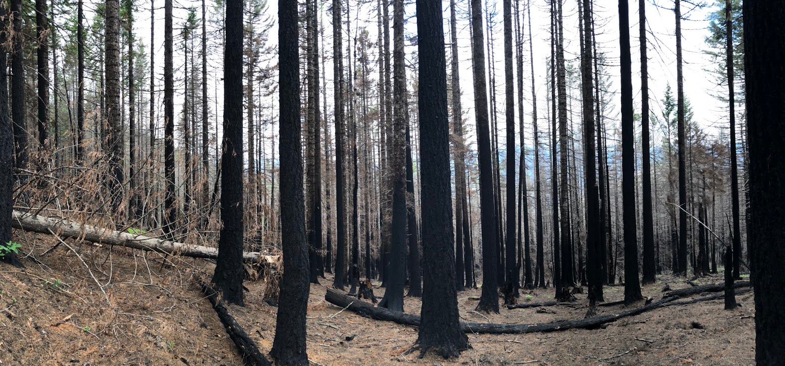
The desolation on Nick Eaton Ridge

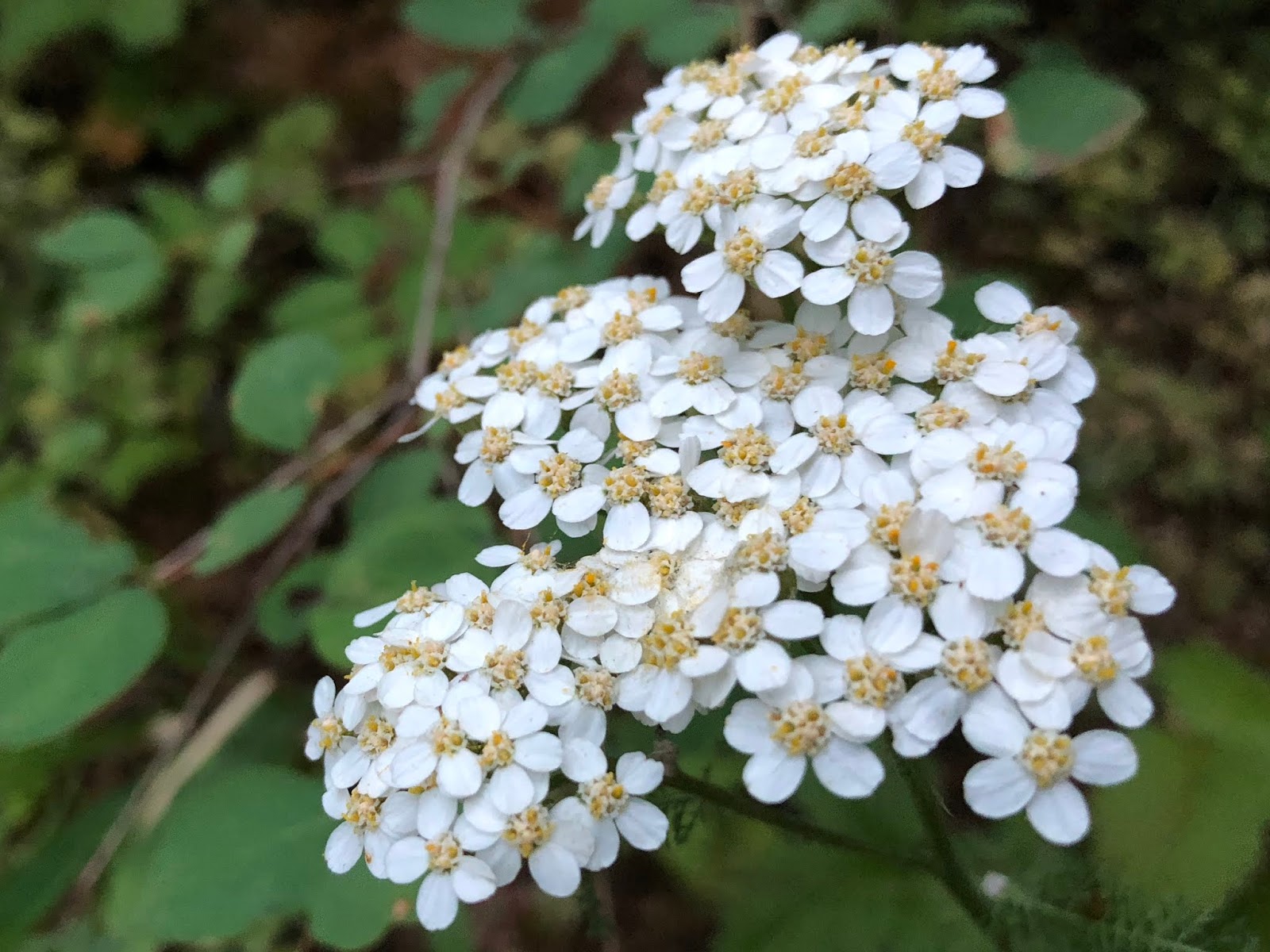
It was my typical early morning start, but I was a tad tardy, starting at 5am, just after dawn. I quickly made it past the power lines, which seemed to be to lower fire-line for the burn. The morning birdsong was abundant. The burn was reasonably light up to 900’ where the first trees appeared that were topped out. I saw Yarrow along the way.
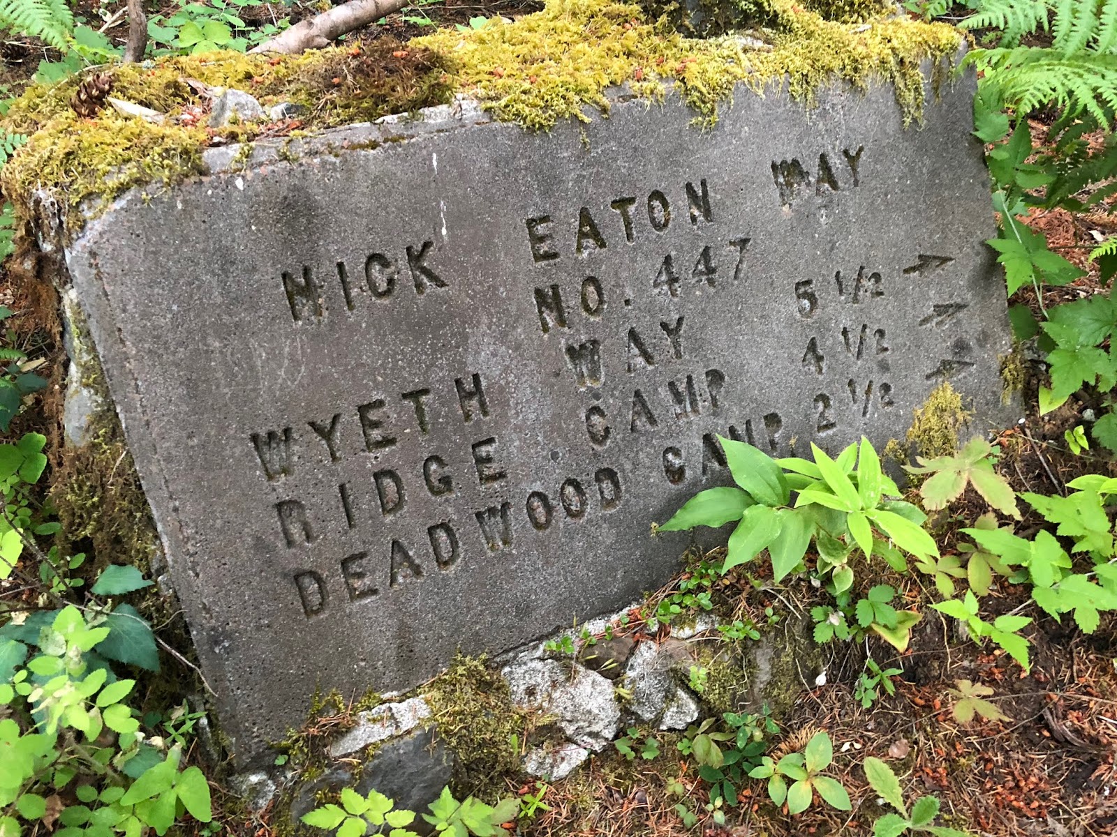
I passed the Herman Bridge Trail to the right and then veered right on the Herman Creek Trail before quickly hanging a left on the Nick Eaton Way Trail that steeply climbs the nose Nick Eaton Ridge. There’s a cool-looking concrete sign just after making the turn, I wonder when this was installed?
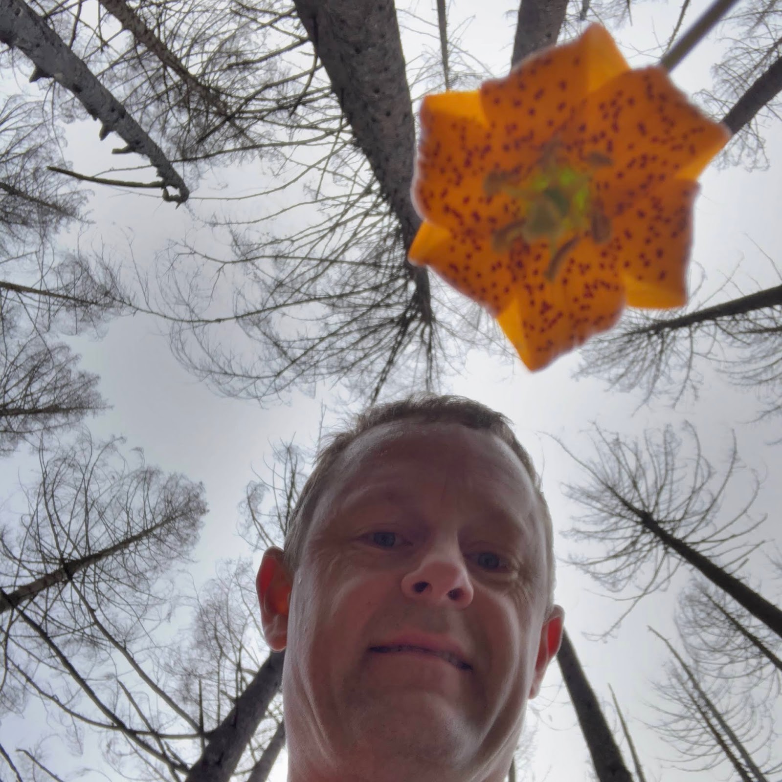
The Tiger Lily was amazing today! I’ve never seen it so prevalent!

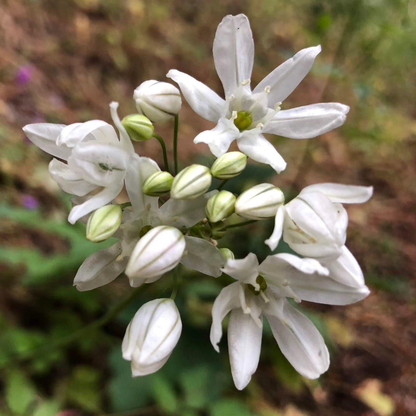
This white flower was a new one for me and I can’t figure it out...what is it?
The Bluehead Gilia was perfect.

The morning clouds still let me see across the Columbia to Carson and Table Mountain.
This Phantom Orchid is super cool. First time I’ve seen one and it was only in this one spot for the entire hike.

The most surreal part of these Gorge hikes post Eagle Creek Fire, is the ability to see through the forest to the river. It’s frankly quite weird to me. A lot of people are saddened by the fire. Don’t get me wrong, I think the destruction caused was terrible. But I’m also very optimistic that it will return to be a longterm healthy benefit. It amazes me to see so much green life out already.

Beautiful Oregon Sunshine.

This Taper-Tip Onion was pretty rare today.

Some Beardtongue.

At 2,500’ I broke out to my first big view in this meadow. This is actually the best view of the hike by far outside of Indian Point.

This is looking west to a classic mosaic burn where the Pacific Crest Trail climbs up to the top of Benson Plateau.

This looks down the Columbia to the west toward Cascade Locks and its Bridge if the Gods.

Here is a video clip of the area.
2018-06-23 Nick Eaton Meadow from Michael Irving on Vimeo.
I think this might be Thread-Leaf Phacilia?

I passed the Ridge Cutoff Trail right by Peak 3152. This is probably the best bang for the buck to turn here. The fire was burning pretty hot up here.

Here is some pretty surreal video that I took with my GoPro.
2018-06-23 Nick Eaton Fire from Michael Irving on Vimeo.
Like I said, Tiger Lily everywhere.
I saw very little Paintbrush on this hike which surprised me a bit.

I could see the forest through the trees.

I passed the Deadwood Camp Trail and kept going up. At 3,500’ was the biggest payoff view to the east.

This pure Columbia Windflower was among the worst of the burn.

After the Deadwood junction, the trail went from being excellently maintained, to obliterated. It was weird, it was almost like a dead end...it was just gone. There were so many dead pine needles on the ground that it was like coming into light snow and losing the trail. Fortunately, it’s pretty obvious to go up the ridge, so that’s what I did and boy was it steep! Maybe there are supposed to be switchbacks? The charred bark flaking off added some interesting color.

I passed the Casey Creek Trail...how did I know? The sign of course!

Beargrass started appearing in abundance,

and I topped out on Peak 4060...with no view.

As I continued south, past the peak, a switch was flipped...no sign of the fire anywhere. I met up with Gorton Creek Trail and continued south to check out Ridge Camp. I actually missed it and had to backtrack to find it. If I was expecting the Ritz, it was more like Motel 6. But at least it was untouched.

Up high was Queen’s Cup.

Heading back now and down the Gorton Creek Trail, I was surprised that there was still no sign of fire. I thought that this ridge might have been spared. That only lasted for about 400’ of my descent before it made its presence well known once again...although more mosaic and not as hot. There were parts of the trail where I wished I had a machete as it was so overgrown and the trail was eroded on a side hill. It was such a stark contrast to the other ridge.
I totally lost the trail in one section due to overgrowth, but thankfully, popped out into this massive talus field.

Western Wallflower was here in small amounts.

We keep hearing this term “mosaic burn”, it was really quite remarkable. I took this picture...

...and then walked 100’ and took this picture...incredible!
The art of the burn can be quite interesting at times.
In this hot area, I lost the trail again. What was remarkable was that I figured out that if I simply followed the “green trail” that it was marking the path of the real trail. I wonder why that is? Humans and animals stirring up the ground making it more conducive for germination??

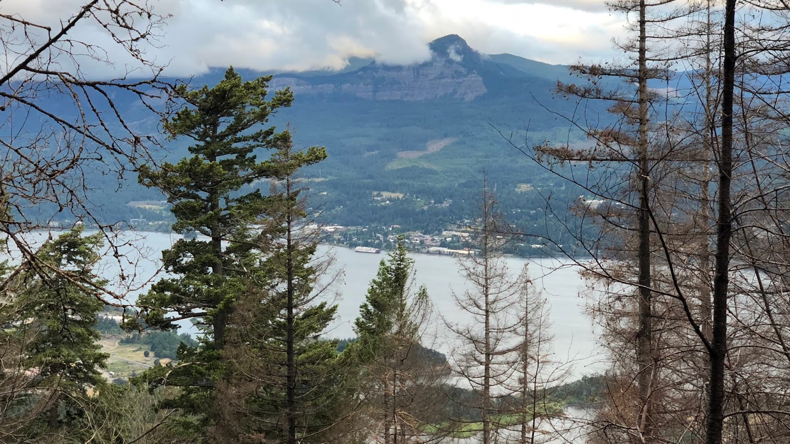
Just before dropping down off the ridge at 3,000’, I could see through the trees again over to the Wyeth area to the east.

Here is a little video clip of it.
2018-06-23 Wyeth View from Michael Irving on Vimeo.
Dropping off the ridge it got “hot” again with a pretty sterile part of the burn.

I remember hiking this loop last year and having to bushwhack and climb over blowdown. Not a problem this year!
I dropped down to Camp Deadwood, which I also missed the first time by. Let’s just say that it’s VERY appropriately named now, with LOTS of dead wood covering it.

Gray’s Creek was running nicely. I also saw my first person for the day who was heading out on the trail. The Deadwood Cutoff Trail sign was a helpful identifier.

As I reached Indian Point, I started to see people regularly. I headed out to the stunning point.

I love this view to the east...one of my favorites...with Wind and Dog Mountains.

Here is the view to the west.

Here is a video of the panorama.
2018-06-23 Indian Point from Michael Irving on Vimeo.
Back to the trail, I’m on the homestretch. With the trail running parallel to the river, I got a really interesting perspective of seeing the river through the trees. Check out the video clip.
2018-06-23 Gorge Fire View from Michael Irving on Vimeo.
Mt Adams finally peeked out of the clouds. There are nice views of it up higher, but too many low clouds today.

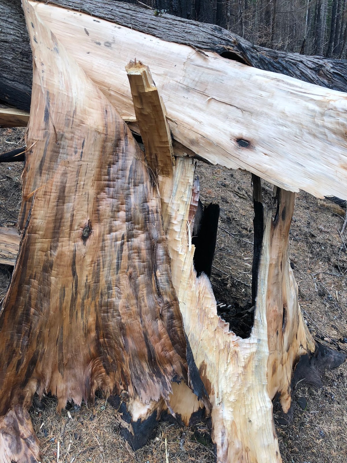
This was my biggest blowdown of the day...massive!

I saw Baneberry for the first time here.

As I passed a couple hikers on their way back I heard one call after me saying, “Are you GoalTech”? I turned around and said yes. I was very fortunate to meet my online acquaintances Arturo and Mani, from OregonHikers.org! We had a great visit for several minutes. It was like we were old friends, even though we had never officially met. They both commented on how much they liked my pictures and trip reports which was very nice to hear as I wonder sometimes if they are inspiring at all to others. As I told them, I’d write them up even if I were the only one to read them, but it’s gratifying to know that others find value in them too. This is Mani on the left, Arturo in the middle and me with our selfie.

After a fun visit, I headed down the trail as I could smell the barn! The very interesting Self Heal flower was here,

and a new one for me in the Plumed Solomon’s Seal.

A few more turns and I was back. Wow, a surreal hike and what a workout! Whew!
Summary:
This is a challenging hike as it’s almost as much gain as Mt Defiance. There is not much of a payoff in views up higher. The best bang for the buck is to do the lower loop via the cutoff trail or Deadwood trail cutoff. The big payoff is lower down at Indian Point which is spectacular. I’d bump up the rating to a 3.5 for the lower loop only to Indian Point. It’s a great training hike!
Favorite experience of the day:
Meeting and visiting with 2 OregonHikers.org online friends Arturo and Mani. (Indian Point
Is always spectacular too)
Least favorite experience of the day:
Having to do some route finding and the brush bushwhacking high on Gorton Creek Trail.
Today's elevation:

Google Earth with Track:
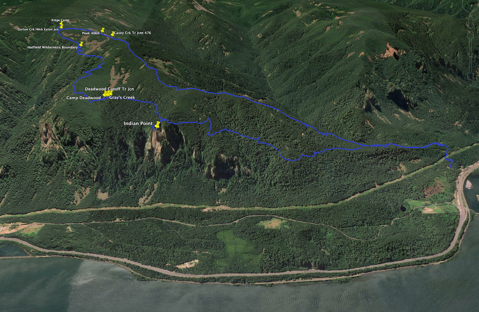
As I was looking at my track on GoogleEarth I was reflecting that the terrain was pre-fire. As I skimmed over the terrain, I was shocked to see a small plume of smoke...it was the origin of the original Eagle Creek Fire that was back deep, before the firework incident. Wow...so crazy to see that tiny spot of smoke that ultimately joined the firework fire to create this massive desolation. Here is a screenshot of its beginning.

GPS Track:
https://www.gaiagps.com/datasummary/tra ... 5dcb4ba32/
-GoalTech (aka Mike)
www.GoalTechHikes.com
@goaltechhikes (Instagram)


