Mount Pisgah (Lane County) 5-01-18

This forum is used to share your experiences out on the trails.
Post Reply
User avatar
bobcat
Posts: 2768
Joined: August 1st, 2011, 7:51 am
Location: SW Portland

Mount Pisgah (Lane County) 5-01-18

Post by bobcat » May 5th, 2018, 8:09 am

While in Eugene, I spent half a day hiking the west slopes of Mt. Pisgah, a basalt hill wedged between the Middle and Coast Forks of the Willamette River near their confluence. This is a great wildflower hike, and at this time of year, two plants stand out: camas seems to be blooming everywhere, and the poison oak is ubiquitous.

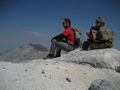
The trails in the Howard Buford Recreation Area, which is Lane County’s largest park, are numbered. I began at the North Trailhead and took Trail #3 and then Trail #1 to the summit. Here there’s a bas relief pedestal that memorializes Jed Kesey, son of noted Oregon author Ken Kesey, who died in 1984 in a car accident at the age of 20 while on the University of Oregon wrestling team. To the south are the farms and homes of Pleasant Valley, where Ken Kesey lived. On a clear day (not the day I was there), you should be able to see Diamond Peak. Spencer Butte dominates the western skyline.

View to the Middle Fork Willamette River, Trail #3, Mt. Pisgah.jpg
Oregon flag (Iris tenax), Trail #3, Mt. Pisgah.jpg
Purple snakeroot (Sanicula bipinnatifida), Trail #1, Mt. Pisgah.jpg
Common bastard toadflax (Comandra umbellata), Trail #1, Mt. Pisgah.jpg
View to Spencer Butte across the Coast Fork valley, Trail #1, Mt. Pisgah.jpg
Henderson's shooting star (Dodecatheon hendersonii), Trail #1, Mt. Pisgah.jpg
Jed Kesey Memorial, Mt. Pisgah Summit.jpg

To make a loop, I descended on Trail #6, and then connected to Trail #3. The latter is a running rivulet fueled by various hillside seeps that trickle down through the oak woods and camas meadows. I connected with Quarry Road (Trail #5) at Buckthorn Creek. Last year this trail, once a mud sucking quagmire, was surfaced with firm gravel. I passed a couple of extensive camas/buttercup meadows and hiked above a former channel of the Coast Fork.

Baby blue eyes (Nemophila menziesii), Trail #6, Mt. Pisgah.jpg
Descending through the oaks, Trail #3, Mt. Pisgah.jpg
Buckbrush (Ceanothus cuneatus), Trail #3, Mt. Pisgah.jpg
Buckbrush Creek, Trail #3, Mt. Pisgah.jpg
Camas meadow, Trail #5, Mt. Pisgah.jpg
Great camas (Camas leichtlinii), Trail #5, Mt. Pisgah.jpg
Coast Fork Willamette River, Trail #5, Mt. Pisgah.jpg
Timothy (Phleum pratense), Trail #5, Mt. Pisgah.jpg
Thick poison oak vines, Trail #5, Mt. Pisgah.jpg

At a gate, I entered the Mount Pisgah Arboretum, a 209 acre preserve dedicated to educating about native plants. Few of these are labeled, but I took a loop using the network of Arboretum trails that visited a wetland, the banks of the Coast Fork, an oak savanna, and a maple/conifer woodland. Then I headed back to the North Trailhead via paths on the west slope.

Vern Adkison Bridge, Mount Pisgah Arboretum.jpg
Tall larkspur (Delphinium trolliifolium), Mount Pisgah Arboretum.jpg
Fendler's meadow-rue - female (Thalictrum polycarpum), Mount Pisgah Arboretum.jpg
Oak copse on Quarry Road, Mount Pisgah Arboretum.jpg
Barn, Mount Pisgah Arboretum.jpg
Red columbine (Aquilegia formosa), Mount Pisgah Arboretum.jpg
Season tree, Oak Woodlands Exhibit, Mount Pisgah Arboretum.jpg
Grass peavine (Lathyrus sphaericus), Mount Pisgah Arboretum.jpg
David Douglas Monument, Mount Pisgah Arboretum.jpg
South Boundary-Incense Cedar Trail Junction, Mount Pisgah Arboretum.jpg
Sessile trillium (Trillium albidum), Mount Pisgah Arboretum.jpg
Field checkermallow (Sidalcea campestris), Trail #7, Mt. Pisgah.jpg
View to Spencer Butte, Trail #7, Mt. Pisgah.jpg

justpeachy
Posts: 3067
Joined: May 28th, 2008, 10:03 pm
Location: Portland, OR
Contact:

Re: Mount Pisgah (Lane County) 5-01-18

Post by justpeachy » May 6th, 2018, 7:51 pm

Very nice! Mt. Pisgah is so lovely in the spring. :D

User avatar
MariposaMan
Posts: 40
Joined: April 14th, 2014, 10:04 pm
Location: Eugene, OR

Re: Mount Pisgah (Lane County) 5-01-18

Post by MariposaMan » May 6th, 2018, 10:20 pm

Lovely pics and report. Mt. Pisgah is always worthy of a visit, but I agree that spring is especially nice. I last visited just over a week ago (it's practically in my backyard). And yes, Diamond Peak can be seen on a clear day, as well as the Three Sisters.

User avatar
Waffle Stomper
Posts: 3707
Joined: May 28th, 2008, 10:03 pm

Re: Mount Pisgah (Lane County) 5-01-18

Post by Waffle Stomper » May 14th, 2018, 7:31 am

What a lovely series of photos. I have to put that on my list of places to visit.
"When we try to pick out anything by itself, we find it hitched to everything else in the Universe." - John Muir

Post Reply