
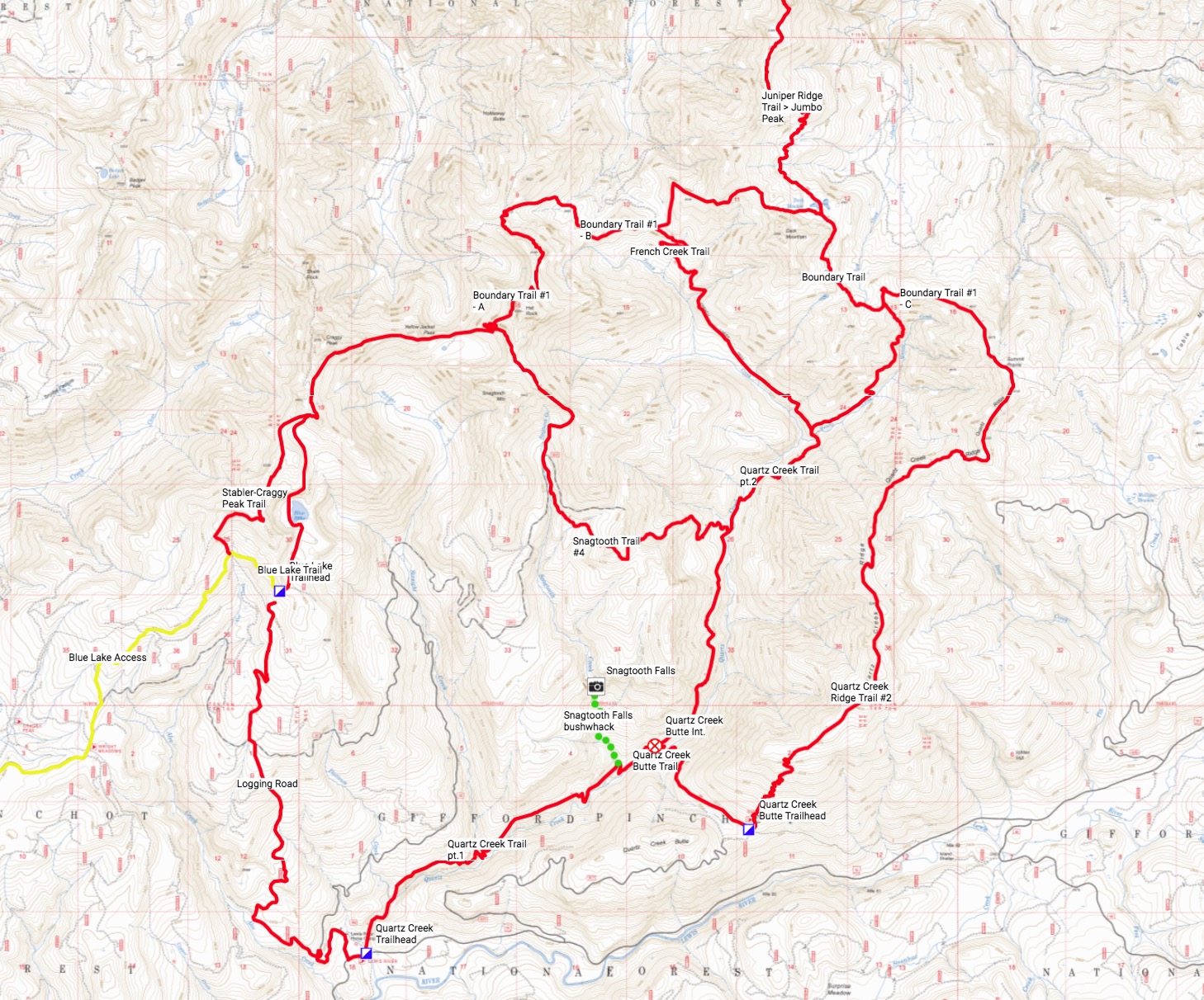
The trail started off fine—a nice tread rolling up and down (but with a general upward trend), and alternating between being close to Quartz Creek and farther up the ridge. The trail in that lower section looked like this—completely lulling us into a false sense of comfort (this pic was actually taken on the way back down)...
Unfortunately, I committed a classic (and colossal) error due to having to work right up to the moment I had to pack and dash to the airport—I forgot my printed maps. I typically use my iPhone (Topo Maps +) with paper as a backup (that I've never had to use), but in this case I didn't even remember to download offline maps of the Dark Divide (doh!). I had my trusty Garmin GPS (and spare batteries) loaded w/topo maps—but no trails, waypoints, etc. So we were more-or-less hiking blind, except for my memory of the trails on the map above that I'd spent hours staring at.
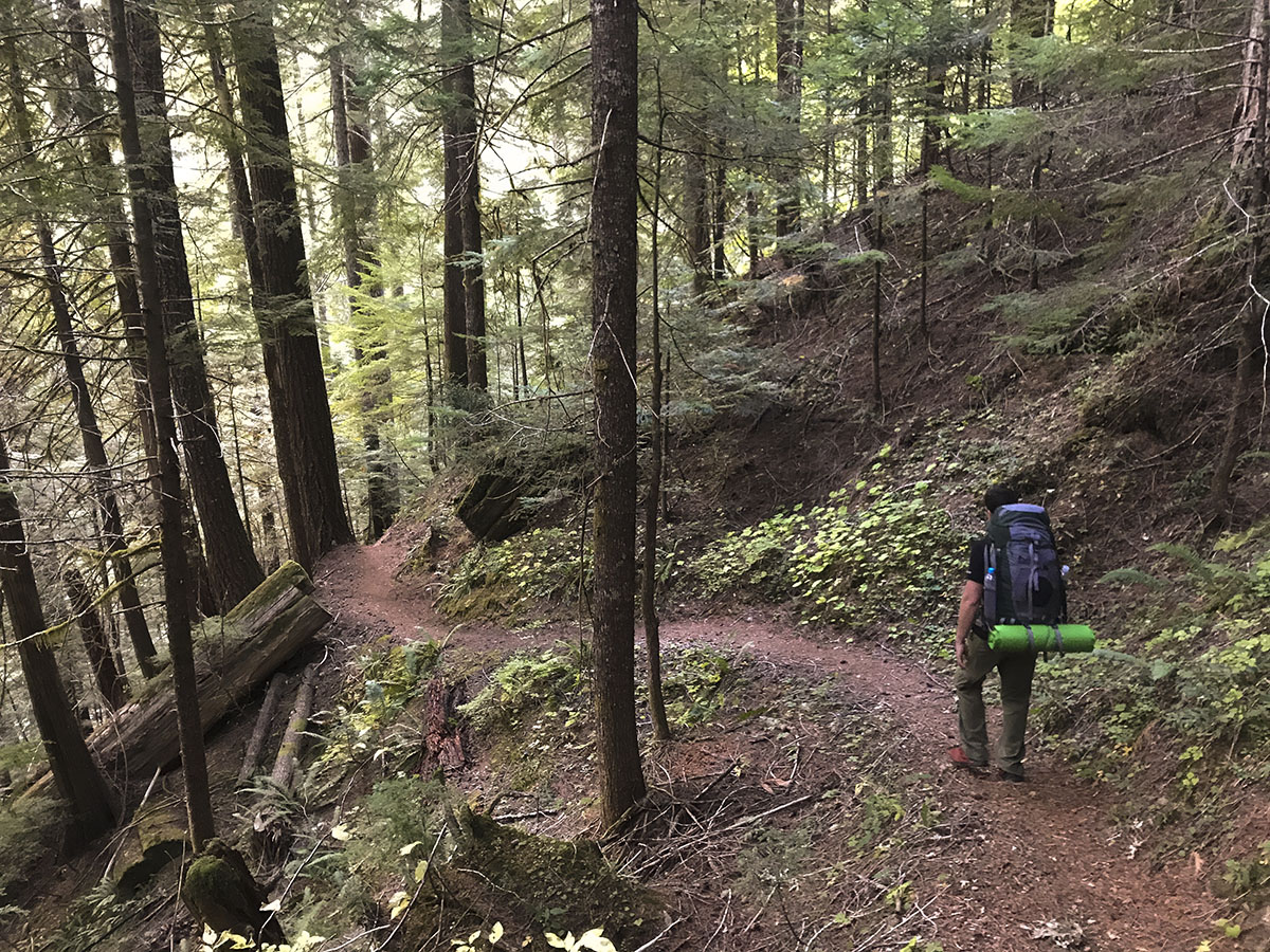
At Straight Creek, the Quartz Creek trail passes a beautiful series of falls and rock formations...
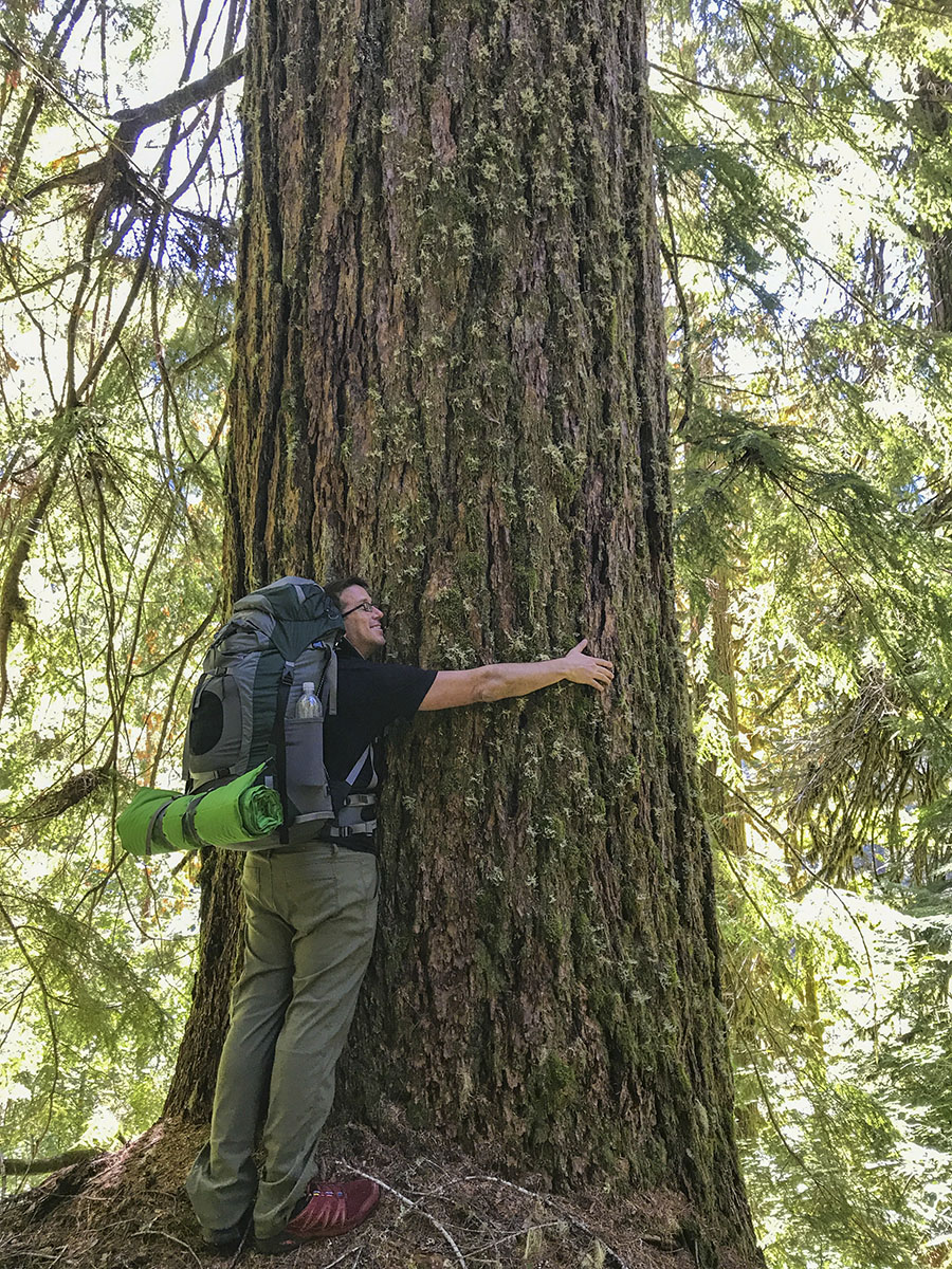
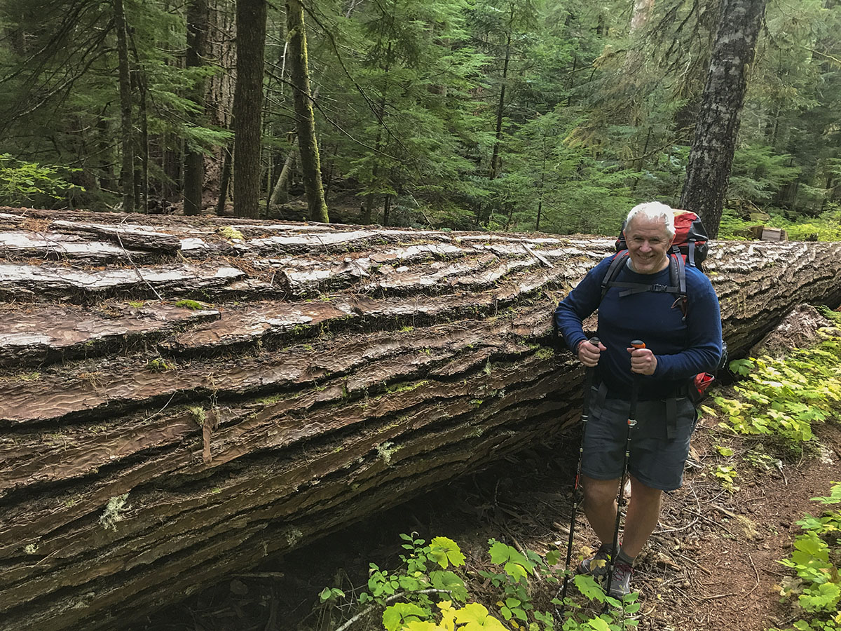
In the first couple miles past Straight Creek, the trail climbs through some spectacular stands of old-growth fir—some of the biggest I've seen in the PNW so far.
I knew the next two trail intersections were at Snagtooth Creek and French Creek, but had no idea how far they were. As we hiked onward past 6, 7, 8, then 9 miles, the trail steadily deteriorated. It became obvious that the vast majority of hikers on this trail go no farther than Straight Creek (or maybe Snagtooth Creek at the farthest). Past Snagtooth, the trail rapidly got worse: the gently rolling hills became tough slogs straight up, followed by losing that elevation by grinding back down to a stream crossing, then back up again.
It also became obvious that the sign we'd seen saying "Boundary Trail - 7mi" was not even close, as we blew past the point where it should have been and so not a trace of it. The trail tread became narrow and overgrown, with large, downed trees across the trail every hundred yards or so. Some were small enough to step over, but others required moves akin to getting onto a horse to get over.
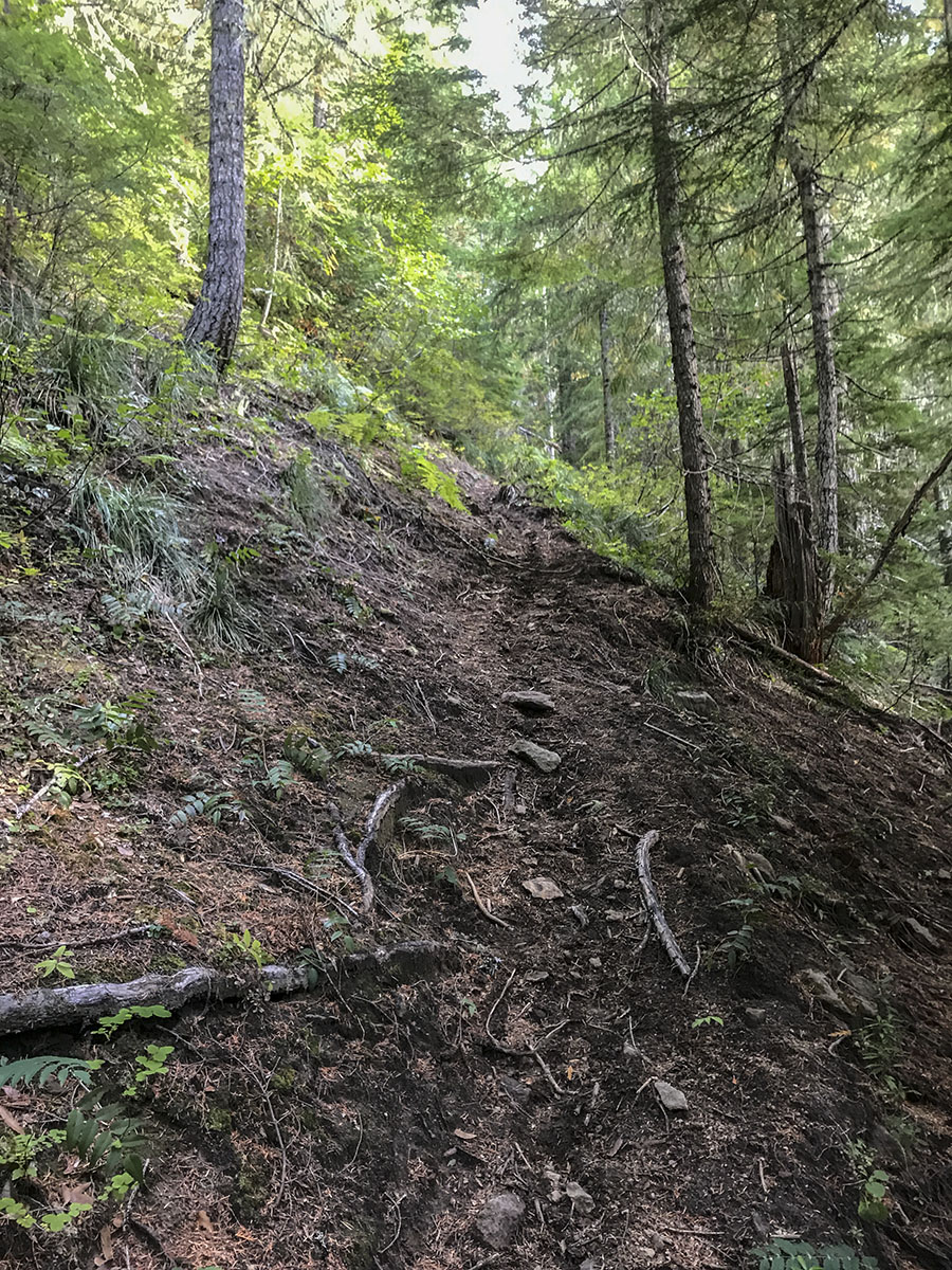
We passed mile 10 around 5pm. Any thought of stopping to camp was dashed by the hopelessly steep trail and steeper terrain on ether side of it—it would have been damn near impossible to camp anywhere, so we slogged onward. At mile 11, we seemed no closer to the Boundary trail—and the Quartz Creek trail got REALLY steep—as in, it basically went straight up the mountain at a ridiculous grade, with zero switchbacks. Here's what one bit of it looked like (it's steeper than it looks in the photo):
Miles 12 passed...then 13...then 14...and still no sign of the Boundary trail. It was now around 7pm and getting dark. We were exhausted and getting grumpy. Finally, at 14.85 miles we hit the Boundary trail—4 miles farther than the map claimed it would be. (Clearly the trail on the map misses a LOT of the ins & outs and ups & downs!) Hoping to find a nice campsite wth a view, we trudged east along the Boundary trail for another half-mile to find nothing—no grass, no clearings, no place to pitch our tent—just dense scrub and fir trees.
We turned and trudged back toward the intersection, and when we found a wide spot in the trail, I said "Screw it—let's camp here," and we proceeded to pitch our tent right in the middle of the Boundary trail.
While my friend and I aren't in just-finished-a-PCT-thru-hike shape, we're not out of shape: I do a 4-mile workout hike with 1K' of elevation gain 2-3 times a week. And the Quartz Creek trail kicked both our asses bigtime. We were TOAST by the time we got to the Boundary Trail (the PCT is like a paved sidewalk compared to this trail), and were so exhausted we blew off dinner and just crawled into our tent and crashed.
The next morning, faced with a choice of heading out the Juniper Ridge trail toward Jumbo Peak or taking the Boundary Trail back west toward Blue Lake, we were both spooked by how brutal the first day's hike was. Fearing hiking any further would doom us to a death march back to Road 90 and the car, we decided to just bail back down the Quartz Creek trail. Going back down wasn't much easier than going up (45-50 degree slopes down loose dirt is no fun).
We stopped at Snagtooth Creek for a long lunch break—cooking bags of Knorr pasta sides spiked with piles of extra salt and a few tablespoons of olive oil. (Of course it was the best lunch I'd had in ages, LOL.) We eventually made it back to Road 90 and the car around 4pm—and hightailed it back to a hotel in Woodland.
In conclusion, I still want to explore the Dark Divide, but I won't do it again via the Quartz Creek trail. It's just not worth the slog! I'd highly recommend Quartz Creek as a nice day hike—but only as far as Straight Creek—or if you want to see some of the best old-growth firs, keep going to Snagtooth Creek then turn back. The miles of trail above Snagtooth to the Boundary Trail are like a dangerous relic of a century-old deer path—not worth hiking unless you're into punishment!
Scott
