Red Buttes Wilderness June 19-23
Posted: July 11th, 2017, 3:44 pm
Long time lurker, first time poster! Unfortunately it’s taken me a little while to get this written up, and it's a bit of a novel, but hopefully the info is useful.
My boyfriend and I both had the week off work June 19-23, so we decided we wanted to do a 4 or 5 day backpacking trip. We had initially thought about doing the Mark Hatfield trail, but after looking at trip reports and the NOAA snow depth map for the area around North Lake/Rainy Lake decided that might be better for another year or later in the season.
Thanks to this forum, we decided to go down to the Red Buttes. We had an awesome adventure!
Our initial plan was to do a big loop starting from the Shoo Fly trailhead, up to Echo Lake on the Butte Fork trail and Horse Camp trail, then to Lonesome Lake and Azalea Lake on the PCT and Boundary Trail, then head to Cameron Meadows via the Fir Glade trail, FR 850/1050 and the Middle Fork trail, and the Frog Pond/Cameron Meadows trail, then back on FR 1040 to our car.
Things did not quite go as planned, but we still had a great time!
Day 1: Unfortunately, we had gotten a pretty late start - we don’t own a car so had to pick up a rental car and the rental car office didn’t open until 7:30. It was about a 5 hour drive down from Portland. We stopped off at the Star Ranger Station in Jacksonville to check on trail conditions - we were told there was some snow up along the PCT/Boundary trail from Echo Lake to Figurehead Mountain, but that the week before some folks had made it through and said it wasn’t too bad. Great! We even decided based on that not to take Yaktrax.
The result of all this was that we didn’t actually make it to the TH until 4pm. Turns out this was *not* enough time to make it up to Echo Lake before dark.
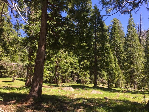
We headed out as I described - from Shoo Fly trailhead to Butte Fork, and then up up up up up up Horse Camp trail. Oof, that is steep. I generally much prefer steep uphills to steep downhills (bad knees), but this was just a grind in 95 degree heat.
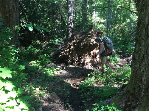
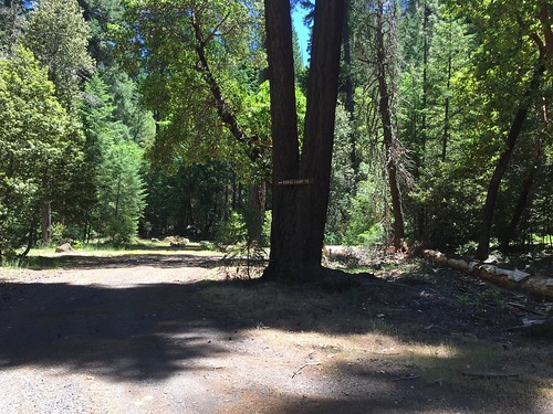
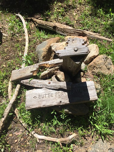
Overall the trails were in pretty good condition. There’s a big downed tree/root ball at the intersection of Shoo Fly and Butte Fork, but nothing indicating that it’s the intersection - we thought the two trails we saw were just different routes around the tree, and took the more-traveled looking path, which turned out to be the wrong way! Thankfully we realized our mistake within a few minutes.
There were three stream crossings along the Butte Fork trail on the way to Horse Camp trail - the first of these (Hello Creek) we couldn’t see a way across on the rocks and took our shoes off - I was grateful for my Crocs camp shoes.
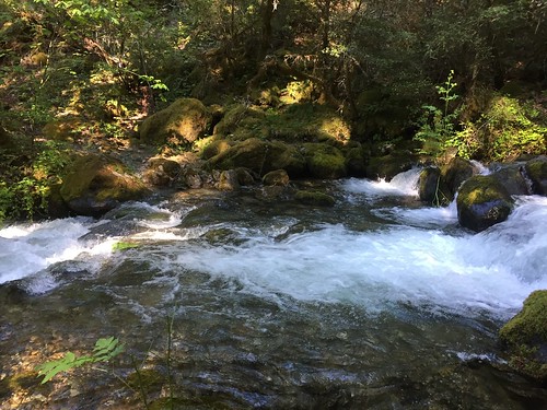
The other two crossings we were able to do on rocks/slippery logs - trekking poles were definitely necessary for balance on the slippery and somewhat decomposing logs.
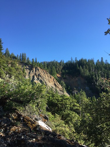
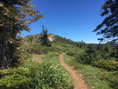
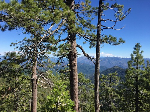
Then on to the Horse Camp trail. As I mentioned, this goes up pretty unrelentlessly. It’s something like a 3000 foot elevation gain in 3 miles up to the PCT. We were really feeling the heat (Possibly TMI… drank a full 2 liter bladder + more and didn’t have to pee until the next day.) We got some beautiful views though, including of the Butte Fork Slide, and it was great to see the terrain change - madrona trees, sedums, and a more desert-like atmosphere.
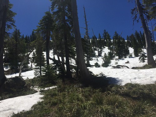
We got to Horse Camp and debated whether we should stop there, but we agreed to press on. Up through here the trail had been in pretty good condition - there were probably 3 or 4 trees down that we had to scramble over, but not too bad. As we got up above 4500 feet we got into more meadows. We started to see patches of snow, and the trail became much harder to find - no more than a faint track in some spots. Thankfully there were some cairns to help indicate we hadn’t lost the trail completely, but we had to do some poking around. As we got to 5000 feet there was more and more snow to get over, and we were having a much harder time finding the trail. We were also completely exhausted and losing the light. I worried that even if we did get to Echo Lake it would be covered in snow, and we would have to hike down to find a snow-free spot.
We found a reasonable-ish spot off the trail and decided to camp. We were both frustrated and exhausted and worn out. We were in a fairly marshy area, and there were quite a few mosquitoes. We cooked dinner by flashlight and collapsed in bed - despite the somewhat lumpy terrain we were camping on, we slept well.
Day 2: After the previous frustrating and exhausting day we let ourselves sleep in. Our campsite ended up actually being pretty good - really pretty in the meadows with views up towards the Red Buttes, not too far from a water source. While going to take down our bear bag, I even discovered an old fire circle with some baby trees growing in it - we weren’t the only ones to find this as a reasonable place to camp.
It took us a little to find our way back to the trail, and to find where the trail next went… and then probably less than 2 minutes up the trail there was an established camp site! Oh well. It was definitely hard going finding the trail in through here - pressing on the night before with the light dwindling would have been a mistake.
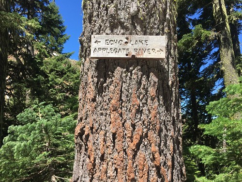
I had printed out USGS 7.5 minute maps of the area - the Kangaroo Mountain, CA quadrangle, and the Figurehead Mountain, CA-OR quadrangle. These indicate that the Horse Camp trail goes right up to Echo Lake, but in reality we came to what seemed like a trail junction… there was a sign pointing in one direction towards Echo Lake, and in the other to Applegate River (where we had come from).
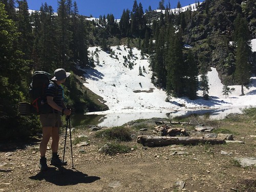
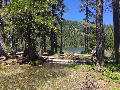
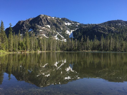
We followed the trail towards Echo Lake, and there it was! Although there was some snow on the ground and snow all above it up to the ridge, there were some clear, beautiful campsites. Oh well.
It looked like there might be a trail leading from next to a campsite, but pretty soon it felt like we were just bushwacking. We decided to head back to the sign we had seen, with the idea that maybe that was a trail junction. Once back there, it seemed like there might be a faint trail headed up the hill - as I said before, this trail junction, with a trail going off to Echo Lake, isn’t on the map we had.
We headed up the hill and pretty soon lost the trail amidst the snow.
We went a bit further, picking our way through the brush and snow, before deciding to pull out the map and compass. With the compass we were able to determine where we thought the trail would go, which also seemed like the gentlest path up the snow-covered ridge. We headed that way, picking our way across the slippery snow and steep slope. At this point I was definitely regretting the decision not to bring Yaktrax. At one point I crossed a snow-covered section to the next set of trees and slipped a few feet. When I turned back I said to N, “well, you’ll probably slip, but you’re not going to go too far because there’s some trees below.” He did indeed slip down the slope 5 or 6 feet, coming to a stop with the help of the branches.
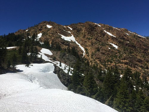
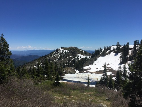
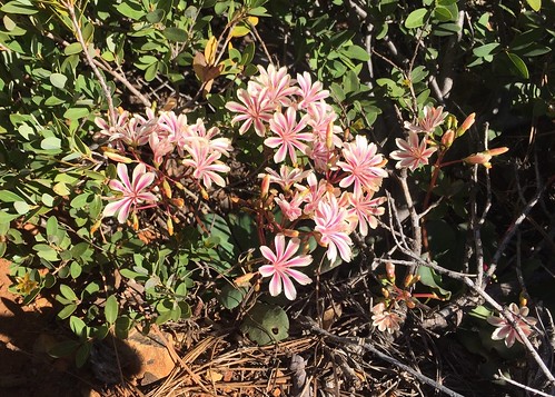
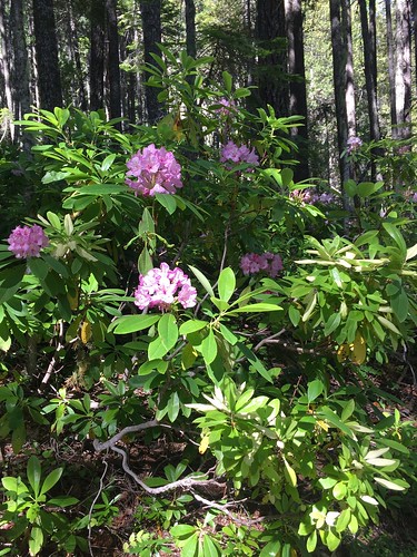
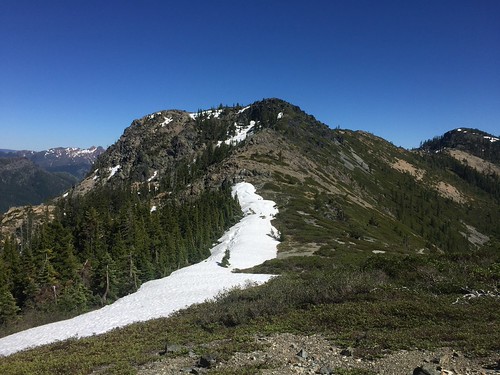
We finally got on top of the ridge and were welcomed by incredible views and wildflowers. We were very relieved, but in our relief and exhaustion we totally forgot to take pictures of what we had come up!
The Red Buttes, with a hint of the snow we came over.
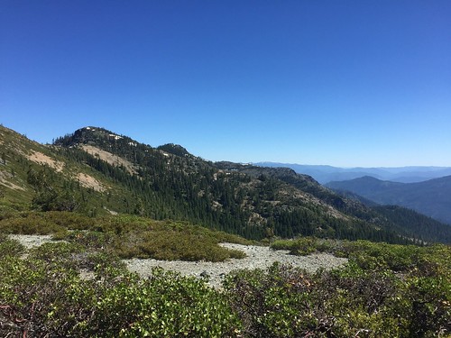
Looking South.
Looking along the PCT towards Cook and Green Butte.
We headed on the PCT and ran into the first people we had seen. 2 boys… they mentioned snow ahead and that they had turned back, but that they thought we could make it since we had poles. We stopped off at Bee Camp - a flat area with red rocks and streams - and had a snack. Plenty of water this year. There were some folks camped out here.
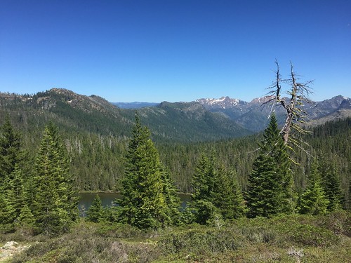
We headed down the PCT and came to Lily Pad Lake, still somewhat frozen over.
The trail intersects with a Jeep road a few times, and in one spot - right at Lily Pad Lake - there’s an unsigned trail junction with a trail leading up to the end of the Jeep road, ending at a rock wall and cattle gate.
We came around the lake and ran into snow on the trail… and then more snow totally obscuring the trail. The trail went along the side of a steep slope, then switchbacked over a ridge. All of this was covered in snow. We spent about 2 hours trying to figure out a way through - it seemed like going up onto the top of the ridge, then following the ridge down to the trail would be our best option, but after scrambling up rocks and bushwacking as far as we could, we still had about 10 feet of snow on an almost-vertical slope to go. It was past our comfort zone, and furthermore we knew that there were several other spots this elevation or higher before we got to Lonesome Lake, and we were pretty damn tired of dealing with snow.
We ended up bushwacking all the way around Lily Pad Lake, back to where we had started 2 hours earlier on the PCT. We tried one last time to find a way over the ridge, then gave up for real and had lunch. It was 3 pm by this point. We were frustrated and exhausted and hot, but after eating lunch (and also dark chocolate peanut butter cups from Trader Joe’s, which have very good rejuvenating properties) we got out the map and figured out a new plan.
We decided to head back on the PCT the way we came, past the turnoff for Echo Lake, to the Cook and Green trail junction at Cook and Green Pass and try to camp there.
We passed through Bee Camp again and talked to the folks camped there - turns out they were trying to get through to Kangaroo Springs and then on to Azalea Lake too, and had also turned back from the snow and decided to camp out.
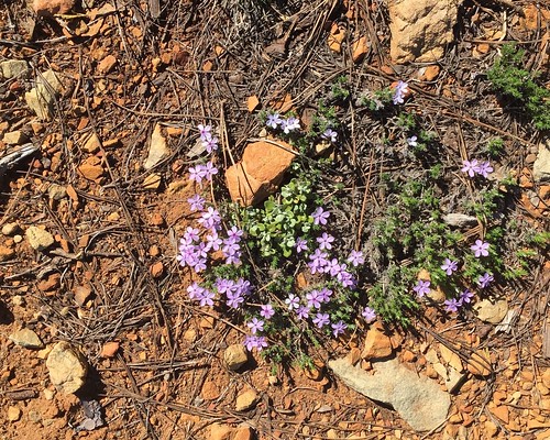
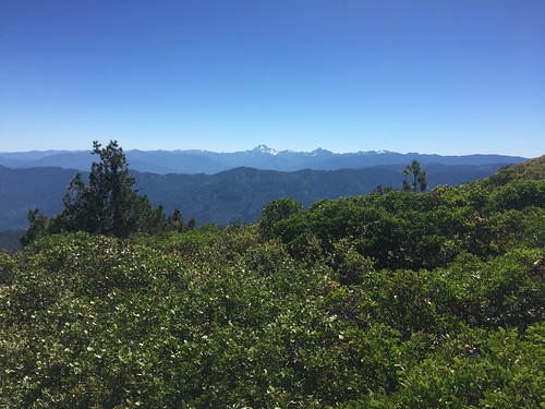
We had a really nice hike on the PCT to Cook and Green Pass. The terrain was beautiful - dry with lots of Madrona trees and a bunch of different wildflowers - and amazing views out towards Mt. Shasta. It was a fairly steady downhill to Cook and Green pass… overall a nice easy polar opposite to everything else we had hiked earlier in the day.
We got to Cook and Green Pass and the junction of the PCT, several roads, and the Cook and Green trail. We had run into a couple PCTers heading south on the PCT a few miles after the turnoff to Echo Lake, and there were about 15 more camped out at the parking lot at Cook and Green pass. Turns out a whole bunch of them had decided to flip up to Ashland from Lone Pine, CA and hike SOBO from there, because there was so much snow and melt-out in the Sierras, making creek crossings extremely dangerous. We warned them about the snow we had encountered, but they had much more experience with snow (as well as crampons and ice axes), so I think they were able to make it.
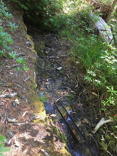
There was a nice campsite right as we came down the PCT to the trail junction. It was much drier on this side of the ridge, and there was a nice breeze which meant no bugs! There’s water about a two minute walk down the Cook and Green trail, from a spring with a very convenient spigot.
Day 3: Got up a bit earlier than the day before, but long after the PCTers had all departed. Headed down the Cook and Green trail, which was a really lovely gentle descent through a bunch of different forest.
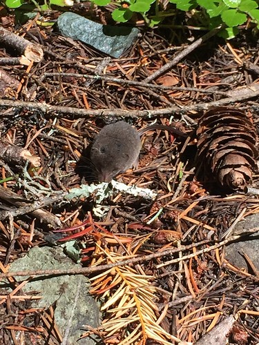
We crossed over two creeks before coming to No-See-Em camp. We had to take our shoes off to get across both these creek crossings. At the second crossing I met a shrew while putting my shoes on.
We had a snack at No-See-Em camp before continuing down.
Overall the trail was in great condition. There were some signs of mountain bikers, and it seemed like they had probably cleared out any blowdown that had been there, which made it very easy going.
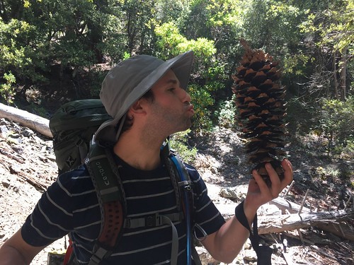
As we got further down we returned to the drier climate we had experienced on the Horse Camp trail… complete with giant pine cones!
We got down to Forest Road 1040 and took a left up the gravel road for half a mile until we got to Horse Camp trailhead. We stopped for lunch at the trailhead before heading up Horse Camp trail.
It was a pretty decent slope, but knowing we only had to go half a mile on it made it easier. Back on to the Butte Fork trail, across the creek crossings - we stopped at the Hello Creek (where we had to take our shoes off) and soaked our feet and had a nice break.
Back to the fallen tree at the Shoo Fly junction, then we continued up the Butte Fork trail. The trail starts to slowly climb up from the river. There were quite a few water sources - more than we expected. At some points there were creeks making there way along the trail, and a few muddy trails, but nothing too bad.
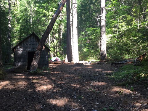
We found a nice campsite at the tool shed that’s been mentioned in TRs before. It was a nice flat area and there was some water available from a spring - accessed fro a very short path from the east (I think?) side of the campsite. Unfortunately, unlike our site the night before, the mosquitoes were very active here. At least we had brought bugspray and head nets, so it wasn’t too bad.
Day 4: Our plan for the day was to have a nice easy hike up to Azalea Lake (probably only 5 miles or less from where we were camped), and spend the day hanging out at the lake, maybe with a short day hike.
The Butte Fork trail continued as it was the day before - fairly gently uphill with the sounds of the river below. From our camp site it was about an hour until we came across the next water source.
We were startled at one point by very aggressive flapping and squacking, from what appeared to be a furious wood chicken. We determined later that this was probably female sooty grouse, and probably she was nesting under some fallen logs right by the trail.
As we gained altitude we started to enter more meadowy-areas. Pretty soon it was obvious we were in Cedar Basin. It was lovely! Beautiful meadow and creeks with incredible (and incredibly-smelling) cedars rising above us.
We took a long snack break before heading up the trail to Azalea Lake. There was a patch of snow right by the trail, but otherwise it was clear. There was a little bit of blowdown on this section of trail, but nothing too hard to deal with.
We got to Azalea Lake, dropped our packs, and followed the perimeter trail all the way around the lake to pick out our site. Some of the hiker campsites were flooded out, and for some of the trail we had to pick our way across marsh.
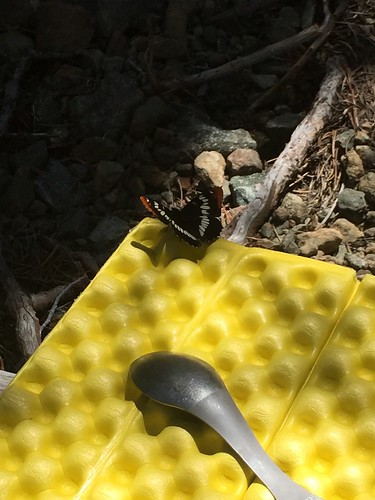
We ended up taking what I think was one of the horse sites (many of the smaller sites had lots of rocks where we would put a tent), but we had the entire lake to ourselves. We set up camp and had lunch (with a butterfly lunch companion, as well as lots of bees, flies, and bee-flies buzzing around - they seemed to just be curious though, no biting) before grabbing stuff for a day hike.
We headed up from Azalea Lake on the Fir Glade trail with a goal of getting some last views before we headed back to our car the next day. The trail had some water and some snow and lots of tiny green bugs, but no major problems until we encountered snow just before the top of the ridge. I thought that we were going to be defeated by snow yet again, but I was able to bushwack a bit to a spot where we only had 5 feet or so of reasonable-grade snow covered terrain to get over. Huzzah! Finally we conquered the snow!
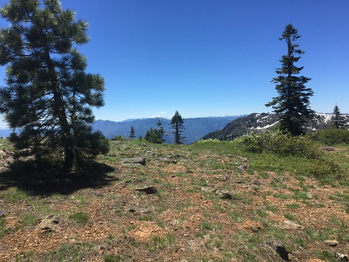
We were rewarded with some awesome views. It was cool to see all the way back towards the Red Buttes, where we had been just a couple days before.
We decided that that was probably good for the day and we had gotten what we had come for (views!!) and headed back down to the lake and took a dip. It was pretty hot and sunny out, and the water felt great. The lake is so shallow that it was pretty warm. We floated and splashed around a bit before making dinner.
Unfortunately as we were making dinner the biting-flies came out. Headed into our tent to read, to the chorus of frogs ribbit-ing, before going to sleep just as it started to get dark.
Day 5: I’m usually not a fan of out-and-backs, but after all of the angst and frustration of earlier in the week, knowing exactly what the trail had in store for us was kind of nice, especially since we knew we would have a long drive back to Portland.
Back down the Butte Fork trail, past the furious wood chicken (female sooty grouse) again - still just as furious at us for disturbing her spot.
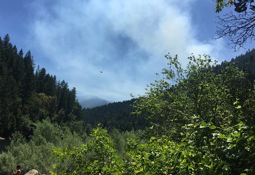
After a little while N called out to me “hey, do you smell that? smoke.” We looked around and realized that smoke was gathering in the trees, and when we got views out from the trees, the valley was very hazy. We picked up our pace, but decided that it seemed like the smoke seemed consistent with a larger fire further away. It was still very disconcerting.
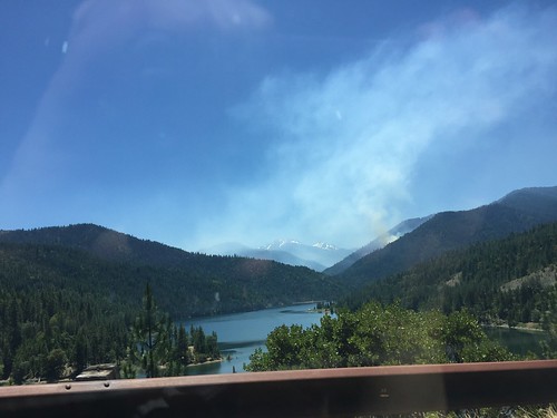
We got back to our car a little after noon and drove back out along Forest Road 1040. We had hoped to stop off at Seattle Bar to go swimming, but it was blocked off by Forest Service and fire vehicles. We looked up above Seattle Bar and could see the smoke billowing out from the fire - closer than we had actually thought it was.
We ended up pulling over at a swimming spot along Applegate Lake. As we swam we could see a helicopter taking water out of the lake and carrying it over to the fire. I’ve never been that close to a forest fire before, and it was pretty freaky.
Anyway, that was our trip! Despite the snow and early on frustrations, we had a great time. We’re super grateful to folks on this forum for the inspiration to go down to the Red Buttes, and for the TRs full of useful information (especially VanMarmot's - seriously, this trip wouldn't have been a success without the info in your TRs).
My boyfriend and I both had the week off work June 19-23, so we decided we wanted to do a 4 or 5 day backpacking trip. We had initially thought about doing the Mark Hatfield trail, but after looking at trip reports and the NOAA snow depth map for the area around North Lake/Rainy Lake decided that might be better for another year or later in the season.
Thanks to this forum, we decided to go down to the Red Buttes. We had an awesome adventure!
Our initial plan was to do a big loop starting from the Shoo Fly trailhead, up to Echo Lake on the Butte Fork trail and Horse Camp trail, then to Lonesome Lake and Azalea Lake on the PCT and Boundary Trail, then head to Cameron Meadows via the Fir Glade trail, FR 850/1050 and the Middle Fork trail, and the Frog Pond/Cameron Meadows trail, then back on FR 1040 to our car.
Things did not quite go as planned, but we still had a great time!
Day 1: Unfortunately, we had gotten a pretty late start - we don’t own a car so had to pick up a rental car and the rental car office didn’t open until 7:30. It was about a 5 hour drive down from Portland. We stopped off at the Star Ranger Station in Jacksonville to check on trail conditions - we were told there was some snow up along the PCT/Boundary trail from Echo Lake to Figurehead Mountain, but that the week before some folks had made it through and said it wasn’t too bad. Great! We even decided based on that not to take Yaktrax.
The result of all this was that we didn’t actually make it to the TH until 4pm. Turns out this was *not* enough time to make it up to Echo Lake before dark.
We headed out as I described - from Shoo Fly trailhead to Butte Fork, and then up up up up up up Horse Camp trail. Oof, that is steep. I generally much prefer steep uphills to steep downhills (bad knees), but this was just a grind in 95 degree heat.
Overall the trails were in pretty good condition. There’s a big downed tree/root ball at the intersection of Shoo Fly and Butte Fork, but nothing indicating that it’s the intersection - we thought the two trails we saw were just different routes around the tree, and took the more-traveled looking path, which turned out to be the wrong way! Thankfully we realized our mistake within a few minutes.
There were three stream crossings along the Butte Fork trail on the way to Horse Camp trail - the first of these (Hello Creek) we couldn’t see a way across on the rocks and took our shoes off - I was grateful for my Crocs camp shoes.
The other two crossings we were able to do on rocks/slippery logs - trekking poles were definitely necessary for balance on the slippery and somewhat decomposing logs.
Then on to the Horse Camp trail. As I mentioned, this goes up pretty unrelentlessly. It’s something like a 3000 foot elevation gain in 3 miles up to the PCT. We were really feeling the heat (Possibly TMI… drank a full 2 liter bladder + more and didn’t have to pee until the next day.) We got some beautiful views though, including of the Butte Fork Slide, and it was great to see the terrain change - madrona trees, sedums, and a more desert-like atmosphere.
We got to Horse Camp and debated whether we should stop there, but we agreed to press on. Up through here the trail had been in pretty good condition - there were probably 3 or 4 trees down that we had to scramble over, but not too bad. As we got up above 4500 feet we got into more meadows. We started to see patches of snow, and the trail became much harder to find - no more than a faint track in some spots. Thankfully there were some cairns to help indicate we hadn’t lost the trail completely, but we had to do some poking around. As we got to 5000 feet there was more and more snow to get over, and we were having a much harder time finding the trail. We were also completely exhausted and losing the light. I worried that even if we did get to Echo Lake it would be covered in snow, and we would have to hike down to find a snow-free spot.
We found a reasonable-ish spot off the trail and decided to camp. We were both frustrated and exhausted and worn out. We were in a fairly marshy area, and there were quite a few mosquitoes. We cooked dinner by flashlight and collapsed in bed - despite the somewhat lumpy terrain we were camping on, we slept well.
Day 2: After the previous frustrating and exhausting day we let ourselves sleep in. Our campsite ended up actually being pretty good - really pretty in the meadows with views up towards the Red Buttes, not too far from a water source. While going to take down our bear bag, I even discovered an old fire circle with some baby trees growing in it - we weren’t the only ones to find this as a reasonable place to camp.
It took us a little to find our way back to the trail, and to find where the trail next went… and then probably less than 2 minutes up the trail there was an established camp site! Oh well. It was definitely hard going finding the trail in through here - pressing on the night before with the light dwindling would have been a mistake.
I had printed out USGS 7.5 minute maps of the area - the Kangaroo Mountain, CA quadrangle, and the Figurehead Mountain, CA-OR quadrangle. These indicate that the Horse Camp trail goes right up to Echo Lake, but in reality we came to what seemed like a trail junction… there was a sign pointing in one direction towards Echo Lake, and in the other to Applegate River (where we had come from).
We followed the trail towards Echo Lake, and there it was! Although there was some snow on the ground and snow all above it up to the ridge, there were some clear, beautiful campsites. Oh well.
It looked like there might be a trail leading from next to a campsite, but pretty soon it felt like we were just bushwacking. We decided to head back to the sign we had seen, with the idea that maybe that was a trail junction. Once back there, it seemed like there might be a faint trail headed up the hill - as I said before, this trail junction, with a trail going off to Echo Lake, isn’t on the map we had.
We headed up the hill and pretty soon lost the trail amidst the snow.
We went a bit further, picking our way through the brush and snow, before deciding to pull out the map and compass. With the compass we were able to determine where we thought the trail would go, which also seemed like the gentlest path up the snow-covered ridge. We headed that way, picking our way across the slippery snow and steep slope. At this point I was definitely regretting the decision not to bring Yaktrax. At one point I crossed a snow-covered section to the next set of trees and slipped a few feet. When I turned back I said to N, “well, you’ll probably slip, but you’re not going to go too far because there’s some trees below.” He did indeed slip down the slope 5 or 6 feet, coming to a stop with the help of the branches.
We finally got on top of the ridge and were welcomed by incredible views and wildflowers. We were very relieved, but in our relief and exhaustion we totally forgot to take pictures of what we had come up!
The Red Buttes, with a hint of the snow we came over.
Looking South.
Looking along the PCT towards Cook and Green Butte.
We headed on the PCT and ran into the first people we had seen. 2 boys… they mentioned snow ahead and that they had turned back, but that they thought we could make it since we had poles. We stopped off at Bee Camp - a flat area with red rocks and streams - and had a snack. Plenty of water this year. There were some folks camped out here.
We headed down the PCT and came to Lily Pad Lake, still somewhat frozen over.
The trail intersects with a Jeep road a few times, and in one spot - right at Lily Pad Lake - there’s an unsigned trail junction with a trail leading up to the end of the Jeep road, ending at a rock wall and cattle gate.
We came around the lake and ran into snow on the trail… and then more snow totally obscuring the trail. The trail went along the side of a steep slope, then switchbacked over a ridge. All of this was covered in snow. We spent about 2 hours trying to figure out a way through - it seemed like going up onto the top of the ridge, then following the ridge down to the trail would be our best option, but after scrambling up rocks and bushwacking as far as we could, we still had about 10 feet of snow on an almost-vertical slope to go. It was past our comfort zone, and furthermore we knew that there were several other spots this elevation or higher before we got to Lonesome Lake, and we were pretty damn tired of dealing with snow.
We ended up bushwacking all the way around Lily Pad Lake, back to where we had started 2 hours earlier on the PCT. We tried one last time to find a way over the ridge, then gave up for real and had lunch. It was 3 pm by this point. We were frustrated and exhausted and hot, but after eating lunch (and also dark chocolate peanut butter cups from Trader Joe’s, which have very good rejuvenating properties) we got out the map and figured out a new plan.
We decided to head back on the PCT the way we came, past the turnoff for Echo Lake, to the Cook and Green trail junction at Cook and Green Pass and try to camp there.
We passed through Bee Camp again and talked to the folks camped there - turns out they were trying to get through to Kangaroo Springs and then on to Azalea Lake too, and had also turned back from the snow and decided to camp out.
We had a really nice hike on the PCT to Cook and Green Pass. The terrain was beautiful - dry with lots of Madrona trees and a bunch of different wildflowers - and amazing views out towards Mt. Shasta. It was a fairly steady downhill to Cook and Green pass… overall a nice easy polar opposite to everything else we had hiked earlier in the day.
We got to Cook and Green Pass and the junction of the PCT, several roads, and the Cook and Green trail. We had run into a couple PCTers heading south on the PCT a few miles after the turnoff to Echo Lake, and there were about 15 more camped out at the parking lot at Cook and Green pass. Turns out a whole bunch of them had decided to flip up to Ashland from Lone Pine, CA and hike SOBO from there, because there was so much snow and melt-out in the Sierras, making creek crossings extremely dangerous. We warned them about the snow we had encountered, but they had much more experience with snow (as well as crampons and ice axes), so I think they were able to make it.
There was a nice campsite right as we came down the PCT to the trail junction. It was much drier on this side of the ridge, and there was a nice breeze which meant no bugs! There’s water about a two minute walk down the Cook and Green trail, from a spring with a very convenient spigot.
Day 3: Got up a bit earlier than the day before, but long after the PCTers had all departed. Headed down the Cook and Green trail, which was a really lovely gentle descent through a bunch of different forest.
We crossed over two creeks before coming to No-See-Em camp. We had to take our shoes off to get across both these creek crossings. At the second crossing I met a shrew while putting my shoes on.
We had a snack at No-See-Em camp before continuing down.
Overall the trail was in great condition. There were some signs of mountain bikers, and it seemed like they had probably cleared out any blowdown that had been there, which made it very easy going.
As we got further down we returned to the drier climate we had experienced on the Horse Camp trail… complete with giant pine cones!
We got down to Forest Road 1040 and took a left up the gravel road for half a mile until we got to Horse Camp trailhead. We stopped for lunch at the trailhead before heading up Horse Camp trail.
It was a pretty decent slope, but knowing we only had to go half a mile on it made it easier. Back on to the Butte Fork trail, across the creek crossings - we stopped at the Hello Creek (where we had to take our shoes off) and soaked our feet and had a nice break.
Back to the fallen tree at the Shoo Fly junction, then we continued up the Butte Fork trail. The trail starts to slowly climb up from the river. There were quite a few water sources - more than we expected. At some points there were creeks making there way along the trail, and a few muddy trails, but nothing too bad.
We found a nice campsite at the tool shed that’s been mentioned in TRs before. It was a nice flat area and there was some water available from a spring - accessed fro a very short path from the east (I think?) side of the campsite. Unfortunately, unlike our site the night before, the mosquitoes were very active here. At least we had brought bugspray and head nets, so it wasn’t too bad.
Day 4: Our plan for the day was to have a nice easy hike up to Azalea Lake (probably only 5 miles or less from where we were camped), and spend the day hanging out at the lake, maybe with a short day hike.
The Butte Fork trail continued as it was the day before - fairly gently uphill with the sounds of the river below. From our camp site it was about an hour until we came across the next water source.
We were startled at one point by very aggressive flapping and squacking, from what appeared to be a furious wood chicken. We determined later that this was probably female sooty grouse, and probably she was nesting under some fallen logs right by the trail.
As we gained altitude we started to enter more meadowy-areas. Pretty soon it was obvious we were in Cedar Basin. It was lovely! Beautiful meadow and creeks with incredible (and incredibly-smelling) cedars rising above us.
We took a long snack break before heading up the trail to Azalea Lake. There was a patch of snow right by the trail, but otherwise it was clear. There was a little bit of blowdown on this section of trail, but nothing too hard to deal with.
We got to Azalea Lake, dropped our packs, and followed the perimeter trail all the way around the lake to pick out our site. Some of the hiker campsites were flooded out, and for some of the trail we had to pick our way across marsh.
We ended up taking what I think was one of the horse sites (many of the smaller sites had lots of rocks where we would put a tent), but we had the entire lake to ourselves. We set up camp and had lunch (with a butterfly lunch companion, as well as lots of bees, flies, and bee-flies buzzing around - they seemed to just be curious though, no biting) before grabbing stuff for a day hike.
We headed up from Azalea Lake on the Fir Glade trail with a goal of getting some last views before we headed back to our car the next day. The trail had some water and some snow and lots of tiny green bugs, but no major problems until we encountered snow just before the top of the ridge. I thought that we were going to be defeated by snow yet again, but I was able to bushwack a bit to a spot where we only had 5 feet or so of reasonable-grade snow covered terrain to get over. Huzzah! Finally we conquered the snow!
We were rewarded with some awesome views. It was cool to see all the way back towards the Red Buttes, where we had been just a couple days before.
We decided that that was probably good for the day and we had gotten what we had come for (views!!) and headed back down to the lake and took a dip. It was pretty hot and sunny out, and the water felt great. The lake is so shallow that it was pretty warm. We floated and splashed around a bit before making dinner.
Unfortunately as we were making dinner the biting-flies came out. Headed into our tent to read, to the chorus of frogs ribbit-ing, before going to sleep just as it started to get dark.
Day 5: I’m usually not a fan of out-and-backs, but after all of the angst and frustration of earlier in the week, knowing exactly what the trail had in store for us was kind of nice, especially since we knew we would have a long drive back to Portland.
Back down the Butte Fork trail, past the furious wood chicken (female sooty grouse) again - still just as furious at us for disturbing her spot.
After a little while N called out to me “hey, do you smell that? smoke.” We looked around and realized that smoke was gathering in the trees, and when we got views out from the trees, the valley was very hazy. We picked up our pace, but decided that it seemed like the smoke seemed consistent with a larger fire further away. It was still very disconcerting.
We got back to our car a little after noon and drove back out along Forest Road 1040. We had hoped to stop off at Seattle Bar to go swimming, but it was blocked off by Forest Service and fire vehicles. We looked up above Seattle Bar and could see the smoke billowing out from the fire - closer than we had actually thought it was.
We ended up pulling over at a swimming spot along Applegate Lake. As we swam we could see a helicopter taking water out of the lake and carrying it over to the fire. I’ve never been that close to a forest fire before, and it was pretty freaky.
Anyway, that was our trip! Despite the snow and early on frustrations, we had a great time. We’re super grateful to folks on this forum for the inspiration to go down to the Red Buttes, and for the TRs full of useful information (especially VanMarmot's - seriously, this trip wouldn't have been a success without the info in your TRs).