This one has been on my to-do list for a while, so I planned my summer to take some time off from Portland to git 'er done while I was down in California visiting some family. I'd like to say that I planned the trip meticulously for months, but I ended up being really busy before I left, and most of my prep ended up happening down here in the week before I started the hike. Aside from tweaking my gear selection, the most important thing was squaring away my food. Muir Trail Ranch (MTR) is the last resupply point if you're heading south, and it's pretty much in the middle of the trail, meaning that due to the 7 day capacity of my borrowed Garcia bear canister, the second 100+ miles of trail would have to happen in a week. Thus the whole hike would be two weeks, QED.
I was hoping to start right at the beginning of September, so as not to push the end-of-season envelope too hard with the weather, but due to food/gear prep and ride finagling, it worked out that my hike would start on the 11th and end on the 25th. This was a record-low snow year, and I expected good temps and no bugs, both of which turned out to be the case. (I didn't even bring bug spray, and wouldn't have had reason to use it if I'd had it.) I didn't have a permit reserved, but was able to just walk into the office in Yosemite Valley and get one for the following day. The weather was dry and pretty much clear the whole time, and overall everything pretty much went perfectly.
I'll keep the narration to a minimum and just lead through the trail in pictures, but there will be a little discussion and recommendations at the end. Mileages given are estimated from the Harrison JMT maps.
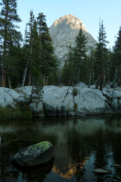
Day 1: Happy Isles (Yosemite Valley) to below Sunrise Camp (11.3 miles + ~1)
I started in Backpacker's Camp in Yosemite Valley and walked maybe a mile over to Happy Isles, where the trail starts. It was my first day, the pack was full, and my legs were green. It was probably the hardest day of the trip. I hiked up out of the Valley as far as I could make it until I was toast (around 2 miles short of my goal of Sunrise Camp). Not many pictures, as I was being conservative with the camera battery, which had to last for 7 days till I could charge it at MTR.
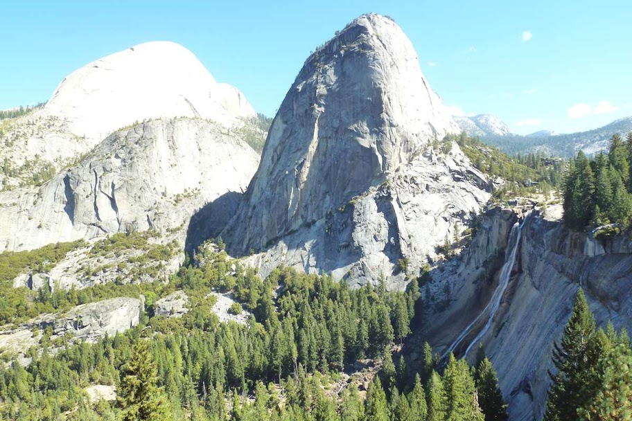
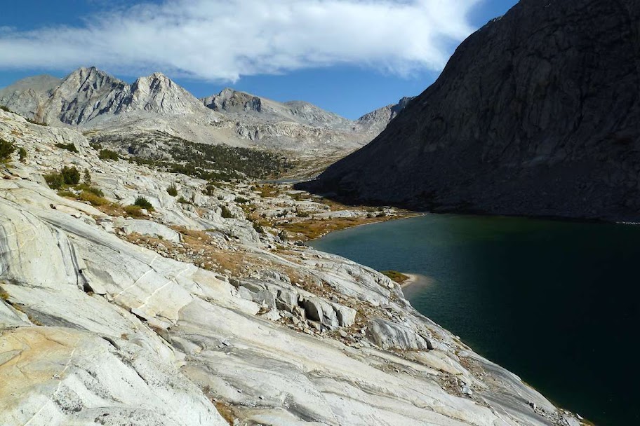
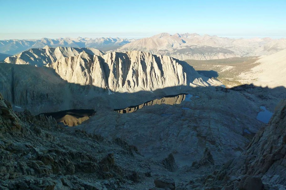
Half Dome (blown out thing on L), Liberty Cap, and Nevada Falls
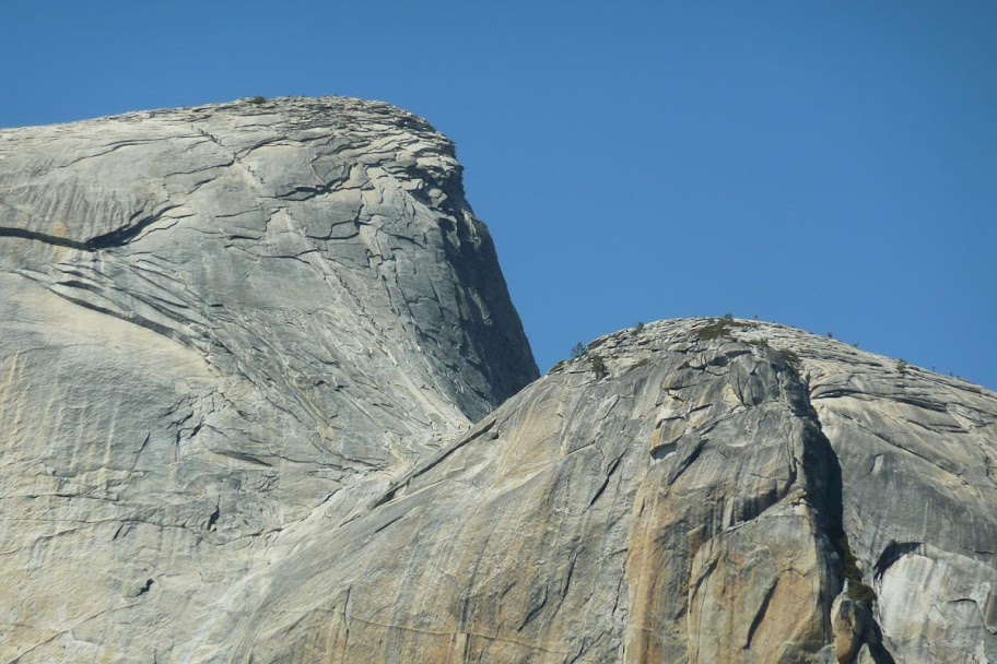
Zoomed in on some people ascending the cable ladder
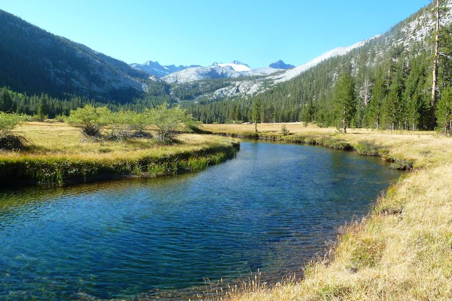
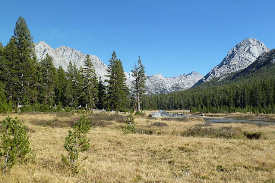
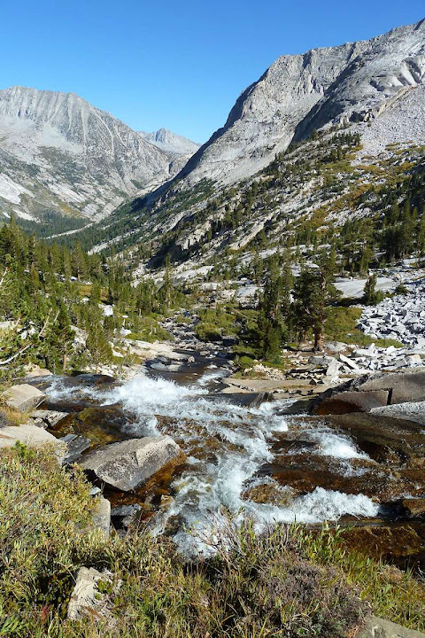
Day 2: Below Sunrise Camp to Vogelsang Junction, Lyell Canyon, Tuolumne (15.4 miles)
Meadow at Sunrise Camp
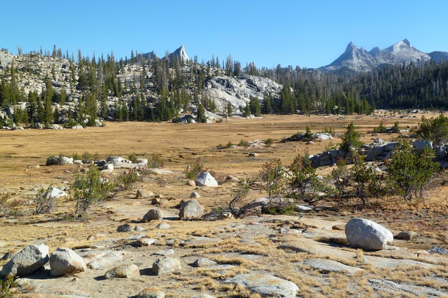
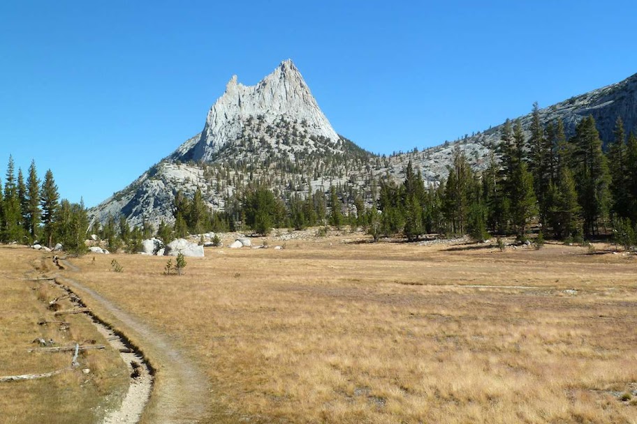
Cathedral Peak
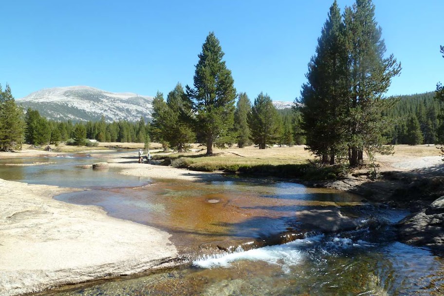
Crossing the Lyell Fork
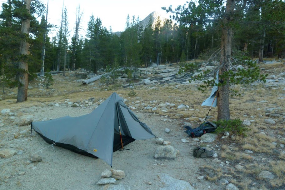
Typical campsite in Lyell Canyon. I slept in a Tarptent Contrail (1.5 lbs).
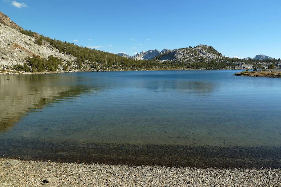
Day 3: Lyell Canyon to Thousand Island Lake (13.4 miles)
Heading down Lyell Canyon towards Donahue Pass (11,056 ft), the first of the trail
Stone steps en route to the pass
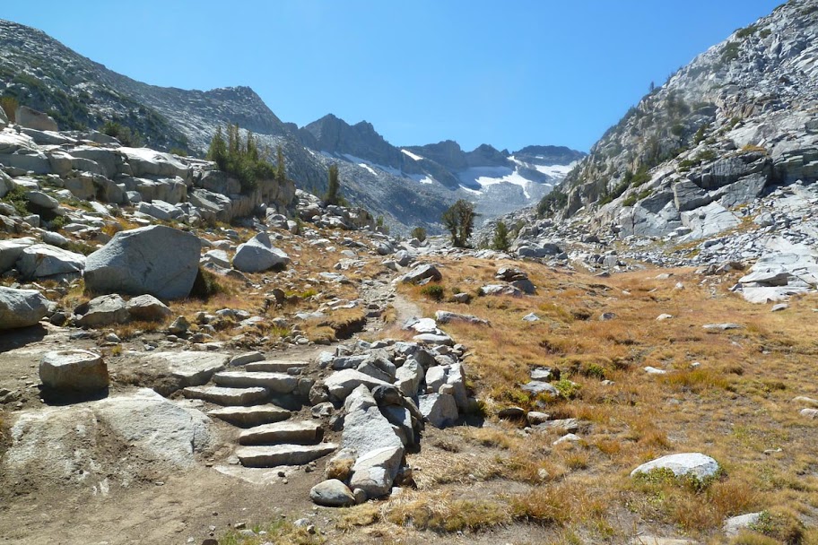
View south towards the Ritter Range from the pass
Over the pass and out of Yosemite

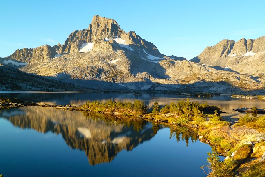
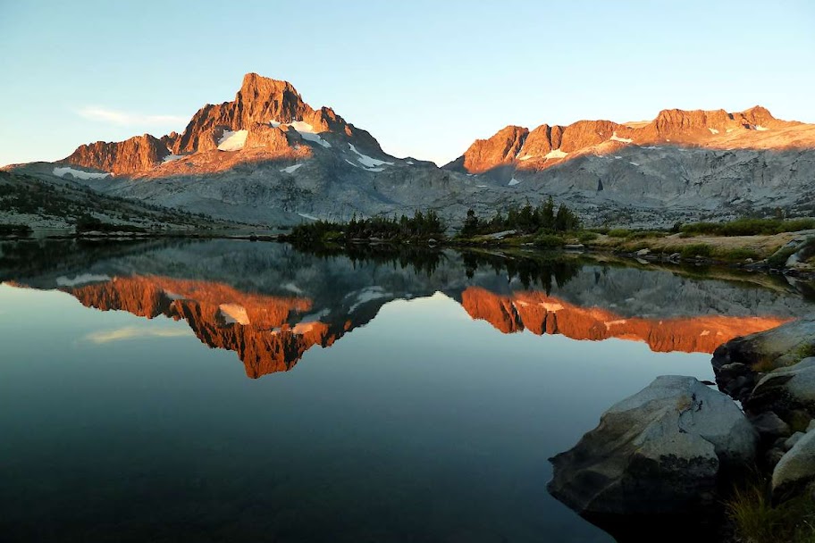
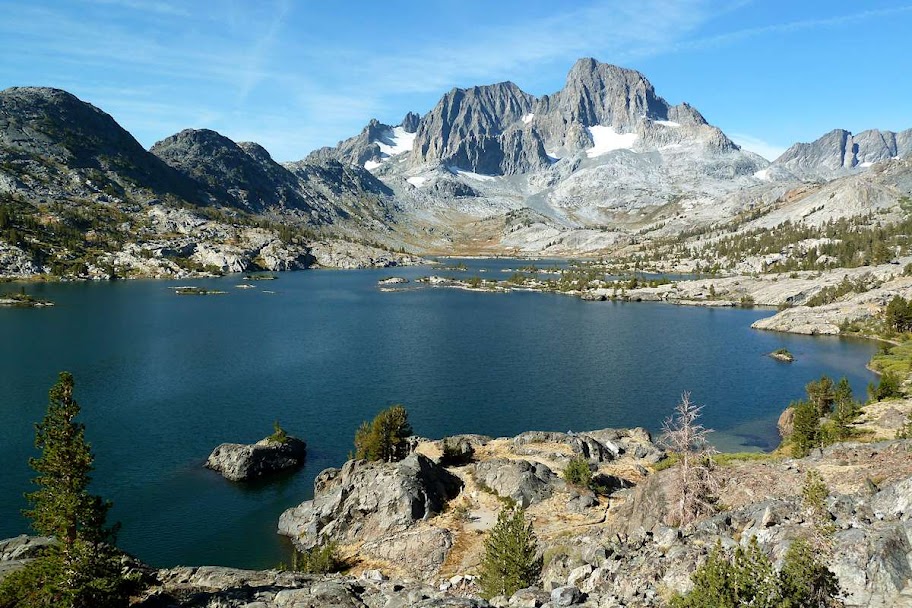
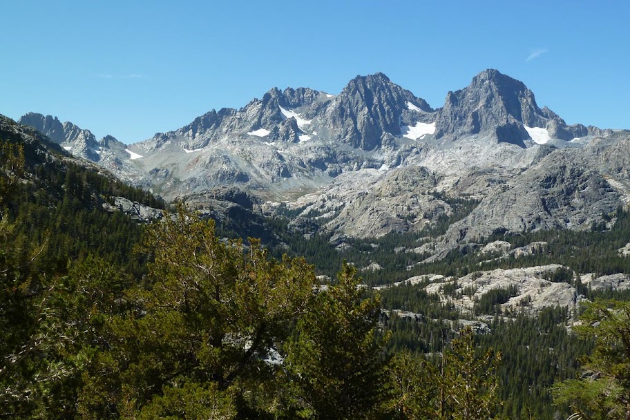
Banner Peak (12,936 ft) and Thousand Island Lake

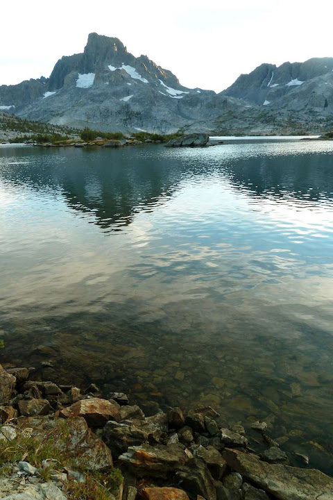
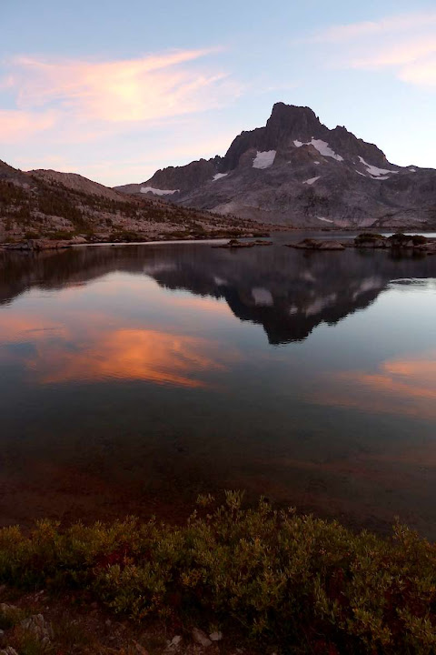
I got up at 6am for the sunrise
Day 4: Thousand Island Lake to Red's Meadow (16 miles)
Garnet Lake, with Mt. Ritter (13,143 ft) peeking out to the left of Banner
Looking back at Banner and Ritter
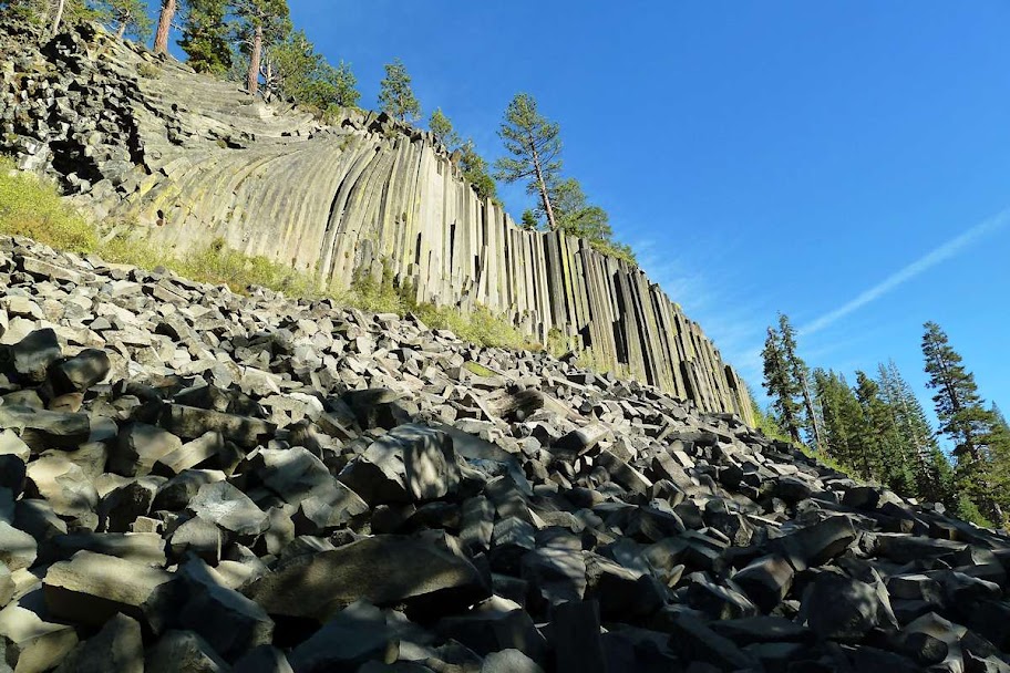
I detoured into Devil's Postpile, as I'd never been there. The normal JMT trail skirts it, but Red's is right on the other side.
Columnar basalt at the Postpile
Being at Red's around tourists in (rented!) RVs was weird. I camped in a free backpacker spot in the campground. The RV people were cooking up the cheapest pasta sauce imaginable, which smelled amazing at this point. I found a really bad fantasy novel in my bear locker and read part of it for the night, but decided to leave it for the next person. (I didn't need the weight!)
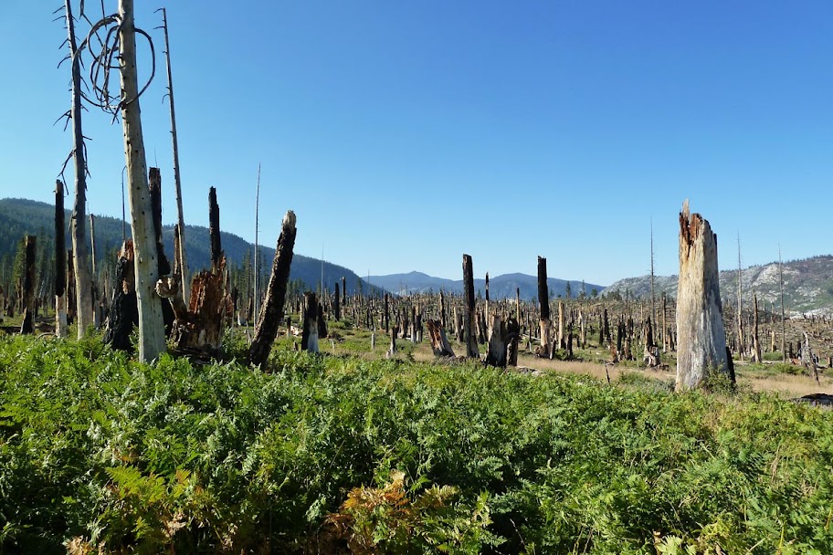
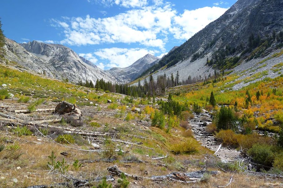
Day 5: Red's Meadow to Virginia Lake (16 miles)
I went into the Red's Resort and got coffee at the cafe, plus a real bowl and some free hot water and made my morning oatmeal at the table. Then onto the trail.
Broken forest after leaving Red's Meadow
Not a lot of views, so not a lot of pictures. I met some hunters with antlers sticking out of a backpack, took a cold swim in Purple Lake, and started to get blisters on the bottoms of my pinky toes. It was a bad hiking day, but I started to learn that each day on a long trail has its ups and downs, just as the trail itself does (metaphorically and literally).
Looking waaay back at the Ritter Range
Purple Lake
Lake Virginia, my highest camp yet at 10,338 ft.
Sunset was nice. I saw bats swooping over the lake, which was amazing.
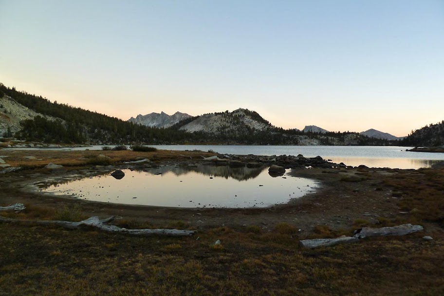
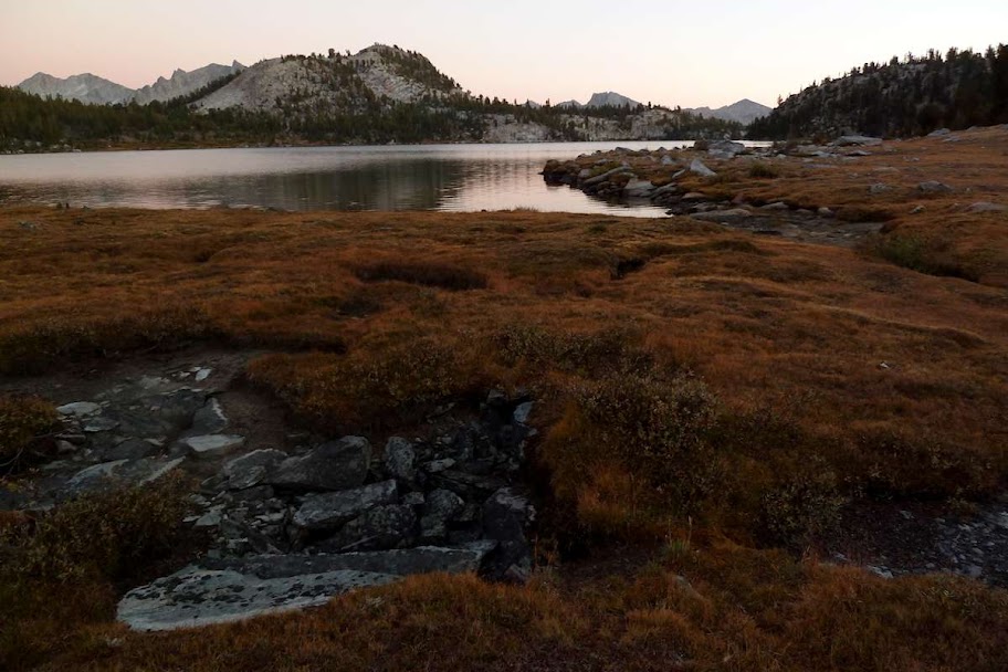
Day 6: Lake Virginia to Quail Meadows (13.4 miles)
I got up at 6am again for sunrise on Lake Virginia.
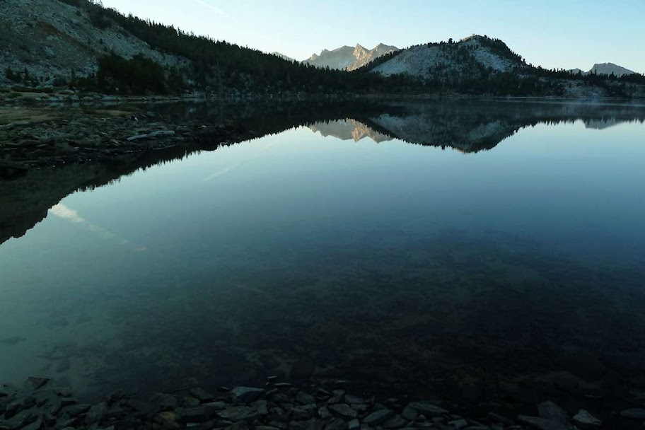
It was a pretty rad lake, sort of up on a plateau.
Then down into the valley.
One of the lakes en route to Silver Pass (10,895 ft)
Another near the top of the pass, probably Warrior Lake

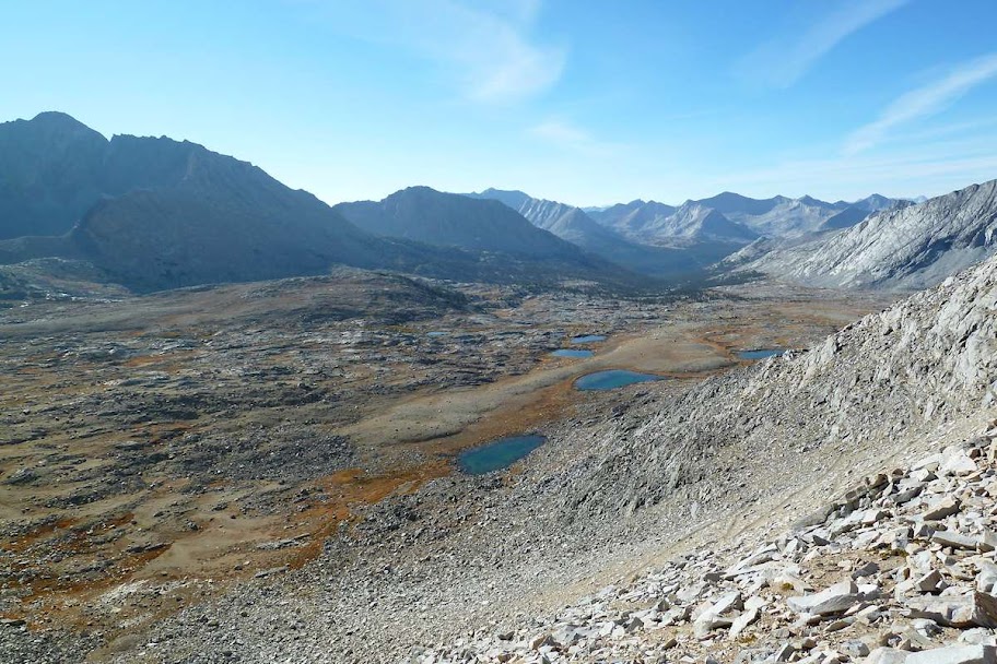
Big granite slabs down the valley on the other side

Good cloud formations that day

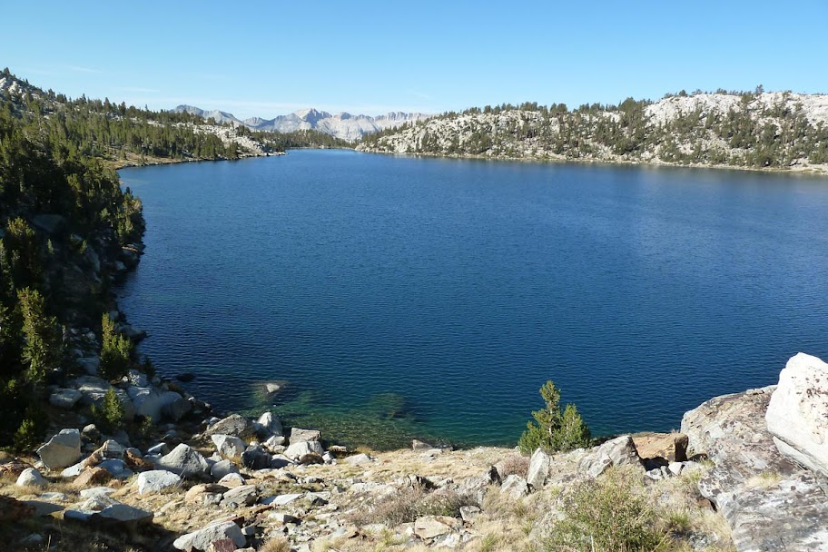
Quail Meadows is where the trail diverges if you want to go to Vermillion Valley Resort (VVR), another resupply point. It's a day before the halfway point and a 6+ mile detour out of the way since their water taxi across Lake Edison wasn't running this year, so I didn't go. I heard from other people it was the party place to be, with food, beer, showers, etc. I was glad to stay in the woods and on the trail though.
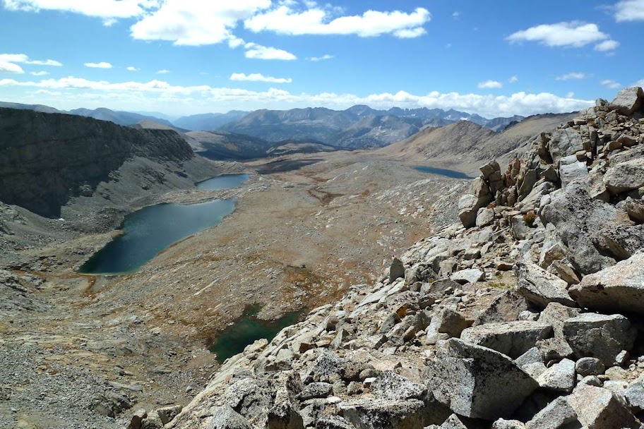
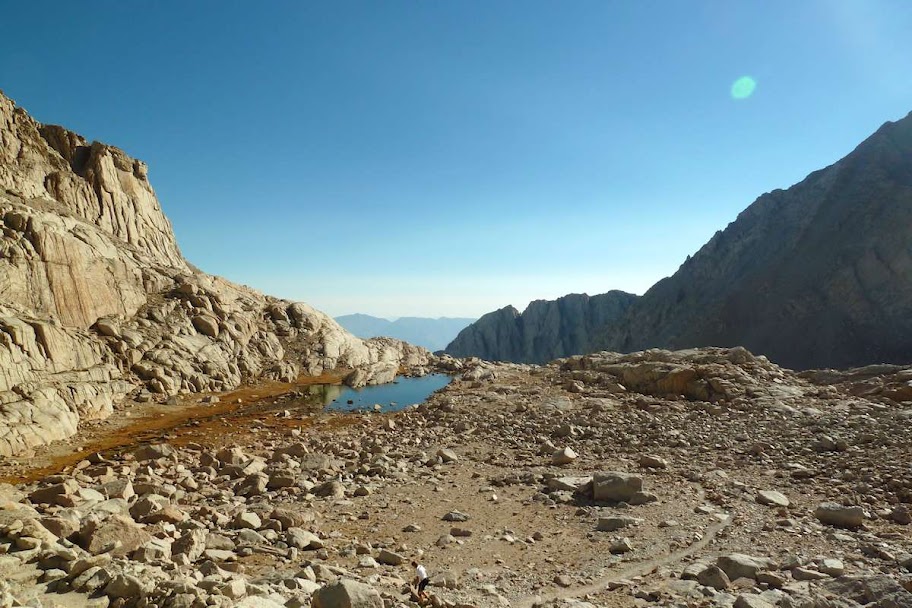
Day 7: Quail Meadows to MTR (20.3 miles)
With my pack mostly empty now, I decided to motor on to MTR in one day, with the option to stop sooner if I needed to, and finish the distance to the ranch the next morning. I felt good, though, and did the whole distance, though I got to MTR about 45 minutes after they closed and had to camp down by the river until morning. They were super unfriendly about not being open; MTR is pretty much the anti-VVR from what I hear. They don't really like you being there in their way, but they want your money for the resupply service.
Anyway, the day started with a 2500 ft climb up Bear Ridge, most of which elevation you then lose before you climb back up again towards the next pass. Joy.
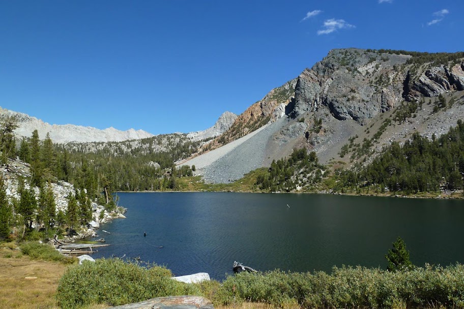
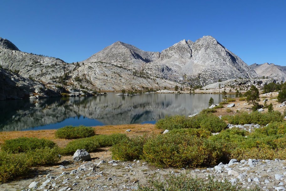
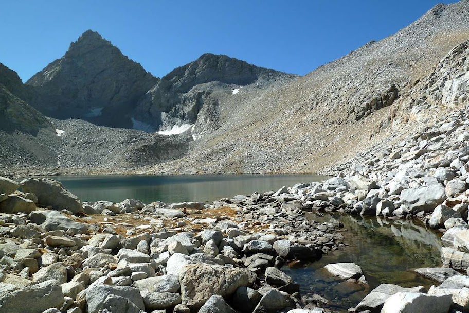
Looking back at Marie Lake (10,551 ft)
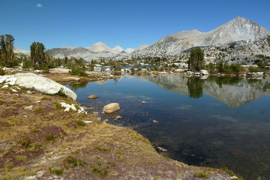
Better view of Marie, closer to the top of Selden Pass (10,880 ft)
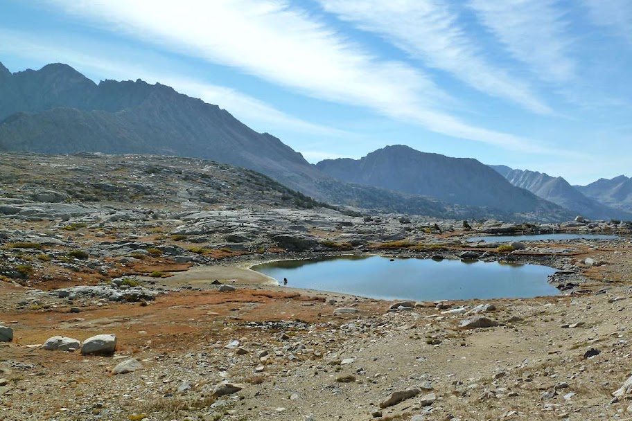
On the other side at the Sallie Keyes Lakes. They were my fallback camp and were really nice, but I kept going to MTR.

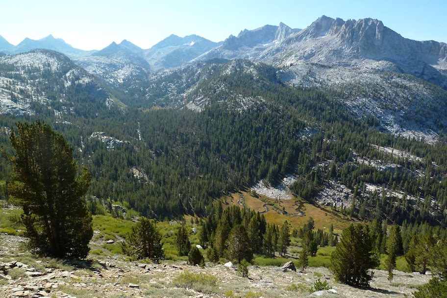
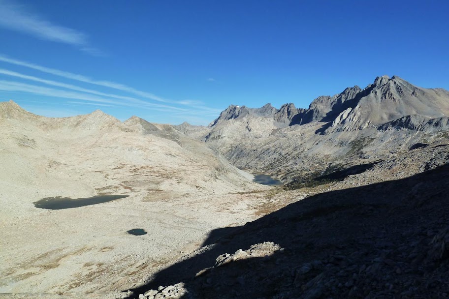
Valley down to MTR
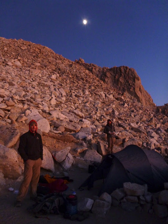
That night I met another person who was laying over at MTR - the first other southbound JMT hiker I'd encountered since the one I'd passed on day 2. I learned there were more ahead of me.
Halfway done.
Day 8: MTR to Colby Meadow, Evolution Valley (13.9 miles)
MTR opened at 8, so I got up early and walked along the river looking idly for the hot springs trail (unsuccessfully, and I was too lazy to walk up to the junction, so I never found them). Then into MTR to get the bucket of resupply food I'd mailed to myself. They charge $55 to pick up and hold your resupply. They also have lots of buckets of free things other people have left behind. I assessed that hot water for my oatmeal would not be forthcoming, and I didn't feel like boiling, so I ended up eating a whole bunch of free snacks - granola bars and trail mix and stuff - that other people had left behind. This was 1) more food that I was used to getting and 2) full of sugary junk that I hadn't been eating, so I felt vaguely ill for most of the rest of the day. However, my resupply of lunch food was pretty light, and the free buckets provided me with a bunch of extra fruit and nut trail mix and some bars for the second half of the trip. It's definitely a worthwhile resource.
After repacking my bear canister (all the new food didn't quite fit), I paid $10 to use MTR's barely working internet for 15 minutes to email my family and tell them I was alive. I also bought some more alcohol for my stove. The little old woman who ran the resupply was extremely nice, but everyone else acted like I was inconveniencing them by existing, so I was ready to leave. Back on the trail around 10:30, which was earlier than I'd planned - this was planned to be a half day under 10 miles.
I weighed my pack on their scale right before I left - 30 lbs on the nose, with 1.5 L of water and 7 days of food.
Hiking along the San Joaquin River to the junction up to Evolution Valley
Evolution (or possibly McClure) Meadow
I didn't find a spot I liked and kept walking, and my half day turned out to be a full day after all. Oh well. I got a nice spot by the river underneath a mountain called the Hermit (12,328 ft)
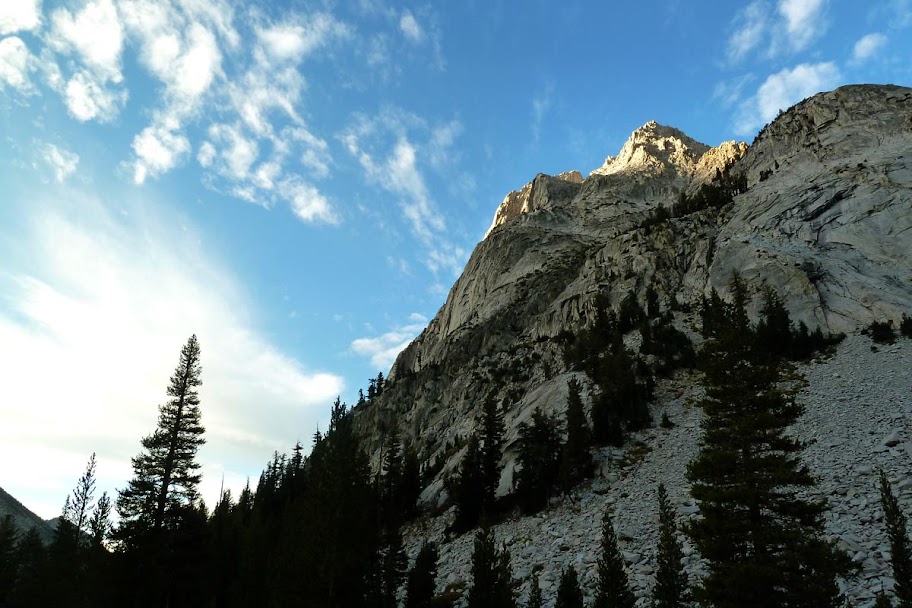
Day 9: Colby Meadow to Big Pete Meadow, Le Conte Canyon (15 miles)
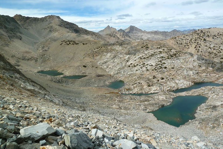
Evolution Lake
I climbed out of Evolution Valley into Evolution Basin and discovered that the Basin is the thing everyone is referring to when they rave about the Evolution area being the "best part of the trail." Good thing, I'd found the Valley underwhelming.
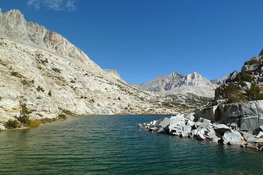
Sapphire Lake (10,966 ft)
At this point I ran into my next fellow southbound (SOBO) JMT'er. This guy was doing 4 weeks and taking all possible side trips, but due to having to carry 2 weeks worth of food, his pack was enormous. I was envious of all the peak bagging, but not the pack.
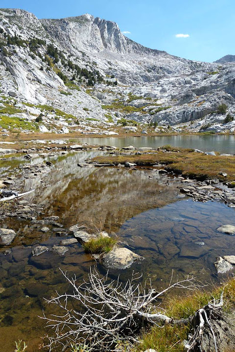
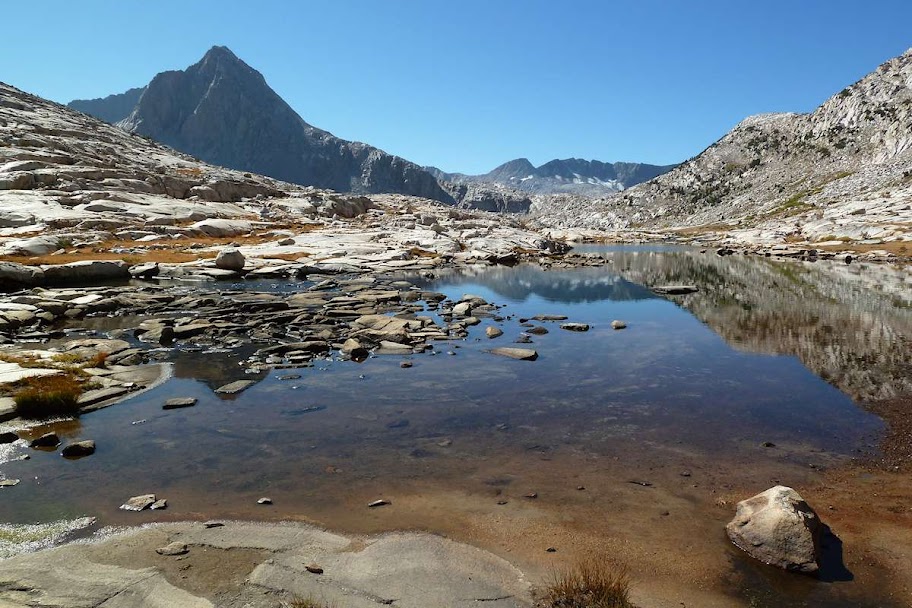
Wanda Lake (11,426 ft)

It was super clear

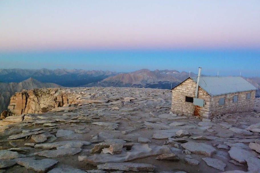
Muir Hut, atop Muir Pass (11,955 ft)
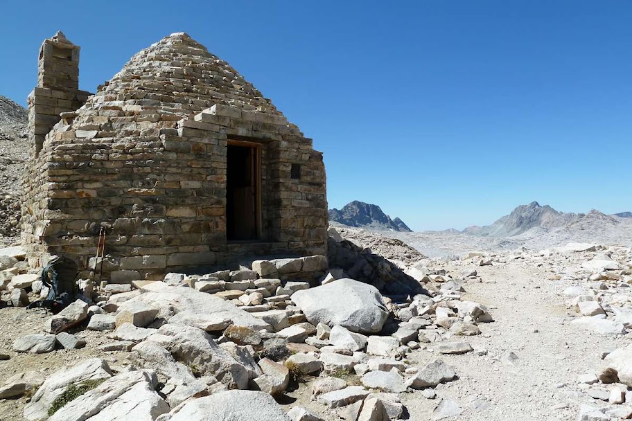
I parted ways with him at Muir Hut, as he was going to go climb a side peak. I never saw him again.
Descending down into Le Conte Canyon
I walked through a guy's campsite for this picture

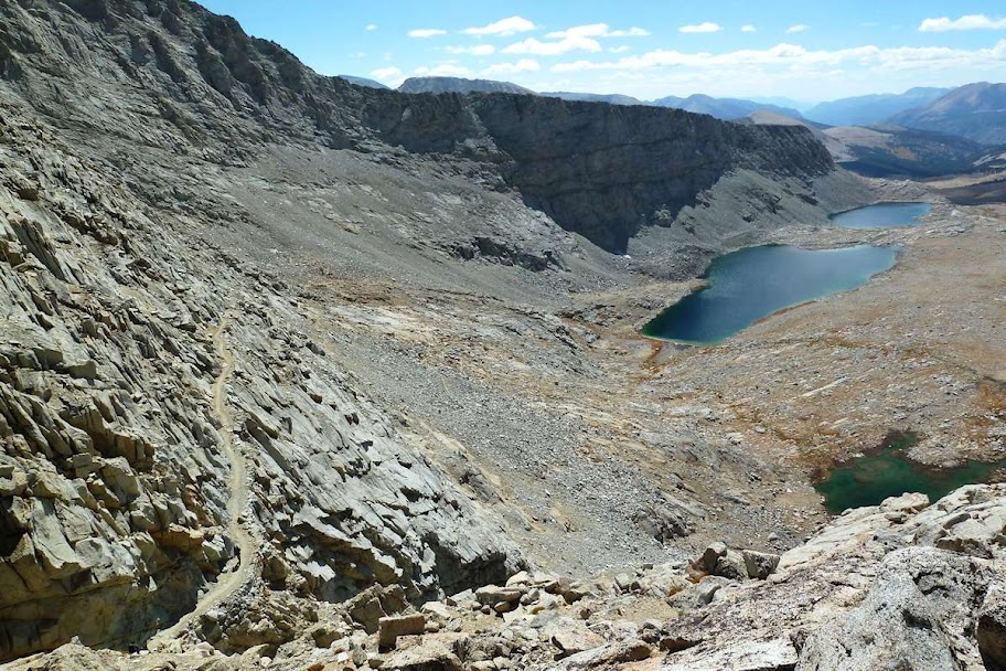
Day 10: Big Pete Meadow to Upper Palisade Lake (13.4 miles)
Le Conte is pretty amazing (big granite walls), but it's cold down in valleys and I miss the expansive views. At the bottom of the canyon, the trail turned left and heads up another more open canyon towards the Palisade Lakes.

Lower Palisade Lake (10,613 ft)
I got there in the early afternoon and went for my second and (sadly) final swim of the trip. I also met two more SOBO'ers - a guy named David, and a girl, Beck, that I'd heard was ahead of me. They were both solo but had met up before. Beck suggested we all join forces for company and head up to the Upper lake to camp, then tackle two passes the next day.
The Upper lake - Mather Pass (12,100 ft) is the notch above the mountain shadow on the right.
Day 11: Upper Palisade Lake to Woods Creek (16.8 miles)
First, Mather Pass. The sun was still rising. We'd done most of the climbing yesterday, so it didn't take long to get to the top.
Looking over the pass into the Upper Basin
Looking back at the Palisade Lakes
Lake Marjorie (11,132 ft)

Looking over pass #2 - Pinchot (12,130 ft)
We dropped down below 10,000 ft into the fire-safe zone again and the others made a fire, the first and only one I'd have all trip. We stayed up too late (9:30!) talking.
Day 12: Woods Creek to Kearsarge Pass/Bullfrog Lake Junction (15.3 miles)
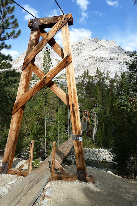
Walking along Woods Creek in the morning
David and I crossed this crazy cable bridge at the same time, making it swing in all directions. At the far side we saw the "one at a time" sign, of course.
Rae Lakes. The light sucked - I've probably tweaked this picture better than it actually looked. The lakes were beautiful though, a good stopping place for another day.

Looking back down at Rae Lakes from Glen Pass (11,978 ft) - the sheerest pass of them all, I'd say. The switchbacks were tight and steep. We caught up with another SOBO hiker I'd heard about, Byron, an Australian.
We'd left Beck behind, as she was going to layover at Rae Lakes and exit later than I was. David planned to run up Kearsarge Pass the next day for cell service to see if his friend was joining him, so we camped at the junction.
View from above camp into the valley towards the next and final pass, which I'd cross tomorrow.

The potentially-stormy weather yielded the best sunset of the trip

East Vidette (12,350 ft)

The cloud above East Vidette was crazily purple - my camera didn't really capture it

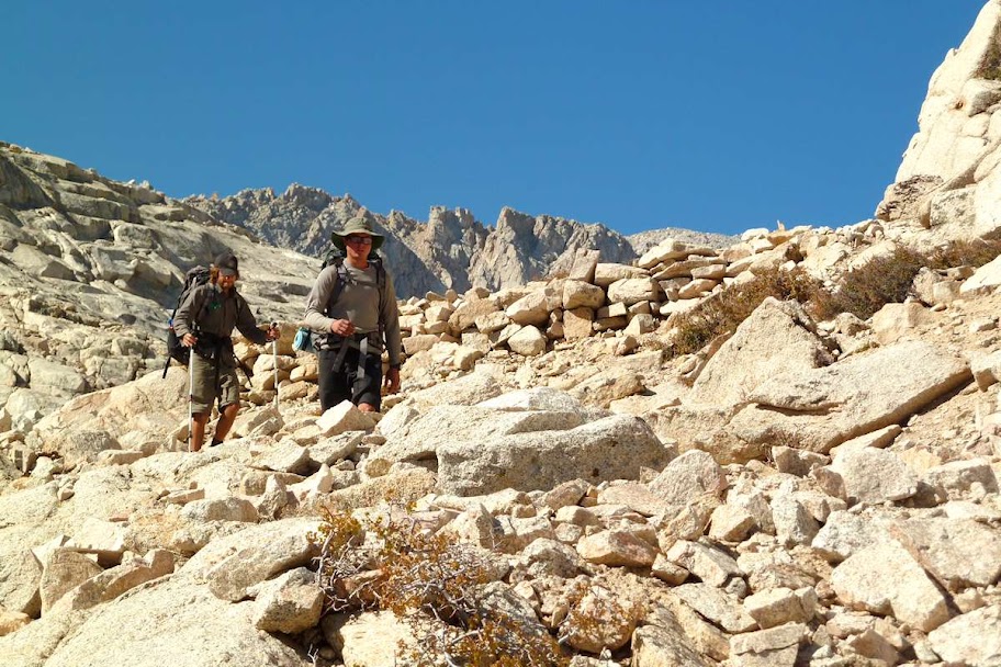
Day 13: Kearsarge/Bullfrog Junction to Wright Creek (19 miles)
David got up around 6am to get up to Kearsarge early. The noise woke me, so I got up and ended up getting my earliest start of the trip, fed, packed, and on the trail by 7:15am. It was good to be solo again.
Heading up the valley towards the Kings-Kern Divide
Fellow JMTer Walt took this picture of me on the way to Forester Pass
Junction Peak (13,888 ft) over a high lake - Forester Pass (13,180 ft) is the notch in the scree field above the lake.
Looking from the pass down onto Diamond Mesa. This was a record high elevation for me for exactly one day.
I met a whole bunch of other SOBO folks on top of the pass and we hung around talking for a while.
The trail down from the pass
I got down off the mesa to the junction at Tyndell Creek I was thinking of camping at, but thanks to my early start it was about 2:30pm, so I kept going.
Trail over Bighorn Plateau, looking back at Tawney Point (12,332 ft - about the height of Mt. Adams)

Finally, Whitney in my sights! (Second from the left.) We still had to go back around it, though.
I finally reached water at what was probably Wright Creek, though I thought I was at Wallace Creek (which was just a little farther). I didn't want to keep going and stopped, even though it was still before 4pm. After crossing Forester and leaving Kings Canyon for Sequoia, the weather had been colder and windier. This camp was no exception, and I went to bed early to escape the cold and isolation.
Day 14: Wright Creek to Trail Crest junction (10 miles)
Crossing a bunch of annoyingly rolling hills en route to the Crabtree junction
Starvation was really starting to get to me. I'd been having trouble not eating my entire lunch (which was really just various snacks) in one sitting, rather than spacing it out over the day, and this morning I felt hungry and weak from the previous day.
Coming up on the backside of Whitney
Back of Whitney above Guitar Lake (around 11,400 ft)
I got to Guitar Lake around 11:30 - no one there. I proceeded to relax there for about 5 1/2 hours as other people trickled in - a guy from Forester the previous day, Byron the Australian, and David, whose friend hadn't been able to come, so he'd trucked on over Forester and caught up with everyone. It was too windy and cold to swim, so the four of us took shelter behind a rock and hung out. Byron, David, and I decided to wait around until late afternoon, eat an early dinner at the lake, and then head up towards Trail Crest about 1000 ft below the summit to bivy and then make a summit bid for the sunrise. Everyone else who was planning to summit the next day opted to stay down at the lake and summit later in the day.
David took this picture of us getting ready to head up Whitney (I'm in the white shirt)
Hiking up towards Trail Crest in the late afternoon - the wind died and the light was great. Guitar Lake below, with the obvious shape.

The sun going down at the junction (13,484 ft)

Getting cold (photo by David)
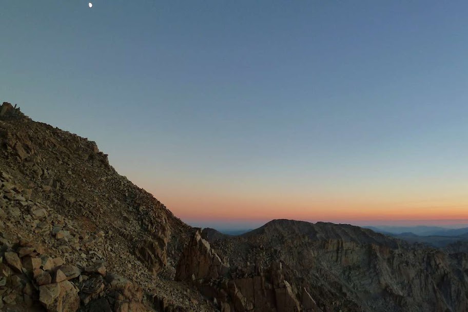
After the sun dipped behind the horizon, the temperature plummeted. We ran over to some prepared campsites and hastily set up Byron's 2 person tent fly, then the three of us squeezed under it and got in our sleeping bags wearing all our clothes. Our water bottles turned slushy overnight, so the inside temperature was probably around 30º; the temperature outside (thankfully not windy) was probably mid to high 20s. This was a new elevation record for me that would last around 12 hours.
Whitney bivy (photo by David)
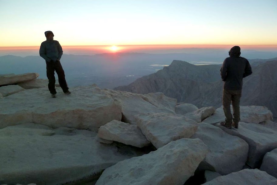
Day 15: Trail Crest to Whitney summit to Whitney Portal (12.3 miles)
We got up at 4am (a half hour before the alarm because we were too cold), packed up, and headed to the summit in the dark. We couldn't really see the trail, but sometimes, between the needle formations, we could actually see down into the eastern valley to the lights of Lone Pine. Woozy with lack of sleep at altitude, we covered the two miles to the summit in about an hour and a half.
It was super cold and super super windy on the summit (I would guess the windchill was around 10º or even zero), so we dashed in and out of the summit hut to watch the sky lighten and take pictures. Then back into the hut to warm our hands. I was wearing my spare socks as gloves since I didn't bring any.

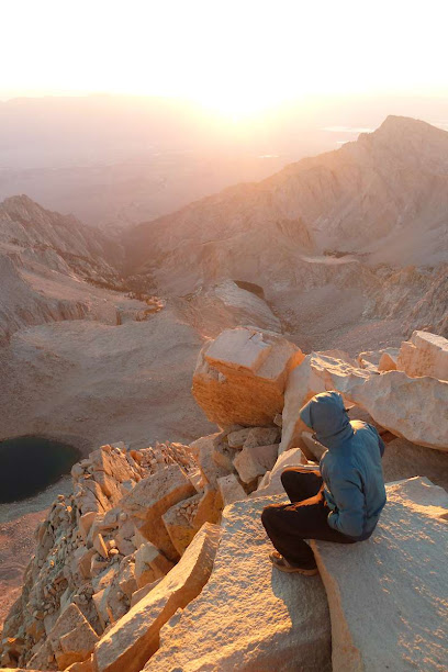
Dawn penumbra of the Earth over the hut as the sun comes up
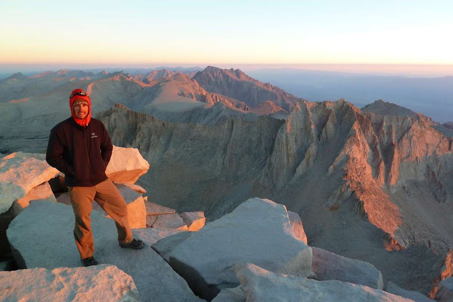
Waiting for the sun on top of the world
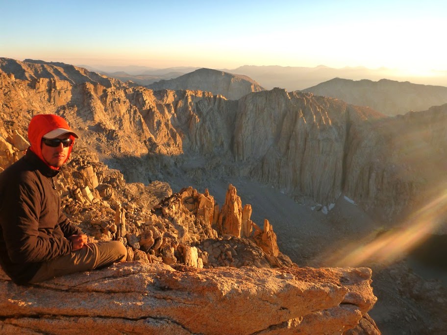
Me on the summit, wearing all the clothes I had
David found a ledge down the face that put us out of the wind and in the sun
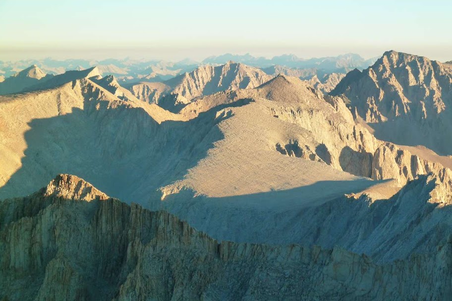
Sea of mountains looking north
We stayed up until after 7 and then headed back towards the Crest. The trail was totally different in the daylight.

Looking down at the Hitchcock Lakes and Guitar Lake
We scurried over Trail Crest and started the descent - 6000 ft down to the Portal. We began to encounter hordes of clean hikers in workout clothes who'd come up the east side of the mountain and were heading towards the summit. They all thought we'd come their way.
Down at Trail camp (around 12,000 ft) we stopped to make some breakfast
Action shot of David and Byron descending
One of the many benches on the descent. Whitney is the stockiest of the points to the left of the rounded bump in the top right part of the background ridge.
Almost down to the Portal, knees are a bit unhappy at this point

Finally back to civilization!

Some stream-bathing and clean clothes occurred, then we met up at the one and only Mexican restaurant in Lone Pine, ate more in one sitting than any of us had had over a two-day period in the past few weeks, and went off on our separate ways.
Postscript: Tips and Recommendations
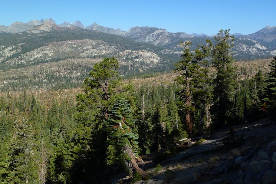
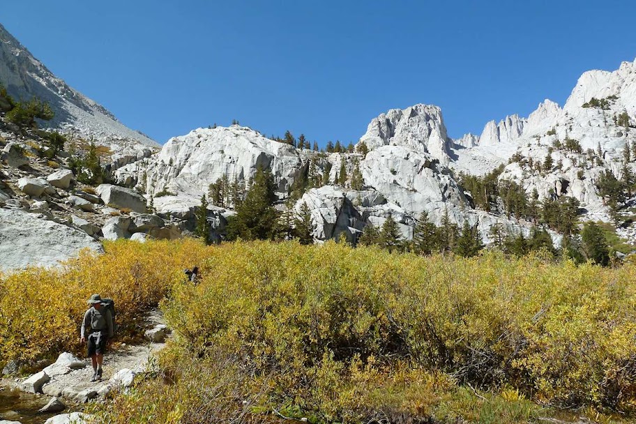
Some people seem to think the JMT is "normally" done south to north. Going southbound is an excellent acclimatizer, as each pass is higher than the previous one. Whitney is also a great finale to the whole hike, and it would be awful to have to start your trip with a 6000 ft climb up above 14,000 ft with a full load of food when your legs are at their weakest. Additionally, while the first half of the trail is pretty spectacular (and easily blows away most places I've been in the northwest), the second half in King's Canyon blows away the first half quite handily, so going north means you see the best part first and the rest of your trip is less impressive. So for all these reasons, I recommend heading south.
If I were to do it again, I would begin with one day of food in the bear canister and mail the rest of the first half of the food to the Post Office in Tuolumne. That way you can climb out of the Valley with a lighter pack on your first day, making it a bit less arduous while you're still not fit or acclimatized. You can also break it up by resupplying at Red's Meadow, but the Post Office doesn't charge the hefty resupply fee.
I brought a 30º down sleeping bag (the only bag I own) and used a 3/4 length pad to save weight. I think a really high quality 20º bag like the Western Mountaineering Ultralite (which doesn't really weigh any more than my 30º Marmot 800 fill bag) would have given me a little more coverage for the colder nights, which would have contributed to better sleep and not waking up chilled at 4am. (It may also have been that my bag's shell sucks and absorbs condensation or body vapor, reducing the loft, because I was warm enough when the bag stayed dry. But 30º is still around the cusp of staying warm, and I encountered plenty of people with 15º bags, especially if they slept cold.) I would also bring a full length pad, as I resorted to sleeping with my feet on my pack to keep them off the cold ground.
Other than that, I have some gear raves and a homemade energy bar recipe that I will post about in their respective forums.
The end!