Nick Eaton/Gorton Creek Loop, Feb 25, 2017

This forum is used to share your experiences out on the trails.
Post Reply
pablo
Posts: 1451
Joined: May 28th, 2008, 10:03 pm

Nick Eaton/Gorton Creek Loop, Feb 25, 2017

Post by pablo » February 25th, 2017, 6:51 pm

Did the shorter Nick Eaton/Gorton Creek loop. Expecting snow I took snow shoes and left the spikes in the truck. Wrong choice as the snow is quite frozen and boot tracks have made the tread uneven and slick. Eventually I broke away from the traveled parts and the snow shoes made more sense but for gear I should have taken spikes. Nick Eaton is snow free much of the way but Gorton Creek is mostly snow covered and slick.

The old logging road use by some as a shortcut to bypass the switchback on the upside of the power lines took a hit and saves distance but no time as negotiating downed trees slows progress. In the future I'll just do the switchback.

Image
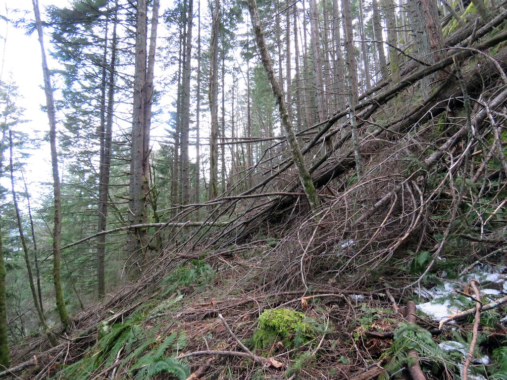
Shortcut by pauljess999, on Flickr

Views from the nice overlook at the 2600' level and the 3152' point in no particular order.

Image
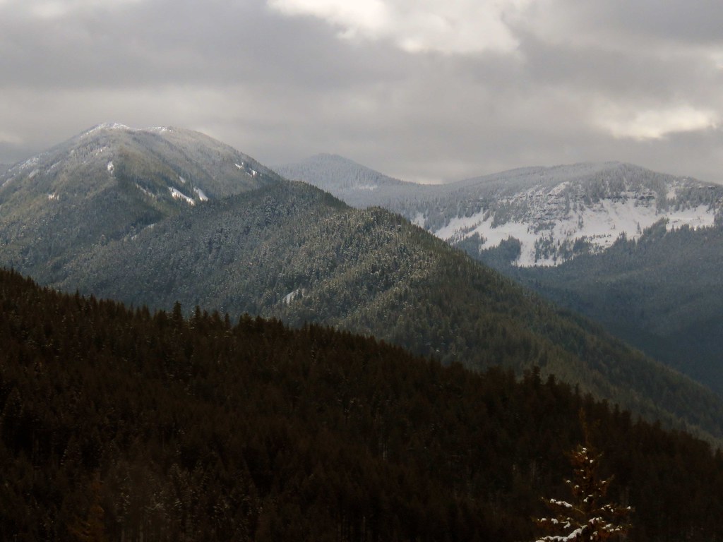
WooleyHornChinidere by pauljess999, on Flickr

Image
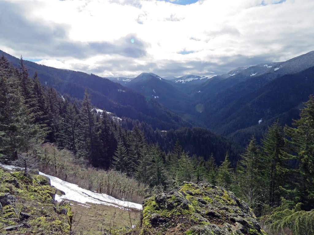
WestFork by pauljess999, on Flickr

Image
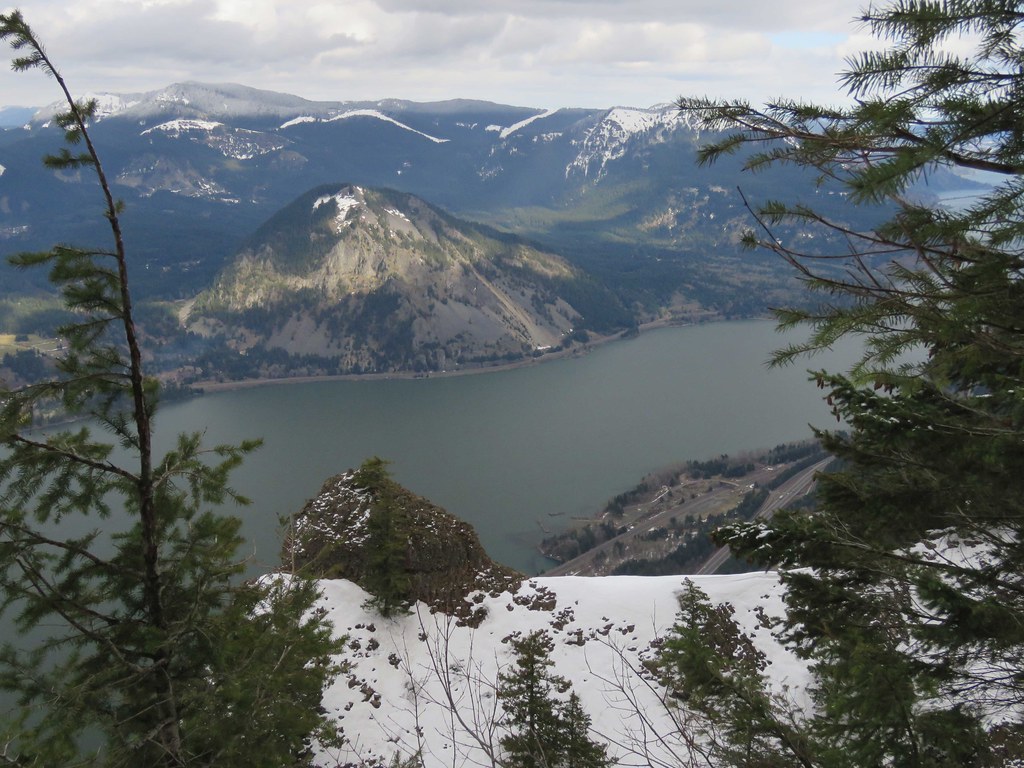
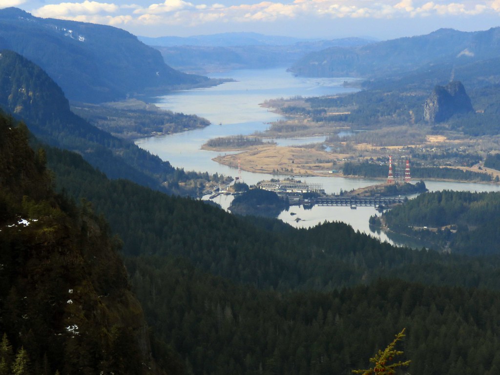
BonBeaconRockColumbia by pauljess999, on Flickr

Image
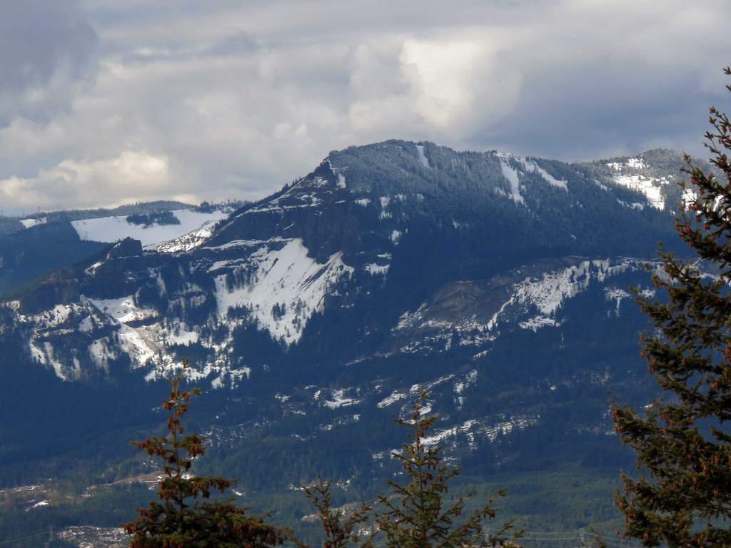
TableMtn by pauljess999, on Flickr

My snow show track crossing an open spot on the way to get on the Gorton Creek Trail from the 3152' point.

Image
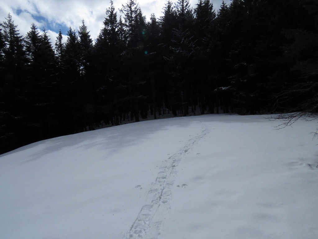
Track by pauljess999, on Flickr

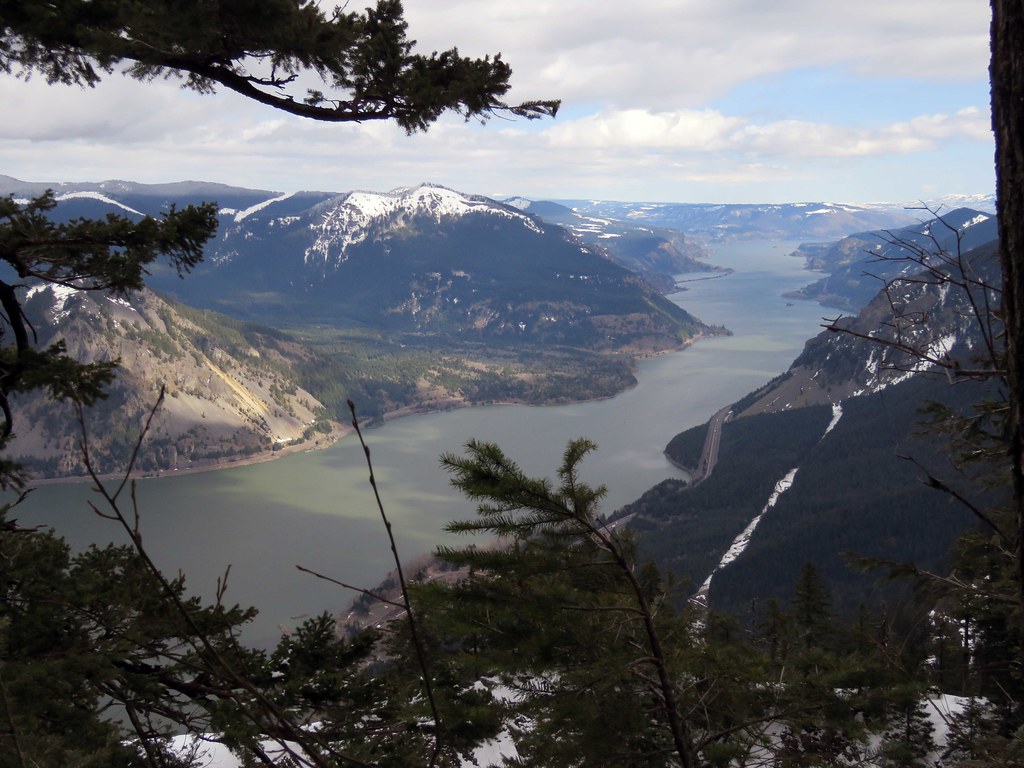
At the intersection of the cutoff trail and Gorton Creek there is a spot with nice views of the Columbia and the Washington side mountains and a good look at Indian Point. I had considered doing Indian point but no one has been on that section of trail since forever (meaning no one has recently done the long Nick Eaton -> Deadwood loop). There was one track I followed but they turned back before getting to the Indian Point cutoff so I turned back also. From the looks I had at IP there is drifted snow on the narrow approach and a cornice. I had an ice ax but I felt crampons would be needed for a safe visit.

Follow the Flickr link for the hi-res version of this photo for some detail on the conditions at Indian Point.

ImageIPnWindMtn by pauljess999, on Flickr

Dog Mtn and upstream Columbia R from the point near Indian Point.

ImageDog by pauljess999, on Flickr

I'm giving myself 8 miles and ~3000' cumulative elevation gain. Nice day for a hike, very much winter up there, maybe next time the Benson Plateau from the PCT out of Herman Creek.

Image
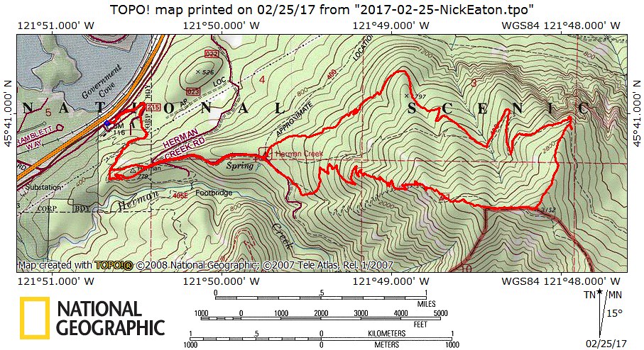
NickEatonMap by pauljess999, on Flickr
The future's uncertain and the end is always near.

User avatar
Eric Peterson
Posts: 4097
Joined: May 11th, 2009, 5:39 am
Location: Oregon
Contact:

Re: Nick Eaton/Gorton Creek Loop, Feb 25, 2017

Post by Eric Peterson » February 26th, 2017, 7:42 am

Holy moly Indian Point looks awesome right now!

Thanks for the conditions update sir :)

User avatar
gratefultrails
Posts: 82
Joined: October 21st, 2015, 8:08 am
Location: Eugene

Re: Nick Eaton/Gorton Creek Loop, Feb 25, 2017

Post by gratefultrails » February 26th, 2017, 8:23 am

That is some cool lighting on the shot of Wooly Horn ridge.. it captures why I love hiking the "foothills" in the winter.

User avatar
woodswalker
Posts: 835
Joined: November 25th, 2012, 4:51 pm

Re: Nick Eaton/Gorton Creek Loop, Feb 25, 2017

Post by woodswalker » February 26th, 2017, 8:47 am

I always really liked the viewpoint at 3152. Not as grand as many others, but just a really nice spot. Thanks for the update.
Woodswalker

User avatar
Don Nelsen
Posts: 4381
Joined: May 28th, 2008, 10:03 pm
Location: Vancouver, WA

Re: Nick Eaton/Gorton Creek Loop, Feb 25, 2017

Post by Don Nelsen » February 26th, 2017, 11:41 am

Nice! Thanks for the report and photos.

dn
"Everything works in the planning stage" - Kelly

"If you don't do it this year, you will be one year older when you do" - Warren Miller

User avatar
BigBear
Posts: 1836
Joined: October 1st, 2009, 11:54 am

Re: Nick Eaton/Gorton Creek Loop, Feb 25, 2017

Post by BigBear » March 13th, 2017, 11:56 am

Thanks for the report. I'm betting Gorton Creek will not be 100% snowfree until May. There's that one 1/4-mile section 2/3rds of the way up the ridge toward the Cutoff Trail Jct. that's always a holdout.

I'm wondering more about the fallen trees and limbs along the Gorton Creek side. I'm just too lazy to keep taking my pack on and off to squeeze under and around things. It interferes with my enjoyment of the forest around me. :)

Post Reply