Mt Adams Shorthorn backpack
Posted: July 7th, 2016, 6:33 am
Chose this spot as an uncrowded location for a July 4 weekend backpack though I only went for one night. Shorthorn is both melted out and maintained (i.e. logs removed) but you can only go so far up there before running into snow. Mt Adams is only a week or two ahead of average snowpack melt IMO.
The Shorthorn trail is well worn and some estimates indicate it was a Native American route before settlers arrived. It's also essentially all in burn now.

Really changes the mood when you get to greenery and a creek

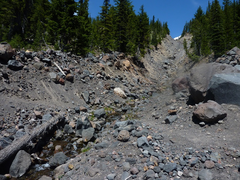
The trail crosses this debris chute before the final uphill to reach the Round the Mountain trail
The mountains has a very broad prospect here

Turning left, I ran into full snow just before Cascade Creek, which is about where the junction is to go to Loookingglass Lake. Not in the mood to do the snow this trip. I noticed a possible easy XC shortcut to avoid the snow by cutting through Madcat Meadow but that will be for another trip. I turned around and retraced my steps past the Shorthorn junction and camped about a mile before the south climb junction. It's mostly desert hiking up there, but with lots of rushing creeks this time of year. A bit of a contrast.

This pic gives a good profile of the south route. Lunch Counter is the prominent dark area in the middle. It is a vast low sloped field with many camps around it's periphery. On a sunny (though windy) holiday weekend like this during the climbing season, there were probably 200 or so people camped up there. The obvious snow ramp to it's left is the bulk of the climb, leading to Piker's Peak. The climber's track up and glissade down it was clearly visible to me, but is washed out in the photo. I've never been past Lunch Counter and am not that motivated, but presumably will get up there some day.

The Shorthorn trail is well worn and some estimates indicate it was a Native American route before settlers arrived. It's also essentially all in burn now.
Really changes the mood when you get to greenery and a creek
The trail crosses this debris chute before the final uphill to reach the Round the Mountain trail
The mountains has a very broad prospect here
Turning left, I ran into full snow just before Cascade Creek, which is about where the junction is to go to Loookingglass Lake. Not in the mood to do the snow this trip. I noticed a possible easy XC shortcut to avoid the snow by cutting through Madcat Meadow but that will be for another trip. I turned around and retraced my steps past the Shorthorn junction and camped about a mile before the south climb junction. It's mostly desert hiking up there, but with lots of rushing creeks this time of year. A bit of a contrast.
This pic gives a good profile of the south route. Lunch Counter is the prominent dark area in the middle. It is a vast low sloped field with many camps around it's periphery. On a sunny (though windy) holiday weekend like this during the climbing season, there were probably 200 or so people camped up there. The obvious snow ramp to it's left is the bulk of the climb, leading to Piker's Peak. The climber's track up and glissade down it was clearly visible to me, but is washed out in the photo. I've never been past Lunch Counter and am not that motivated, but presumably will get up there some day.