
My 14 year-old daughter and I took our annual backbacking trip this past weekend. I usually don't like to go out on holiday weekends, but this was the only weekend available. I was leary that the popular places would be, well popular and crowded. So I cast about for a less well-travelled route. We settled on revisiting a trip we took three years ago, up School Canyon trail to Flag point, with a jaunt up to Lookout Mt, in the Badger Wilderness. This is a fantastic area for hiking, but for some reason rather overlooked. It's in the transition zone between dry eastside and wet westside and is home to a huge diversity of trees, flowers, and animals. You can read a lot more about it in the field guide. I love the open forests dominated by Ponderosa Pine.
Last time we did the trip in mid-June, and I think May & June are the best times to visit this side of the Cascades, when the forests are still moist and the wildflowers are at peak. Early July is definitely pushing it a bit -- hot and dry. The main thing you have to worry about on this route is finding reliable water.
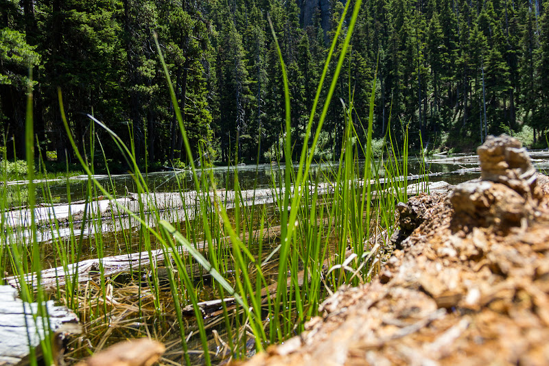
This time around, we decided to make a loop by returning on the Tygh Trail. We parked at the Tygh Trailhead, where we would end our trip, and walked about a mile on FR-27 towards the School Canyon Trailhead. Before reaching the trailhead proper, we headed off into the forest and bushwacked up to the trail, saving about half a mile. In this area there is ample evidence of cattle grazing, although we didn't see any this time. The School Canyon trail is a lovely walk that starts in dry Oak and Ponderosa pine forest, then contours around Ball Point, passing through a fire burned area. In some stretches, the trail is starting to get overgrown by underbrush. There was much more growth than three years ago. The trail re-enters a mixed conifer forest and finally joins the Little Badger trail at the heliospot, where there are some campsites and a spring. The spring was still going strong. We camped here, about 4 miles in, enjoying a warm evening and exploring the fantastic rock sculptures.

Ready to go!


Brush overgrowing trail


The next morning we continued up the Little Badger trail towards the Flag point road. Balsamroot and Lupine are mostly finished here, but open areas are dotted with more common flowers like penstemon, along with the occasional lily. After a brief lunch break, we continued on the Divide trail towards Lookout Mtn. The trail maddeningly goes up over every little peak, only to go back down to the local saddle as it follows the ridge. I'm sure it's very nice if you aren't carting a heavy backpack (although any views are mostly hidden by rapidly regrowing forest.) The best views come from a variety of rock cliffs on the west side of the ridge. Along the way, we dropped to Oval lake to pump some water, and reached the final saddle just before the peak of Lookout. We dumped our packs, set up camp, and then set off, joyously packless, for the final assent to the peak.

Junction with the Tygh cutoff trail.

Tygh cutoff trail, from junction with Little Badger Trail

Lilies


Rock outcroppings along the Divide Trail

Junction with trail to Oval Lake

Oval Lake

Campsite near summit of Lookout Mt.
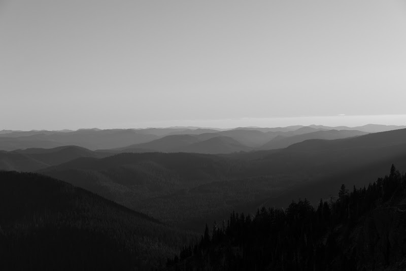
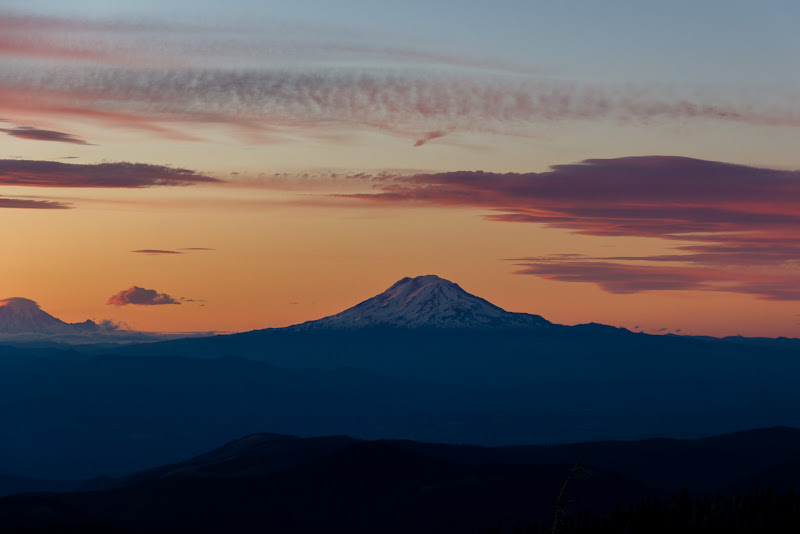
Lookout Mt might be one of the best viewpoint spots in the Mt Hood area. It has the advantage over any hike on Mt. Hood of actually having a view of Hood. In addition, you can see Mt St Helens, Rainier, Adams, Jefferson, and the Sisters, plus a view into Eastern Oregon (including all the windmills). Pretty spectacular. Being a Saturday and only a 2 mile hike from a trailhead, it was also crowded.


While standing on top and looking at the map, I noticed that it showed Senecal Springs just off the North East side of the summit. I decided to explore whether they were accessible and still flowing, as being able to refill our water bottles would make life a lot more comfortable. I followed the old road bed off the summit and just before it curves around to head down the mountainside, struck off into the woods. I quickly found a well-travelled game trail that seemed to be going in the right direction. After a short walk the magical tinkling sounds of water rushing over rocks reached my ears and 20 more feet brought me to the spring gushing from the steep rocky hillside. On the other side of the small creek was a very well worn use path that switchbacks up the hill and joins the main trail a few hundred feet before the summit, and just a short distance from our camp. So, good to know that the spring on Lookout Mt is accessible and pretty reliable. I would guess that it runs almost year round.
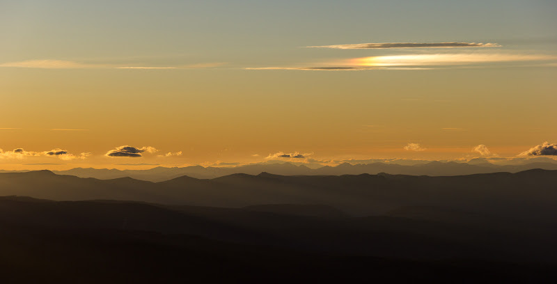
After enjoying the view from on top, we returned to camp, relaxed and had dinner. We then returned to the top to watch the sun set. This time we shared the top with just one other person, a camper setting up camp right on top.


The next day we set off early to make our 9 mile return trip to the Tygh trailhead. Sadly, we ran down our camera battery taking sunset photos, and so have no photos from the last day. We returned on the Divide trail to the Flag Point road and then took the Tygh trail. This trail follows the ridge across from the Tygh creek from the School Canyon Trail. Although the Field Guide says that this is a "Lost Trail" and can be hard to follow, we found it quite straightforward. It appears to have recently been cleared of most blowdown, and seems to have gotten significant horse traffic, at least between Flag Point and where the Jordan Butte Trail connects. The trail is a beautiful walk mainly though Ponderosa Pine parkland, even though most wildflowers are gone by.
(Incidentally, the Sunset spring, which is accessible from the Little Badger Trail just before Flag point Rd, and flows across the Tygh trail lower down, was all dried up at Tygh trail. The last time we did this trip, in mid-June, the little creek was flowing. )
After dropping gently in the first mile from Flag Point road, the Tygh trail is mostly flat for the next three miles. The final decent from Pen Point is really steep, amongst the steepest trail I've experienced. It loses almost 1800' in just under two miles. At first we agreed that it would be really exhausting to go up this way, but by the time we were halfway down, we were beginning to wonder if we wouldn't rather go up instead of come down this long, steep section, especially after a couple of days of hiking.
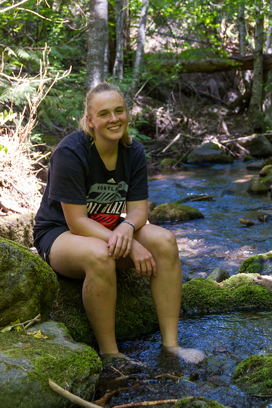
We were really glad to finally reach the trailhead and soak our tired feet in the cold creek.
A scenic drive through Dufur and the Gorge, with a well-deserved stop in Hood River for ice cream, wrapped up a fabulous trip in the wilderness.


