Lost Creek Lake (Upper Rogue River) 04-Feb-2016

This forum is used to share your experiences out on the trails.
Post Reply
User avatar
VanMarmot
Posts: 1924
Joined: May 28th, 2008, 10:03 pm
Contact:

Lost Creek Lake (Upper Rogue River) 04-Feb-2016

Post by VanMarmot » February 5th, 2016, 9:26 am

While we're glad, thanks to El Nino, to be able to snowshoe again, we do (selfishly) miss being able to hike clear trails in the high country in January. Casting around for snow-free mid-winter trails has caused us to consider some lower elevation trails we passed on during the past two dry years. One of these runs along the north shore of Lost Creek Lake, a 3,340 acre Corps of Engineers reservoir (Lost Creek Lake) that sits astride the Rogue River about 30 mi NE of Medford. Previous hikes near or around reservoirs have included Henry Hagg Lake W of Portland (Hagg Lake TR) and a loop that includes Applegate Reservoir (Collings Mtn TR). Neither of these were outstanding hikes, so we approached Lost Creek with some reservations - only to find that this hike had a lot more to offer than just gazing at a partially filled bathtub. We parked at the Takelma Park TH, which, on a mid-winter's weekday, was empty except for us (come summer and this area is immensely popular with boaters, mountain bikers, and trail runners (runners)),

Image

then headed N on the almost level trail.

Image

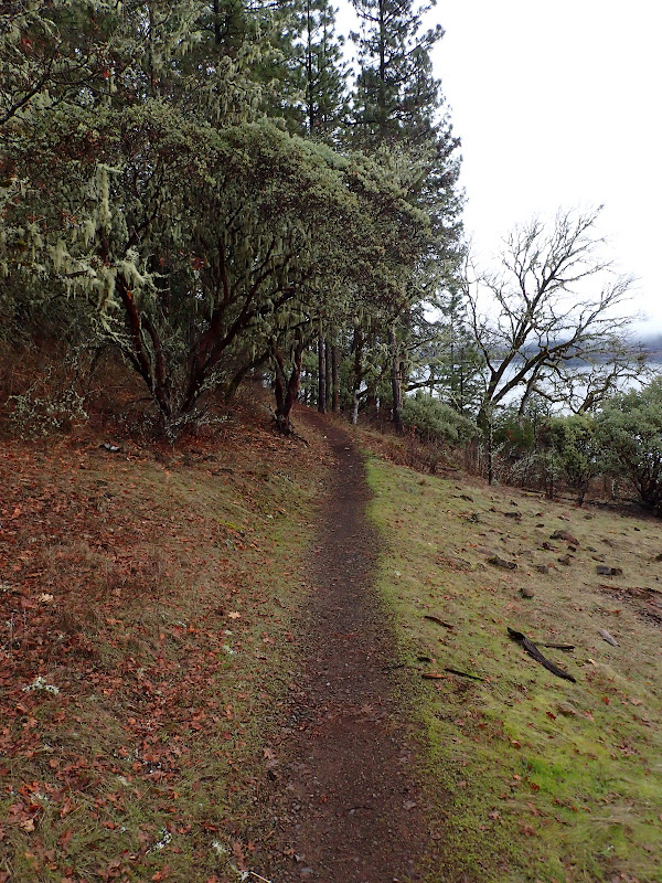
Much of this trail runs through forest, which gives you a sense of isolation and detachment from the reservoir.

Image

The trail is maintained by the Corps, who have done a great job maintaining the tread and a series of handy footbridges over small streams - all of which were running well in this high water year ( :) ).

Image

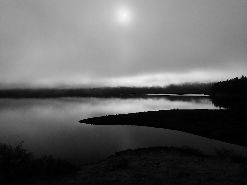
The day got off to a foggy start, which created some really moody, noir effects on the lake's waters.

Image

Image

The trail works its way past some trail and lake-accessible campsites at Four Corners Camp and then continues N into the northern-most arm of the lake.

Image

Here, the trail briefly merges with a service road,

Image

and then becomes a trail again - the Rogue River Trail,

Image

as it drops off of the road,

Image

and continues on to the Lost Creek TH on the northern-most arm of the reservoir.

Image

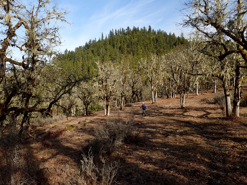
The appearance of a "Rogue River Trail" here might be a bit confusing. The vastly more famous 40 mi long Rogue River Trail (Rogue River TR) is far to the west. The Upper Rogue River Trail (USFS #1034) goes from N of Crater Lake to near the ranger station in Prospect (here). Sullivan (per the updates on his website) now says you can - with some manuvering - make your way from the Lost Creek TH to Prospect {Update: You can, if you're willing to suffer}. Today, we were satisfied to just follow the trail as it headed a bit inland and climbed (very gently) through some oak woodlands on the S side of Fawn Butte,

Image

repleat with well-watered lichens,

Image

to a view E toward the lake.

Image

Then some more travel through the woods,

Image

to our destination for the day - the Blue Grotto - with its 40' waterfall and soft greenish rock, which is ash from Mt. Mazama (now Crater Lake).

Image Image

Image

Image

After a snack, it was back along the trail,

Image

past an odd tree,

Image

to a detour along the service road,

Image

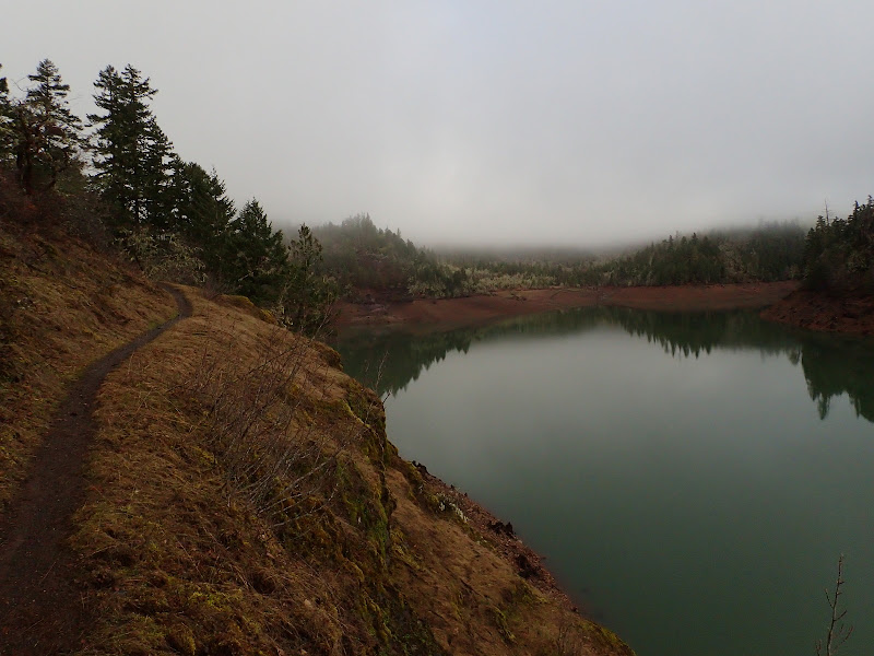
to Four Corners Camp and a view of the lake - now free of fog and clouds - and then the TH.

Image

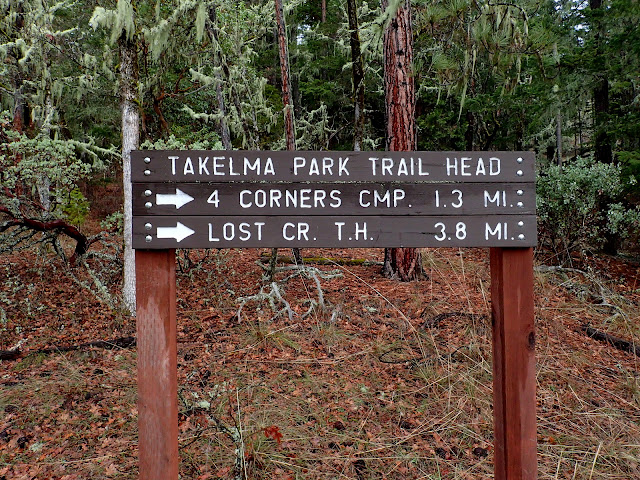
A long, but low gain, hike (15.5 mi RT, 600' EG) through some surprisingly pretty meadows and forests to an intriguing waterfall. This feature is more readily accessible from a TH to the E via a 2.5 mi trail and also directly from the lake - we suspect it's a popular destination since it has its own floating restroom moored in the bay. :roll: But today it was all ours... :D

Image
Last edited by VanMarmot on March 1st, 2018, 3:36 pm, edited 2 times in total.

User avatar
miah66
Posts: 2039
Joined: July 6th, 2009, 8:00 pm

Re: Lost Creek Lake (Rogue River) 04-Feb-2016

Post by miah66 » February 5th, 2016, 9:37 am

Yep, you had me confused at at Rogue River trail. :lol: I admit, the environs in your Southern OR trip reports really intrigue me. It seems like a strange mix of Eastern Gorge (white oaks, grassy knobs) Eastern hardwood forest, and high desert (madrone, ponderosa, juniper, etc). I really have to get down that way and see for myself.
"The top...is not the top" - Mile...Mile & a Half

Instagram @pdxstrider

User avatar
VanMarmot
Posts: 1924
Joined: May 28th, 2008, 10:03 pm
Contact:

Re: Lost Creek Lake (Rogue River) 04-Feb-2016

Post by VanMarmot » February 5th, 2016, 10:41 am

miah66 wrote:Yep, you had me confused at at Rogue River trail. :lol: I admit, the environs in your Southern OR trip reports really intrigue me. It seems like a strange mix of Eastern Gorge (white oaks, grassy knobs) Eastern hardwood forest, and high desert (madrone, ponderosa, juniper, etc). I really have to get down that way and see for myself.
We have a lot of fir and pine trees too. The geology down here - involving exploding volcanos and colliding crustal plates - is pretty convoluted. These convolutions face in different directions at different altitudes which allows for a variety of ecosystems - some very unique - in close proximity to one another. Ruediger's The Siskiyou Crest is one good introduction to this ecology in the Siskiyou / Red Buttes area. But - even better - come on down and see for yourself! :D

Post Reply