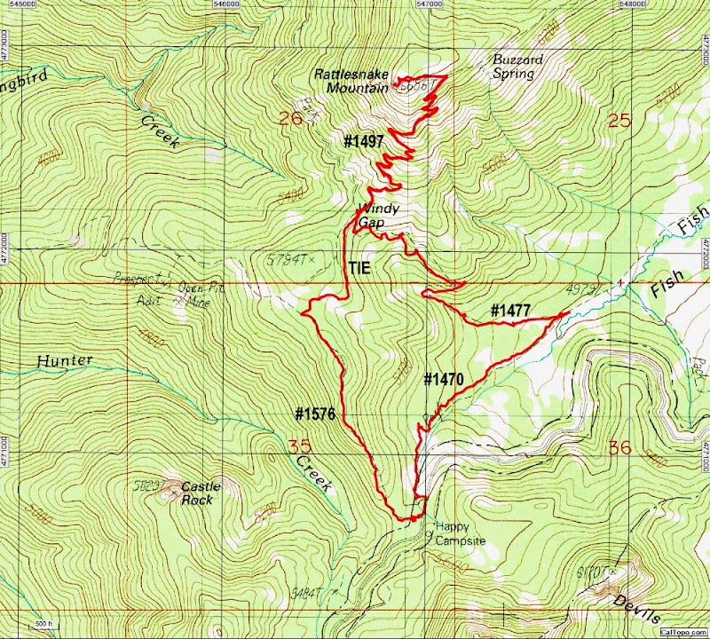
Some driving on reasonably OK gravel roads brought us to Happy Campsite (a pit toilet and two picnic tables) near the end of FR 870. We parked there and walked back down the road about 300' to a junction with the Rogue-Umpqua Divide Trail (USFS #1470), a trail of varying quality that runs the length of the wilderness.

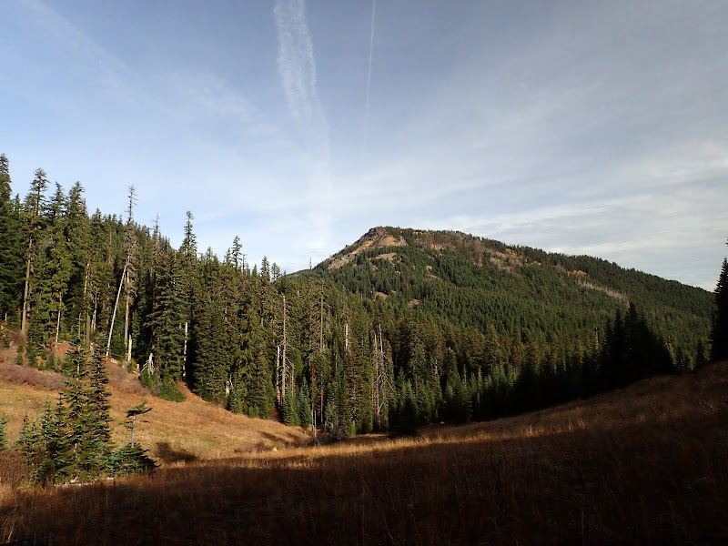
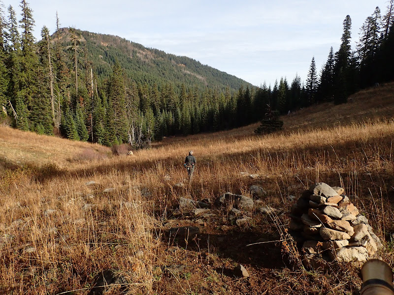
That trail took us down into one of the meadows that line the Fish Creek Valley where we got our first clear look at Rattlesnake Mtn - the trail to the summit goes up the left ridge. The day started out sunny but would soon cloud over ahead of our first snow storm on the season.
Trails through meadows in this area have a tendency to disappear into the veg, so some navigation is performed by following large cairns.
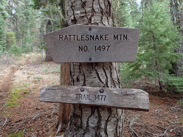
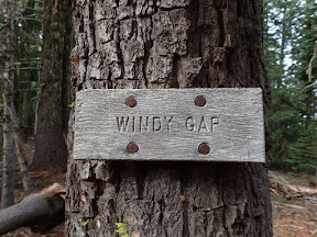
About 0.7 mi N on the #1470, we came to its unsigned junction with the Whitehorse Meadows trail (USFS #1477) which took us uphill to Windy Gap on the southern shoulder of Rattlesnake Mtn and a junction with the Rattlesnake Mtn Way trail (USFS #1497).
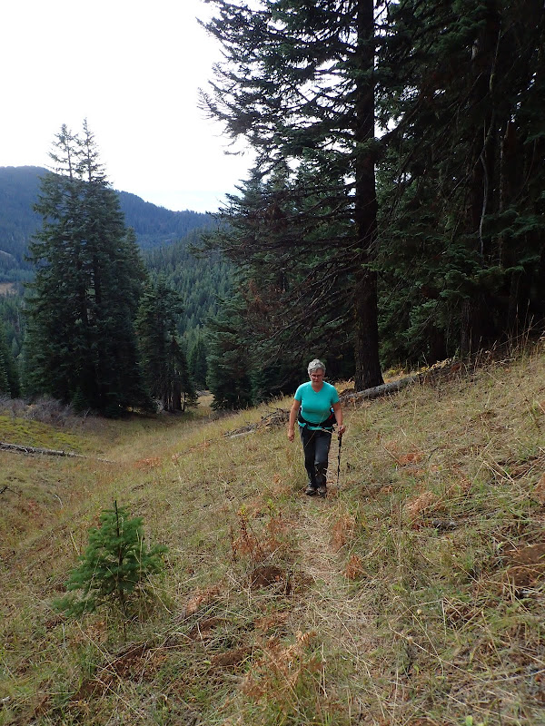
We turned right and followed the #1497 up through forest and meadow,
to the summit.
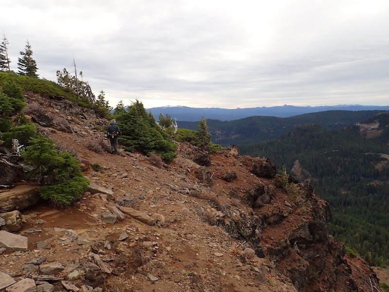
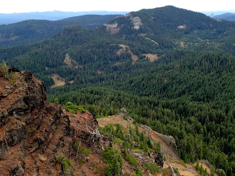
By now high clouds were in and a cold wind had started but there were still some views to be had - the Fish Creek Valley below with Fish Mtn in the distance,
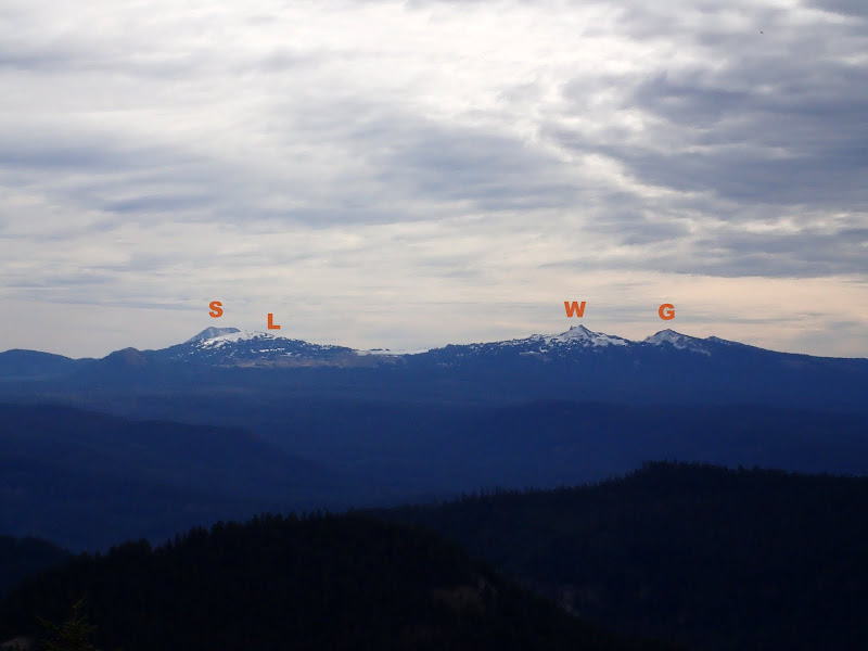
Scott (S), LLao (L), The Watchman (W), and Garfield (G) around Crater Lake,
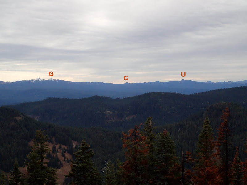
along with Garfield (G), Crater (C), and Union (U),
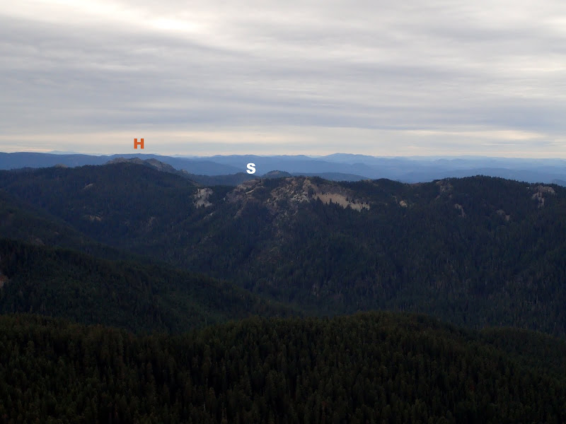
Hershberger LO (H) and Standoff Point (S) {where the Rim Rock trail cuts through some amazing cliffs TR here},
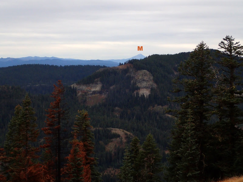
and Mt. McLoughlin (M) peeking over Fish Mtn.
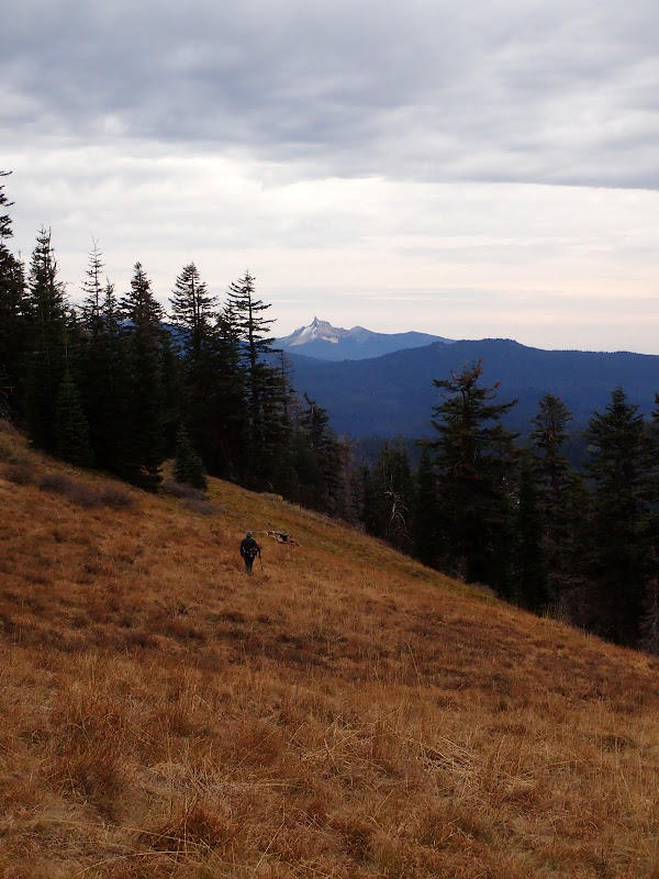
After a cold, hence brief, lunch on the summit, we headed back down the #1477, with Mt. Thielsen in the distance.
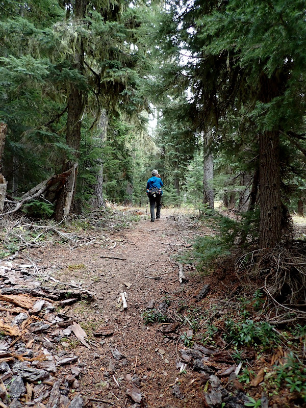
Once back at Windy Gap, we continued on a tie trail to the Castle Creek trail (USFS #1576) and followed it downhill to Happy Camp.
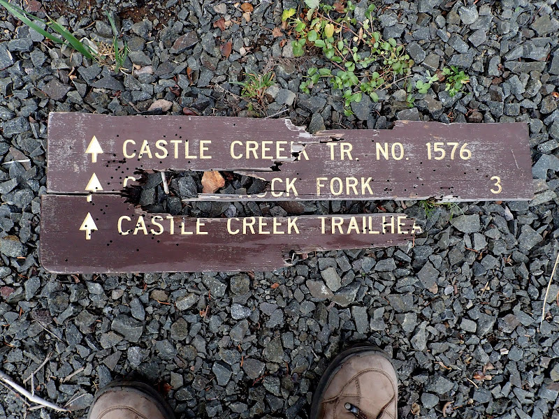
When we'd first parked at Happy Camp, we couldn't find any sign for the Castle Creek trail and just started off hoping it would arrive back at the TH as described in the guidebooks. As we were approaching the TH on our return, we found the shotgun-blasted pieces of the sign in the bushes and re-assembled it as best we could. While we don't have problems with responsble gun owners or hunters, we do have one with the intellectually, socially, and morally deficient idiots who use the few signs the USFS puts up as targets! Arrragh!!!
A short, but fun, hike (6 mi RT, 1750' EG) to a nice viewpoint and one that could be combined with another short hike (like Abbott Butte (Abbott TR)) to make a full day of hiking in this area.