
So from N (near Crater Lake NP) to S (near Hwy 140), here are the THs and our TRs for this wilderness. These THs exist to serve hikers, backpackers, equestrians, and hunters but we've (obviously) focused on those most favorable to dayhikers and backpackers.
Red Blanket TH

Stuart Falls
This used to provide access to the popular Stuart Falls area but the road (FR 6205) is currently blocked - but may reopen - and the trail is badly damaged - and there are no plans to fix it. So be careful if you take this trail (be prepared to walk a road for 5 mi RT just to get to the TH)! Also note that the trails comprising the loop around Lucky Meadow were also damaged by the 2008 Lonesome Complex fire, have suffered from fallen trees, and may not be easily passable.
Hike #42 in Sullivan's Southern Oregon guide, 3rd edition
USFS #1090
Tom and Jerry & Middle Fork THs
We didn't visit these this year because they enter a portion of the wilderness that was devastated by - and has yet to recover from - the 2008 Lonesome Complex fire. There are also no lakes or peaks nearby.
USFS Tom & Jerry TH
USFS Middle Fork TH
Sevenmile Marsh TH
We finally got around to visiting this trailhead and found it to be good way into the northern part of the wilderness. It's a longer drive from the west (but not from Highway 97) but an easier way into the Seven Lakes Basin than from the Seven Lakes TH to the west.
Hike #44 in Sullivan's Southern Oregon guide, 3rd edition
USFS Seven Mile Marsh TH
Alta Lake TH
Alta Lake
We didn't visit this TH either but did access a part of the Alta Lake trail (#979) from the Seven Lakes TH. While #979 was in good condition (seemingly due to volunteer efforts at keeping it clear), Alta Lake is much easier to get to via the Seven Lakes trail. And Alta Lake is a gem worthy of a visit or, better, an overnight backpack.
Hike #43 in Sullivan's Southern Oregon guide, 3rd edition
USFS Alta Lk TH
Seven Lakes TH

South Lake
This is a very popular TH which provides easy access from the W to the Seven Lakes Basin and Devils Pk.
Hike #43 in Sullivan's Southern Oregon guide, 3rd edition
USFS #981
Nannie & Cherry Ck THs
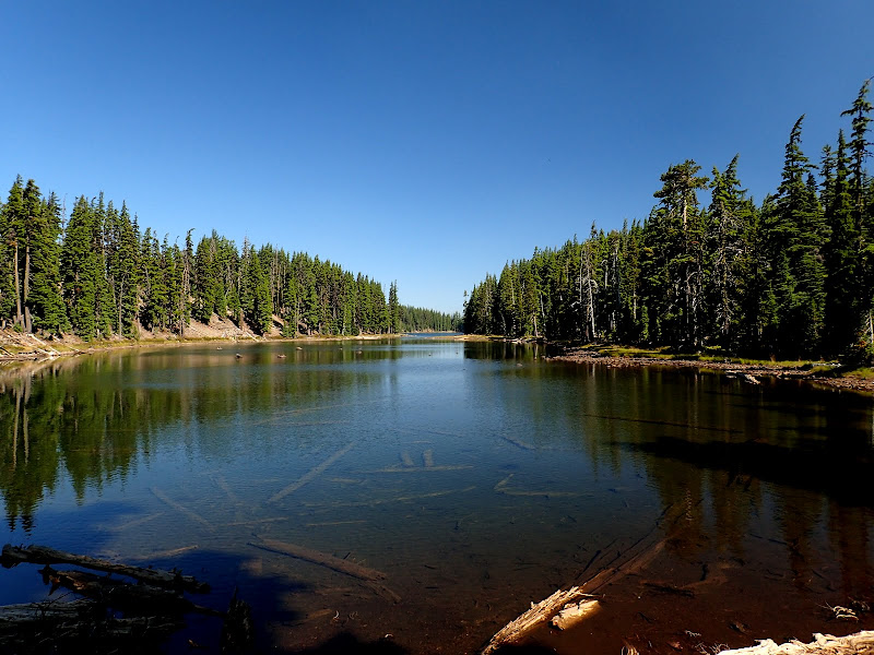
Trapper Lake
Nannie Ck is by far the more popular of these two THs, as it's higher and closer to the lakes E of Luther Mtn, in the center of the wilderness. Both of these also provide access to the Dwarf Lakes Basin.
Hike #44 in Sullivan's Southern Oregon guide, 3rd edition
USFS Nannie Ck TH
USFS Cherry Ck TH
Upper South Fork TH
Another one we didn't visit, again because it seems like a harder way to get to the Blue Lakes Basin in the southern part of the wilderness.
USFS Upper S Fk TH
Cold Springs TH
Heavenly Twin Lakes
Another popular TH (with amenities!) providing easy access to the Dwarf Lakes Basin and also to the lakes near Luther Mtn.
Hike #49 in Sullivan's Southern Oregon guide, 3rd edition
USFS Cold Springs TH
Blue Canyon TH

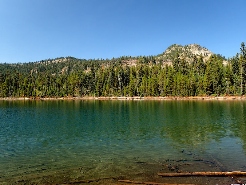
Island Lake
A little bit more driving, but then very easy access from the W to the Blue Lakes Basin and the Judge Waldo Tree. You can also access this basin from Fourmile Lk, but this TH provides more direct access.
Hike #46 in Sullivan's Southern Oregon guide, 3rd edition
USFS Blue Cyn TH
Twin Ponds TH
Another one we didn't access because its easier to access Fourmile Lake (and the trails that start there) from Hwy 140.
USFS Twin Ponds TH
Fourmile Lake TH

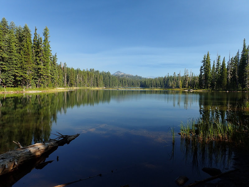
Fourmile Lake & Mt. McLoughlin
A very popular camping, boating, and hiking spot, easily accessible from Hwy 140. Finding the TH from the parking lot can be a little confusing since it's behind one of the campsites. This TH made for the start of a fun, long loop through the Blue Lake Basin using the PCT, but if you just want to get right to the lakes in that basin, then I'd recommend using the Blue Canyon TH.
Hike #48 in Sullivan's Southern Oregon guide, 3rd edition
USFS Fourmile Lk TH
Mt. McLoughlin TH

Mt. McLoughlin
McLoughlin is the tallest peak in southern Oregon and a worthy hike/scramble any time of the year. Catch the weather right, and the views from the top are ENORMOUS! But pay attention to the signs the USFS has posted (in two places) about getting to and from the summit. When snow covers the approach trail or the upper slopes, it's easy to get lost in the forest or descend the "easy" (but wrong) S side all the way to Hwy 140 (oops!). Don't make the local SAR teams work any harder!
Hike #47 in Sullivan's Southern Oregon guide, 3rd edition
USFS #3716


