Fourmile Lake Loop (Sky Lakes Wilderness) 03-Jul-2015

This forum is used to share your experiences out on the trails.
Post Reply
User avatar
VanMarmot
Posts: 1924
Joined: May 28th, 2008, 10:03 pm
Contact:

Fourmile Lake Loop (Sky Lakes Wilderness) 03-Jul-2015

Post by VanMarmot » July 4th, 2015, 8:11 am

The Sky Lakes Wilderness (not to be confused with the Mountain Lakes Wilderness further S) stretches from Crater Lake Nat'l Park south to Hwy 140. The numerous lakes in this wilderness divide somewhat in to three sections - the Seven Lakes Basin N of Devils Pk (Seven Lakes TR), the Dwarf Lakes Area accessible from the Nannie Ck and Cold Springs THs, and the Blue Lake Basin just N of Fourmile Lk. Owing to all of this open water, this wilderness is infamous for its infestation with hoards of mosquitos in July and August. Still, I'd wanted to check out the Blue Lake Basin for some time and it was hot enough in the valley (100+F for days) to make desanguination by flying syringes seem acceptable. Note: This is a loop for folks who like lakes - lots of lakes - because 95% of it is through forest (the famous Oregon "green tunnel") and views are minimal at best.

Image

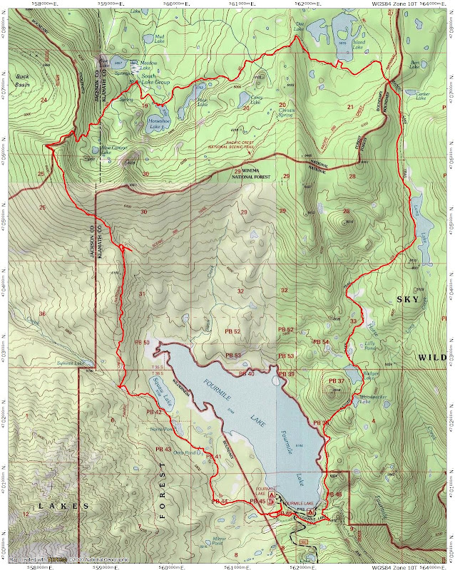
The Blue Lake Basin can be accessed directly from the W (see Hike #46 in Sullivan's Southern Oregon guide, 3rd edition) but the TH at Fourmile Lake, while it requires more hiking, also requires a lot less driving on forest roads (via just 6 mi of gravel road off of Hwy 140). I got a very early start to take advantage of what morning cool there was and headed out on the Twin Ponds Trail (USFS #993) toward Swan Lake.

Image

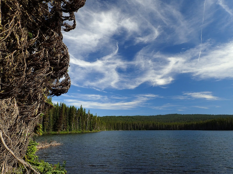
Shortly after leaving the TH, I passed Orris Pond,

Image

and then Swan Lake.

Image

Just past Swan Lake, I reached a junction with the PCT and went N on it. While there were definitely mosquitos around, they weren't out in clouds and a little judiciously applied DEET kept them at bay. The PCT climbs a little here, which provided one of the day's few views - of Fourmile Lake.

Image

About a mile or so N along the PCT, I came to its junction with the Cat Hill Way trail (USFS #992) and took that NW up the hill. This way trail crests at about 6300' and provides another of those elusive views - this time of the E side of Mt. McLoughlin (which doesn't look as cool as it's W side - the view you get from I-5).

Image

Near where the way trail crests, there is an unsigned junction of the Cat Hill Way trail (which continues N from here to the Blue Canyon TH) and a trail that drops NE into Blue Canyon (the #992 N from here doesn't show on the Nat'l Geo TOPO maps but is shown in Sullivan). This is where some of the navigation fun starts. The USFS calls this the Meadows Lakes trail (USFS) but gives it the same number (#976) as the Blue Canyon trail coming from the Blue Canyon TH (USFS #976). The Blue Canyon trail was previously the #982 trail and it's still referred to by that number in some current guidebooks (Bernstein and Urness's for example) but not by the USFS. OK then. :roll: I took this rocky and worn "whatever" trail down into the basin to its junction with the Blue Canyon trail (#976 / #982) and then took that trail E past Horseshoe Lake,

Image

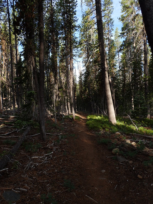
and past delightful Island Lake,

Image

which has a large island in its middle (the trees in the center of the photo) and excellent camp sites,

Image

to a junction with the Red Lake trail (USFS #987). Not having done enough navigation homework, I missed visiting the Judge Waldo tree at Island Lake (Waldo Tree). Fodder for another hike but by this time I was starting to feel the heat and looking forward to a cool (alcohol-free) one at the TH. So a short stretch on the Red Lake trail brought me to its junction with the PCT and the Badger Lake trail (#3759; formerly the Long Lake trail #3758). I took the Badger Lk trail - without further navigational confusion - all the way back to Fourmile Lake, passing Long Lake,
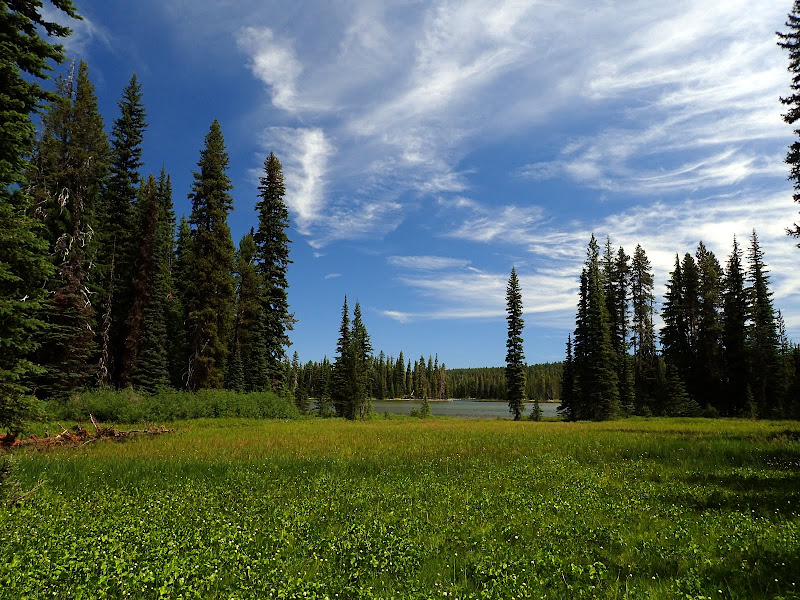
Image

Lily Pond,

Image

Image

Badger Lake,

Image

and Woodpecker Lake along the way.

Image

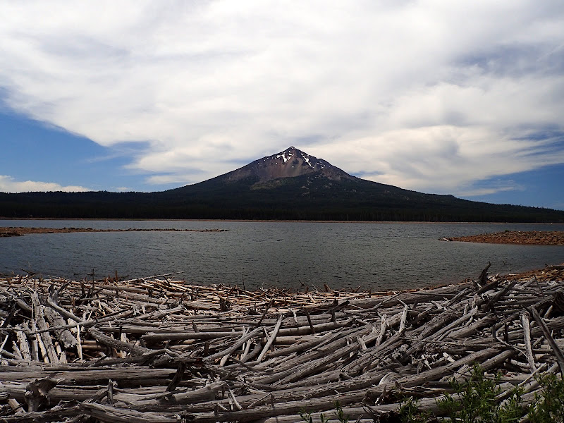
This trail comes out on the shore of Fourmile Lake and there provides the only BIG VIEW of the day - of the E side of McLoughlin. I think if you were shown W and E profiles of this peak, you'd think they were different mountains.

Image

A great, long ramble (17 mi RT, 1500' EG) on good trails, with surprisingly manageable levels of bugs. This is clearly one for lake-lovers, particularly those who'd like a moderate backpack to a nice campsite near a lake (with fish!). This is not really the hike for those wanting views or summits or who don't like trees! ;) And, although the drive-in campground was ready full, I saw no one along the trail or at any of the lakes! :D

Image
Last edited by VanMarmot on September 16th, 2023, 5:54 am, edited 1 time in total.

User avatar
mjirving
Posts: 1185
Joined: July 5th, 2011, 10:40 am

Re: Fourmile Lake Loop (Sky Lakes Wilderness) 03-Jul-2015

Post by mjirving » July 4th, 2015, 1:24 pm

Nice, I'll be going south on the PCT in few weeks through there and had planned to do a Sky Lakes alternate in that area. Thanks for the preview.

Mike (aka GoalTech)

siskiyoudaniel
Posts: 14
Joined: June 26th, 2015, 1:55 pm

Re: Fourmile Lake Loop (Sky Lakes Wilderness) 03-Jul-2015

Post by siskiyoudaniel » July 5th, 2015, 7:27 am

Thanks again for another well documented (great pics) trip report. I've been meaning to get up to the Sky Lakes and it's nice to know what to expect.

Cheers

User avatar
miah66
Posts: 2039
Joined: July 6th, 2009, 8:00 pm

Re: Fourmile Lake Loop (Sky Lakes Wilderness) 03-Jul-2015

Post by miah66 » July 6th, 2015, 2:30 pm

Wow! That Waldo tree stuff is fascinating! It's interesting b/c that tree doesn't look that big, yet it was carved by someone in 1888! Just shows how slowly those trees grow. When you see a monster, it could be centuries old! It's also amazing how instrumental that journey was and yet I never once heard about it.

Cut and pasted your link:

"On September 13, 1888, after traveling two months along the spine of the Cascade Range, Judge John B. Waldo, Oregon’s foremost nineteenth-century conservationist, and his companions rested at Island Lake and carved their names into the mountain hemlock near the southeast shore of the lake. This trip provided first-hand information for Waldo to use in his lobbying efforts to support legislation designating the 4.5 million-acre Cascade Forest Reserve in 1893. That reserve is now represented by the Mt. Hood, Deschutes, Willamette, Umpqua, Winema, and Rogue River national forests. The Waldo Tree is the only known tangible evidence of Waldo’s 1888 trip, a journey that is significant in the forest conservation history of Oregon and the entire Pacific Northwest."
"The top...is not the top" - Mile...Mile & a Half

Instagram @pdxstrider

User avatar
VanMarmot
Posts: 1924
Joined: May 28th, 2008, 10:03 pm
Contact:

Re: Fourmile Lake Loop (Sky Lakes Wilderness) 03-Jul-2015

Post by VanMarmot » July 7th, 2015, 5:31 am

miah66 wrote:Wow! That Waldo tree stuff is fascinating! It's interesting b/c that tree doesn't look that big, yet it was carved by someone in 1888! Just shows how slowly those trees grow. When you see a monster, it could be centuries old! It's also amazing how instrumental that journey was and yet I never once heard about it.

Cut and pasted your link:

"On September 13, 1888, after traveling two months along the spine of the Cascade Range, Judge John B. Waldo, Oregon’s foremost nineteenth-century conservationist, and his companions rested at Island Lake and carved their names into the mountain hemlock near the southeast shore of the lake. This trip provided first-hand information for Waldo to use in his lobbying efforts to support legislation designating the 4.5 million-acre Cascade Forest Reserve in 1893. That reserve is now represented by the Mt. Hood, Deschutes, Willamette, Umpqua, Winema, and Rogue River national forests. The Waldo Tree is the only known tangible evidence of Waldo’s 1888 trip, a journey that is significant in the forest conservation history of Oregon and the entire Pacific Northwest."
All the more reason for a return visit to Island Lake via Blue Canyon TH this Fall... :D

Post Reply