Me and my buddy Todd hiked the Timberline Trail CCW yesterday from 4am - 9:30pm. The full moon was great to start as I didn't even need my headlamp. To start off, I created a video using my head-mounted GoPro camera of all the major water crossings and key points of interest. It's long, but it shows my strategy to get across each one and how they were running. Of course I'm not you, so don't assume that since I did it that it's "safe". I'm not suggesting that the way I did it is the best either, so please come to your own conclusions. For reference, we had a low temp in the morning of 70, a high of 90 and a low upon return of 65.
Trip Report Video:
https://vimeo.com/132576221
I also posted a video earlier today in the "Trail Q&A" section that covers only the Eliot crossing...it's in much more detail. So you may want to go take a look at that too.
Now...on to the trip report where I will focus mostly on conditions since the trail is familiar to many of us.
I stopped to get water 5 times with about 2 liters each time, so I drank about 12 liters (or 3 gallons) of water on this 17 1/2 hour hike with a high of 90.
We got down to the White River quickly and crossed dry and easy. We could see signs that the water was much higher during the heat of the day, so our easy crossing was pretty nice over I think 3 forks.
We crossed over the beautifully meadowed Mt Hood Meadows and I fantasized about tree skiing down through Jack's Woods and down my favorite run Absolute Magnitude.

We crossed Clark and Newton pretty easily and dry around 6am or so.
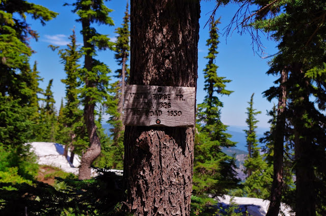
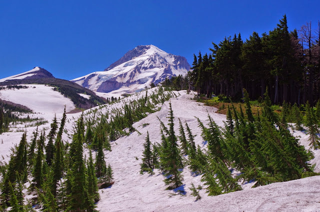
Up we went passed Lamberson Butte along Gnarl Ridge to one of my favorite views of the loop. Then along the snow fields...snow fields? Where were they? They were there, but small! Significantly smaller than my last time across in *SEPTEMBER* of 2012. They were very easy to cross with no slipping.
We contoured around in a light jog to Cooper Spur shelter and then continued contouring to the top of the moraine of the Eliot. It took us just over 10 minutes to walk down the moraine-top to the big cairn marked switchback to do down to the plateau. I was impressed with the quality of the non-trail on top of the moraine, if you didn't know it wasn't the trail you'd never guess. (Last time through I had stayed the night at Cloud Cap so I didn't go up this higher route.) We scooted quickly down to the rope which was easily found and scampered down the short and not-difficult slope. On a side note, this Eliot traverse was much more well-marked with rock cairns than my last time through 3 years ago. Be careful though as the rock cairns indicated a crossing right near the rope. We did this on a rock-hop, but had tiny packs on that weighed hardly anything. My understanding (I haven't done it) is that if you go upstream a bit, it's a much easier crossing. This is about where the single branch is fed with I think 3 other smaller forks. So...bottom line is to not blindly follow the rock cairns like we did. This is looking down Eliot.

Along the other side we went until it generally matched up with the plateau and then a hairpin turn downstream to the upward rope that is right on the edge of the washed out section. This rope is longer and more useful. We scrambled up to the top of this without trouble physically, but it would be much easier to jar loose rock loose into a fall so stay spread out and have your head on a swivel.
Once on the ridge we figured that it took us 45 minutes to cross from the top of the moraine or about 30 minutes from the bottom of the Cloud Cap-side moraine. We went down the 1/8-mile steep social trail to meet back up with the official Timberline Trail and on our way.
We got around to the Coe Branch. There was no makeshift bridge of logs like I've used in the past so it was a pretty wild crossing...more so than Eliot. I think this was when we gave up keeping our feet dry...which was a good thing as it felt so good on this long day in the heat. On a side note, I was surprised how non-icy even the raging creeks felt...the water just wasn't that cold. On my hike around Adams last weekend, they were freezing!
We got to Elk Cove which was stunning and finally we started to see wildflowers that didn't appear past their prime. The wildflowers on Adams last week were WAY better and larger than anything on Hood this week as many looked past their prime, but these northern slopes still had some good ones. Wy'east Basin was nice and then we hit Ladd Creek which was another rager. Keep in mind that it was now about 1:30 and really hot. I never felt intimidated but I think I went across a single narrow log over the main quick flow but then just walked through the water through the rest...felt so good on my feet. One group of 3 was debating turning around that were coming CW and were there when we crossed. We met two women later that also turned around at Ladd Creek.
We got water at the clear McGee creek and jogged down the ridge to the PCT junction and continued jogging down the Timberline Trail around Bald Mountain down to the Muddy Fork. It was now 3:30 and it was running pretty high and had I think 3 forked crossings. Two of them could probably have been done dry with very strategic rock hopping, but the last one for us there was no way. Here's a shot up to the Sandy Glacier and the Muddy Fork. Yocum Falls (I think that's what it's called) was dry.

As we climbed out of the Muddy Fork I remembered some pumice chutes through here and that one was really bad. It wasn't as bad this time compared to 2012, but still required some careful footing just to be sure.
On a side note, trekking poles where HUGE for the water crossings to judge depth and stabilize the crossing and also for these somewhat sketchy washed out chutes. (The chutes are in the video above too)
We jogged down to Ramona and got water there and enjoyed the cool. Then we crossed the Sandy just before 6pm which wasn't hard to cross in the water, but fording was the only option as there were no prominent rocks sticking up to jump...at least near to the path of the trail. This also was likely due to the hot day and the lateness of our crossing in the day.
Then it was a punishing up, up, up...I thought it was never going to stop! It took an hour and a half to get to the top of the canyon of (the Paradise Branch?) of the Sandy. We stayed on the Timberline Trail not going up to Paradise Park Loop (no more elevation please!). Down to Zigzag which was a pretty easy crossing and then up and out with a beautiful picture on top.

Then a short, quick and easy Little Zigzag and under the chair lifts back to Timberline Lodge exactly at dusk. We couldn't have planned it better if we had tried.

It was a fantastic loop experience, but I'll be taking 3-4 days next time and stopping to smell the roses. In summary, I was surprised at how little snow there was on the mountain. It was no where near us except for the small remaining snow fields up Gnarl Ridge. Bugs were a non issue for us, but we didn't stay the night and we were moving fast...they certainly weren't swarming though. The most challenging crossings were Eliot, Coe, Ladd, Muddy Fork and Sandy. The ones that would have freaked me out the most if I fell in were Eliot and Coe.
My blog has more pictures and a different, less technical take on the trip if you're interested.
http://goaltechhikes.blogspot.com/2015/ ... n-day.html
Let me know if you have questions or thoughts and have fun!
Mike (aka GoalTech)