French Pete Creek to the 5 mile marker - 5/16/15

This forum is used to share your experiences out on the trails.
Post Reply
User avatar
derwoodynck
Posts: 286
Joined: April 21st, 2013, 2:26 pm
Contact:

French Pete Creek to the 5 mile marker - 5/16/15

Post by derwoodynck » May 17th, 2015, 9:48 am

Due to the cloudy forecast we thought it would be a good day for a nice creek hike through some old growth forest. With that in mind we headed to the French Pete trail 3311 in the Three Sisters Wilderness. Our goal was the 5 mile marker mentioned in Sullivans "100 Hikes in the Central Oregon Cascades". To reach the 5 mile marker we knew we'd have to either find a way across the creek at the 1.8 & 3 mile crossings or try and find a way along the north side of the creek between the two crossings. In the Third Edition of the book (hike #70) Sullivan mentions a rough scramble trail along the north side of the creek, but in the fourth edition (hike #69) that reference has been removed for reasons I'll get to later. Now on to the trip report.

The trail starts at the French Pete Trailhead which is located across from the French Pete Campground on Road 19 (A mile beyond Cougar Reservoir). Road 19 or Aufderheide Rd runs between the McKenzie Hwy 126 and Hwy 58 near Oakridge.
Image

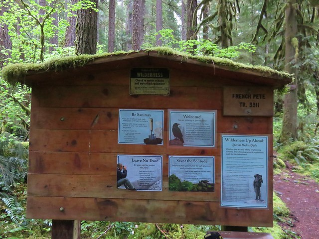
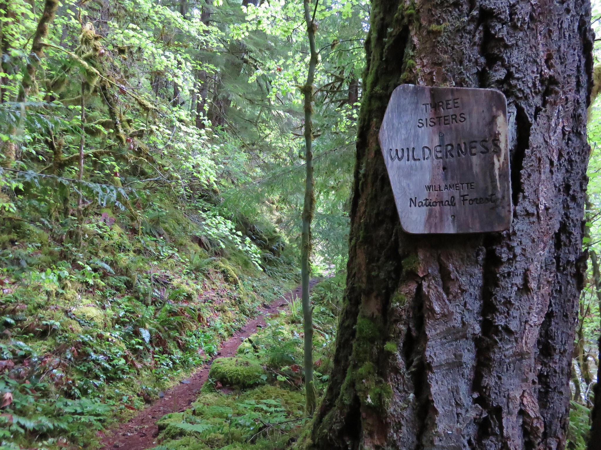
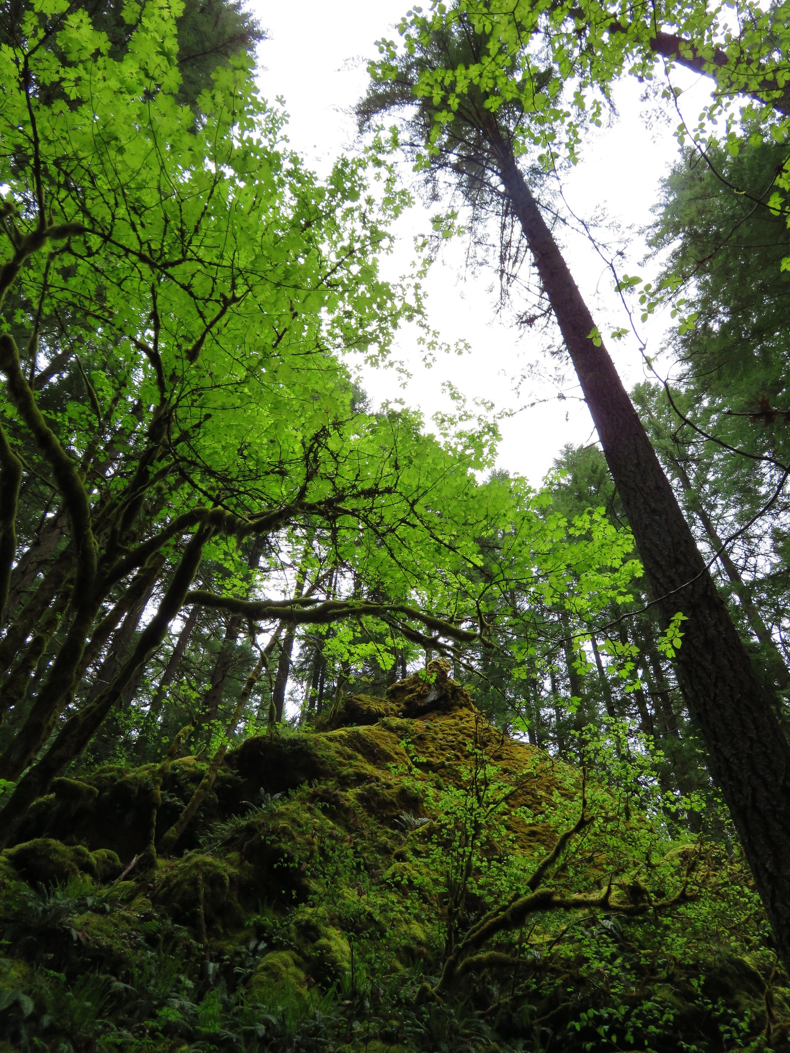
The trail promptly enters the Three Sisters Wilderness passing through nice old growth and several access points to the creek.
Image

Image

Image

Image

Image

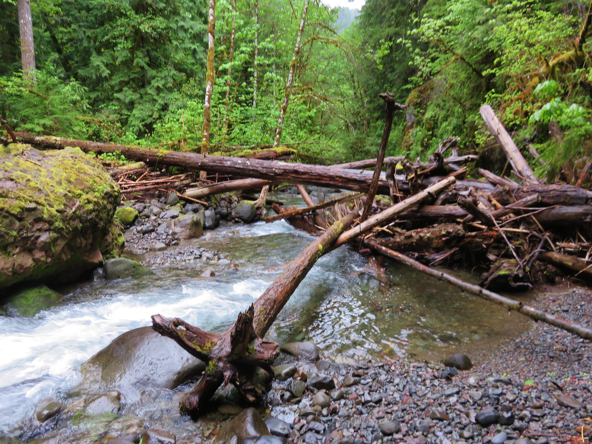
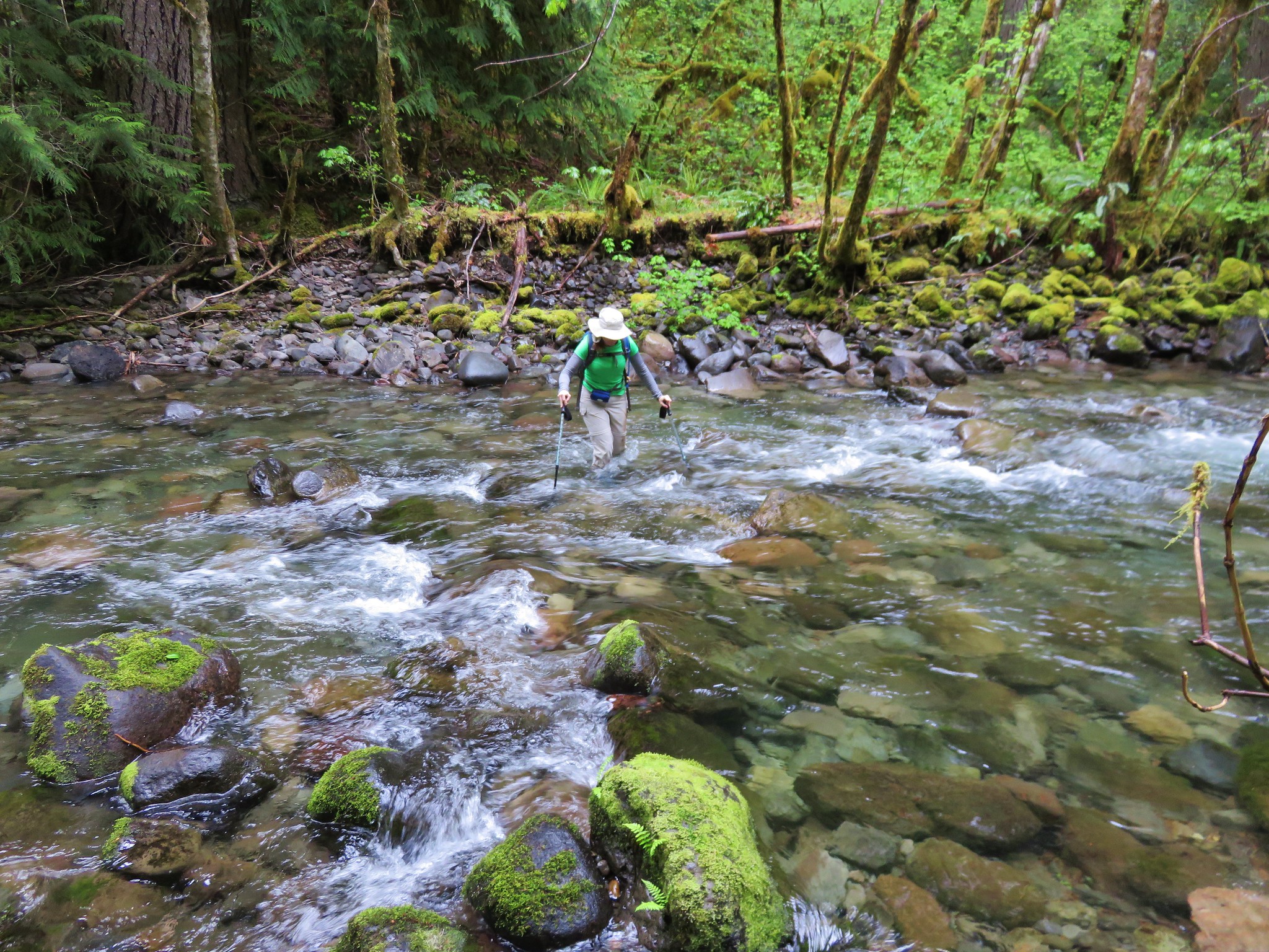
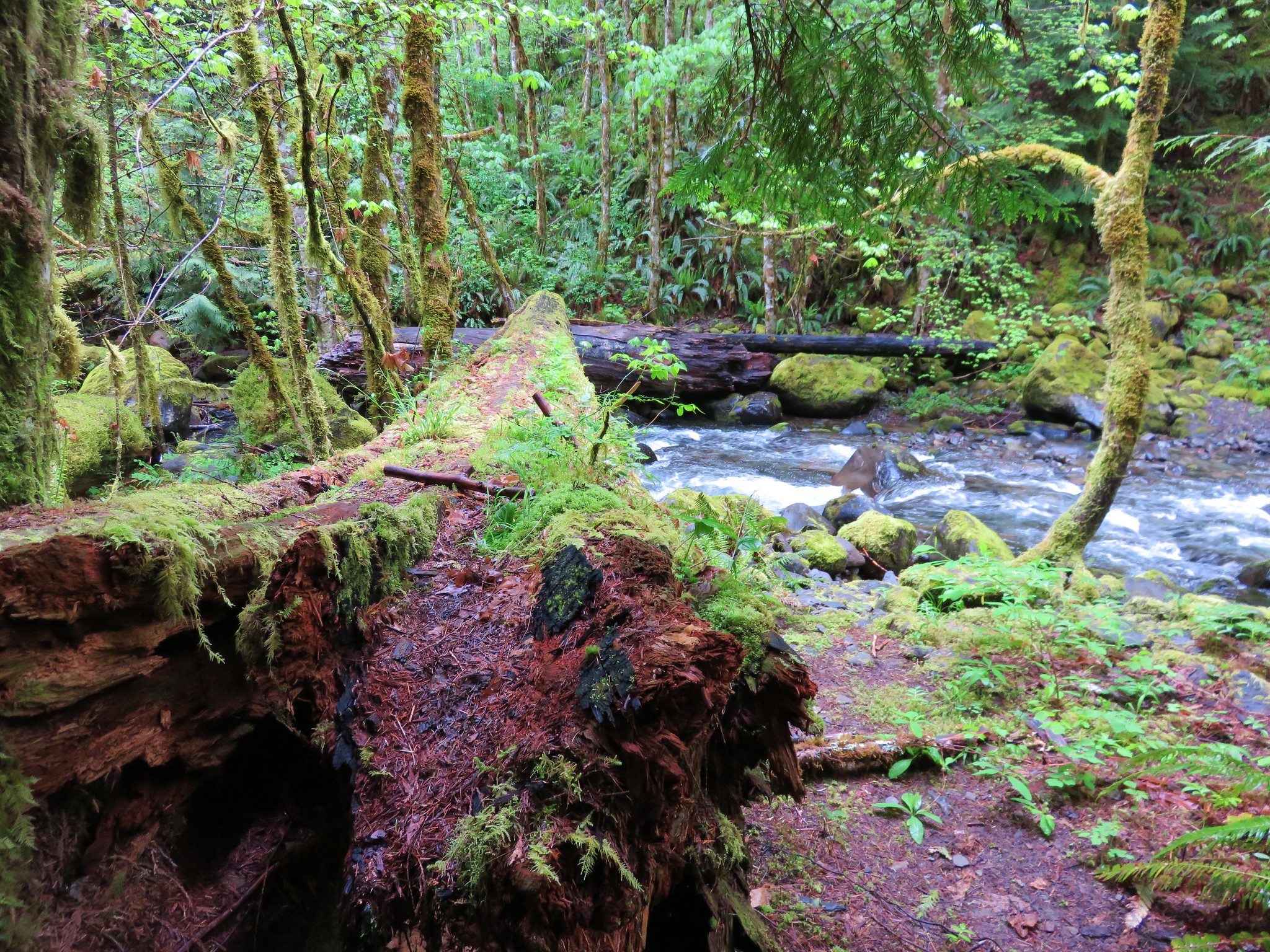
After 1.8 miles of some up and down trail we arrived at the first crossing. There had been a bridge here years ago but now if you want to continue on you either ford the creek or attempt to cross on a log jam just downstream. We inspected the log jam but given the wet weather the logs were rather slick and we decided that it wasn't going to be the best option on this day.
Image

As I mentioned the Third Edition of 100 hikes mentioned a possible third option to the ford or log jam, a rough 1.2 mile scramble trail along the north side of the creek. Where the trail turned down toward the creek there was indeed a rough trail leading further along the creek so we decided to try that option versus the ford.
Image

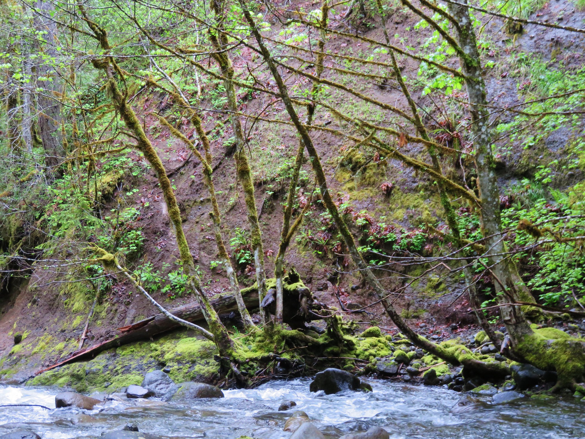
I also mentioned that it was not mentioned in the Fourth Edition and we soon discovered why and I do not recommend attempting this route. The tread was very narrow with some blowdown and a few sketchy spots before when after about .4 miles we came to the spot of a slide about 15' above the creek. The path (and I use that term lightly) dove down the slide to the creek bank. I made it down but when I turned around I could tell my Wife was not going to be able to do the same. I managed to get back up to where she had gotten crossed up and helped her do a controlled slide in the dirt/mud down to a log that she was able to stop herself on. We wouldn't be going back that way so we sallied forth to the next big obstacle - a slanted rock shelf traverse.
Image

We managed to find enough footholds to not slip into the creek which was quite deep in this section and then was stymied again by another big slide. While I was attempting to find a way around this new obstacle my Wife realized she lost her phone. We backtracked having to recross the rock shelf to the spot of her slide where I found the phone wedged against the log and covered in dirt. Luckily it was inside its case and undamaged. When we turned back to find the phone we had only covered about half the distance needed to rejoin the official trail and neither of us wanted to tempt fate with a third crossing of the rock shelf. From where we were we could tell by the GPS that the trail was just on the other side of the creek so across we went.
Image

From the far side we had a pretty good look at the slide area that had started all the trouble.
Image

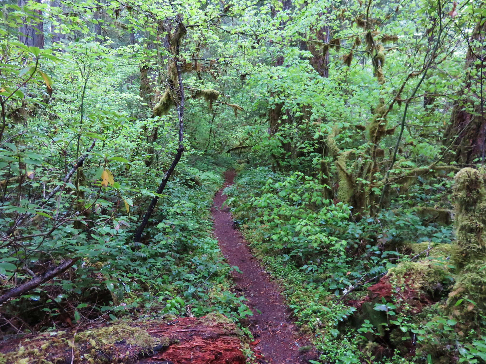
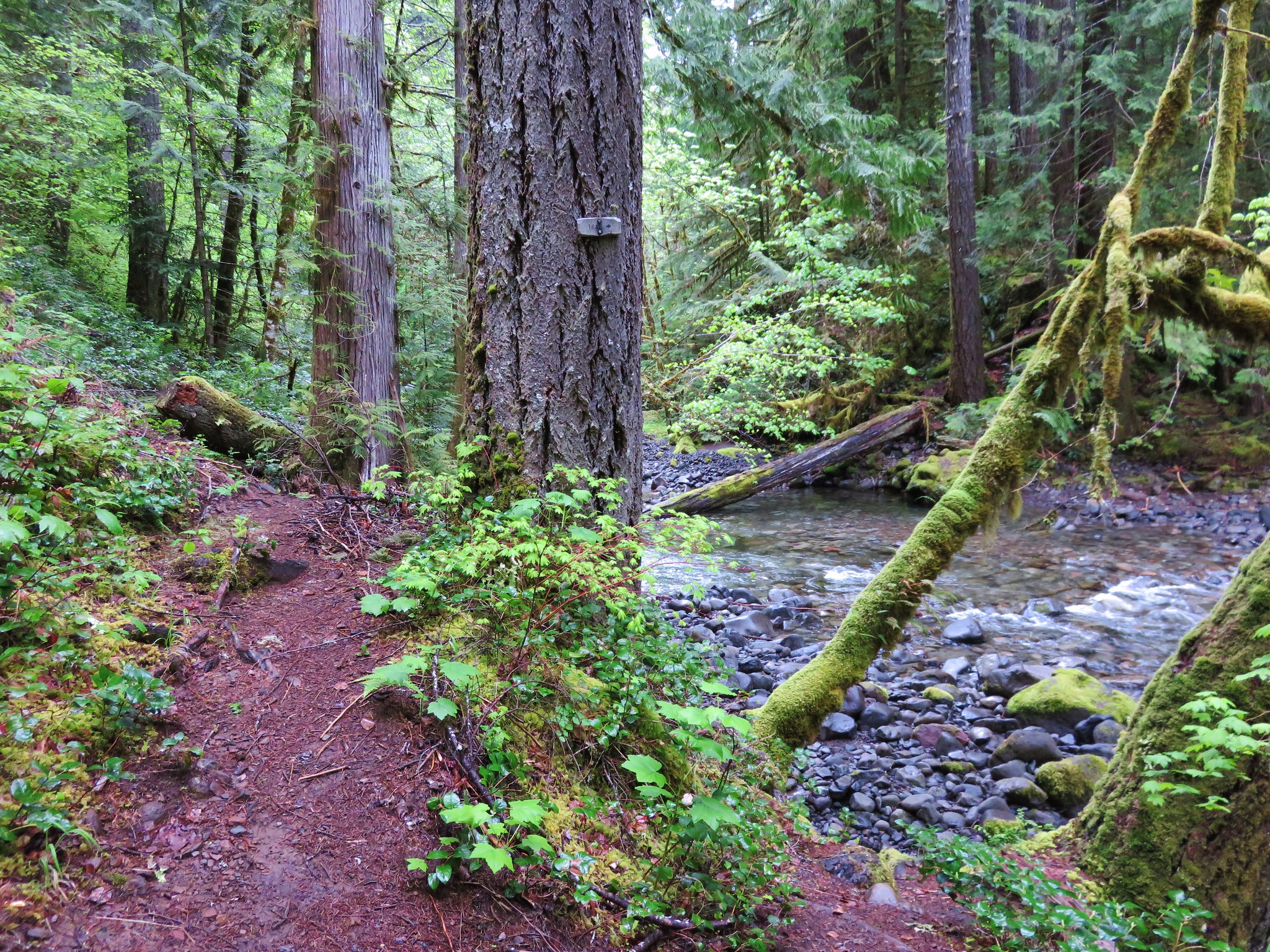
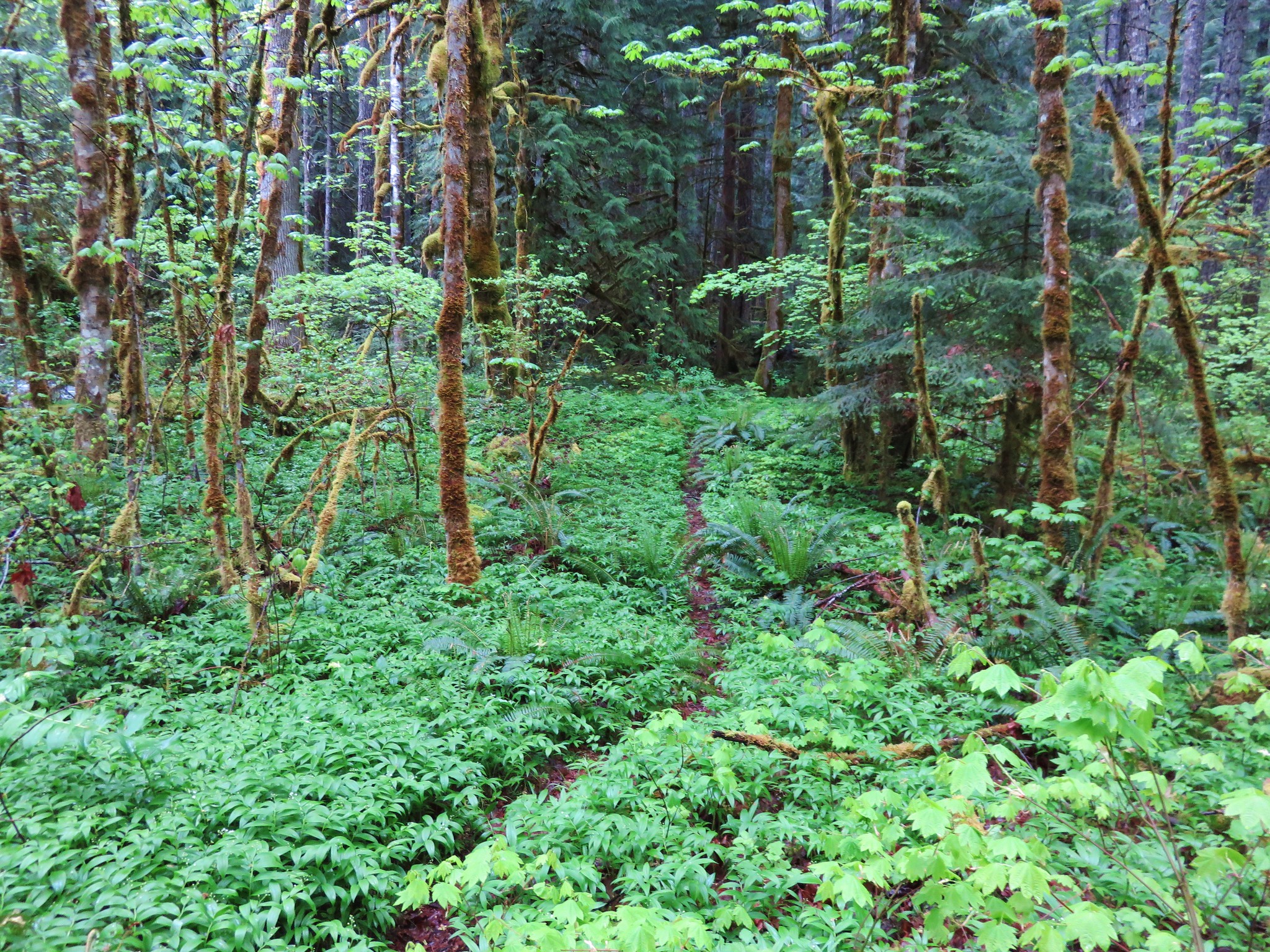
We came up from the creek about 10' from the trail and continued on our way. The trail in this section was a bit overgrown but in pretty good shape given most hikers turn back at the first crossing.
Image

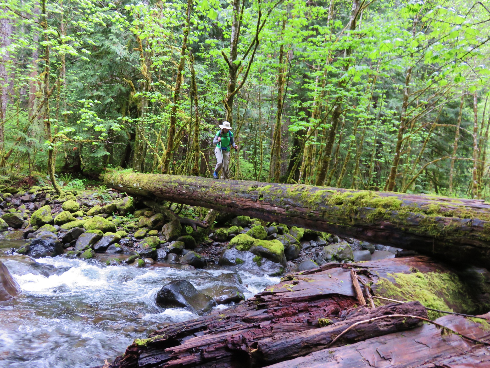
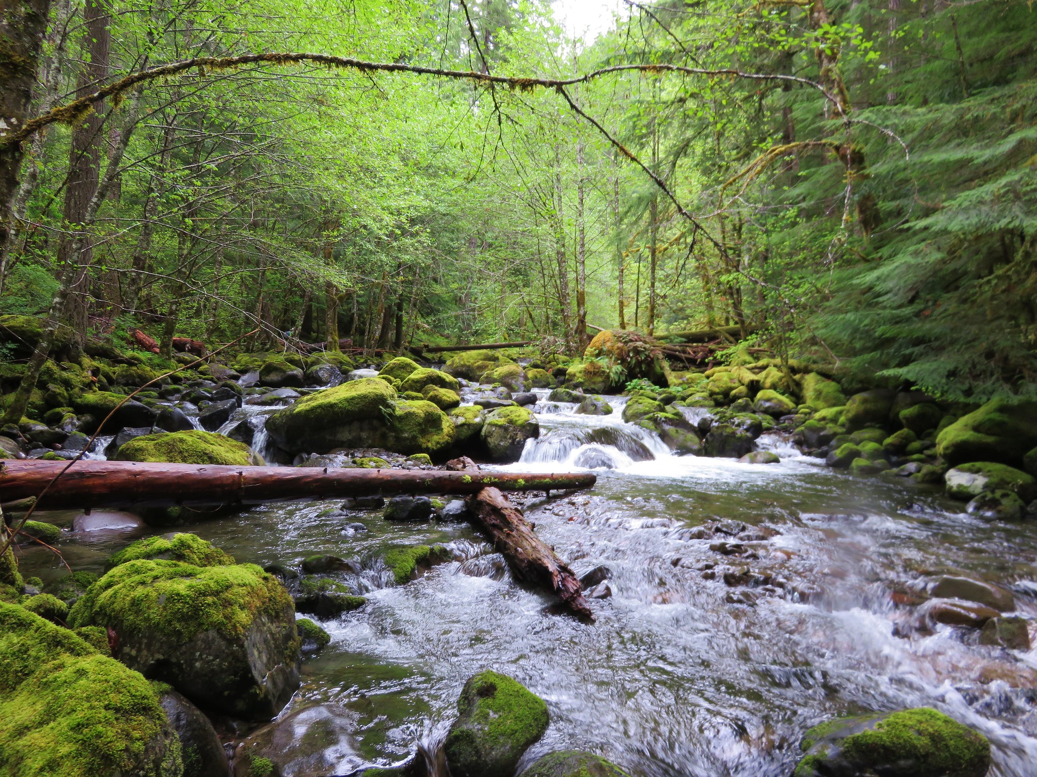
We made it to the second creek crossing where a nice cedar log serves as a suitable bridge.
Image

Image

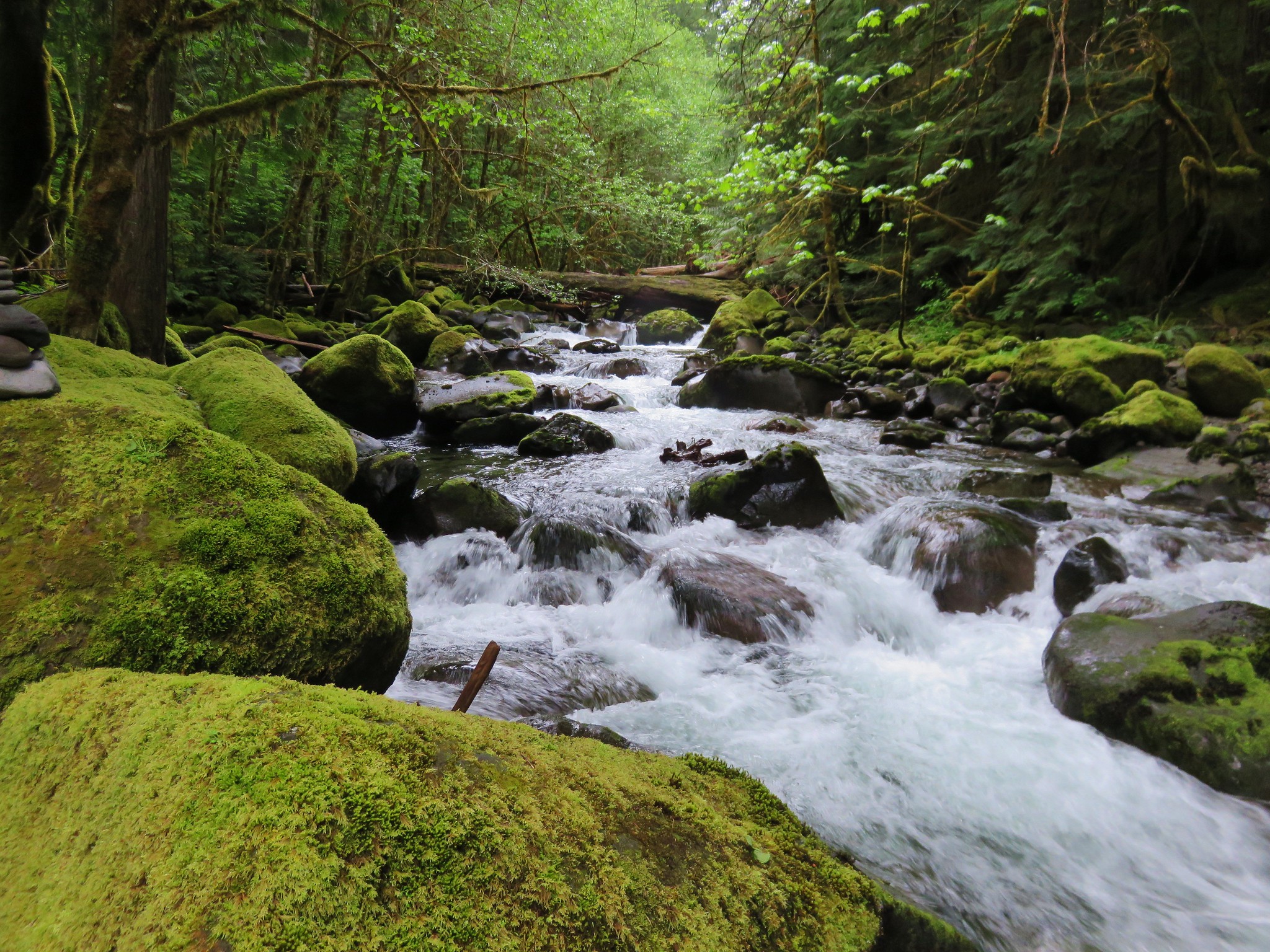
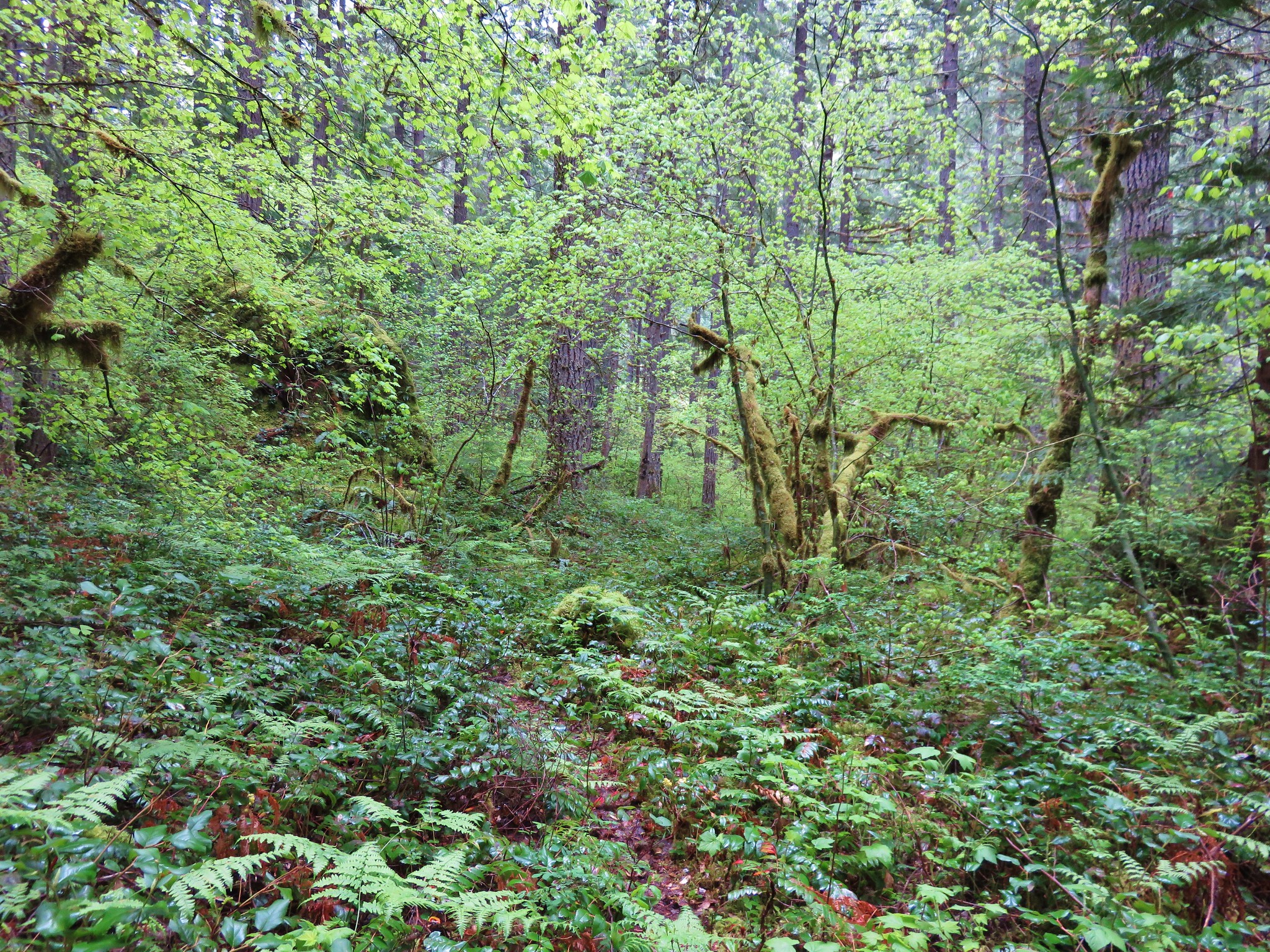
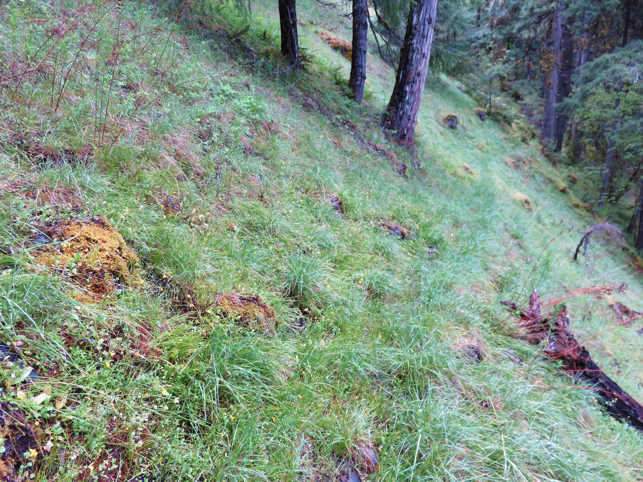
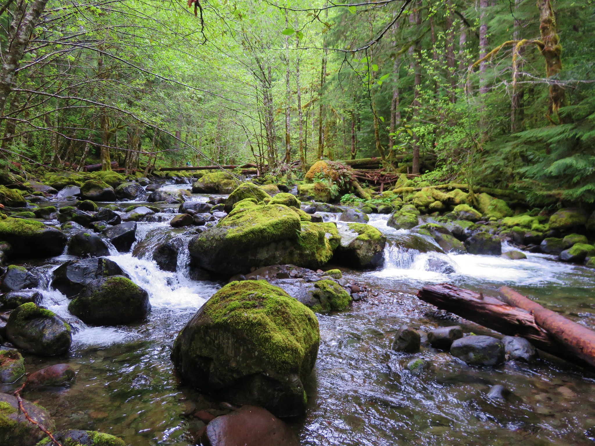
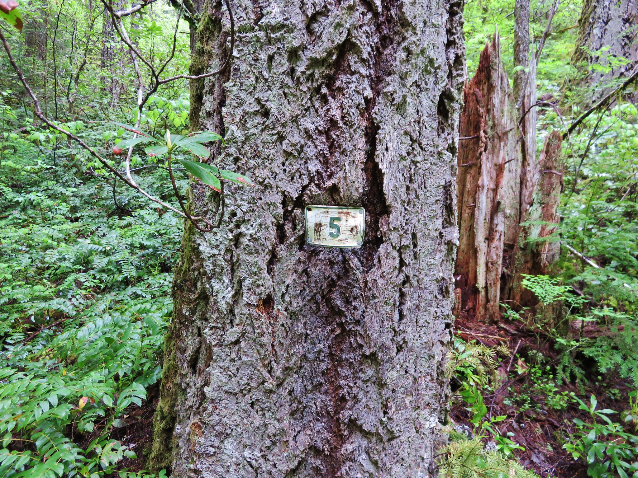
We had another 1.8 miles to go after the second crossing to reach the 5 mile marker. This section of trail was also fairly overgrown and narrow but there were no major obstacles along the way. The trail climbed up above the creek at times passing through a grassy meadow and past some nice rock formations.
Image

Image

Image

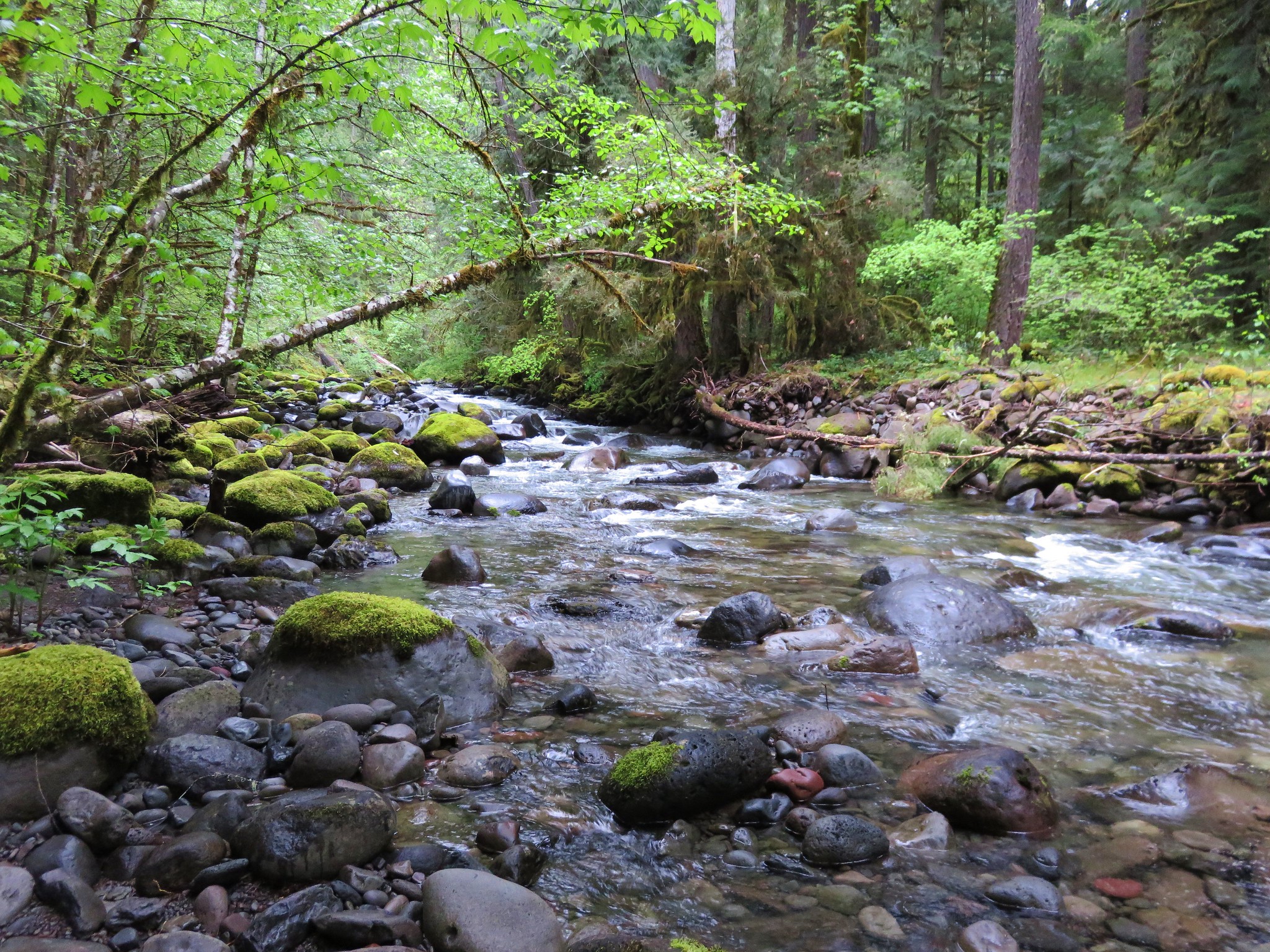
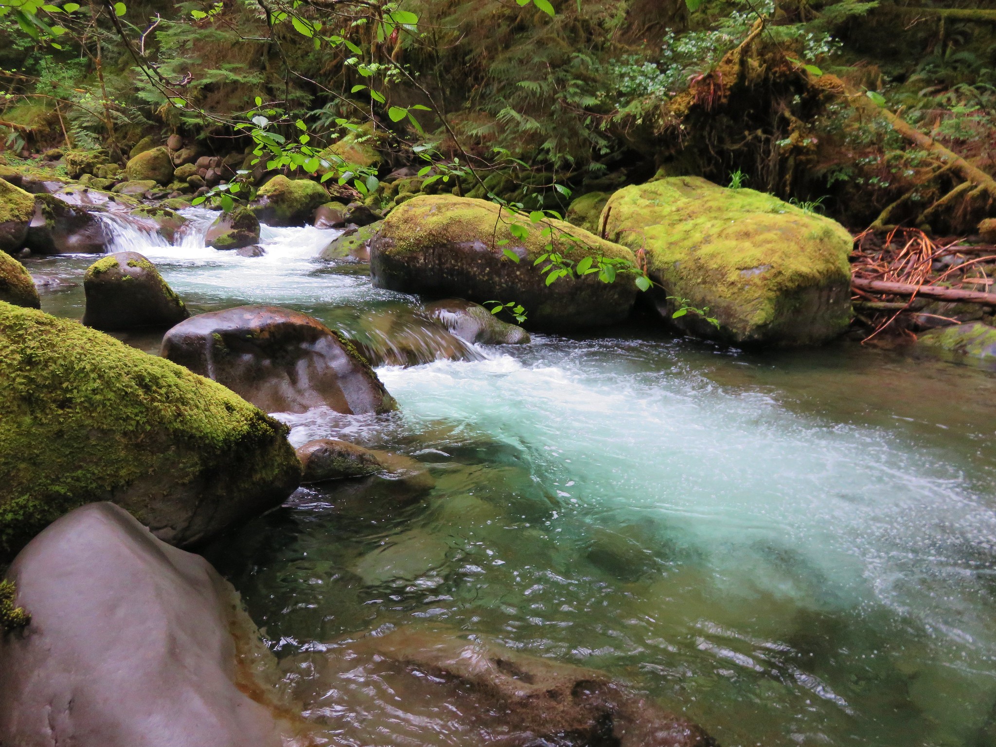
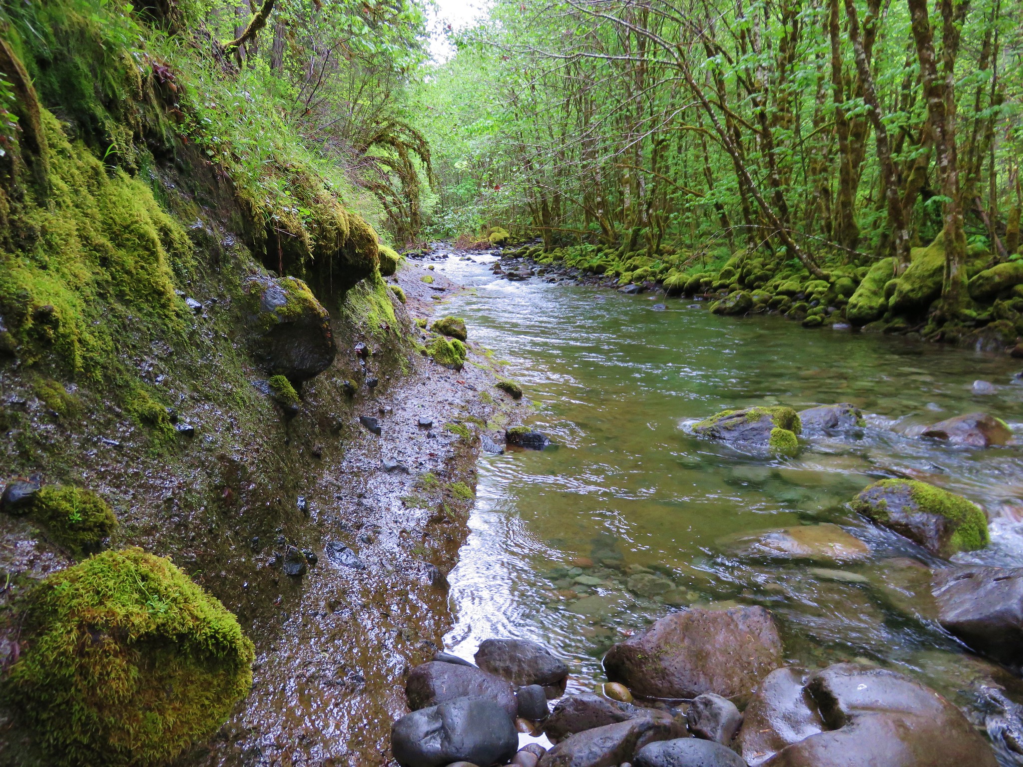
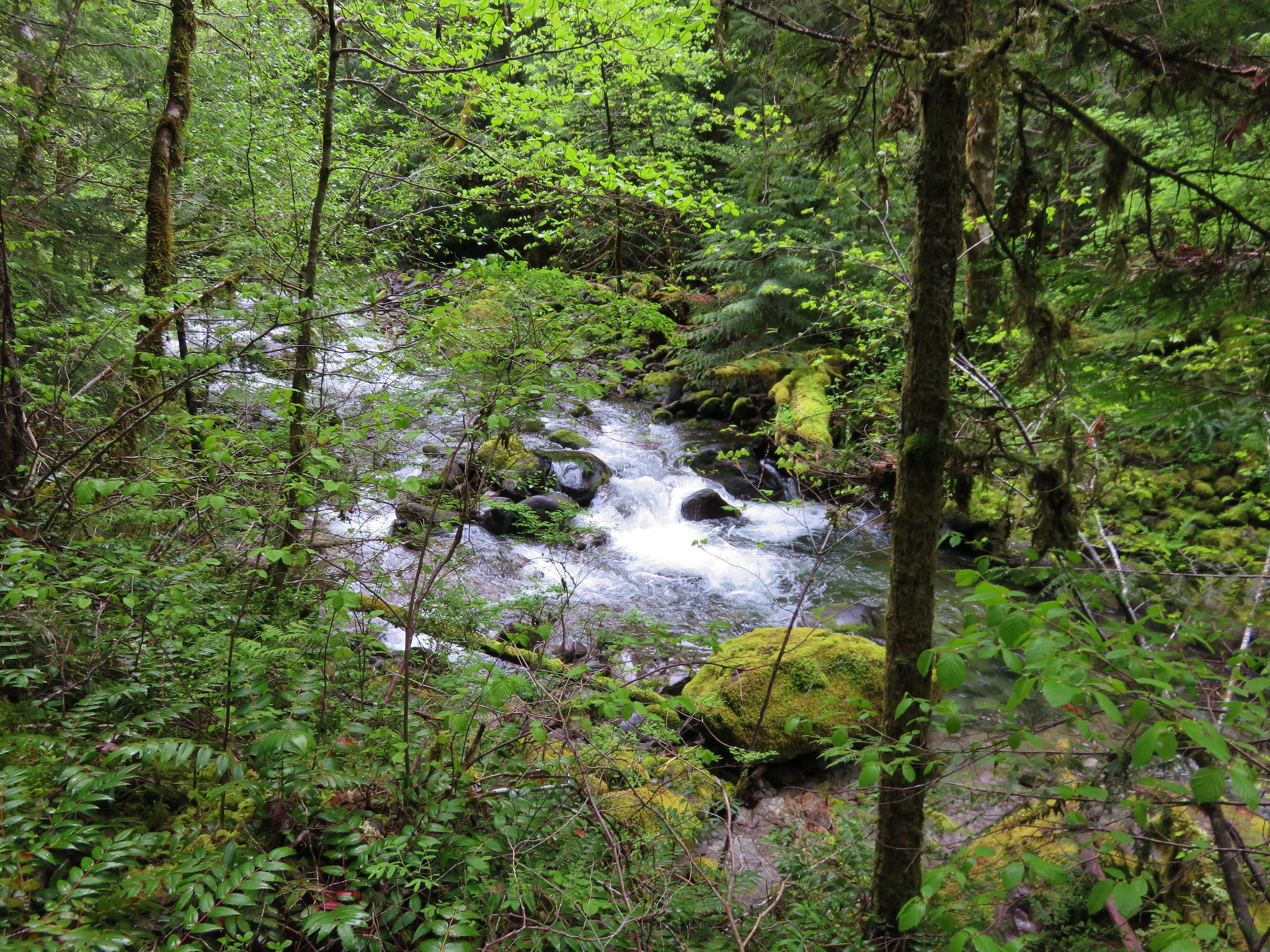
It also provided some of the best views of French Pete Creek.
Image

Image

Image

We returned via the official trail after reaching our goal.
Image

We only ran into three other groups of hikers, all on the way back between the trailhead and first crossing making for a nice quiet hike.

User avatar
sprengers4jc
Posts: 1036
Joined: October 22nd, 2013, 11:35 am
Location: Vancouver, WA

Re: French Pete Creek to the 5 mile marker - 5/16/15

Post by sprengers4jc » May 17th, 2015, 10:43 am

Excellent TR and glad you guys made it through that slide area safely.
'We travel not to escape life but for life to not escape us.'
-Unknown

pdxgene
Posts: 5073
Joined: May 28th, 2008, 10:03 pm

Re: French Pete Creek to the 5 mile marker - 5/16/15

Post by pdxgene » May 17th, 2015, 11:08 am

Thanx for showing this. It's always been one of those, ' i'd kinda like to go see this but it sure is a long drive' hikes for me. It's looks like it'd be worth getting motivated to head down there some time..

User avatar
kelkev
Posts: 800
Joined: May 28th, 2008, 10:03 pm
Location: McMinnville, OR

Re: French Pete Creek to the 5 mile marker - 5/16/15

Post by kelkev » May 17th, 2015, 1:04 pm

I remember the massive old log footbridges from when I was a youngster, those were pretty neat. Too bad they've rotted away. That McKenzie Valley is really a neat place to hike. Thanks for sharing the great photos!
"Going to the mountains is going home."
— John Muir

User avatar
mattisnotfrench
Posts: 1318
Joined: May 28th, 2008, 10:03 pm
Location: SE Portland
Contact:

Re: French Pete Creek to the 5 mile marker - 5/16/15

Post by mattisnotfrench » May 18th, 2015, 12:39 pm

It's nice to see a report of this area! I remember doing this hike when I was about 10 years old. Back then the first bridge was still in place, but we did the hike in March and the second crossing was ridiculously cold and deeper than my 10 year old self liked. I loved the hike, though. Until we found a tick embedded in my chest 2 days after we got home. :shock:

Seeing this report brought back a lot of memories. Thanks for posting it!
Author of Extraordinary Oregon!, PDX Hiking 365, 101 Hikes in the Majestic Mount Jefferson Region, and Off the Beaten Trail. Website: www.offthebeatentrailpdx.com

User avatar
5th
Posts: 121
Joined: April 27th, 2015, 9:11 am
Location: Eugene

Re: French Pete Creek to the 5 mile marker - 5/16/15

Post by 5th » May 18th, 2015, 2:09 pm

This hike was my very first backpacking trip in 1977. I was a 90 lb 11yo, the bridges were still there of course. I need to get out there and ford the creek.
mattisnotfrench wrote:Until we found a tick embedded in my chest 2 days after we got home. :shock:
Do some people naturally repel ticks? I've been hiking in the WNF for almost 40 years. I have never taken any precautions against ticks and have never been attacked. I just assumed there weren't any to worry about...

Post Reply