With the exception of the iconic Rogue River trail, most guidebooks don't list many hikes just W of Grants Pass. But Sullivan (hike #85) and Bernstein & Urness (hike #68) both suggested Briggs Creek as an easy trail with interesting flora and history, so we decided to give it a try. The TH is at the Sam Brown Campground in the Siskiyou NF, easily accessible via a 1 lane paved road (FR 25) from outside Merlin.
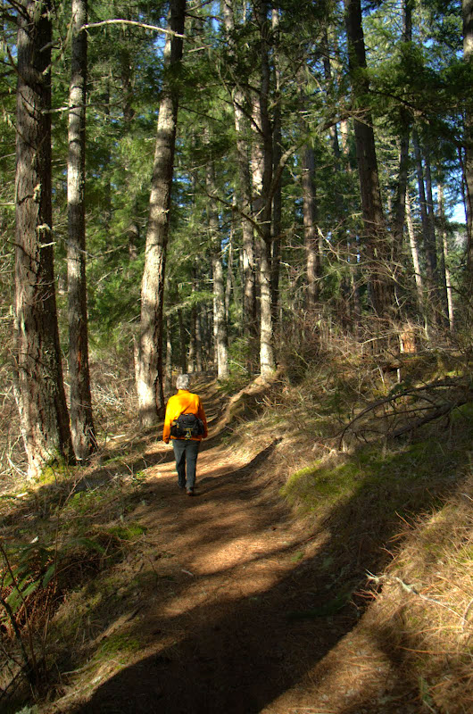
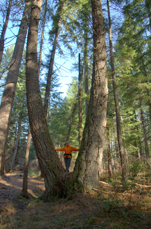
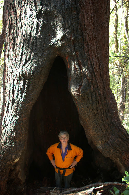
Except for a few stream crossings, the trail is a pleasant ramble down Briggs Creek through stands of large, old trees,
some with rather unique shapes.
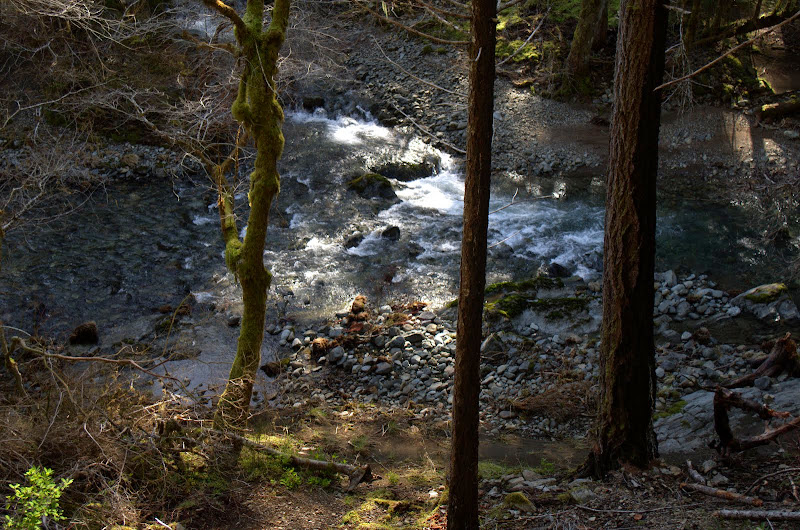
Given that this was the heart of hydraulic mining in Josephine County from the 1850s to the 1930s, it's amazing that so many of these big trees survived. The trail soon drops to within sight of crystal clear Briggs Creek,
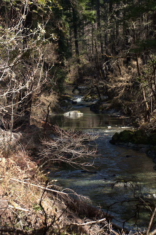
which cascades down through various rock outcrops.
A fire went through here a few years back and the big trees seem to have survived that too.
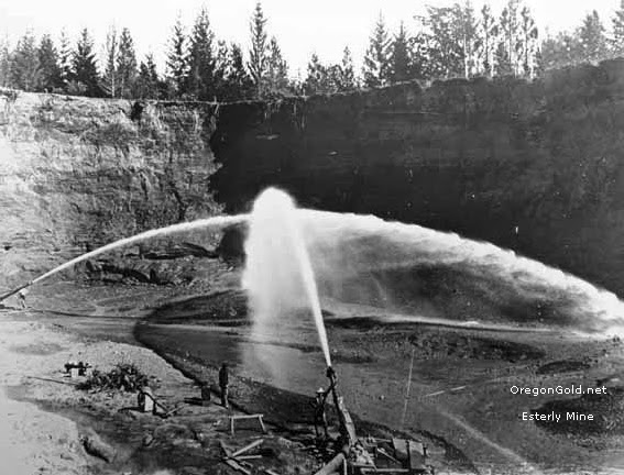
About halfway into the hike, we reached the site of the Elkhorn Mine, which didn't cease operation until 1933. The preferred form of gold mining in this area was hydraulic - some of the hand-dug flumes used to channel water to the workings and "giants" are still visible - which we could imagine started like this,
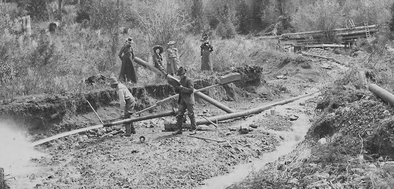
and ended like this. Some of the large washout scars are still clearly visible.
Shortly after the Elkhorn site, the trail actually crosses the creek. We were able to avoid having to wade - too cold now, but recommended in summer - because of a collection of old logs spanning the creek just below the trail crossing,
which allowed us to pick our way across and above the clear blue-green waters of the creek.
Who says miners don't have a sense of humor (or irony)?
After crossing the creek, the trail ambles on, eventually reaching an extensive forest of oak and madrone,
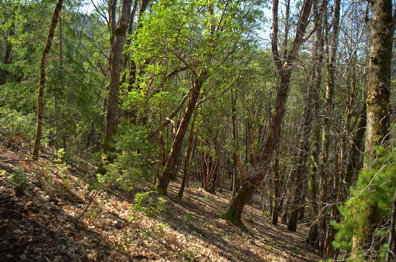
punctuated by still more large trees,
before dropping to the site of an old cabin along the creek.
Sullivan says the cabin is still there, while Bernstein & Urness say it's not - it's not. This being a leisurely exploration hike, we had lunch at the "cabin" and then retraced our steps. A fun short hike (9 mi RT, 600' EG) - and undoubtedly a great one on a hot summer's day - but not among the classics. Still, it was interesting to see how big hydraulic mining had been in this area, given that it's most often associated with gold mining in the California Sierra.
Briggs Creek (S Oregon) 04-Mar-2015
- retired jerry
- Posts: 14421
- Joined: May 28th, 2008, 10:03 pm
Re: Briggs Creek (S Oregon) 04-Mar-2015
Was Sam Brown campground open? I've thought about going there just before or after Rogue River hike but didn't want to drive miles down a road to uncertain camp spot
Re: Briggs Creek (S Oregon) 04-Mar-2015
Thanks for the report, Van!
I'd been eyeing this trail as a possible link into the Illinois River Trail for a one-way pack. Going this way would add some mileage and avoid the necessity of driving what's said to be a fairly rugged road out to the traditional starting point at the Brigg's Creek campground. Looks like a short stretch of road walking from Soldier Creek down to the start.
Sounds like the creek crossings were no big deal?
Re: Briggs Creek (S Oregon) 04-Mar-2015
It's open - including some of its toilets. It's big with plenty of campsites.retired jerry wrote:Was Sam Brown campground open? I've thought about going there just before or after Rogue River hike but didn't want to drive miles down a road to uncertain camp spot
Re: Briggs Creek (S Oregon) 04-Mar-2015
You'd add about 7 miles one way going from Sam Brown to the Briggs Creek TH - incluidng a stretch of road at the end. The first crossing of Briggs Creek was accomplished on a log but you'd have to wade the one near the now missing cabin. And while the trail was fine up to the cabin site, I can't speak for its conditon further downstream.mandrake wrote:Thanks for the report, Van!
I'd been eyeing this trail as a possible link into the Illinois River Trail for a one-way pack. Going this way would add some mileage and avoid the necessity of driving what's said to be a fairly rugged road out to the traditional starting point at the Brigg's Creek campground. Looks like a short stretch of road walking from Soldier Creek down to the start.
Sounds like the creek crossings were no big deal?
Re: Briggs Creek (S Oregon) 04-Mar-2015
Thanks! Looks like wading wouldn't be too bad from your photos...
Re: Briggs Creek (S Oregon) 04-Mar-2015
Not too bad this early in the year mainly because of the lack of rain/snow. Unless the weather changes, it should only become more wadeable as the summer progresses.mandrake wrote:Thanks! Looks like wading wouldn't be too bad from your photos...