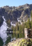
Tip of the hat to Miah's excellent TR on the Ozette Triangle posted earlier.
http://www.oregonhikers.org/forum/viewt ... =8&t=21164
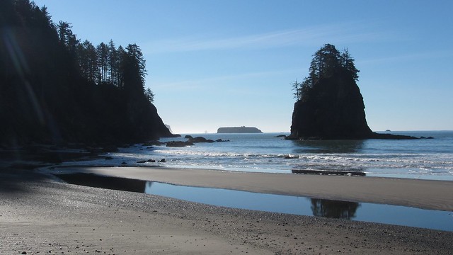
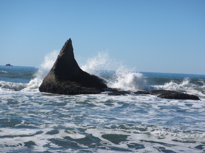
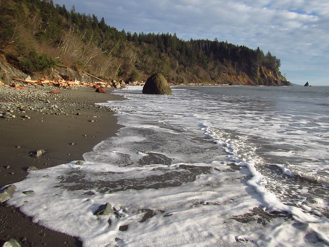
As it happens I was also up on the Olympic coast this last weekend, backpacking the south stretch between Third Beach and the mouth of the Hoh River (aka Oil City - the unfortunate name deriving from a petroleum extraction operation that occured in the area in the late 19th century; it's not a city and there's nothing going on there currently except a lovely riverside trailhead). The south coast is a good bit more rugged; the route spends less time on the shore and swings inland frequently (sometimes for miles) to to get around impassable headlands. This area tho' is my favorite for the sea stacks alone. The entire stretch from Point of the Arches, Ozette and south to Kalaloch is said to be some of the best wild undeveloped coastline in the lower 48.
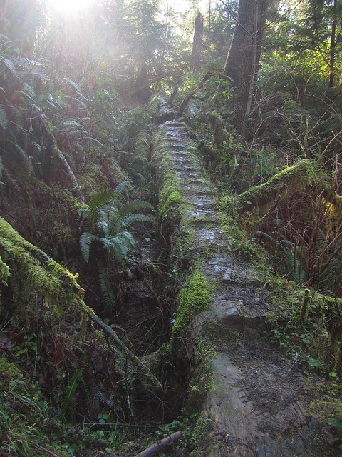
Backpacking along the coast sounds easy, tho' the Olympic coast turns out to have a number of interesting complications. Hiking along sandy beaches obviously presents no real challenge, but the shoreline turns rocky sporatically, in places requiring passage through areas of cobble and occasional stretches of slippery boulder-hopping. There piles of driftwood to climb over/under/around, and steep muddy embankments to get up & down when getting on and off the beach. A number of the latter have ropes or sand ladders to assist which can be interesting with a big pack. The Olympics in general receive a mind-boggling amount of precipitation every year -- and it's total rainforest out there. Be prepared for Olympic quality mud on the inland trails. There's no avoiding the stuff, so just wear the gaiters and slog on through.
And... there's the tides. There are a number of headlands along the coast that are only passable at low tide. Some have overland bypasses... and some do not. If one happens to arrive at one of these at high tide, there's nothing you can do except park it and wait for the tide to go back out again. (Obviously being caught in one of these areas at high tide could be Extremely Bad.) Tides are also affected by weather and can be higher than normal during high winds, storm conditions, etc. It's a good idea to always carry a tide table with you out here. Depending on when the low tides are you may need to hike at odd times of the day or night to make it through. In summary, the coastal route often has more in common with an obstacle course than your typical hiking trail. Fun!
Even more logistics: the NPS requires backpackers to have a permit for overnight trips out on the coast. (I believe the Ozette area has a quota during the summer to keep it from getting too crowded). Coming up from Portland in the off-season, it's best to swing by the ranger station at Quinault (~2mi off Hwy 101) and pick up a self-serve permit. Cost for the permit is $5 + $2/person/night. Backpackers are also required to carry hard-sided food canisters out on the coast... not so much for bears but to ward off thieving raccoons. Travel time from Portland to either trailhead on the south stretch is about 4.5hrs, with ~45min required to shuttle between them.
(Sidebar note: the Third Beach trailhead used to have something of a bad rep for car-breakins, although apparently they caught the perpetrators. They've not had an incident out there in a couple of years now. There were certainly plenty of folks parked there when I arrived.)
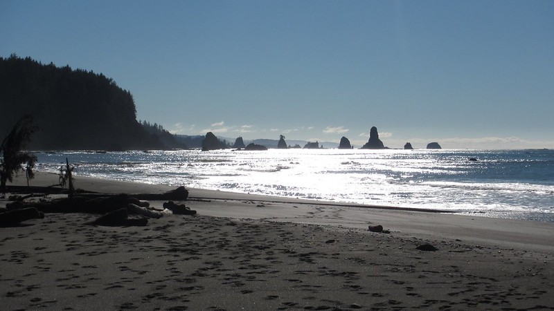
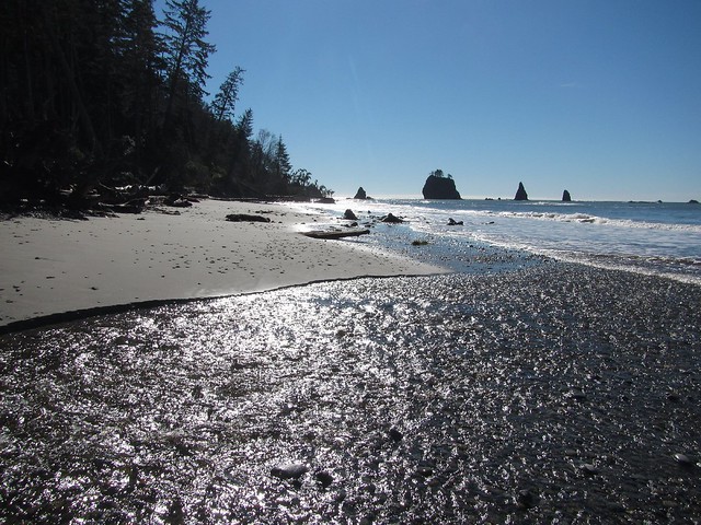
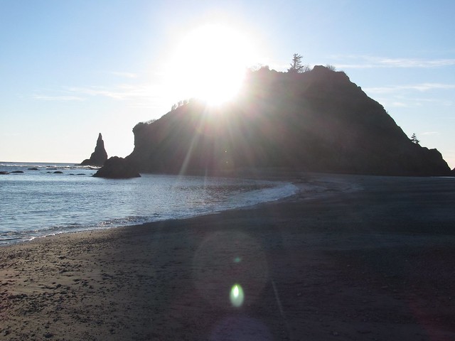
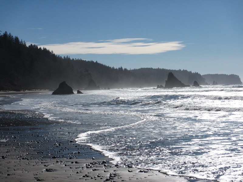
From the northern Third Beach trailhead, folllow the best bit of trail on the south coast for ~1.5mi down to the beach proper; this area sees quite a lot of day hikers. On arriving down at the beach you get your first preview of coming attractions: the range of offshore seastacks rising above the Pacific. This area is known picturesquely as the Giant's Graveyard.
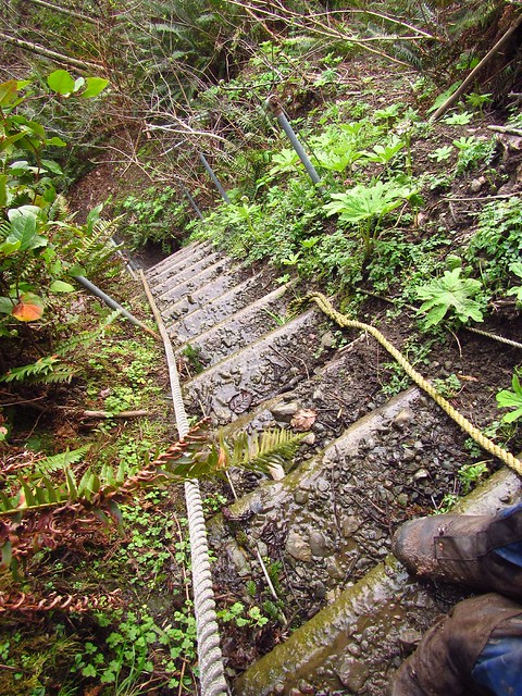
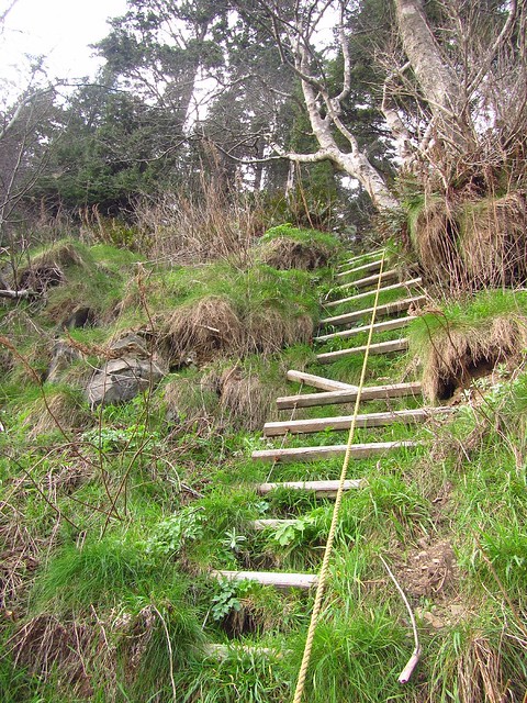
Time on the beach is short & sweet at first. Generally you hike down the beach a short distance to the next headland where you're required to take an inland trail. You cross the headland to the next beach and repeat until you get to Scott's Bluff. To assist hikers, the NPS has installed markers: look for the signature red & black disks that denote where the inland trails are located. The first of these is also the first obstacle on the route: one needs to ascend a muddy embankment, followed shortly by the first sand ladder on the route (e.g two metal cables hanging down from above linked by a series of cedar planks).
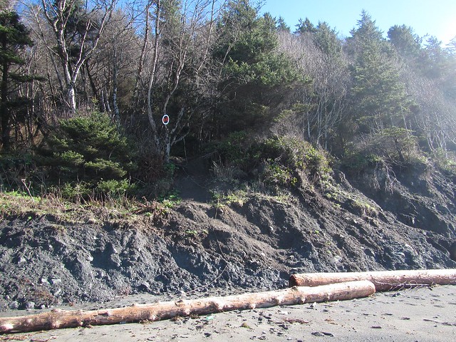
Beyond the second beach, one has to ascend what appears to be a currently-in-(really-slow)-progress mud slide. Again a couple muddy ropes hang down from above. I did mention getting dirty? (If you look in the field guide, there is a "back door" route into this area that links in just atop the mudslide... tho' coming in this somewhat diminishes your time on the beach.) Beyond the trail swings around Scott's Bluff and descends to several campsites near the creek of the same name. Just ahead down the shore is the first tidepoint of the day.
With the drive up from Portland and setting up the shuttle, I'd had a relatively late start today - and with high tide around 2pm, by the time I arrived it was too high to continue, so -darn!- I had to kick back & relax for an hour enjoying the surf and the views. Apparently an old shelter used exist here, but it seems it's long gone; I could find no remaining trace of it. Eventually the tide went out enough to continue on
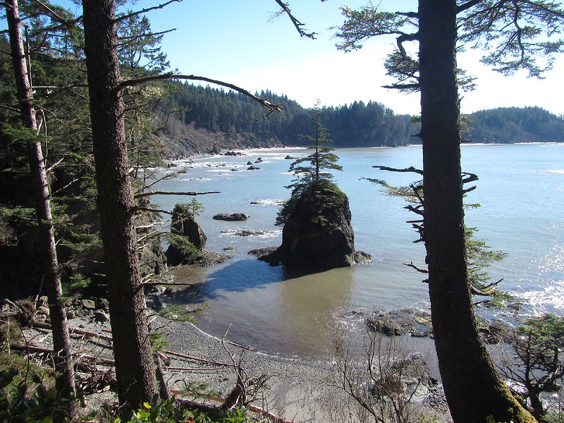
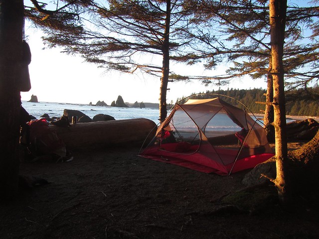
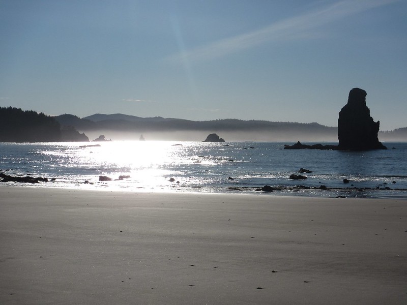
A couple other backpackers were already camping at Strawberry Point, so I pushed on and located an excellent site near Sundial Rock. The closest water source here is Jackson Creek around the corner at Toleak, but realizing this and having had some time on my hands I'd already stocked up back at Scott's Creek. Time to kick back and enjoy the views -- with the tide going out the the vantage near Sundial is absolutely outstanding. As the tide receded into evening more and more rock formations appeared out in the bay.
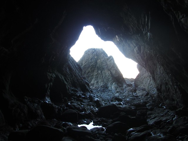
I got up early in the morning to catch the low tide. Previously I'd heard there were some sea caves on the backside of the Strawberry Rock, so went to check them out. Lots of tidepools, caves, and great views. I also saw a raccoon climbing upwards towards, presumably, his home safe atop Strawberry Rock. From there, back to camp, packing up and heading south once again.
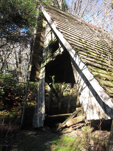
I stopped off briefly to check out the old A-frame emergency shelter at Toleak Creek (not too much left; it seems its days are numbered), then off down the beach for another mile or so before cutting inland over the next headland.
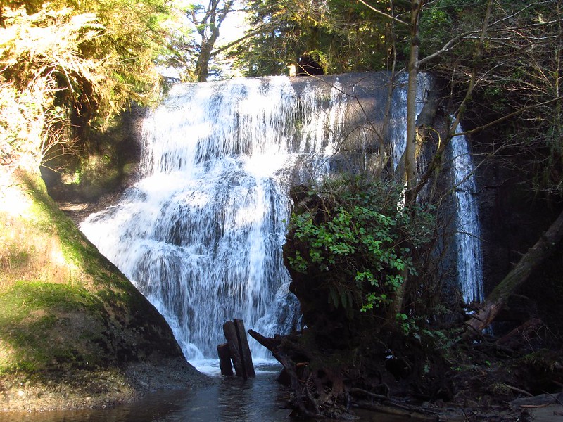
This next inland trail gives a nice sample of the rainforest -- with a smattering of huge cedars, one in particular being redwood size in girth. This section is not without its obstacles too... aka the creek crossings. The first is Falls Creek being ankle deep -- with a beautiful waterfall just upstream. I waded up to get a better shot of it. The second stream crossing on Goodman Creek can be a little more hairy. Trail guides describe it as generally being calf-to-waist deep depending on flow... it apparently is also affected by tide. Fortunately for me it was on the shallow end of the spectrum and I was able to wade across without incident. Having some watershoes for the crossing can handy. Another short stretch of trail beyond leads to a series of ropes and a muddy embankment leading back to the beach. Tip: on returning to the beach take a look at the rockface on your right to find a sea cave bored through it. This can be used to reach a "hidden beach" perhaps 0.3mi long that stretches back west to the mouth of Goodman Creek.
From here the beach heads south a couple of miles to Mosquito Creek and more campsites. (Despite the name and summer weather no flying pests were encountered.) Here it's possible to continue along the shore another couple miles if there's an uber-low tide, but most folks will need to turn inland on the longest of the bypass trails up and over the Hoh Head.
This section of trail is probably the worst on the entire south coast. The trail has a bad case of the wanders and it seems the original designers wanted the trail to run along as close as possible above the ocean to glean occasional views. Unfortunately per a combination of the intense precipitation and general beach erosion, entire forested hillsides on the northern part of the bypass are every-so-slowly sliding away. There huge holes in the ground and the area looks very unstable. A number of short bridges spanning creeks along the way are gone, other sections of mossy boardwalk are slippery, and I think I mentioned the Olympic quality mud previously. Squish, squish. It's all good tho' -- and certainly makes for an interesting route. (The OH field guide mentions a washout here, but it's been re-routed for now... but more reroutes are sure to come in future.)
The 3mi long bypass culminates in descending a trio of sand ladders descending steeply to the beach. The first of these doubles a chute for some water runoff. Fortunately there are good ropes to hang to at all points. Can't quite see what they're tied to per all the foliage, but they seemed to hold.
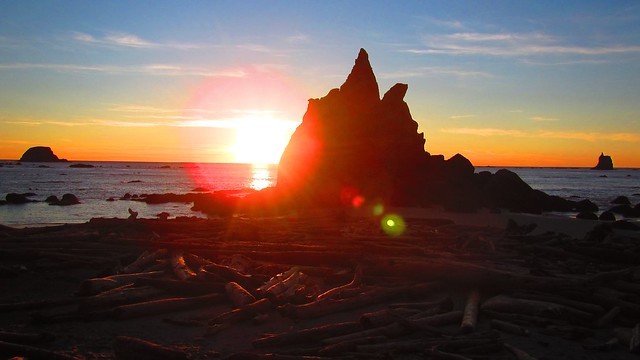
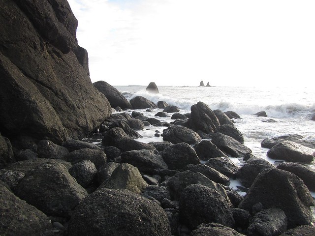
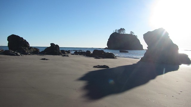
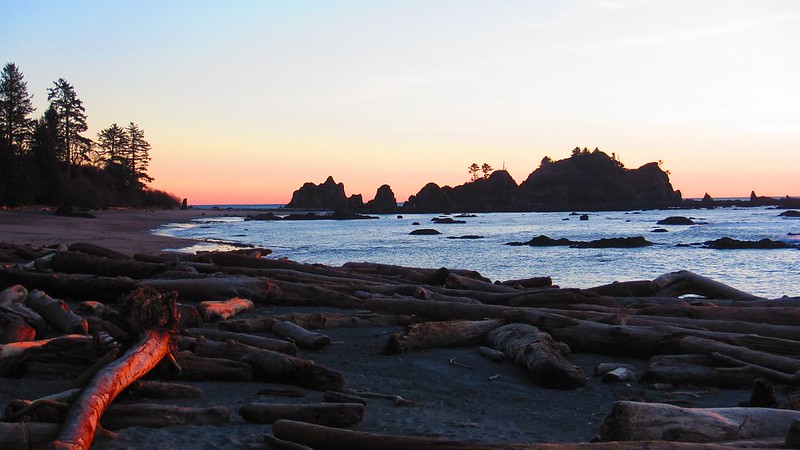
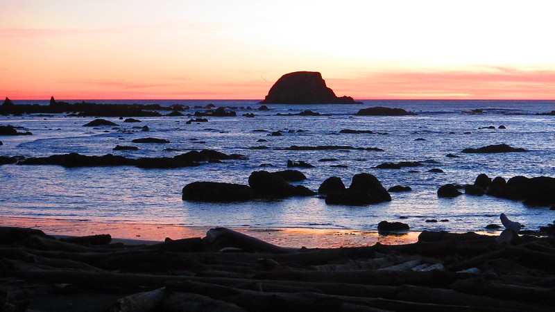
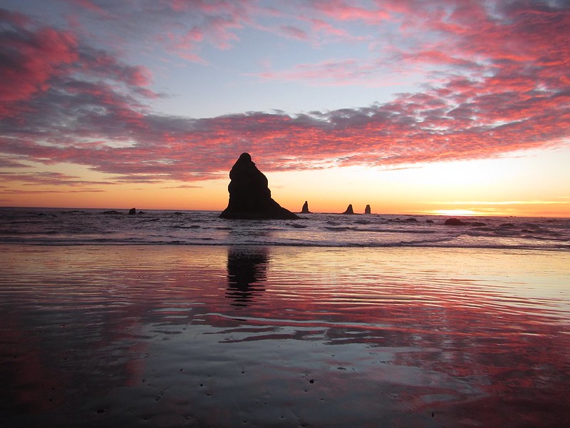
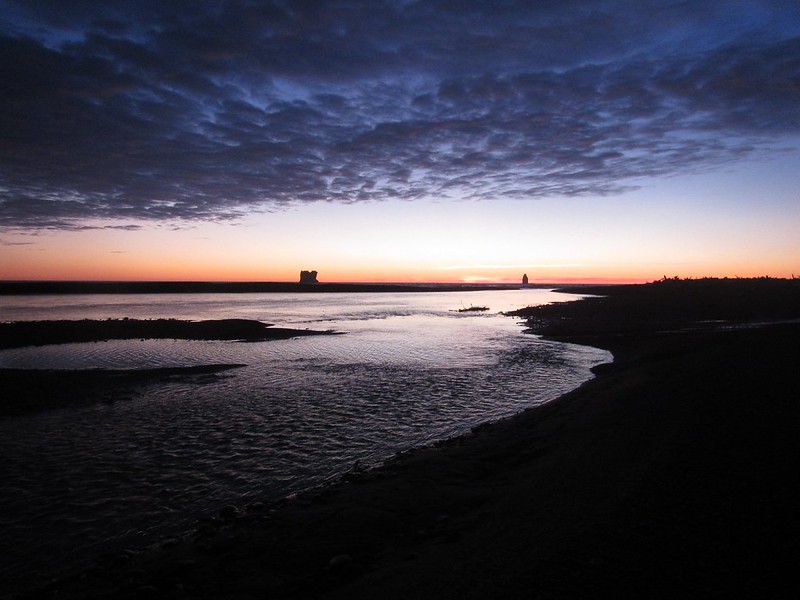
Back down on the south side of the Hoh Head one enters Jefferson Cove. On the far side is another 4ft tidepoint, followed by a second 5ft tidepoint. Again I was a bit early in the day and the tide was too high to continue, so had to park again for a bit, kick back & relax until the tide was low enough to continue. These last two tidepoints require a good bit of boulderhopping... a nice change of pace from the rainforest above. I made it through and back onto the beach on the far side just in time for a grand finale sunset. It was amazing. I was hoping to get out before dark, but kept getting distracted and taking more pictures.
After passing the last two boulder-headlands, you're on the beach again for the last stretch all the way to the Hoh River. Inland there's a mass of driftwood. Don't bother trying to go that way, but instead stay along the shoreline which will eventually guide you inland, becoming the north shore of the Hoh River. Keep going along the rocky shore for perhaps a quarter-mile inland until you encounter the last trail marker denoting the inland trail. From here it's a half-mile to the Oil City trailhead.
Caution: from Hwy 101 in to the Oil City trailhead the road (paved initially, becomes good gravel) passes through a short area of not-well-signed open range land. On my way out several cattle were barricading a one-lane bridge, standing right in the middle of the road. Encountering black cows at night out in the road may be the most hazardous part of the coastal trip.
Summary: the Olympic coast is awesome. My recommendation: don't settle for mediocre weather for a trip out there. When it's good, it's really good...
----------------------------------------------------------
Some useful resources for planning Olympic coastal trips:
For the south coast you can look up and download the tidal predictions out of La Push:
http://tidesandcurrents.noaa.gov/noaati ... id=9442396
You can download the tidal timetables on the right hand side. The predictions are downloaded in a chart for the entire year. Usually in planning trips I like to try to time it such that the low tide will take place somewhere in the morning or middle of the day so as to be able to keep moving. Some weekends are better than others.
Custom Correct Maps of the Olympic coast:
http://www.customcorrectmaps.com/
Some excellent maps of the coast which, more importantly, include info on all tidepoints along the route - including how low the tide needs to be to get through.
All Points Charters
http://www.goallpoints.com/
A trailhead shuttle service operating out of Port Angeles on the Olympic peninsula. Coastal shuttles can be a bit pricey, so best to go with a group to keep the costs down.
Olympic National Park - wilderness permit info & regs on coastal hiking in the park, including beach-camping & fires.
http://www.nps.gov/olym/planyourvisit/w ... ermits.htm
http://www.nps.gov/olym/planyourvisit/w ... -coast.htm