Acorn Woman Peak (S Oregon) 21-Feb-2015

This forum is used to share your experiences out on the trails.
Post Reply
User avatar
VanMarmot
Posts: 1924
Joined: May 28th, 2008, 10:03 pm
Contact:

Acorn Woman Peak (S Oregon) 21-Feb-2015

Post by VanMarmot » February 22nd, 2015, 8:55 am

Previously (Little Grayback TR), I'd hiked a part of the Little Grayback trail but got diverted from it by a climb of Little Grayback itself. This time around the goal was to hike the whole trail (and not get flayed by foolishly trying to go XC through manzanita and buckbrush thickets!) and continue on to the old LO (now a met station) on Acorn Woman Peak (name updated when new name became official in September 2022). We started at the lower Little Grayback TH,

Image

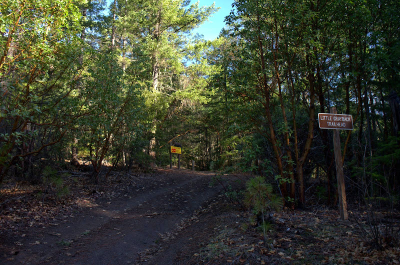
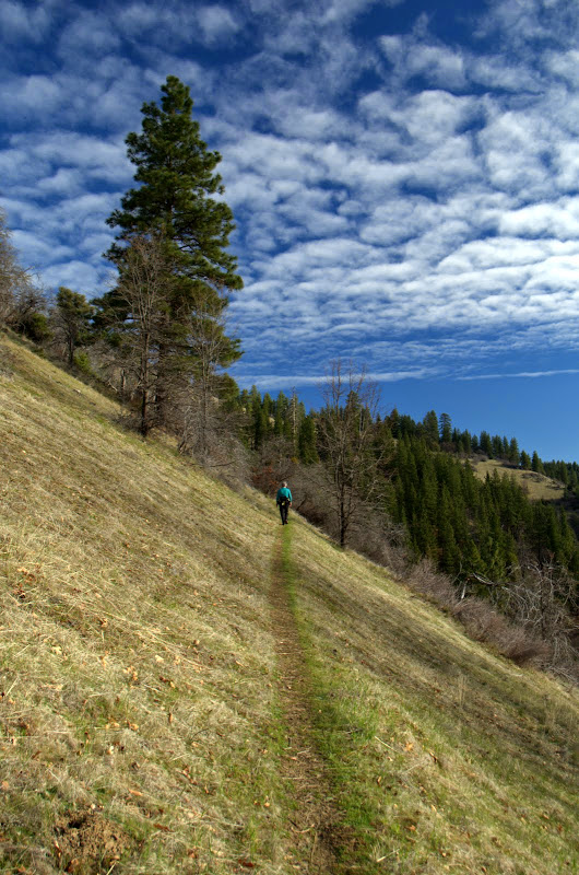
and began a gentle but ever upward traverse into a madrone forest,

Image

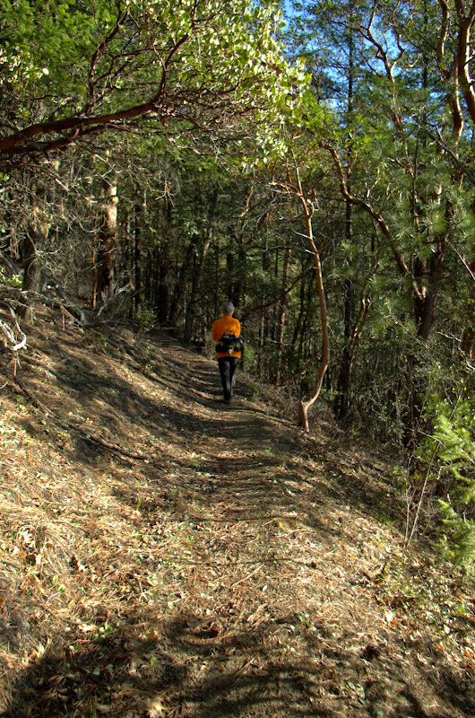
then on up into a forest heavy with Ponderosa pines (possibly my favorite pine),

Image

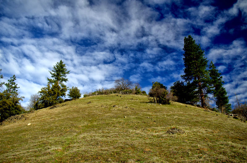
across open meadows,

Image

Image

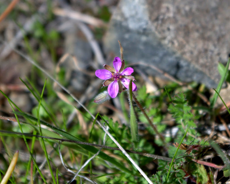
where the first tiny flowers of Spring are already out,

Image

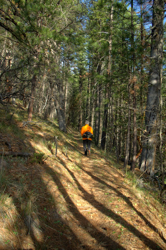
then back into the forest,

Image

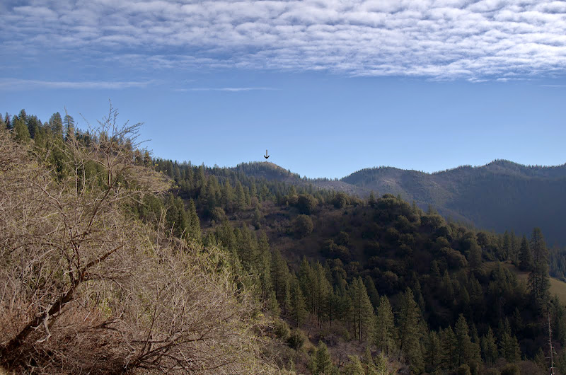
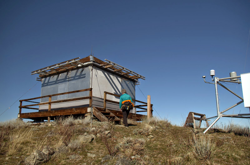
before finally glimpsing the old LO (arrow), our goal for the day.

Image

The entire trail - except for the short road section up to the LO - is S facing, so my decision to wear shorts in February worked out just fine! The LO itself is out of commission - what matters now is the automated met station next to it. During our last series of storms, that station clocked winds in excess of 110 mph over the peak - it was amazing that there weren't more trees down on the trail.

Image

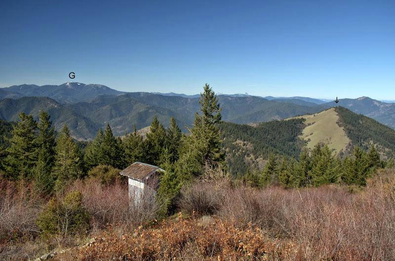
There are, of course, views - of Grayback Mountain (G), Baldy Peak (arrow), which is accessible via the Mule Mountain trail (Mule Mtn TR), and the LO's sanitary facility,

Image

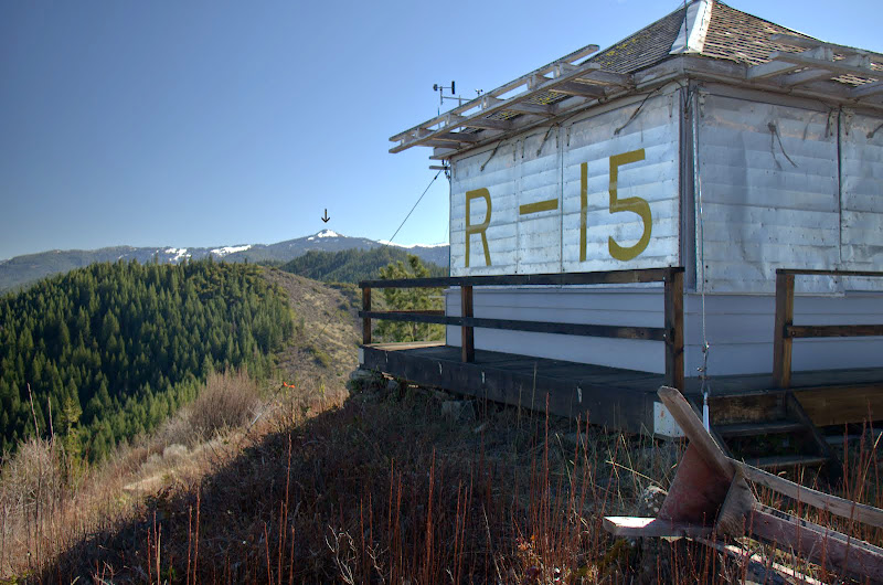
of Wagner Butte (arrow),

Image

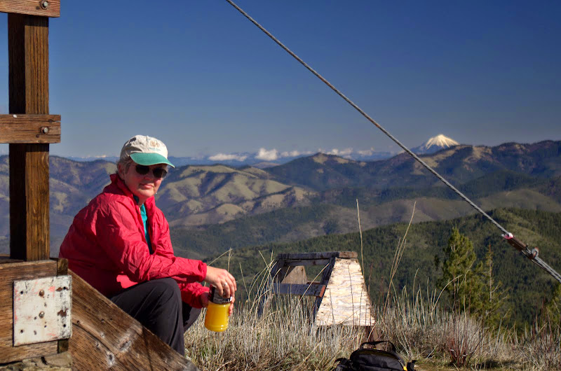
and of Mt. McLoughlin.

Image

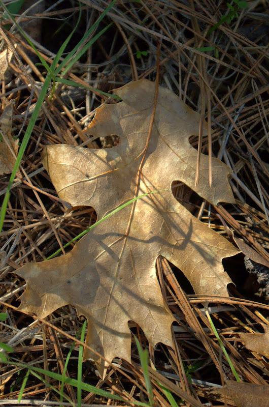
After lunch, we went back the way we'd come - passing a raucous group of Medford Happy Hikers along the way - and marveling how quickly the leaves of Fall were giving way to the new grasses of Spring.

Image

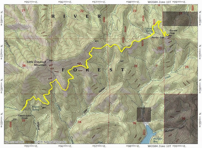
An easy (11 mi RT, 1800' EG) and highly recommended hike and, according to the locals, a wildflower bonanza in the Spring.

Image
Last edited by VanMarmot on September 16th, 2023, 6:05 am, edited 2 times in total.

User avatar
jdemott
Posts: 651
Joined: July 23rd, 2010, 1:43 pm
Contact:

Re: Squaw Peak (S Oregon) 21-Feb-2015

Post by jdemott » February 22nd, 2015, 9:16 am

Thanks so much for continuing to post trip reports from southern Oregon! Obviously, those of us in the Portland area can't hope to do any of those hikes as day hikes, but it is great to have an archive of trip reports for those times when we can do a southern road trip. Squaw Peak looks like a great hike. How long does wildflower season last in that area? I plan to be down there in late April.

User avatar
VanMarmot
Posts: 1924
Joined: May 28th, 2008, 10:03 pm
Contact:

Re: Squaw Peak (S Oregon) 21-Feb-2015

Post by VanMarmot » February 22nd, 2015, 9:56 am

jdemott wrote:Thanks so much for continuing to post trip reports from southern Oregon! Obviously, those of us in the Portland area can't hope to do any of those hikes as day hikes, but it is great to have an archive of trip reports for those times when we can do a southern road trip. Squaw Peak looks like a great hike. How long does wildflower season last in that area? I plan to be down there in late April.
Thanks! Stuff is starting to leaf-out & bloom now but I've been told that peak is usually (not sure about this year though) mid-March thru April. The plants may give out earlier if we don't get more rain - some of which is expected this coming weekend.

User avatar
Splintercat
Posts: 8333
Joined: May 28th, 2008, 10:03 pm
Location: Portland
Contact:

Re: Squaw Peak (S Oregon) 21-Feb-2015

Post by Splintercat » February 22nd, 2015, 1:22 pm

Wow! What a cool hike! On my list for my next SoOR trip! Love the mix of madrona and ponderosa, too. But I'm wondering if you're actually commuting from Redding for these trip, Van... as...
...in the United States, the name "madrone" is used south of the Siskiyou Mountains of southern Oregon/northern California and the name "madrona" is used north of the Siskiyou Mountains according to the Sunset Western Garden Book....
:o

Who could doubt the Western Garden Book, after all! :lol: That said, I definitely use "madrona", not sure where I picked that up... apparently, somewhere north of the Siskiyous..! :)

I'm also surprised to see a "squaw" feature left on the maps -- I thought the OGNB had scrubbed all of these several years ago (most prominently in the Whychus and Tumala switches). Maybe there's a second phase of map scrubbing ahead?

Thanks for posting, Van!

Tom :)

User avatar
VanMarmot
Posts: 1924
Joined: May 28th, 2008, 10:03 pm
Contact:

Re: Squaw Peak (S Oregon) 21-Feb-2015

Post by VanMarmot » February 23rd, 2015, 8:11 am

Splintercat wrote:Wow! What a cool hike! On my list for my next SoOR trip! Love the mix of madrona and ponderosa, too. But I'm wondering if you're actually commuting from Redding for these trip, Van... as...
...in the United States, the name "madrone" is used south of the Siskiyou Mountains of southern Oregon/northern California and the name "madrona" is used north of the Siskiyou Mountains according to the Sunset Western Garden Book....
:o

Who could doubt the Western Garden Book, after all! :lol: That said, I definitely use "madrona", not sure where I picked that up... apparently, somewhere north of the Siskiyous..! :)

I'm also surprised to see a "squaw" feature left on the maps -- I thought the OGNB had scrubbed all of these several years ago (most prominently in the Whychus and Tumala switches). Maybe there's a second phase of map scrubbing ahead?

Thanks for posting, Van!

Tom :)
Thanks, Tom! I didn't know there were two choices: madrona vs. madrone. The botanical guru for the Siskiyous (Ruediger) uses "madrone" so I may have to go with that in the future. As for the "S" word, it looks like the 2014 revised map for this area still uses it a lot - so possibly the "scrubbing" has run it course?

User avatar
-Q-
Posts: 1433
Joined: July 5th, 2008, 10:42 pm

Re: Squaw Peak (S Oregon) 21-Feb-2015

Post by -Q- » February 23rd, 2015, 5:09 pm

VanMarmot wrote:
Splintercat wrote:Wow! What a cool hike! On my list for my next SoOR trip! Love the mix of madrona and ponderosa, too. But I'm wondering if you're actually commuting from Redding for these trip, Van... as...
...in the United States, the name "madrone" is used south of the Siskiyou Mountains of southern Oregon/northern California and the name "madrona" is used north of the Siskiyou Mountains according to the Sunset Western Garden Book....
:o

Who could doubt the Western Garden Book, after all! :lol: That said, I definitely use "madrona", not sure where I picked that up... apparently, somewhere north of the Siskiyous..! :)

I'm also surprised to see a "squaw" feature left on the maps -- I thought the OGNB had scrubbed all of these several years ago (most prominently in the Whychus and Tumala switches). Maybe there's a second phase of map scrubbing ahead?

Thanks for posting, Van!

Tom :)
Thanks, Tom! I didn't know there were two choices: madrona vs. madrone. The botanical guru for the Siskiyous (Ruediger) uses "madrone" so I may have to go with that in the future. As for the "S" word, it looks like the 2014 revised map for this area still uses it a lot - so possibly the "scrubbing" has run it course?
The on-trail trail sign for Squaw Mountain in MHNF still reads Squaw Mountain.
The maps & road names etc all state Tumalo Mountain.
Going to confuse somebody big time one day

Post Reply