Once More Unto the CCT, Dear Friends 24-Dec-2013

Discussions and Trip Reports for off-trail adventures and rediscovering lost trails
User avatar
VanMarmot
Posts: 1924
Joined: May 28th, 2008, 10:03 pm
Contact:

Once More Unto the CCT, Dear Friends 24-Dec-2013

Post by VanMarmot » December 25th, 2013, 8:51 am

At the risk of exposing an unhealthy obsession, yesterday I had another go at finding the Cascade Crest Trail (CCT) as it rounded the E side of Dog Mtn. A previous wandering (CCT Last Week) had yielded little in the way of missing trail, but several helpful hints as to where to look (thanks Don, Paul, and Eric!). Armed with this new beta, I found myself leaving the Portland fog bank just beyond Cascade Locks and arriving at the Dog Mtn TH in full bluebird conditions. The climb toward the old LO site was graced by clear skies and the moon.

Image

Image

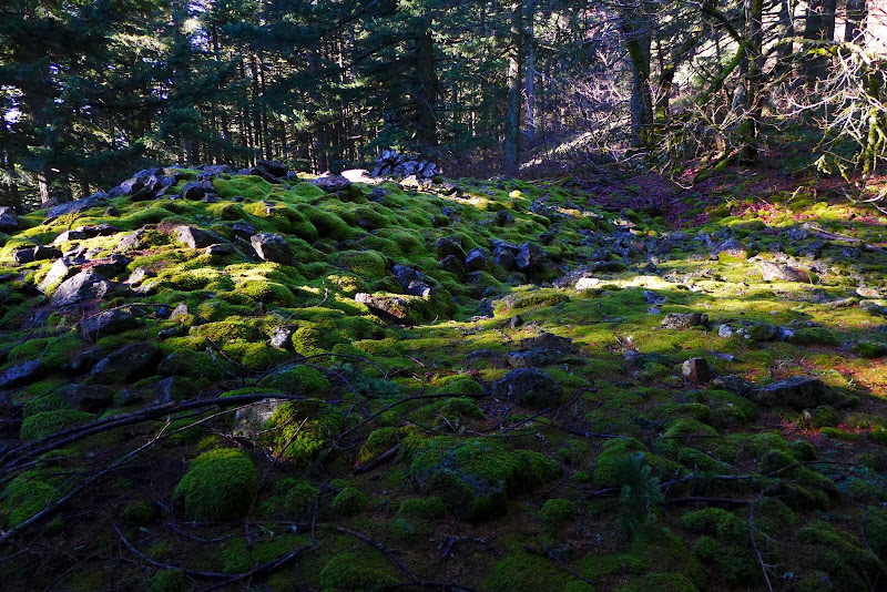
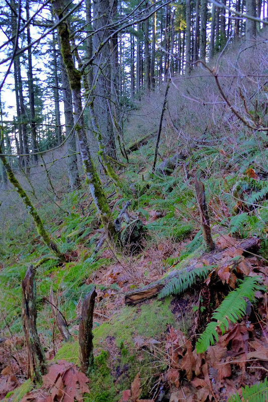
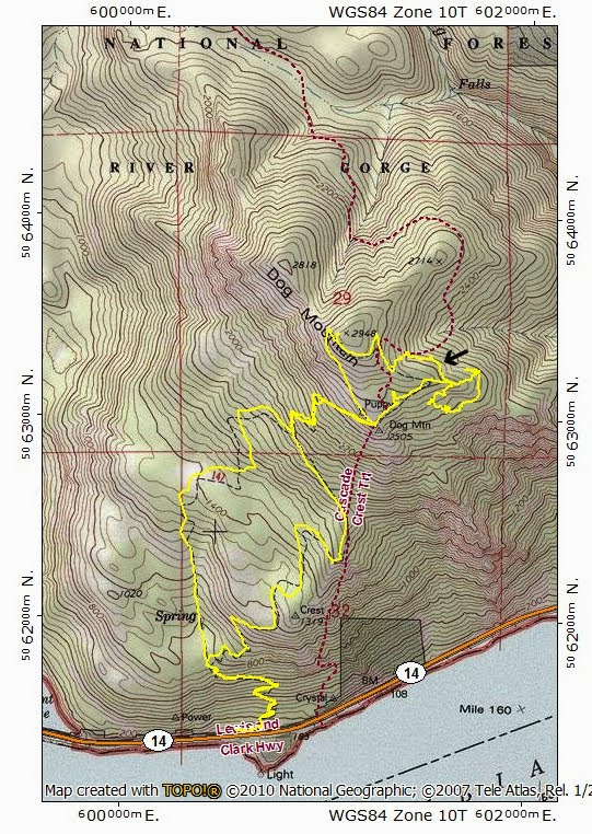
From the LO site, I followed the current trail for a while, then angled off to intersect Dog’s SE ridge at about 2,600’, then went down the ridge to see if I’d cross a trail. Something looked promising at 2,500’ but I continued down then circled back just to be sure. The area between the LO site and the SE ridge is fairly open, with several moss covered boulder fields.

Image

Eventually, I made it back to where it looked like the old trail cut the ridge,

Image

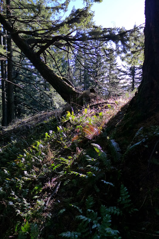
and continued on along what was a pretty well defined (for a while at least) track. The old CCT contoured around Pt 2714 just below 2,600’ and this track was doing precisely that.

Image

I kept looking for blazes and/or trail markers but saw none until, about half-way along this good section of trail, I saw an old telephone line insulator embedded in a tree!

Image

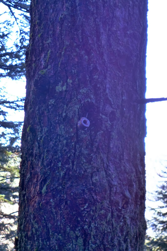
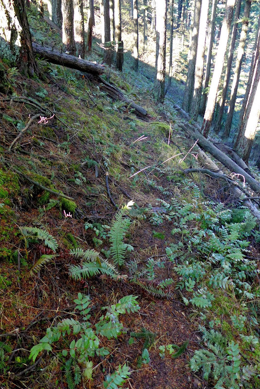
To me, this is evidence that I’d found (or re-found) what remains of the CCT in this area. These insulators usually indicate the previous existence of a phone line to a LO. Dog Mtn had served as a “lookout point” starting in the 1920s but an actual LO structure was not built until 1931 (then rebuilt in 1952 and removed in 1967). As of 1930, there was no phone to the LO site (One wonders how a fire was reported?), which made it an ideal location for some of the U.S. Forest Service’s earliest experiments with radio communication between lookouts and district HQs (Dwight Beatty report, 1931). Presumably a phone line was added after the 1931 structure was built – possibly to the ranger station at Hemlock (now Stabler)? I continued along the trail until it entered a draw and was overcome by vegetation – at which point I called it good. One obsession down, many more to go.

Image

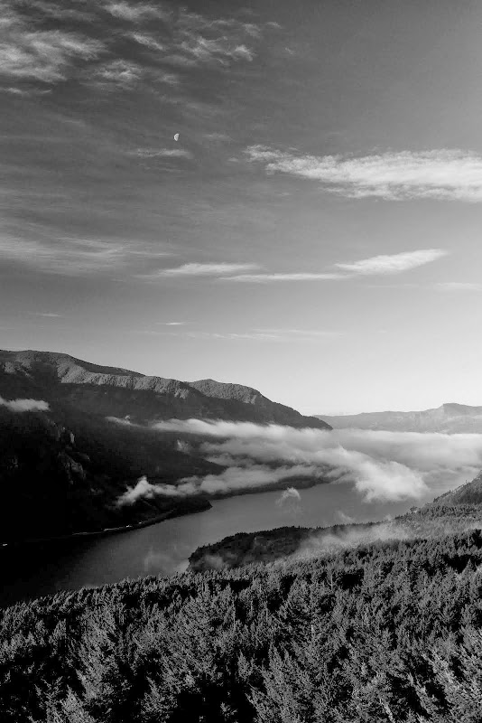
My guess is that the old trail continues – in over-vegetated fits and starts – until it drops into, and finally succumbs to, the veg chocked morass of the intermittent tributary of Dog Creek. “Mission accomplished”, I ‘schwacked from the draw up to the main trail and on to the summit for lunch – to enjoy the sunshine filling the Gorge.

Image

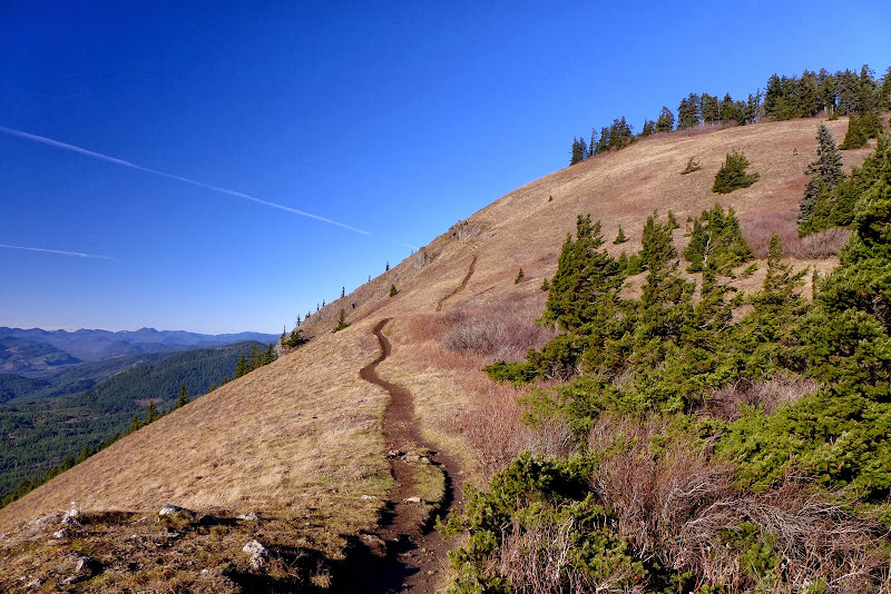
A short day of exploration (7.2 mi, 3000’ EG), with an obsession-taming find of a small portion (arrow) of the old CCT (Topo!’s rendition of the CCT between the TH and Pt 2714 is fully bogus).

Image

Merry Christmas!

Image

Ho! Ho! Ho!
Hike! Hike! Hike!

pablo
Posts: 1451
Joined: May 28th, 2008, 10:03 pm

Re: Once More Unto the CCT, Dear Friends 24-Dec-2013

Post by pablo » December 25th, 2013, 7:45 pm

Hey Bruce, nice TR, another lost trail found, I may take a stroll over that way one of these days to see what else is left further north.

Thx,

--Paul
The future's uncertain and the end is always near.

User avatar
Eric Peterson
Posts: 4097
Joined: May 11th, 2009, 5:39 am
Location: Oregon
Contact:

Re: Once More Unto the CCT, Dear Friends 24-Dec-2013

Post by Eric Peterson » December 25th, 2013, 8:04 pm

Here, follow this -
old_cct1.gpx
(9.74 KiB) Downloaded 262 times
The old alignment from Puppy Point, 2500', around the back of Dog might still have remnants of trail.

It's on my to do list but I'm afraid I might not have as much hiking time as I used to for awhile...

User avatar
VanMarmot
Posts: 1924
Joined: May 28th, 2008, 10:03 pm
Contact:

Re: Once More Unto the CCT, Dear Friends 24-Dec-2013

Post by VanMarmot » December 27th, 2013, 9:08 am

Eric Peterson wrote:Here, follow this -
old_cct1.gpx
The old alignment from Puppy Point, 2500', around the back of Dog might still have remnants of trail.

It's on my to do list but I'm afraid I might not have as much hiking time as I used to for awhile...
I think your gpx is possible from waypoint 009 on N but I don't think waypoints 001 to 008 match-up with where the CCT was back in the day. My guess is that the trail between Puppy and the SE ridge got realigned once or twice and lost its connection to where the old CCT used to cross the SE ridge and contours over to the NE side of Pt 2714. This will stay on my list too but I have other fish to hike in the meantime.

Hopefully your hiking time isn't being curtailed for a bad reason?

User avatar
kmcdade
Posts: 104
Joined: March 31st, 2013, 3:43 pm

Re: Once More Unto the CCT, Dear Friends 24-Dec-2013

Post by kmcdade » January 1st, 2014, 1:11 am

I've just read both of your posts on this topic. I'm afraid I have an unhealthy obsession with this trail, too. You see, I've hiked it, twice. The first time was in 1989 or 1990, and we followed it without much trouble from the Dog Mtn. summit area to where it intersects with the logging road just below the power line. We did have to follow blazes and flagging tape part of the time, but at the time it was maintained at least that much by Girl Scouts who hiked it every year or two because it was possible to hike from there down into the camp at Wind Mountain.

However, the second time I went, in 1993, we lost the trail completely somewhere on the back side of Dog Mountain and ended up bushwhacking our way along the creek until we reached the road (and ended up staying out all night in the process). So just in those few years, the trail had gotten overgrown enough for that.

As I recall (and I haven't even been up Dog since probably 1995 now) there was a summit loop trail, which we followed clockwise past the summit area and then picked up the Cascade Crest trail somewhere on the other side of the summit.

Another time a friend and I tried to find the trail the other way - starting from the logging road - but we didn't have any luck there.
--Kathleen. Or K-Mac. As in KMC, because that's what people have taken to calling me here. :-)

User avatar
VanMarmot
Posts: 1924
Joined: May 28th, 2008, 10:03 pm
Contact:

Re: Once More Unto the CCT, Dear Friends 24-Dec-2013

Post by VanMarmot » January 1st, 2014, 8:18 am

kmcdade wrote:I've just read both of your posts on this topic. I'm afraid I have an unhealthy obsession with this trail, too. You see, I've hiked it, twice. The first time was in 1989 or 1990, and we followed it without much trouble from the Dog Mtn. summit area to where it intersects with the logging road just below the power line. We did have to follow blazes and flagging tape part of the time, but at the time it was maintained at least that much by Girl Scouts who hiked it every year or two because it was possible to hike from there down into the camp at Wind Mountain.

However, the second time I went, in 1993, we lost the trail completely somewhere on the back side of Dog Mountain and ended up bushwhacking our way along the creek until we reached the road (and ended up staying out all night in the process). So just in those few years, the trail had gotten overgrown enough for that.

As I recall (and I haven't even been up Dog since probably 1995 now) there was a summit loop trail, which we followed clockwise past the summit area and then picked up the Cascade Crest trail somewhere on the other side of the summit.

Another time a friend and I tried to find the trail the other way - starting from the logging road - but we didn't have any luck there.
Wow! Thanks for this bit of history! I would never have guessed that this "trail" was somewhat functional as late as the early 90s. Today there is a summit loop trail and I think I found where (at a ridge crossing) you could depart that trail and link-up with the old CCT. The part of the CCT I found was in OK shape for a while and then, when it started into the first draw, it quickly became obscure. So then I too tried to find the trail from the logging/service road to the N but the vegetation along the creek was too thick and there was no sign of a trail at all. But having kept a trail that lets you loop all the way around Dog would have been pretty cool.

Curing this obsession may require me trying to follow what's left from end to end but when - given all the other hikes on my "top do" list - I can't say.

User avatar
Eric Peterson
Posts: 4097
Joined: May 11th, 2009, 5:39 am
Location: Oregon
Contact:

Re: Once More Unto the CCT, Dear Friends 24-Dec-2013

Post by Eric Peterson » January 1st, 2014, 8:20 am

Hey Kathleen, I think I asked you before but was their a trail from Camp Wind Mt up to the
powerline saddle below Dog or did they just use the logging roads?

I've seen a logging spur that leads down off of Augspurger Trail but it's around Grant Lake and appears
to lead down into private property.

Incidentally right around that spur there is a old logging road that heads over towards the switchback
landing where the Dog trail splits into harder and hardest ;)

User avatar
kmcdade
Posts: 104
Joined: March 31st, 2013, 3:43 pm

Re: Once More Unto the CCT, Dear Friends 24-Dec-2013

Post by kmcdade » January 1st, 2014, 4:05 pm

Eric, there are many old logging roads that make their way through camp; one of them connects up with the road below the powerline (not the actual powerline road). On the topo maps of the area, you'll see a box marked 19, and that area is where the roads intersect. There's actually a survey marker up there. You can also follow these roads and end up on Bergen Road near Martin Lake (where the maps say the road ends).

The spur trail near Grant Lake probably does go to private property, or maybe down to Mountain Glade Road, which runs east from Bergen Road. Most of what was the Girl Scouts' property east of Home Lake is now Gifford Pinchot land, but there's still quite a bit of private property to the southeast, I believe.
--Kathleen. Or K-Mac. As in KMC, because that's what people have taken to calling me here. :-)

beag
Posts: 350
Joined: April 6th, 2009, 2:30 pm

Re: Once More Unto the CCT, Dear Friends 24-Dec-2013

Post by beag » January 1st, 2014, 6:30 pm

KMC. Do you know if it is possible to drive in from the west to the Quarry on the North end of Augspurger. We have hiked to Augspurger from Triangle Pass and we also have driven in from Mill A but it would be shorter to drive in from the West if possible.

User avatar
K.Wagner
Posts: 652
Joined: June 2nd, 2013, 1:25 pm
Location: Vancouver, WA

Re: Once More Unto the CCT, Dear Friends 24-Dec-2013

Post by K.Wagner » January 14th, 2014, 7:31 pm

Beag,

If I can jump in here .... it is possible to drive to the old quarry from Home Valley, was up there a couple of weeks ago, bagging a couple of little peaks. The second jct after crossing Wind River is Berge Rd. Follow it for several miles, all paved. At just over one mile past the cemetery sign take the gravel road that diagonals away from the main road. It is a DLNR road, wish I could give you the number, but it is posted. There are lots of unmapped little spur roads, just follow your nose and stay on the main track. Most of it is easy driving, all 2WD. As you near Larson Lakes, the key is: 1st jct -- stay right; 2nd jct -- stay left; 3rd jct -- stay left. Here is map: Mt Defiance Quad. It is pretty neat as you approach the Augspurger ridge, the road crosses over an open blocky lava flow, that looks really recent. When you finally break out on top of the ridge, the trail (signed) is straight ahead at the far end of the obvious bench.
Kelly
There is no shortcut to anyplace worth going to.

PM me about the soon to be released:
Skamania 231
"How to really get off the beaten path in Skamania County"

Post Reply