
[video]http://www.youtube.com/watch?v=9rxZ-xUwKv0[/video]
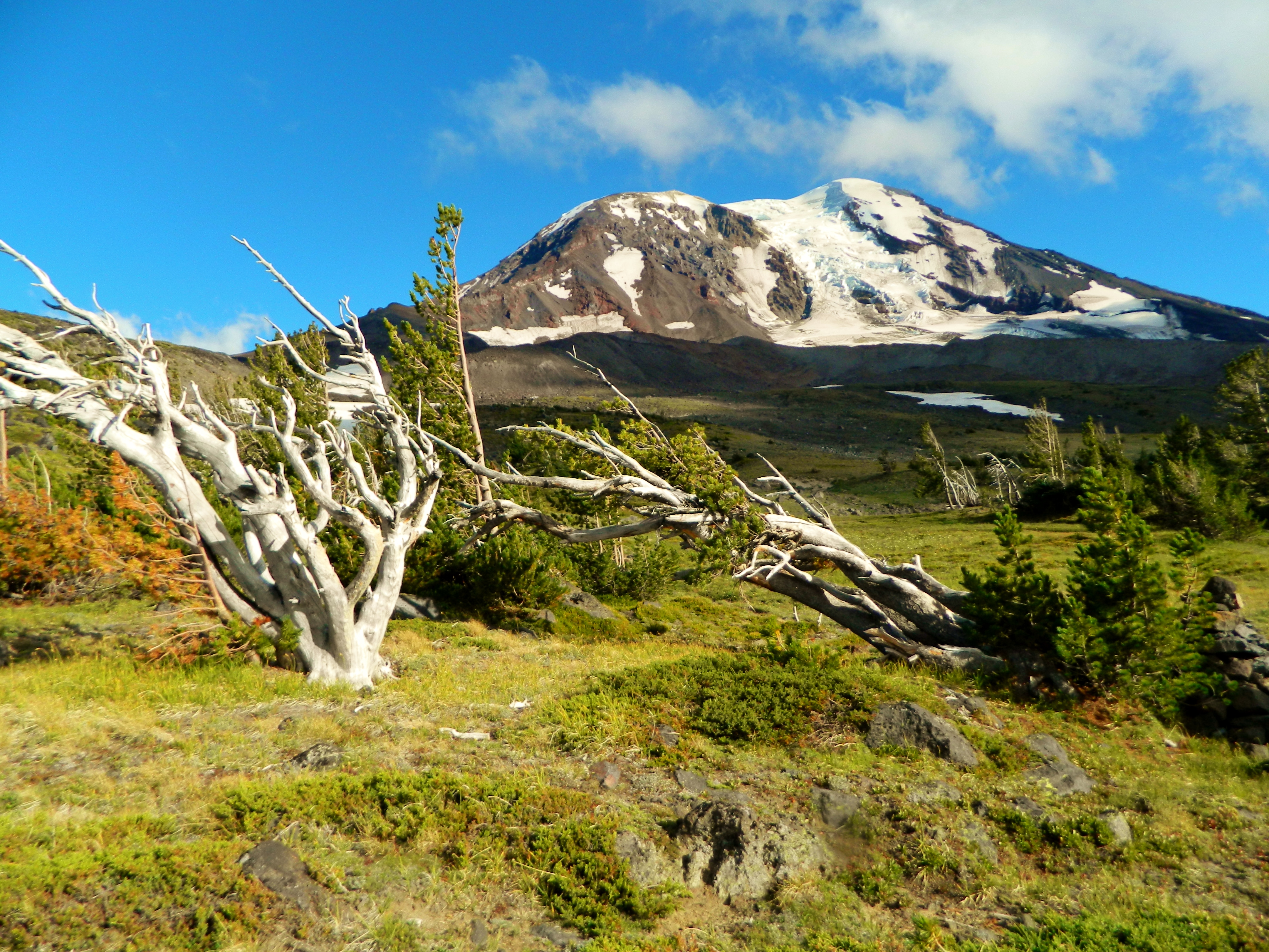
Mount Adams stands at 12,286 ft according to the USGS, making it the second highest mountain in the Cascades north of California. It is a huge mountain; when measured in terms of eruptive volume, it is the second biggest in the Cascade Range, only after Mount Shasta. Adams is characterized by lush, flower-filled meadows that rival that of Mount Rainier's own, tumbling creeks and waterfalls, dramatic canyons, glaciers, and dense, old growth forests on it's lower slopes.
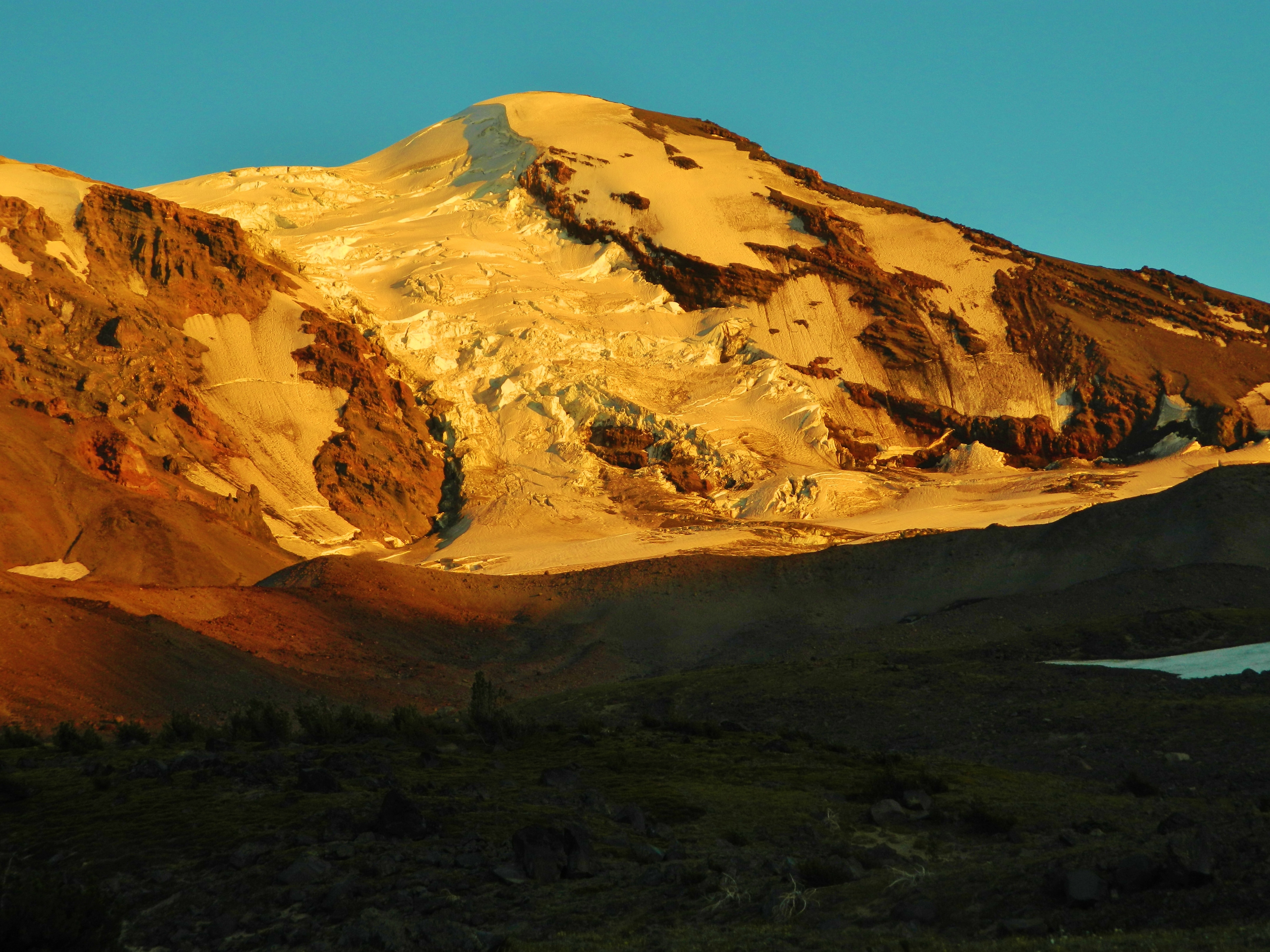
Mount Adams glaciated northwest face. Adams Glacier dominates the view from Adams Glacier Meadows.
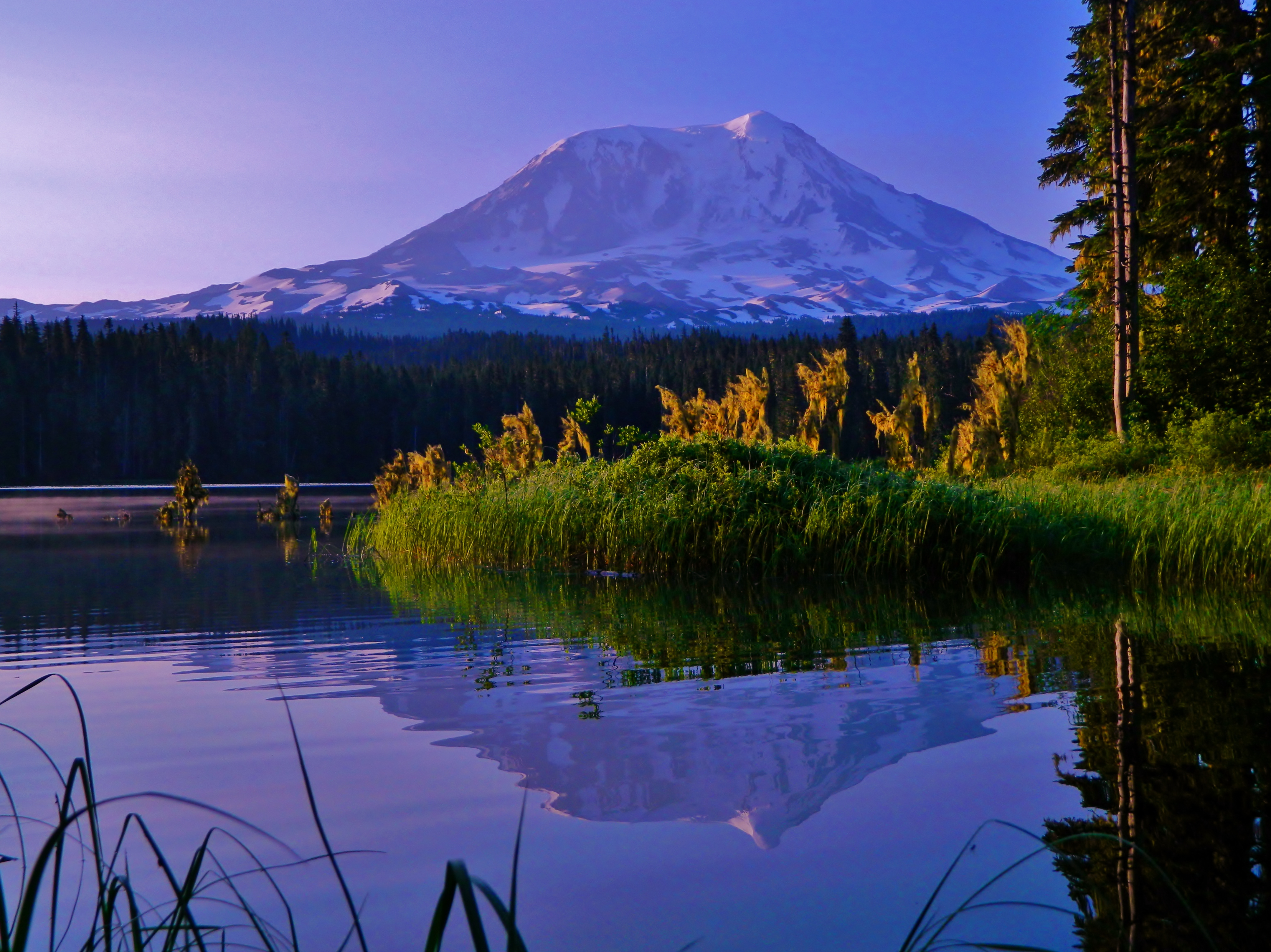
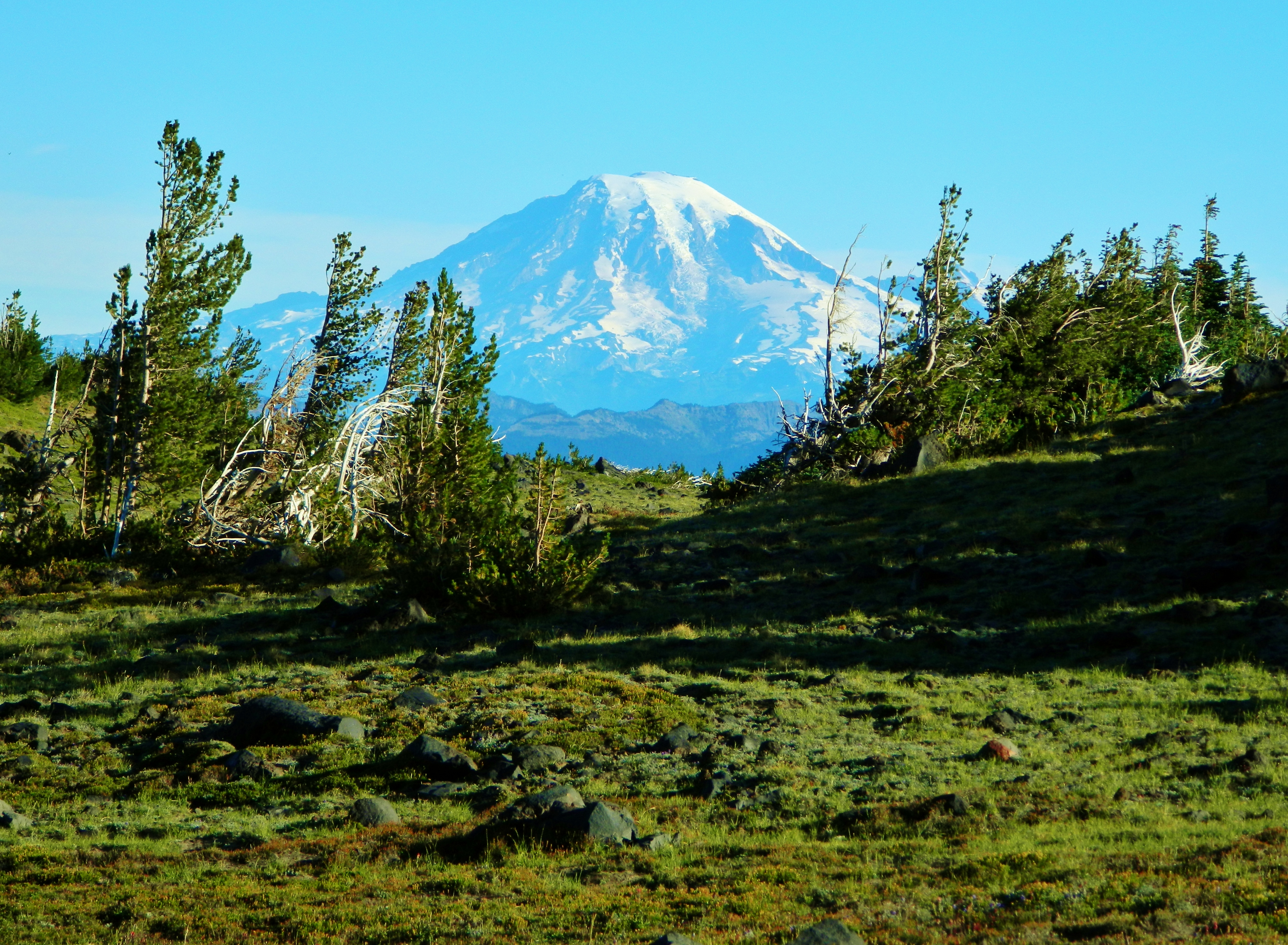
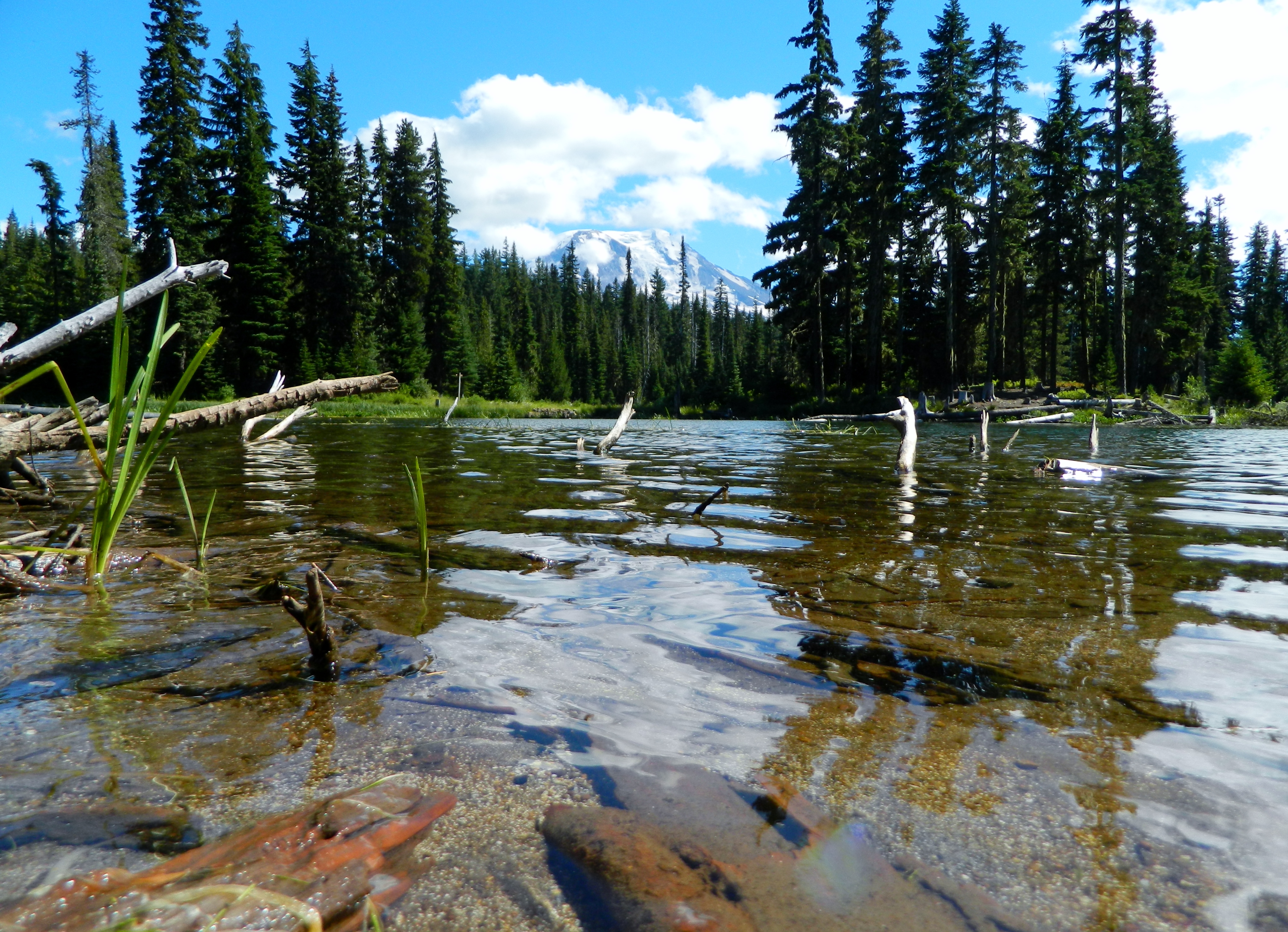
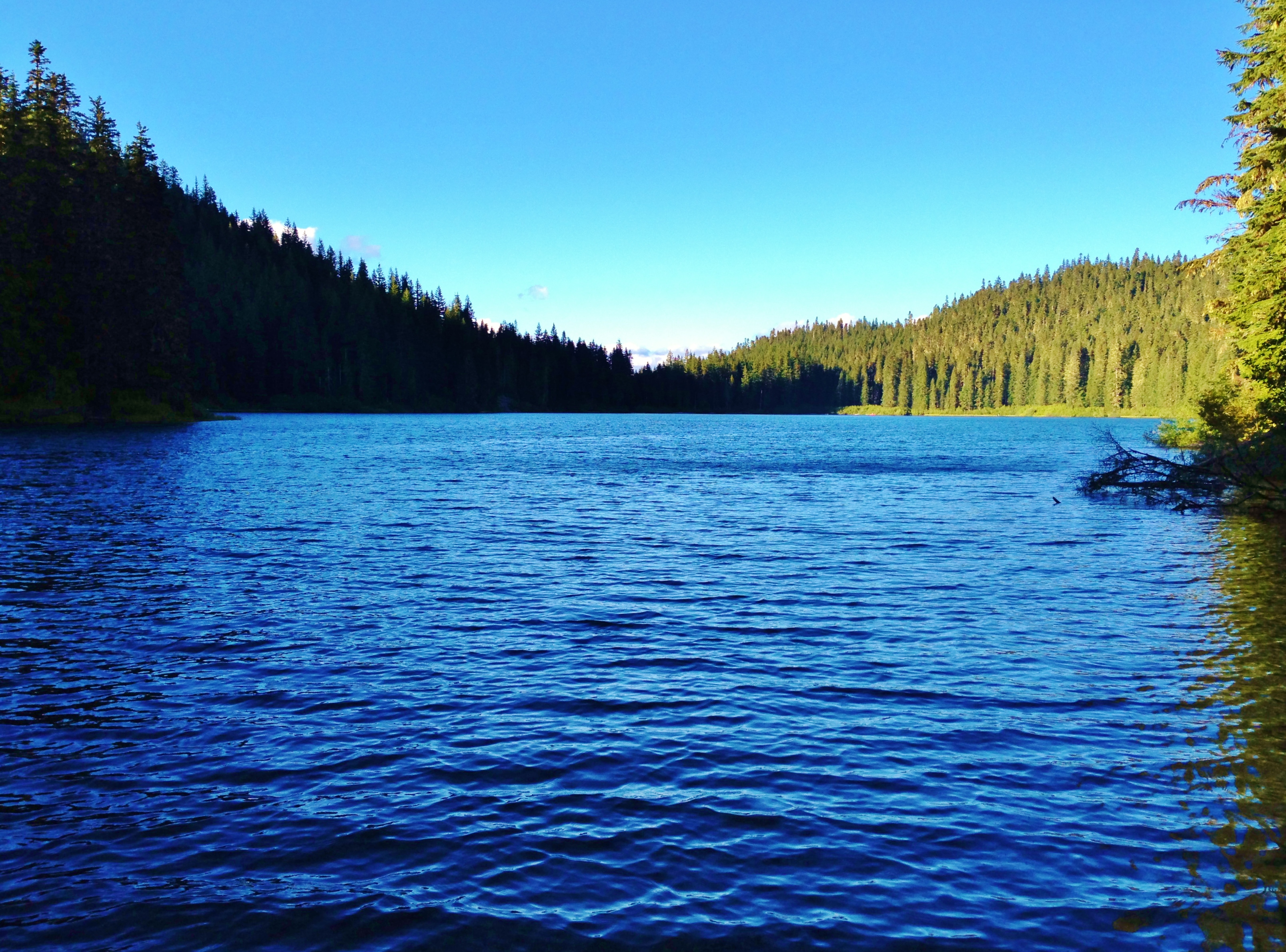
Here is Takhlakh Lake:

And in early morning light:
Source:Takhlakh Lake Reflection
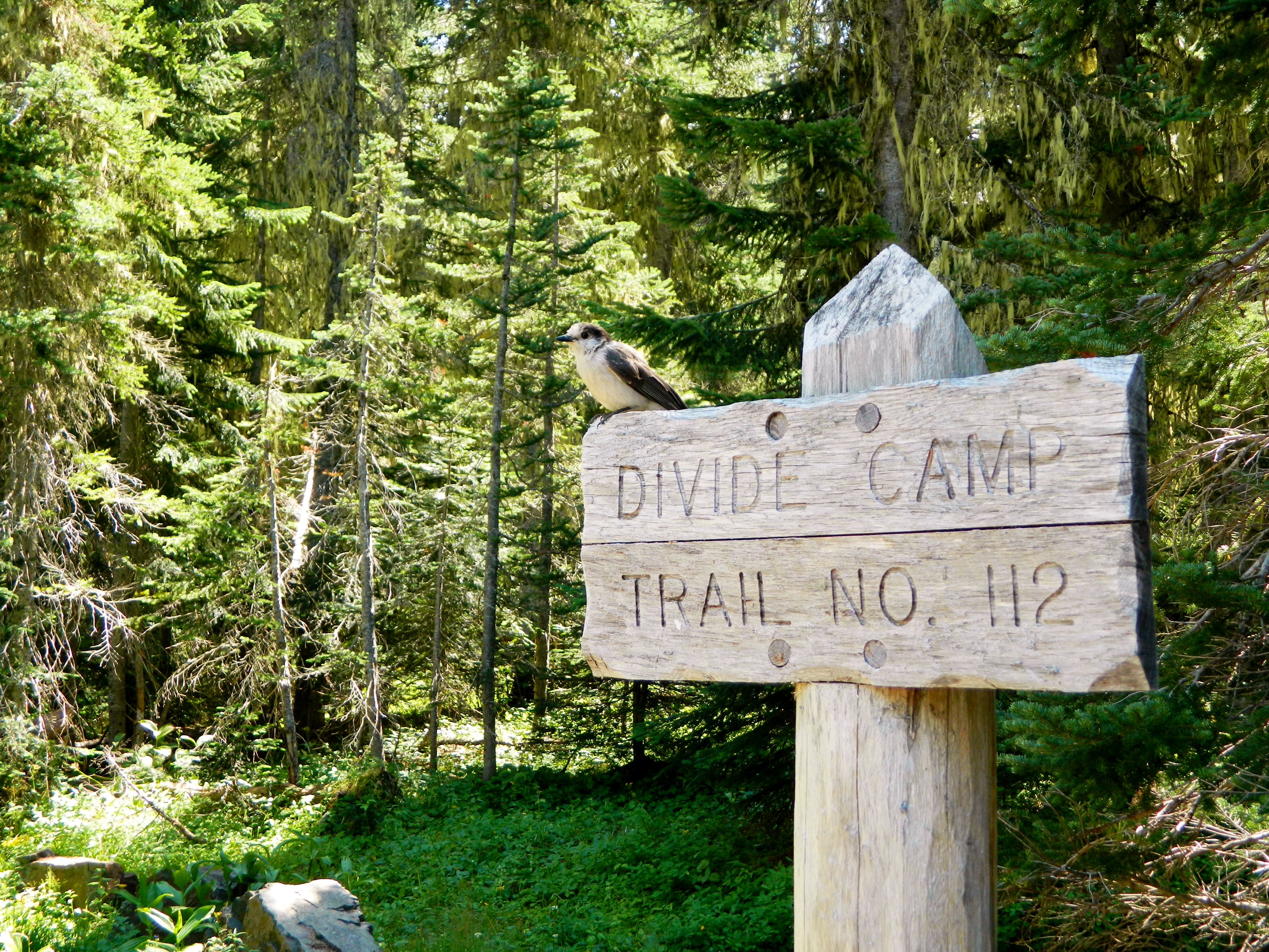
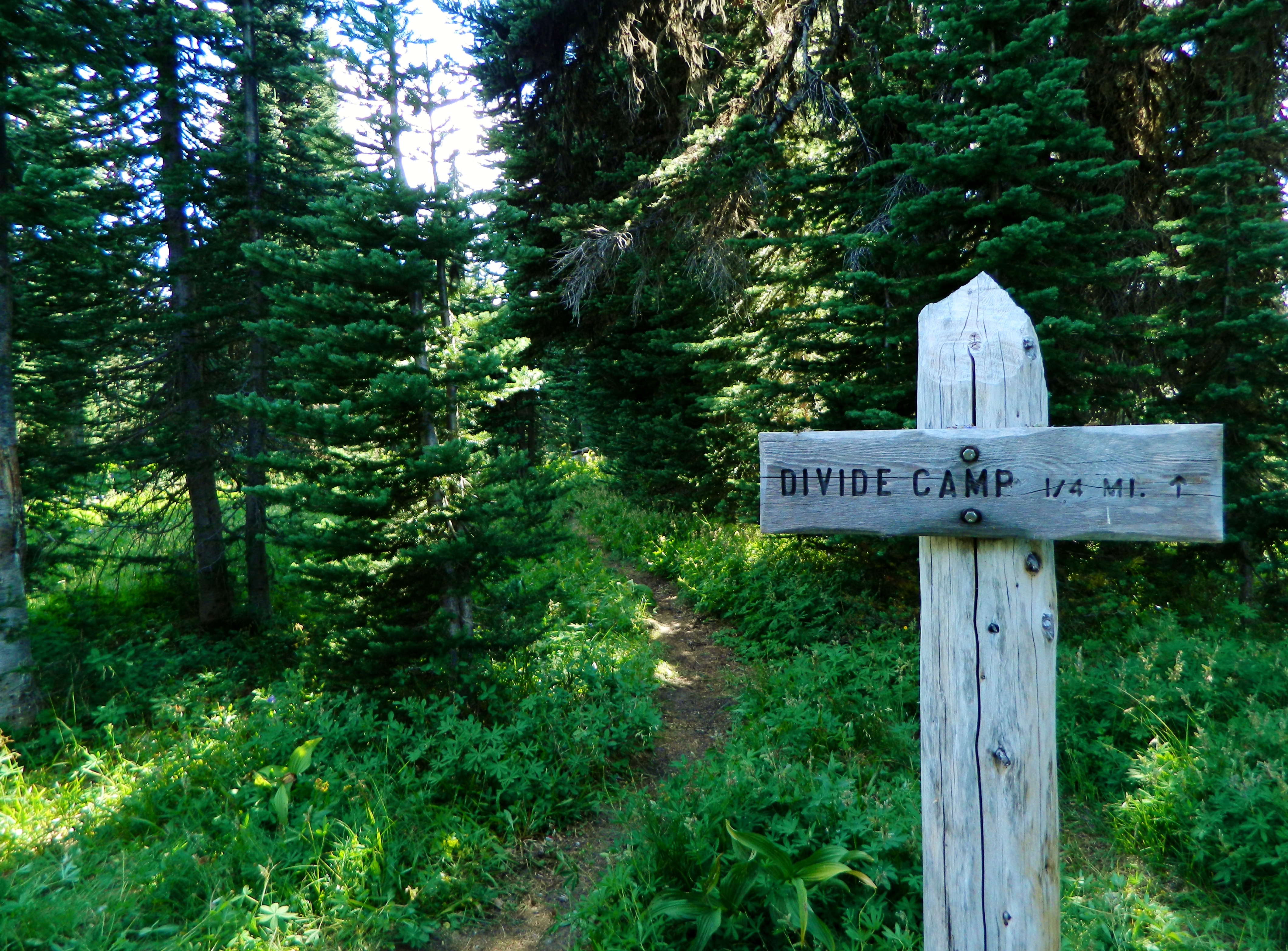
We began at the Divide Camp Trailhead, off of FR 2329. We hiked about 2.5 miles up the Divide Camp Trail.
A bird posed for the camera on the Divide Camp Trail sign:
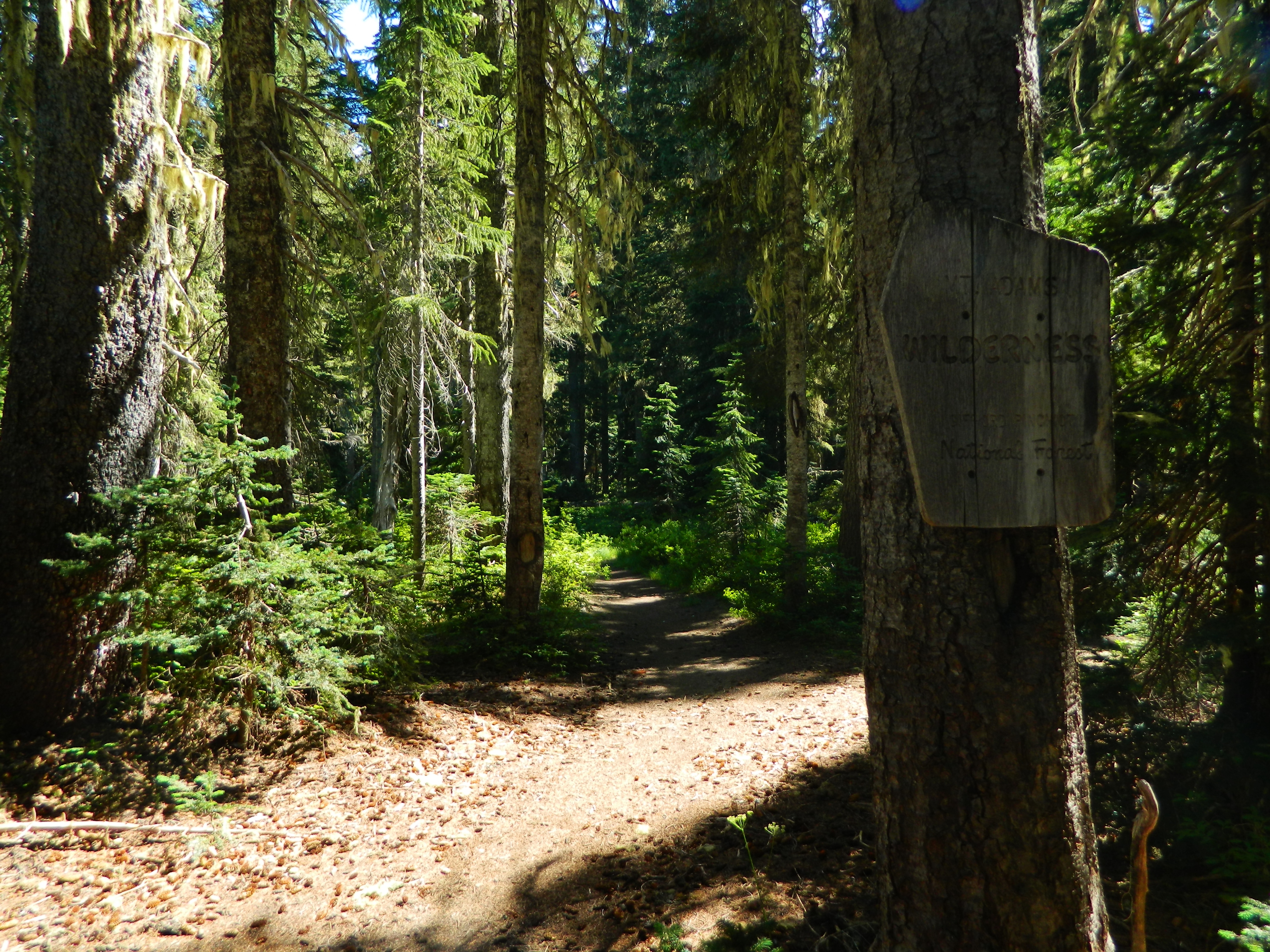
Entering the Mount Adams Wilderness:
Nice bridge along the trail:

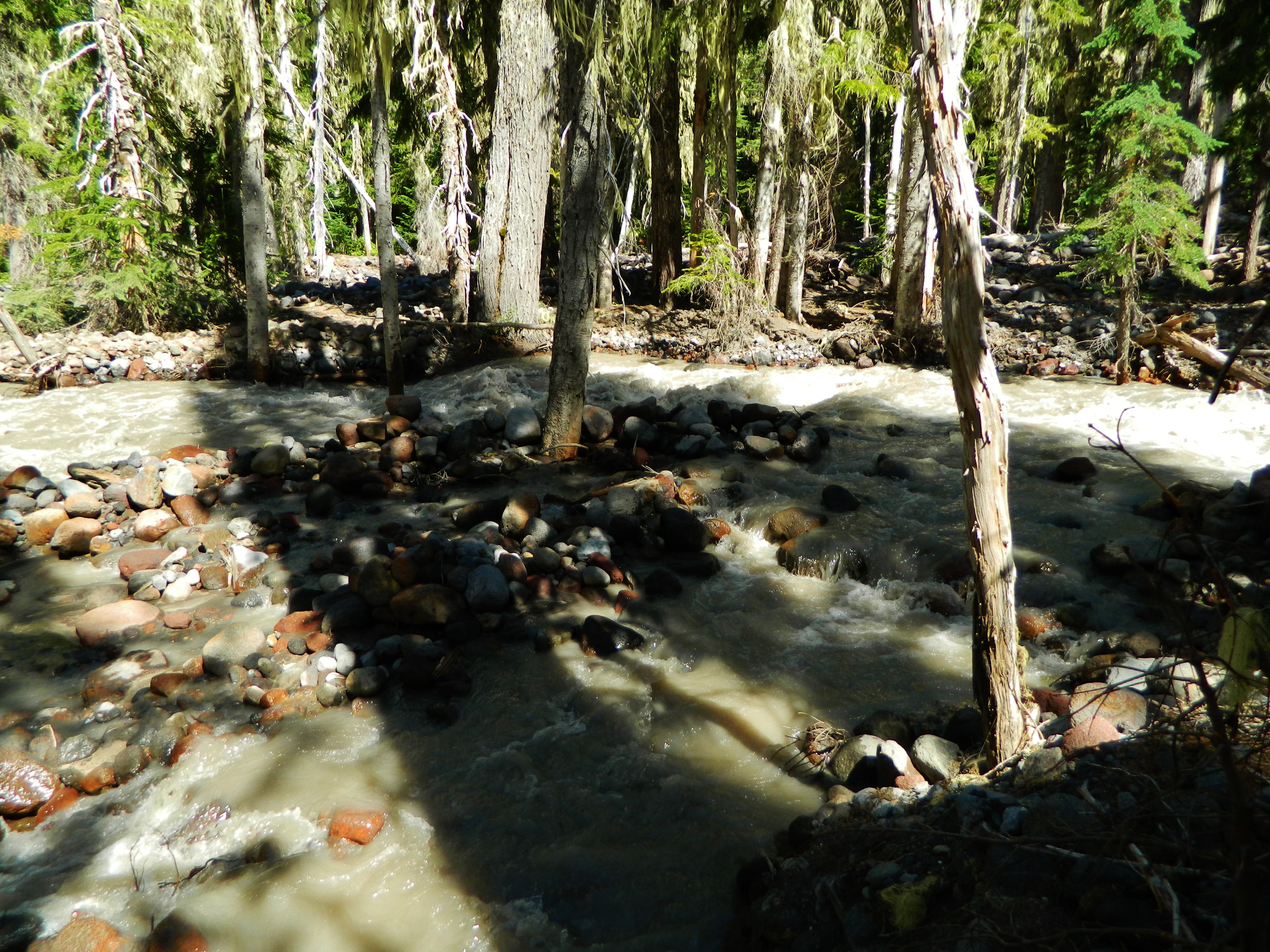
We followed the Adams Creek. We could hear the rushing sound it made as it tumbled over rocks on its way down the mountain.
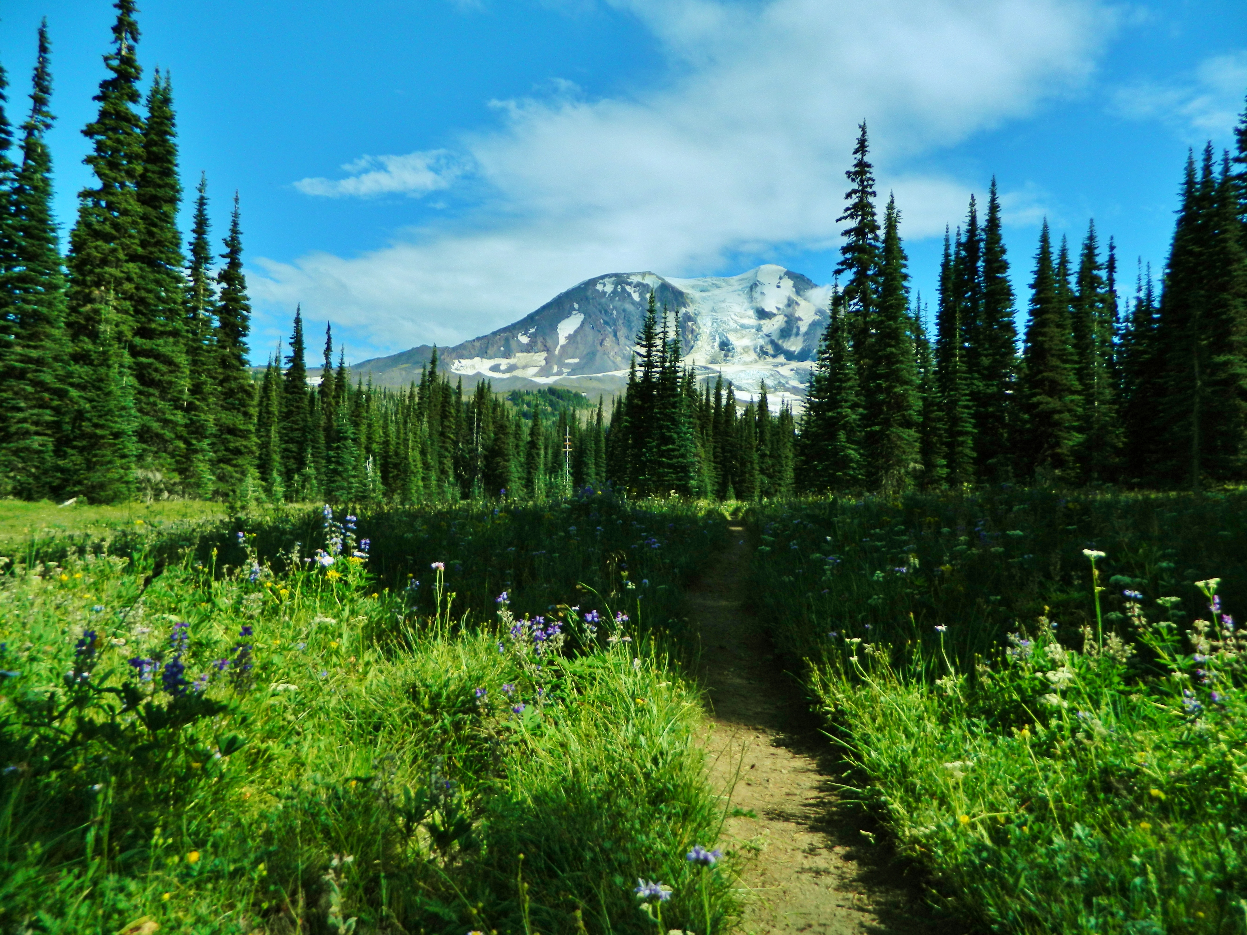
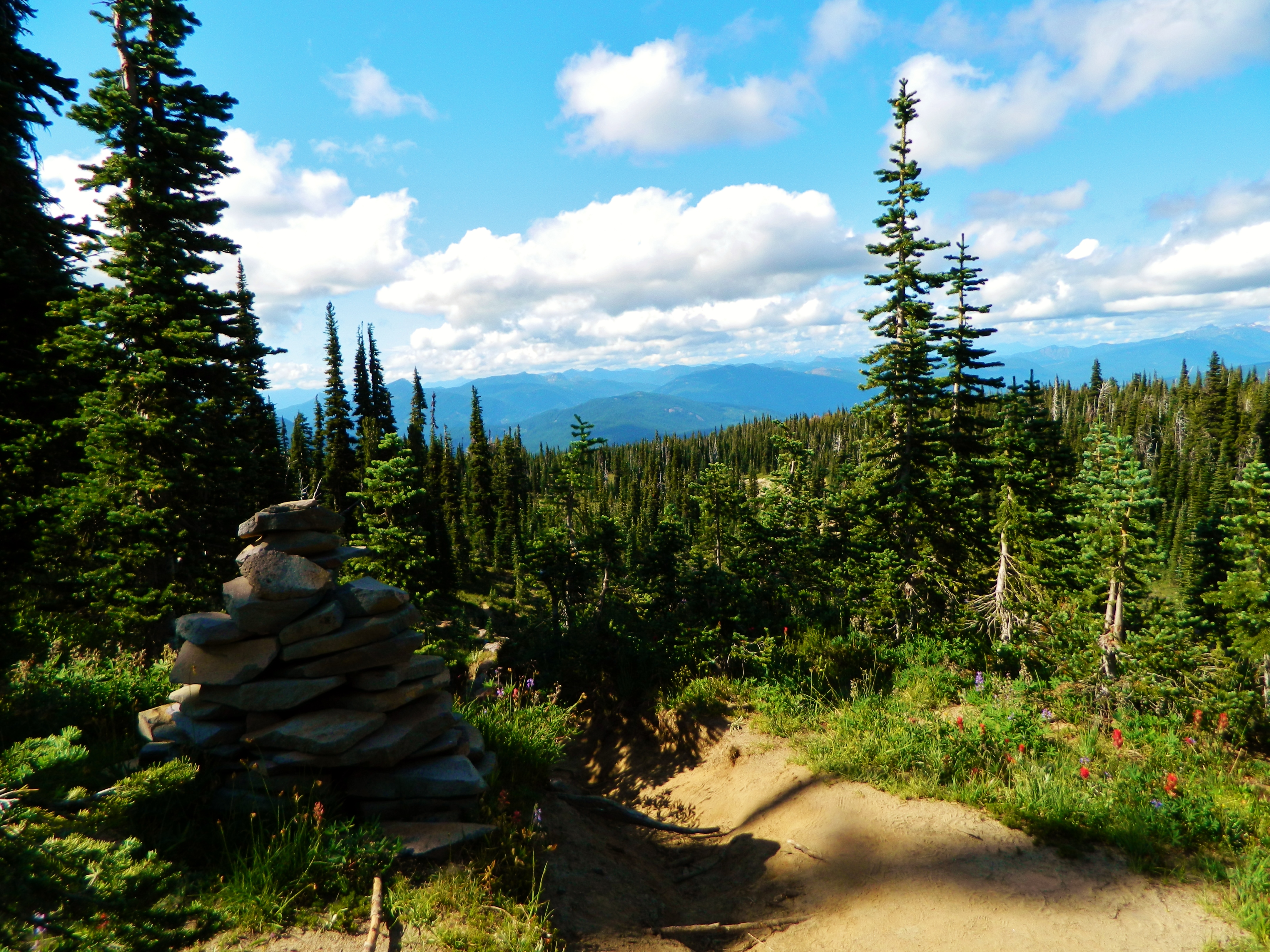
We reached the beautiful Divide Meadows. There were many flowers blooming along the trail.
The meadow was our junction with the spur trail to Divide Camp. Most maps don't show this trail though.
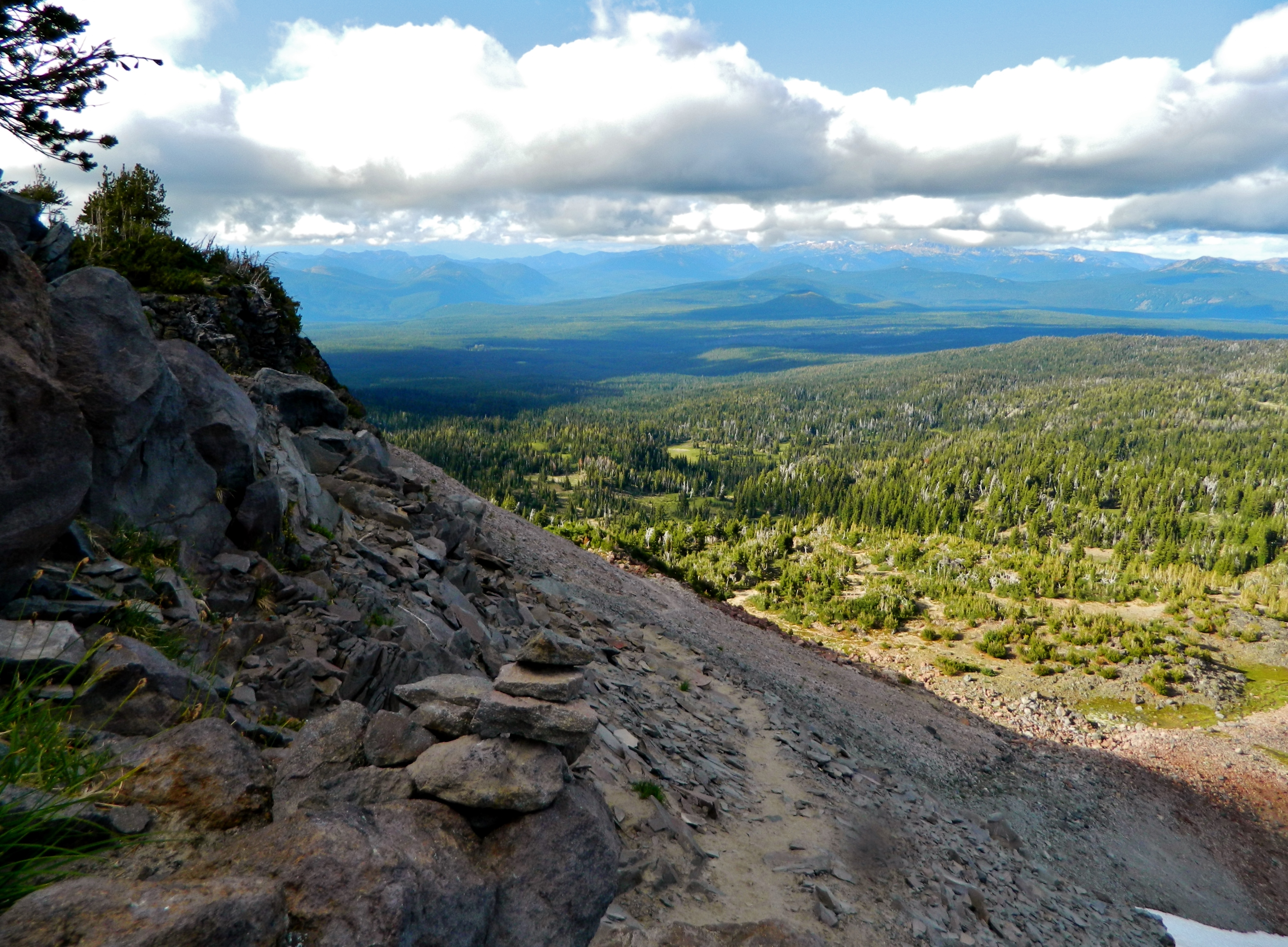
Once we set up camp. My friend and I climbed up a lava flow adjacent to our campsite and got this amazing view!
On the next day, we hiked the last .5 miles on the Divide Camp Trail, and met up with the PCT. We turned left, or northeast on the PCT (towards Canada). The trail was lined with many colorful wildflowers!
At the junction:
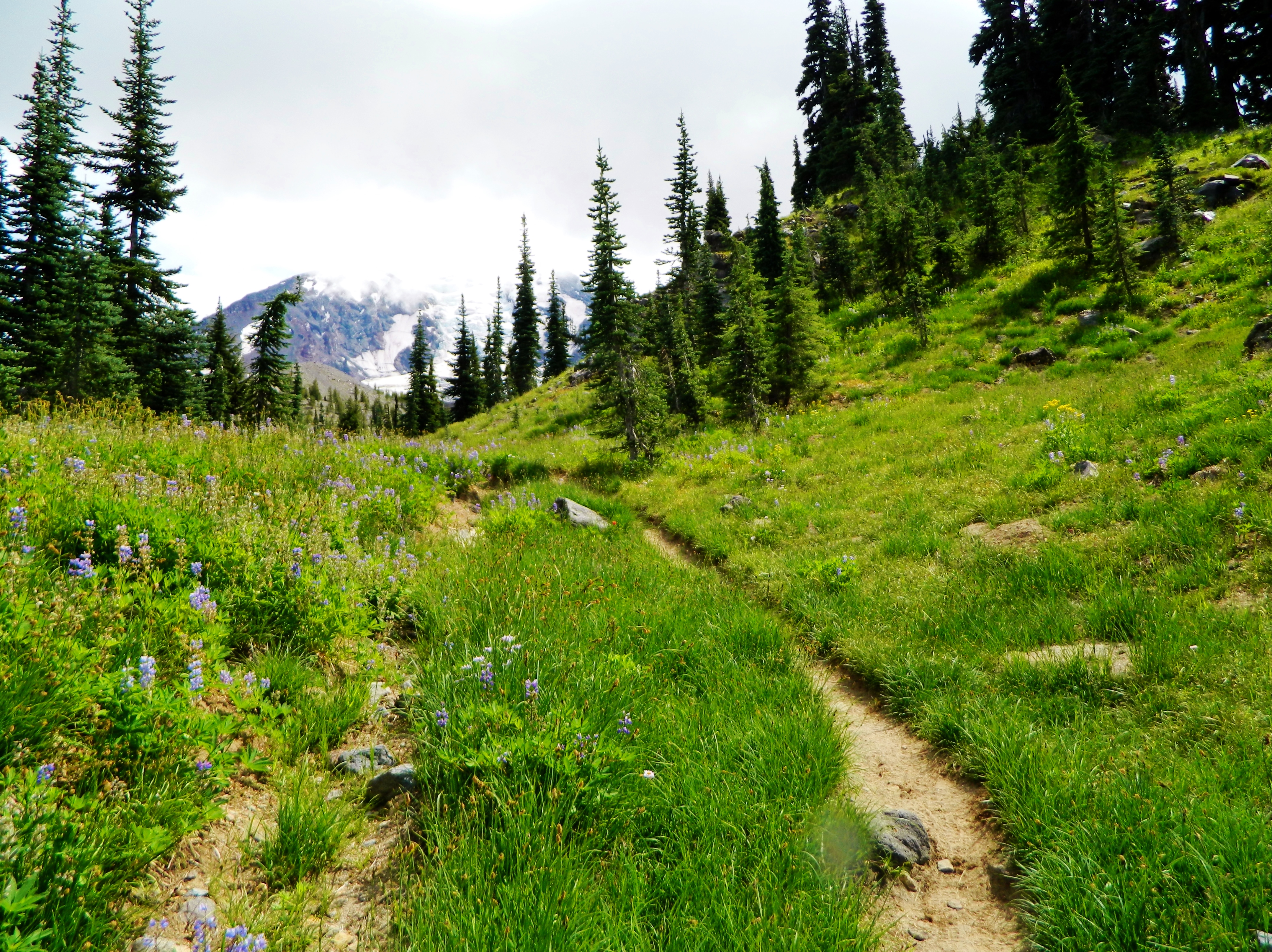
Wildflowers!
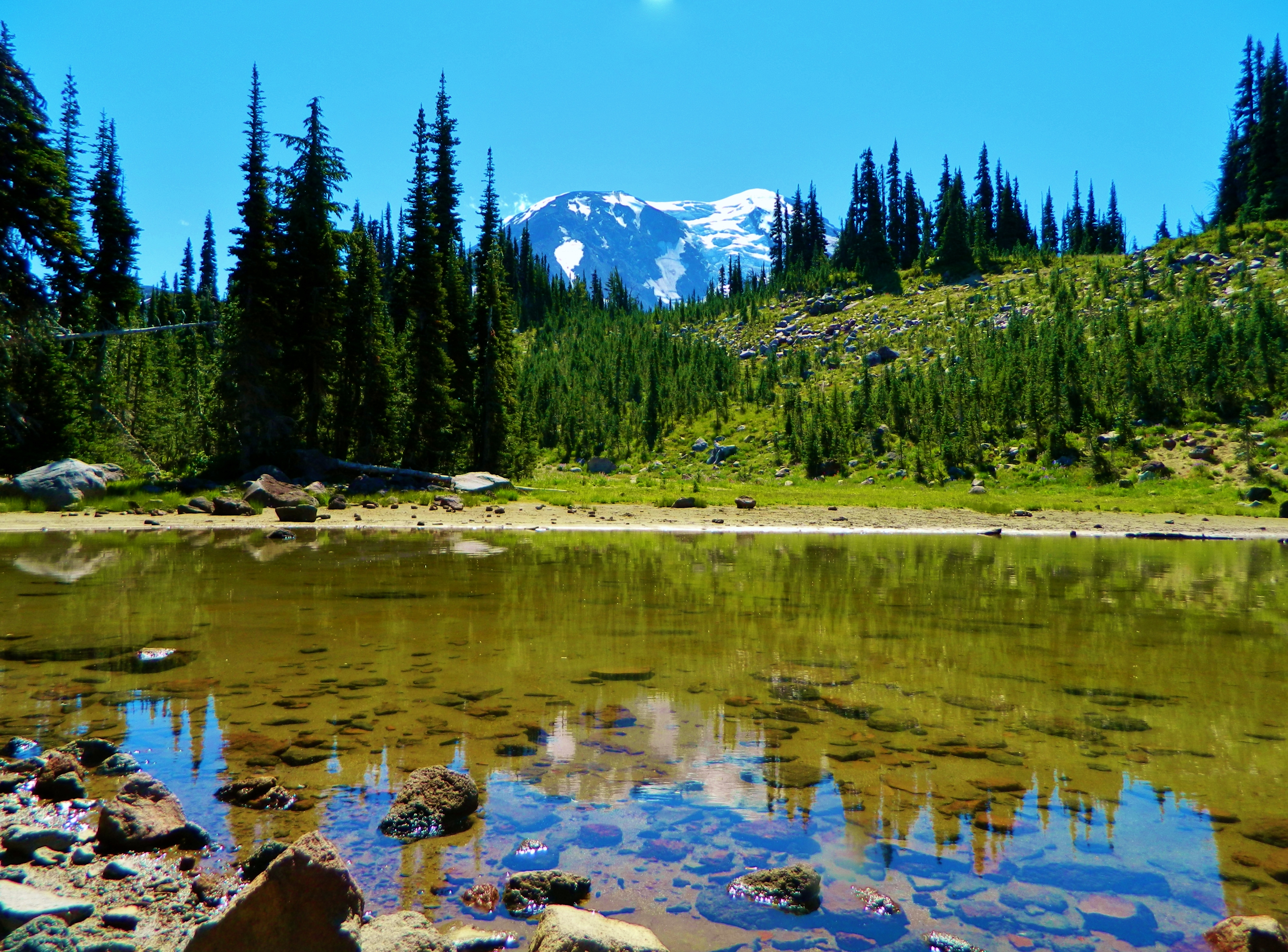
This beautiful lake was found along the PCT, between the Divide Camp Trail/PCT junction and the High Camp/PCT/Killen Creek Trail junctions.
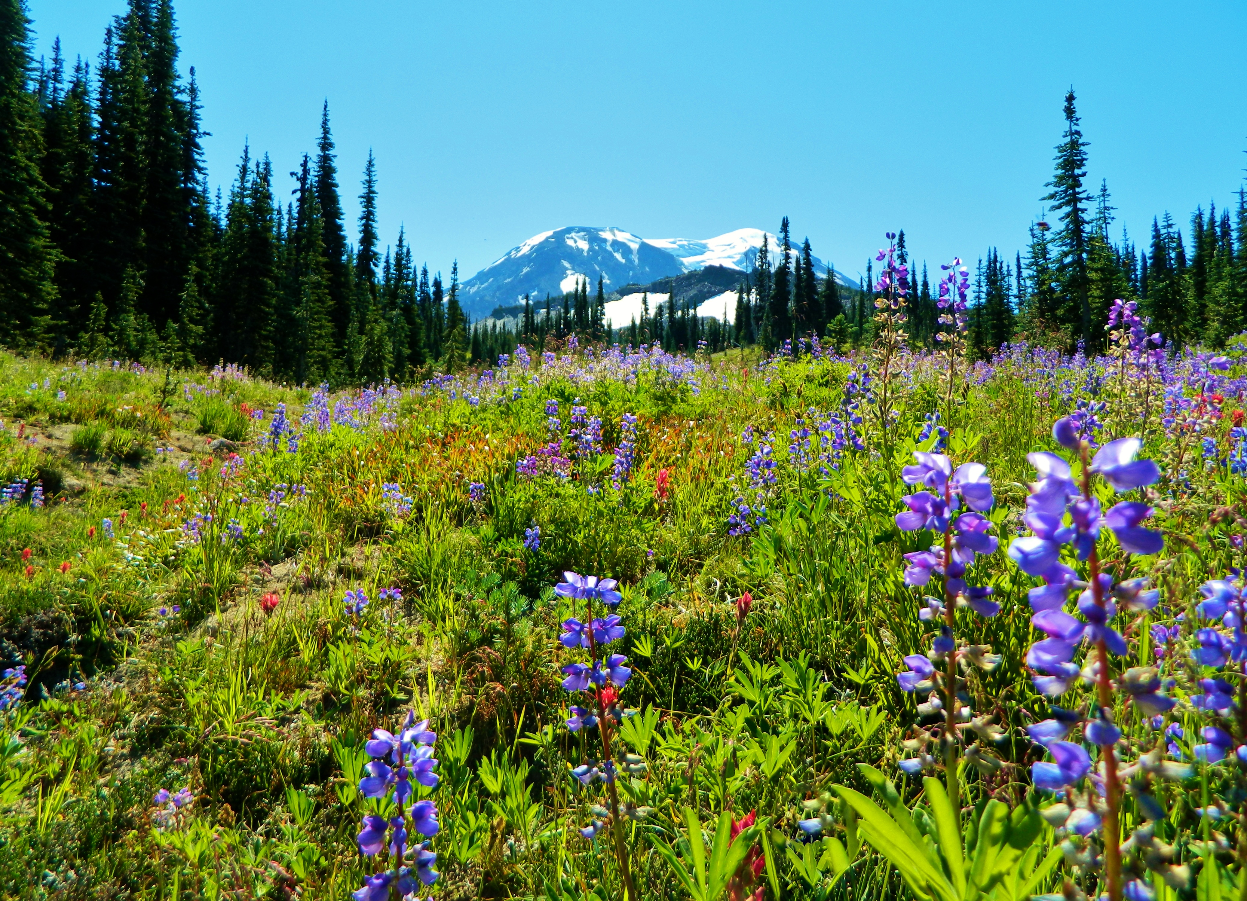
The view of Mt Adams from the Killen Creek Trail/PCT/High Camp Trail 4-way junction. There were many, many wildflowers on this hike:
More flowers from the junction!:
We then started up the High Camp Trail #10.
This is the view down the trail:
The views were amazing! I could see Takhlakh Lake, Council Bluff, Potato Hill, the Goat Rocks, Mount Rainier, Horseshoe Lake, Green Mountain, Mount St. Helens, and more!
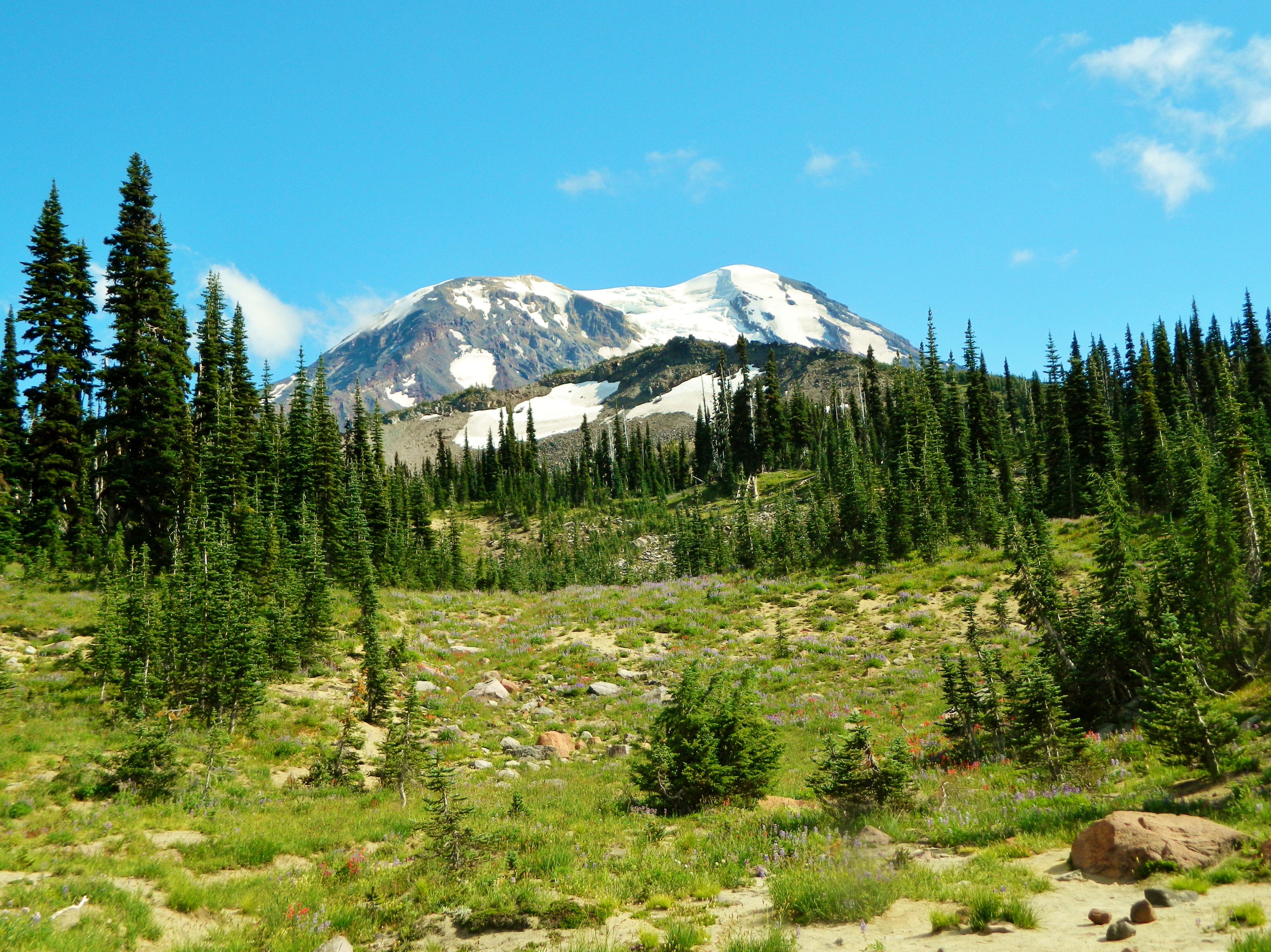
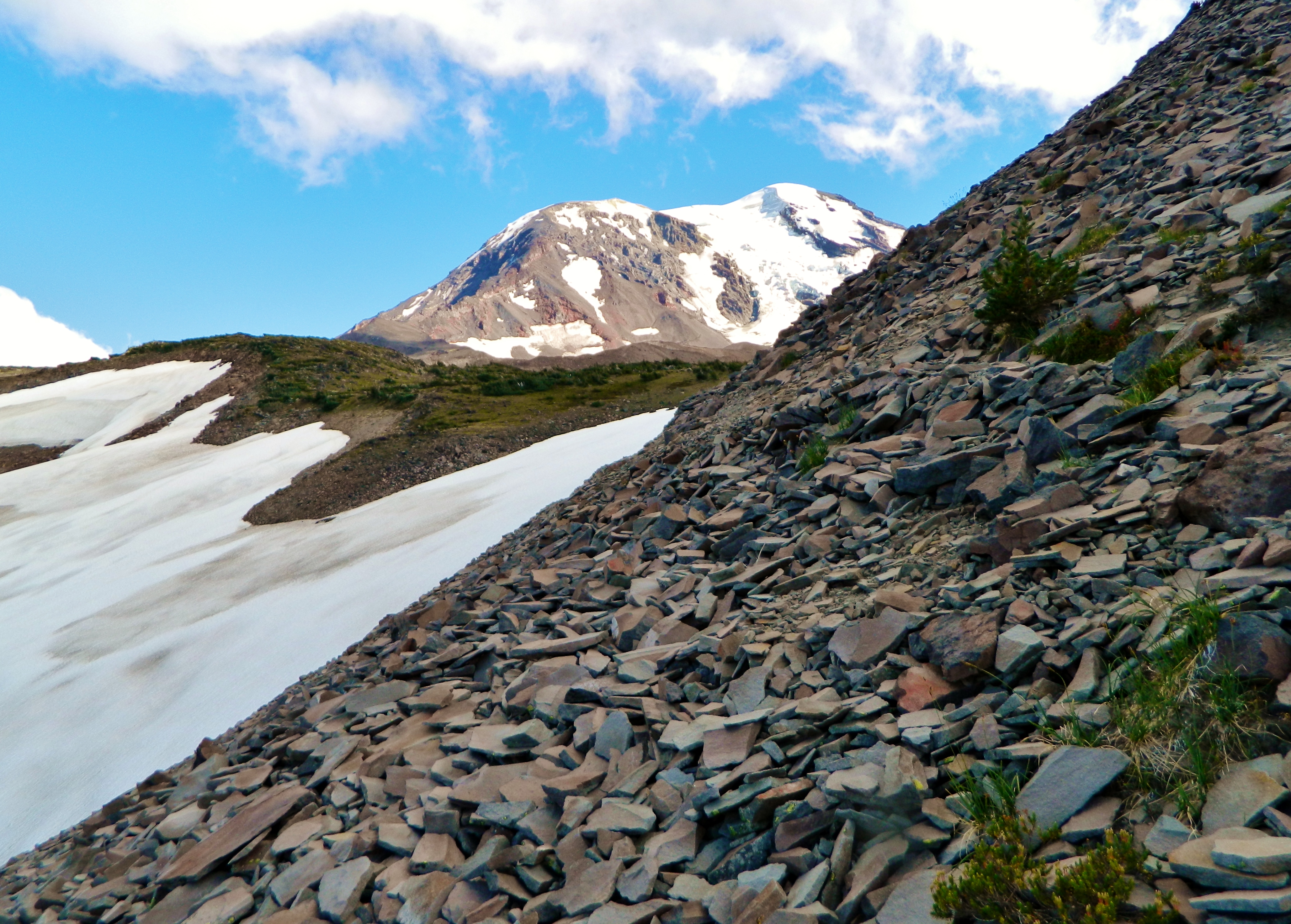
The trail climbed the side of a talus slope. To the left of us was the headwaters of Killen Creek, ahead of us loomed Mount Adams, and behind us were expansive views down the mountainside.
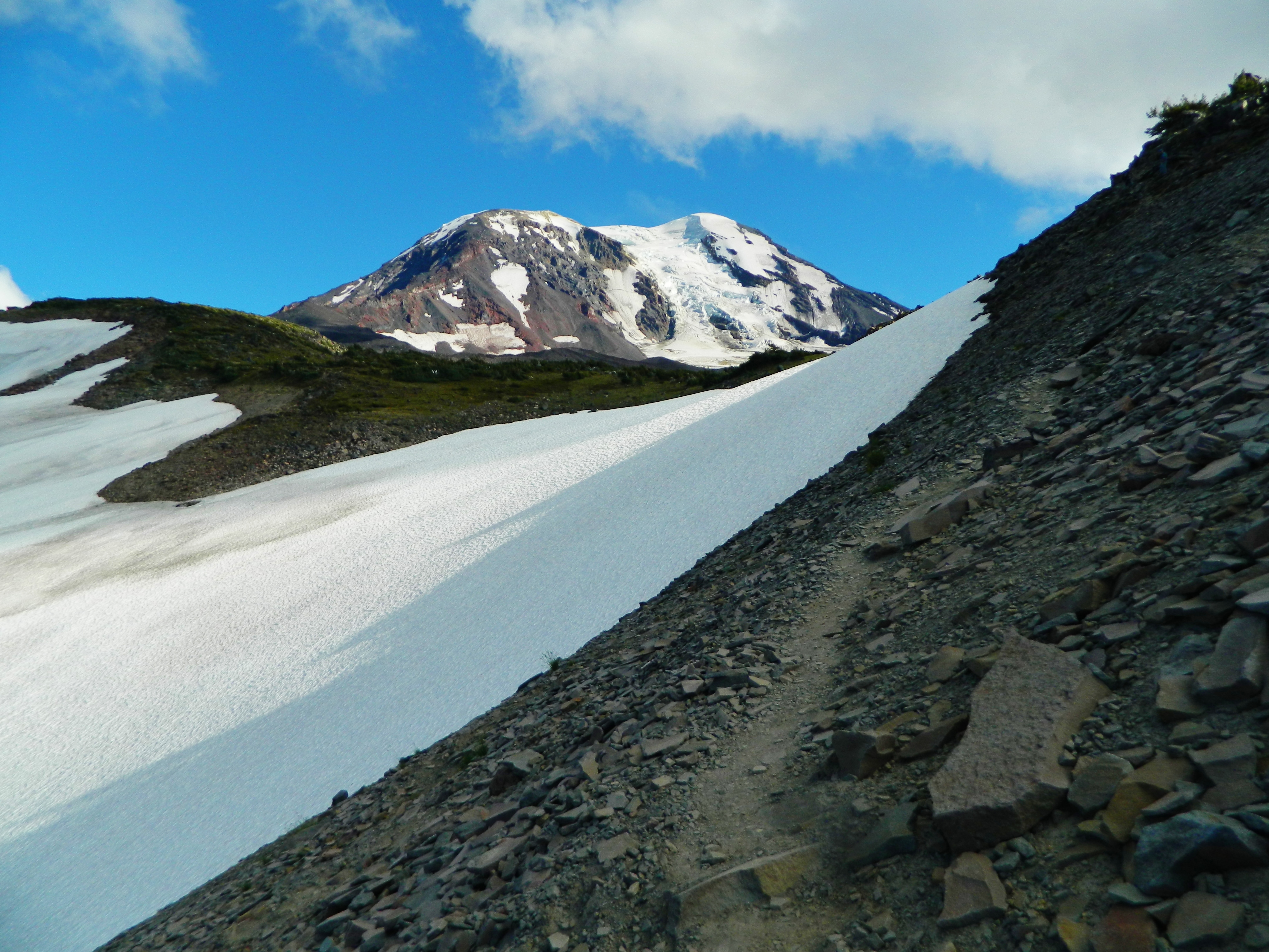
Mount Adams again:
Finally we arrived at High Camp! The views were so amazing! We were just at the foot of the HUGE Adams Glacier, seen cascading here:
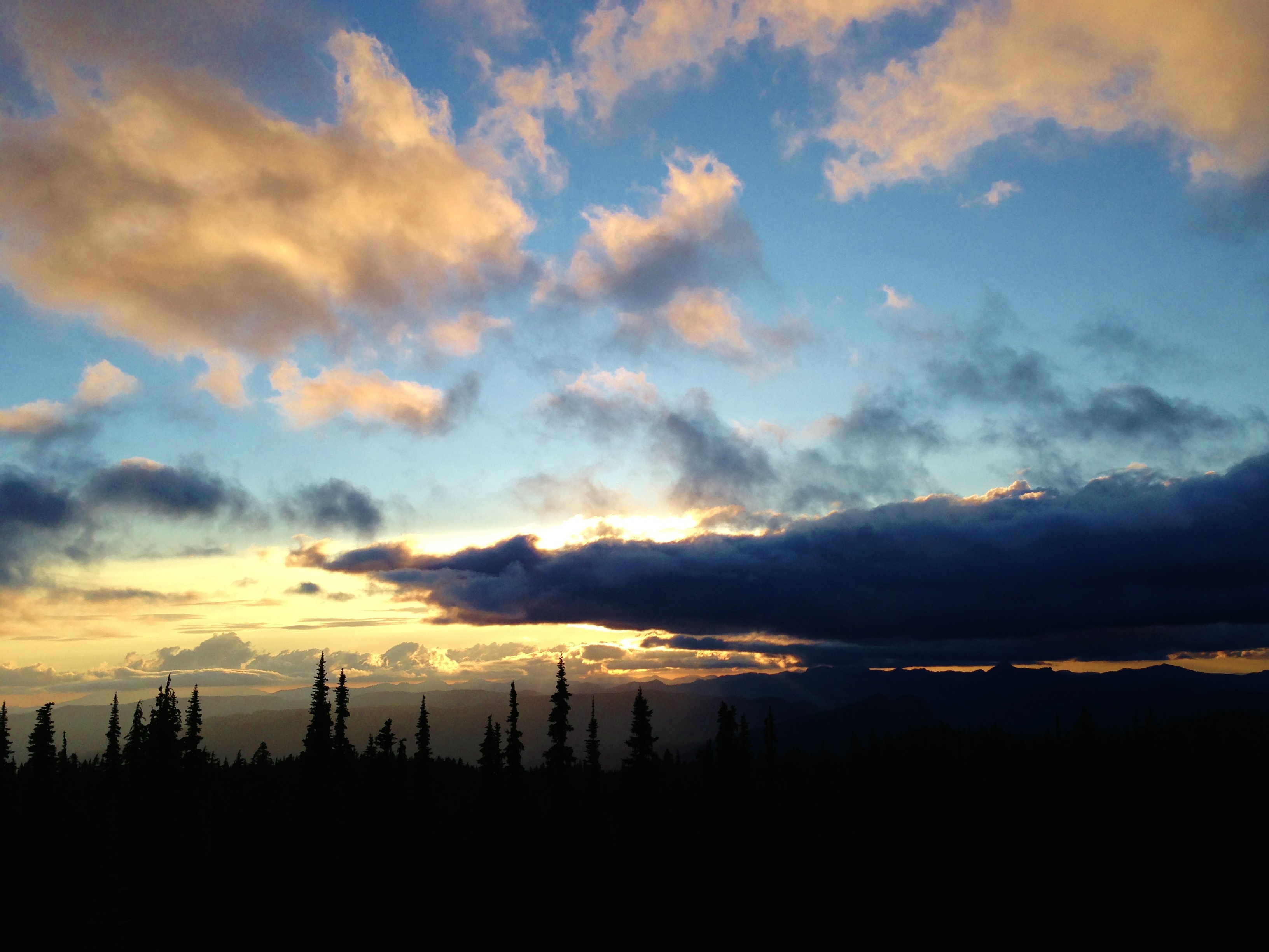
It was a beautiful sunset at High Camp.

It was also an amazing sunset for Adams and Adams Glacier. I think one of the most amazing things here, was the jaw-dropping views of the Adams Glacier, the second largest in the contiguous United States.
Night arrived. We climbed a high point just to the north of our camp. We watched as the moon slowly rose above our camp.

As morning arrived, I got these photos:
Mount Rainier rising to the north. Rainier is the highest volcano in the entire Cascade Range.:
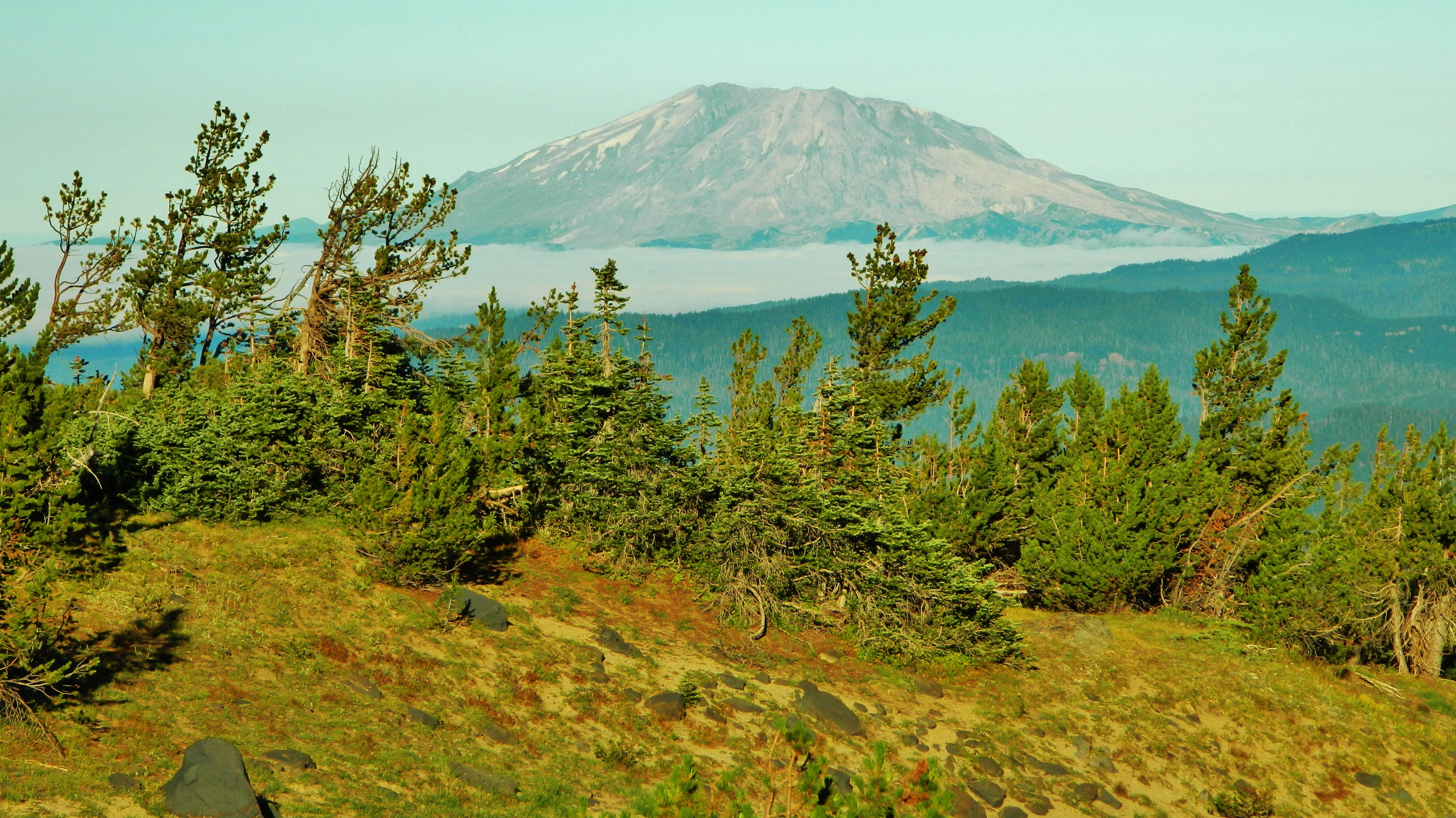
Mount St. Helens' blown off top rising to the west above the morning clouds:
Mount Adams has a pink morning glow:

Oh, and I should mention that on a map, we are only halfway up Mount Adams distance-wise. That's just how big this mountain is. If all of Adams was spread over Manhattan, it would bury the island over 3 miles deep!
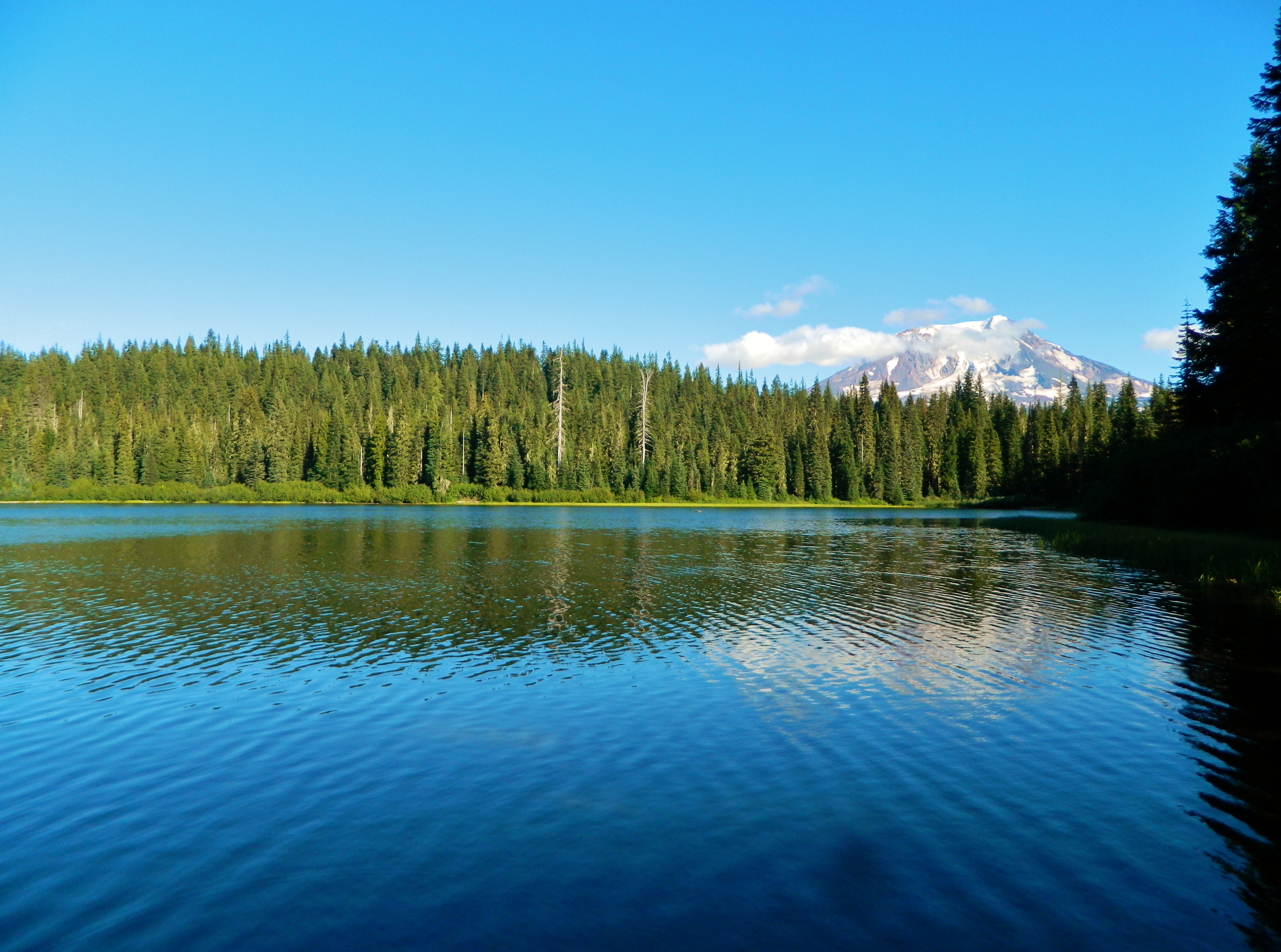
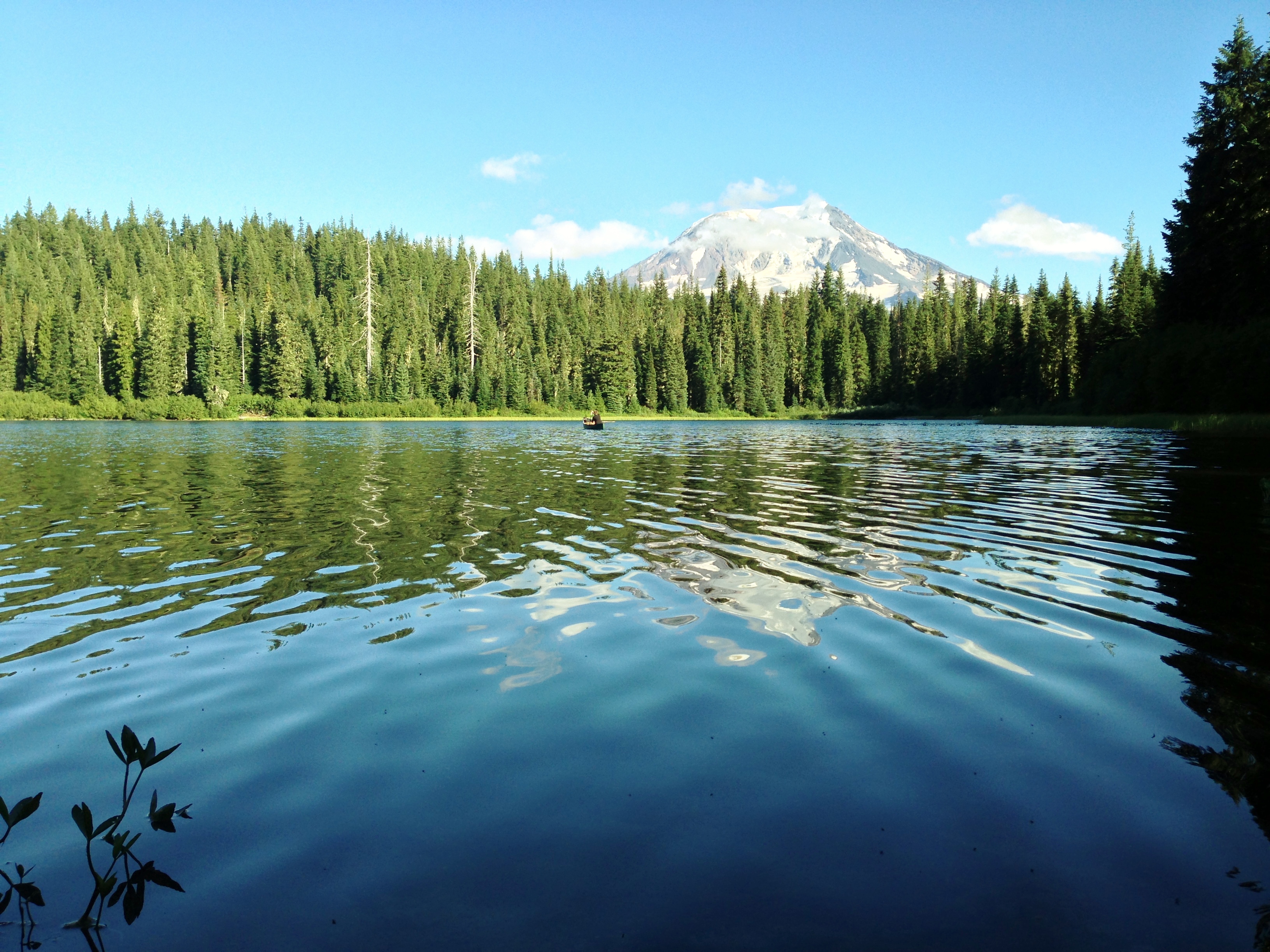
On the 3rd day of our backpacking trip, we headed down from High Camp all the way back to the Divide Camp Trailhead. We arrived at Takhlakh Lake at around 2:30 PM.
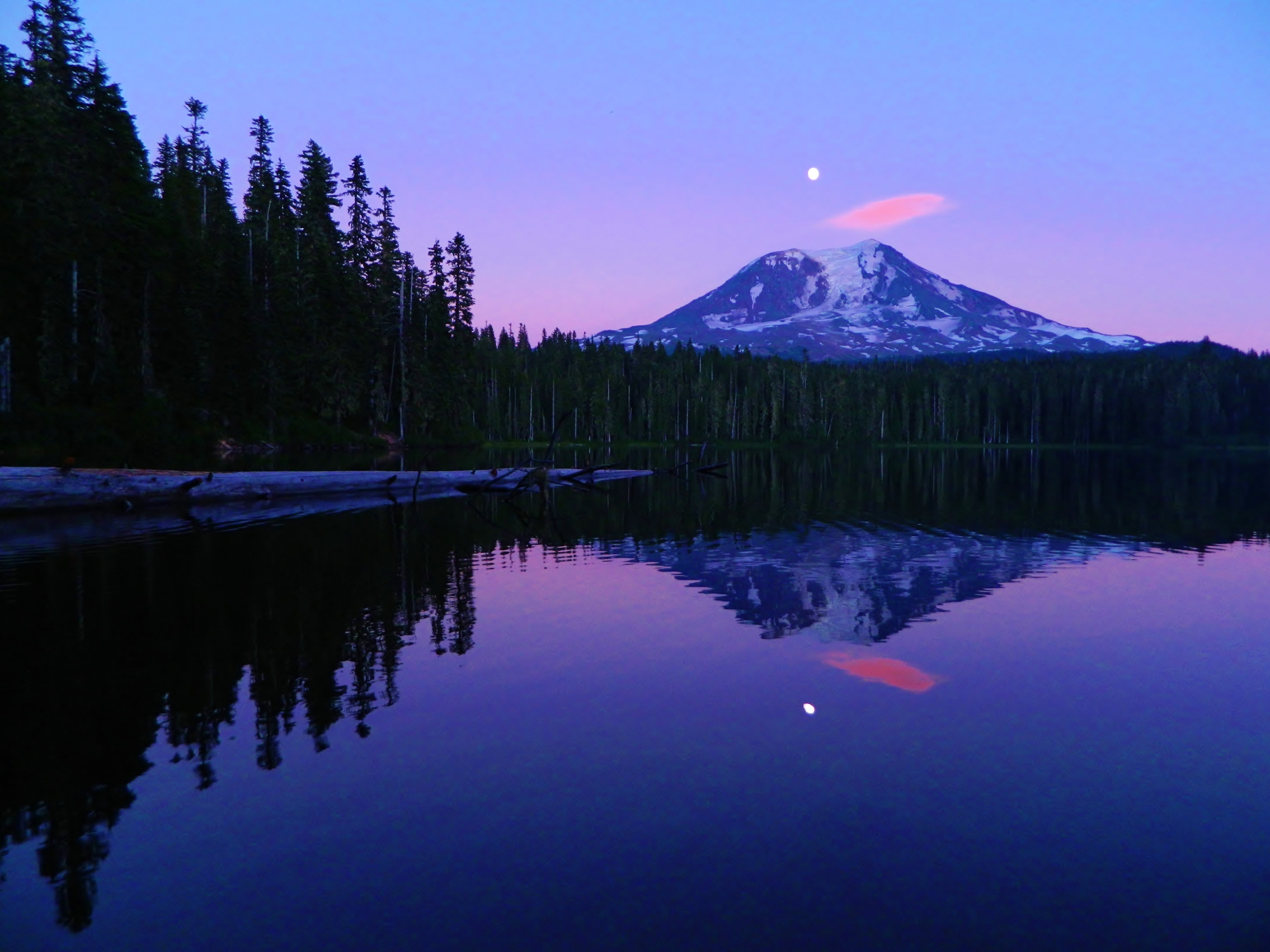
That night, I took this photograph of Takhlakh Lake in the early moonrise:
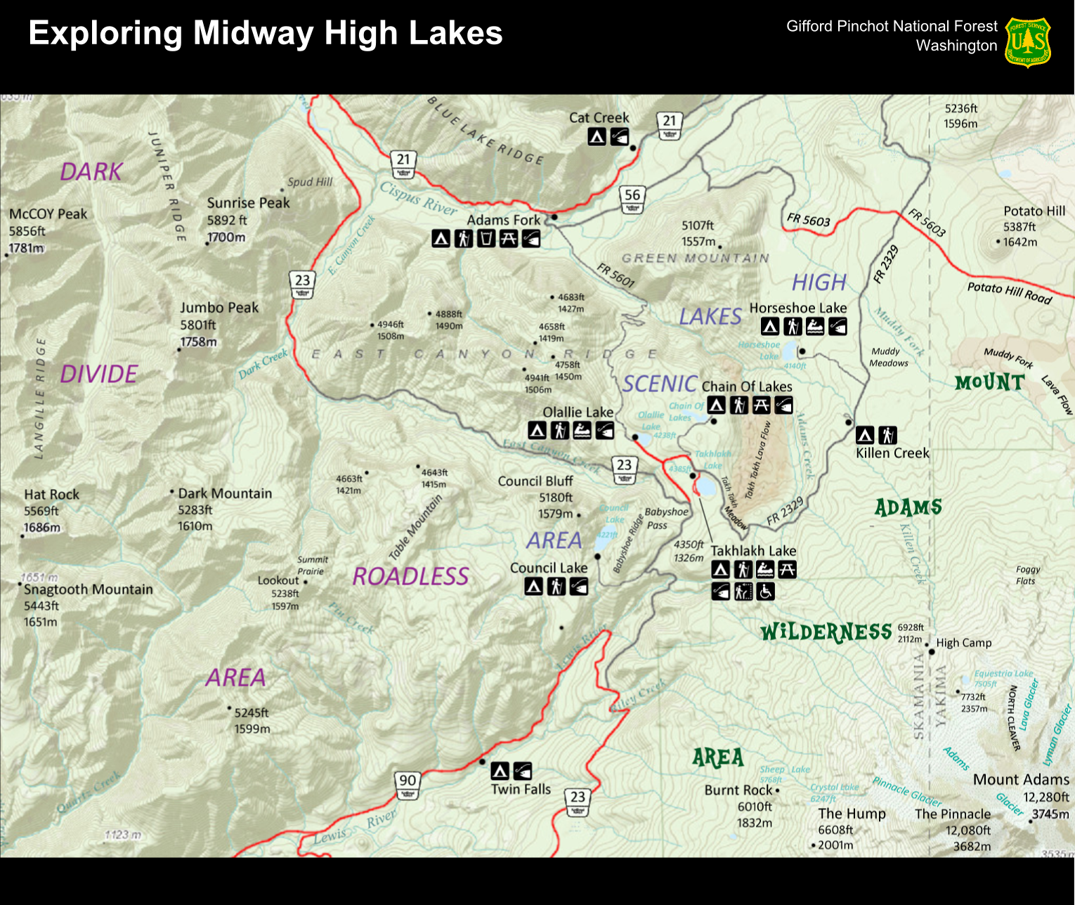
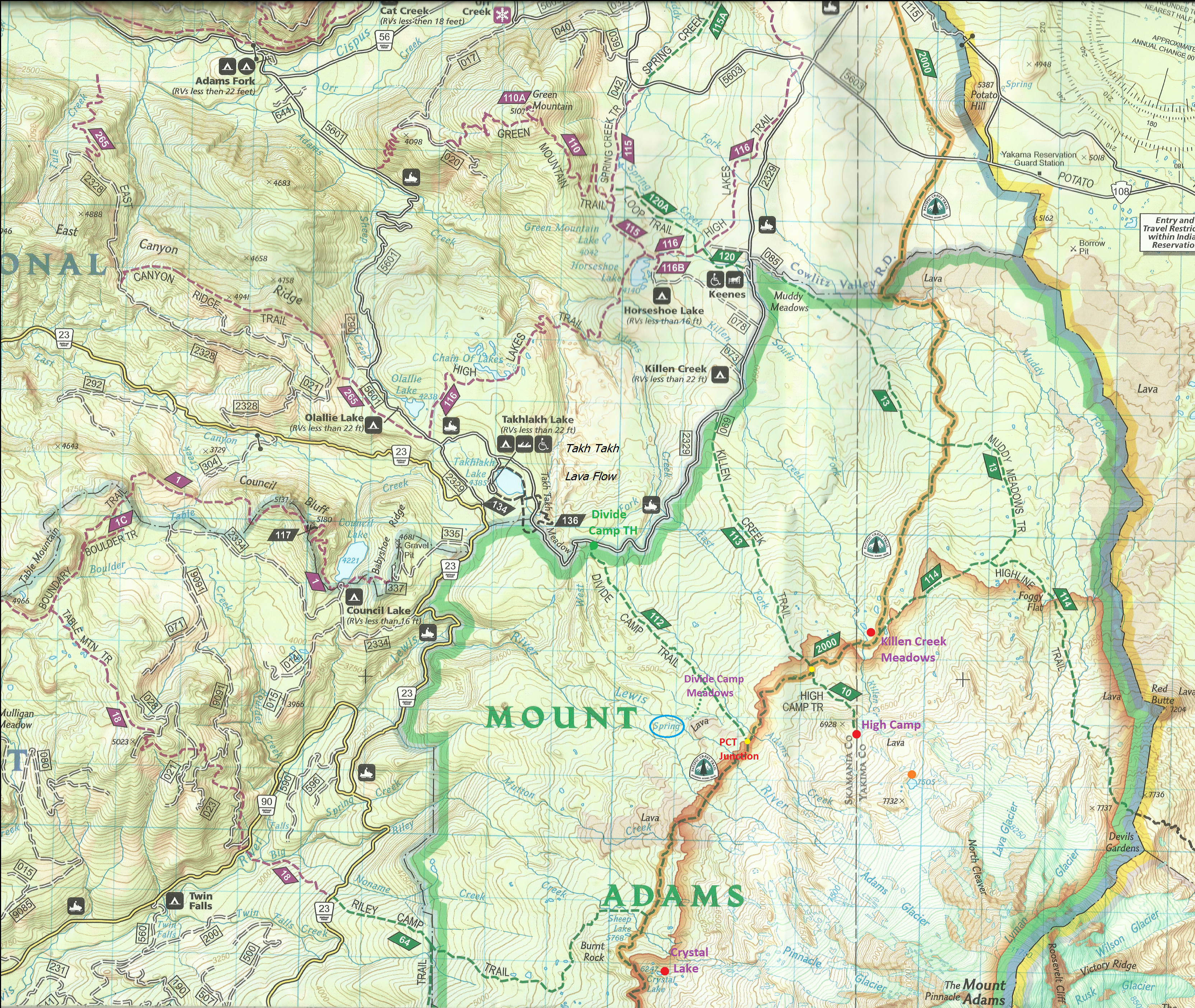
Here is a map I made of the area we visited on Mount Adams. Takhlakh Lake and High Camp are shown here as well:
Source Link: http://fluttershyismagic.deviantart.com ... -358480968
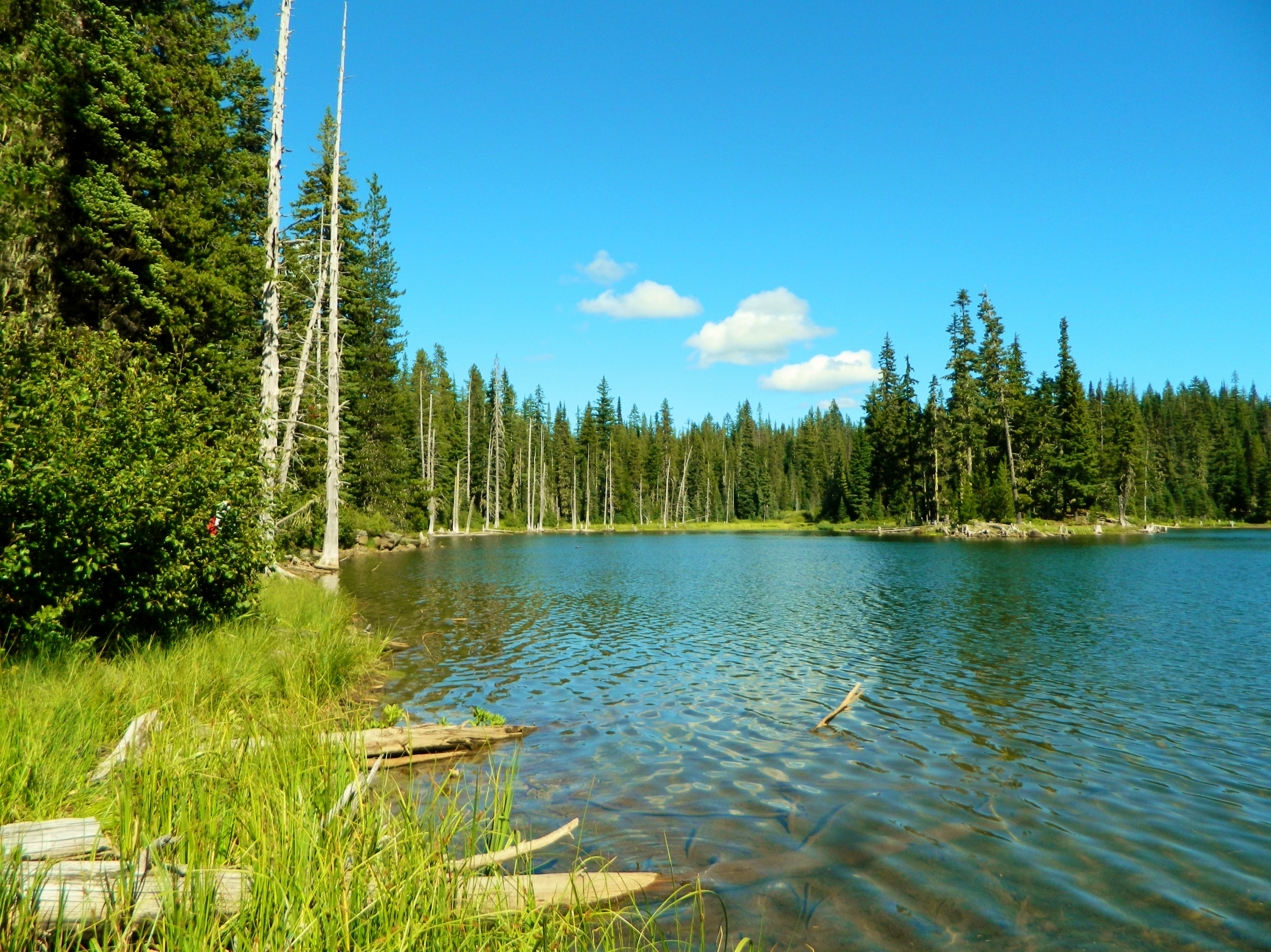
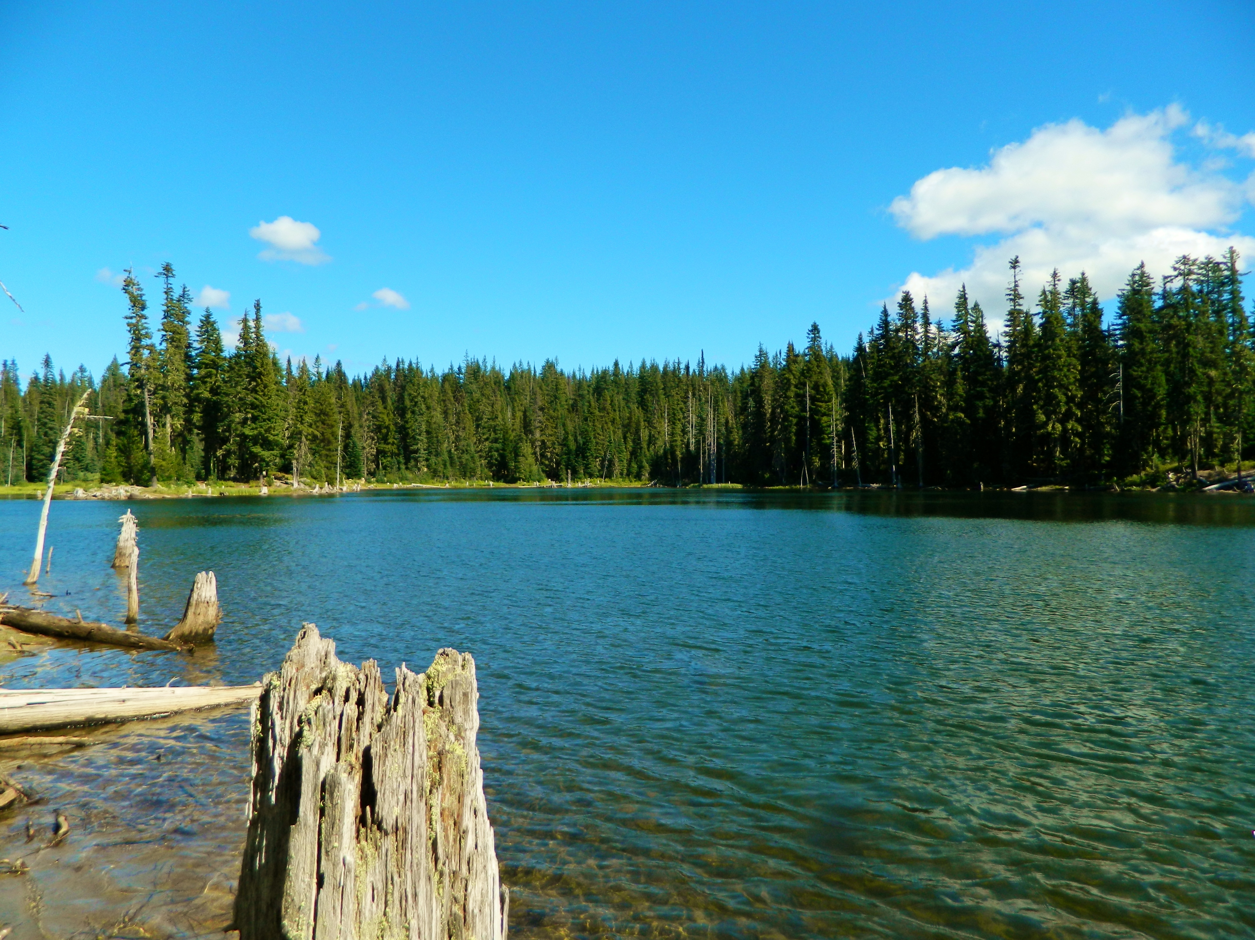
On our last two days, we did some driving around the beautiful Midway High Lakes Area. First we visited Horseshoe Lake, one of the largest of the five lakes.
Horseshoe Lake:
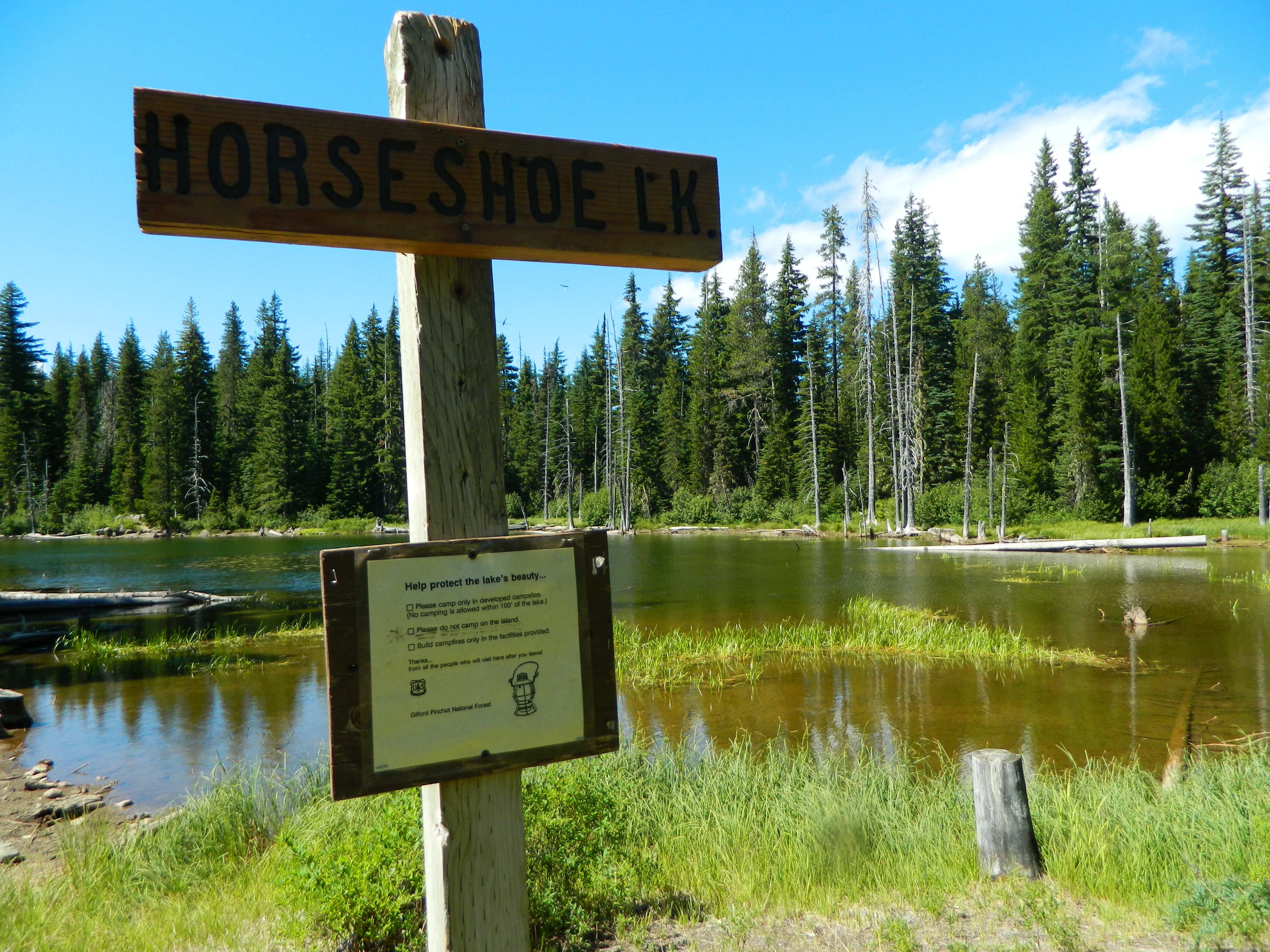
We hiked partway around the lake to get these views:

Then we drove to pretty little Olallie Lake:
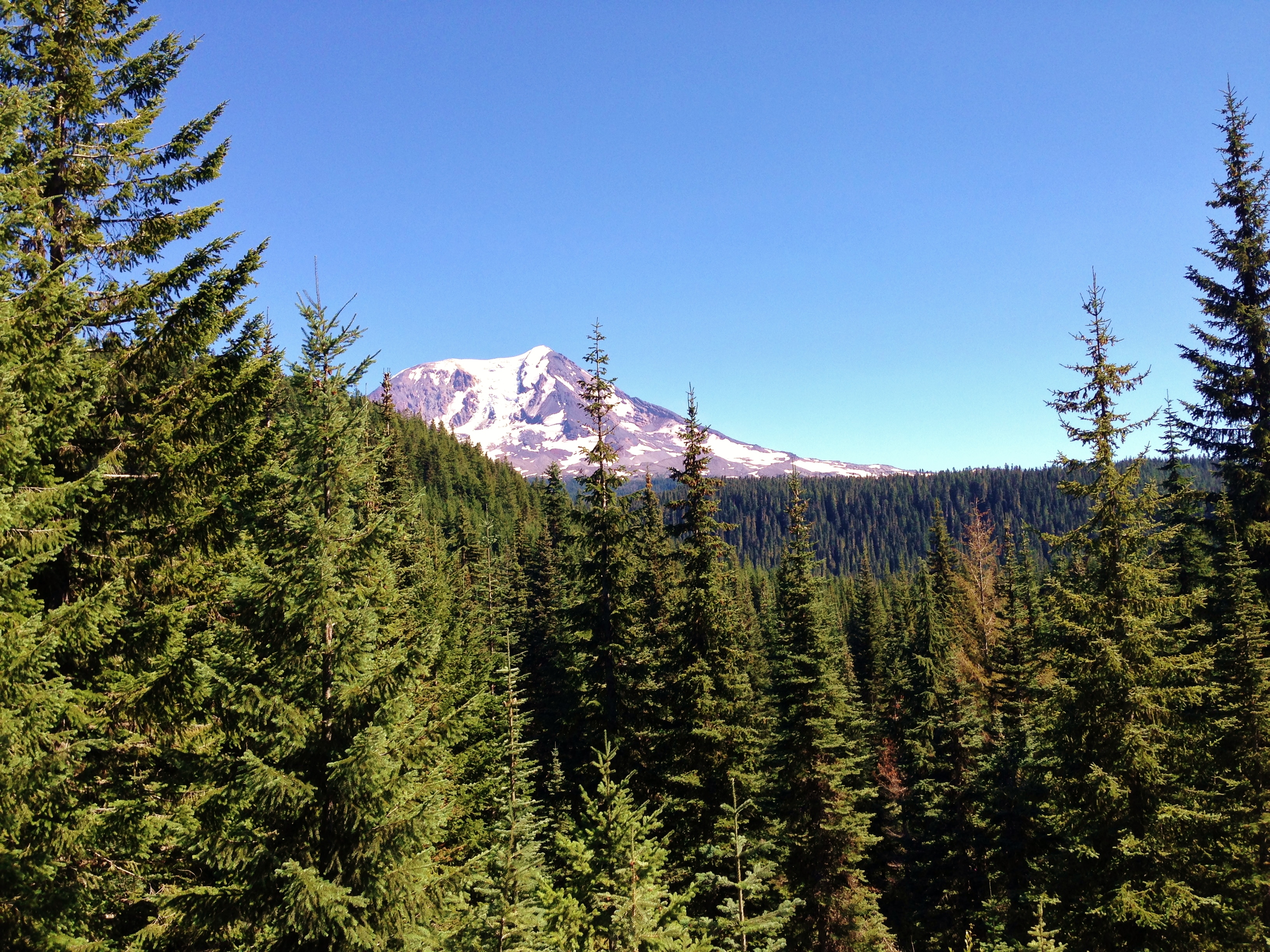
From Olallie Lake, we drove over Babyshoe Pass. Babyshoe Pass is a high mountain pass within the Gifford Pinchot National Forest. Forest Route 23 traverses the pass, northwest of Mount Adams, between Mount Adams flank to the east and Babyshoe Ridge to the west. The pass separates the Lewis River Watershed and the Cispus River drainage. Forest Route 23 traverses the pass, providing the main north-south access on the east side of the Gifford Pinchot National Forest and the many trails within or around the Mount Adams Wilderness Area and the Midway High Lakes Area.
The Pass crosses at 4,350 feet:

Mount Adams comes into view:
Our last lake to see was Council Lake, the largest of the five lakes at 44 acres:
From here, we took a short hike up Council Bluff. At the summit, we were treated to one of the most amazing views in the Mount Adams area.
View from the top:

Panomama shot:

On our way home, on the last day, we took a side trip to the Big Tree. Big Tree (also known as Trout Lake Big Tree), is a massive Ponderosa pine tree in old growth pine and fir forest of southern Washington state, at the southern base of Mount Adams. The tree is 202 feet (62 m) tall[2] with a diameter of 7 feet, and is one of the largest known ponderosa pine trees in the world.
Big Tree:

Looking up:

A scan of Nat Geo Maps and areas I had in mind to hike to on this trip. Next time I come here, I need to plan for more time.
All in the quote is old stuff. I no longer have quite the same "views" now (some the same, some has changed). So feel free to skip.
Also, I'm interested next year in backpacking or hiking to one of these: Crystal Lake, Devils Garden, Killen Creek Meadows, Foggy Flays, or High Camp/Iceburg Lake again. Which do you think is better? I'm interested in a trip with amazing views and great photographing opportunities.My ideas for the future of Mount Adams and it's unique landscape:
I think that Mount Adams, one of Washington great sentinels of the Cascades, deserves more attention, and for really good reasons. Adams stands at 12,286 ft, making it the second highest mountain in the Cascades north of California. It is a huge mountain; when measured in terms of eruptive volume, it is the second biggest in the Cascade Range, after Mount Shasta. Adams is characterized by lush, flower-filled meadows that rival that of Mount Rainier's own, tumbling creeks and waterfalls, dramatic canyons, and dense, old growth forests on it's lower slopes. The mountain is also home to numerous varieties of species of wildlife, some of which are endangered.
You would think that such a great and spectacular mountain would receive national recognition, yet only about a third of the mountain is protected as the Mount Adams Wilderness. It would be great to see in the future that the Mount Adams Wilderness be expanded to include more of the mountain's unique and changing landscape, since the Mount Adams Wilderness only protects about a third of the mountain. My vision is that the areas directly to the north of the mountain, directly south of South Climb Trailhead including the A.G Aiken Lava Bed, and directly east of Forest Road 23 would be designated as wilderness. (Basically all the currently designated roadless areas around Adams lower flanks.) It would be great to see that the High Lakes Area centered around Takhlakh Lake to be designated as the "High Lakes Scenic Area," thus giving this area a higher level of protection from encroaching activities, such as destructive logging.
If anyone looks at any satellite image of the Pacific Northwest forests outside of wilderness areas, scenic areas, or national parks, (especially in the Mount Hood NF and the Gifford Pinchot NF), you will easily notice a "checkerboard" of clear-cut logging that goes otherwise unnoticed when driving through some of the main forest roads. You won't see it while driving, because of a 10 foot corridor of trees around the road's perimeter.
It's also interesting to know that only 4% of all forested land in Oregon and 10% of all forested land in Washington are protected in the form of wilderness areas and national parks.
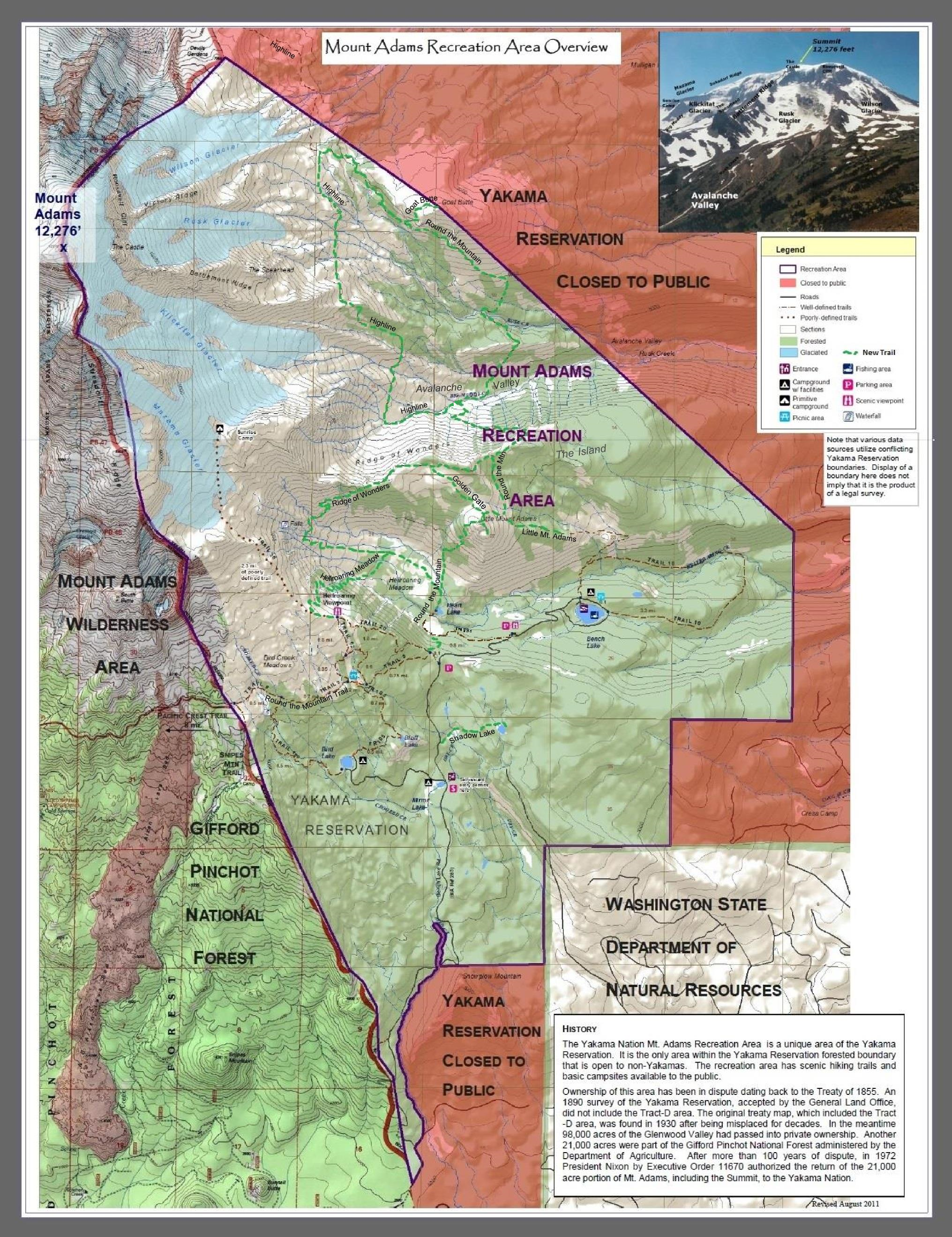
For more hiking opportunities on Mount Adams, it would be great to see new trails built within the Mount Adams Wilderness, exploring key areas around High Camp (Adams Glacier Meadows), Crystal Lake, as well as trails exploring the rugged east side of the Mountain within the Yakima Nation Mount Adams Recreation Area. My biggest (and craziest!) idea is completing the circumnavigation trail on the rugged east side of Adams, in the Mount Adams Recreation Area, allowing easier access this unique landscape of dramatic canyons, rocky edifices, tumbling waterfalls, creeks, peaks, and rocky ridges, that otherwise most people would never see or know about. Basically a rule of thumb is that the more popular the mountain is, the more it receives protection. Just look at the areas surrounding our Mount Hood: there are so many new wilderness areas just in 2009 that were designated, as well as old wilderness areas getting an expansion (i.e. Clackamas Wilderness, Mount Hood Wilderness expansion, Mark O Hatfield expansion, creation of White River Wilderness.) Then take a look at the Gifford Pinchot NF; one can easily see that it is far more neglected and ignored.
Map of possible new hiking trails in the east side of Mount Adams:
What do you think? Currently, there are three national parks centered around a Cascade volcano. Those are: Lassen Peak NP, Crater Lake NP, and Mount Rainier NP. There are also two National Volcanic Monuments; those are: Mount St. Helens NVM and Newberry NVM. There are many benefits to national park designation. For one, they have much larger budgets than the USFS does. This translates into better trail, campground, road, and facility maintenance. It also means trail building. I think that many of our Cascade volcanoes are deserving of a promotion, a promotion to a national park level. I'm still not quite sure though if it's best.
What do you think about these potential candidates?:
Mount Baker National Park
Mount St. Helens National Park
Mount Adams National Park
Mount Hood National Park
Three Sisters National Park
Mount Shasta National park
Thank you!


