Birkenfeld Mountain

This forum is used to share your experiences out on the trails.
Post Reply
User avatar
K.Wagner
Posts: 652
Joined: June 2nd, 2013, 1:25 pm
Location: Vancouver, WA

Birkenfeld Mountain

Post by K.Wagner » September 28th, 2013, 10:33 pm

It was a dark & stormy morning.....

But, I had seminar to attend at the Skamania Lodge, with paid mileage. 1:00pm, with a buffet … how could I say no? And, the rain wasn't really supposed to arrive until the evening. And I still had several minor peaks in the Rock Creek drainage to summit. So close …. and with paid mileage to Stevenson …. and a buffet!

So, after spending some time on the maps, finally decided that realistically the only one I should go for should be Birkenfeld Mtn. That's the big unnamed bump on the ridge immediately N of Table Mtn, that nobody seems to know the name of (except of course Don Nelson) and the PCT contours around on its way up near Three Corner Rock. Wasn't sure how far up the road I could get in the old 2WD Toyota, with it being so wet, but worth a try.

So managed to leave Vancouver around 7:30, which is pretty good for me. Drove out Hwy 14 to the Stevenson Museum, and worked my way up the hill, until the pavement ends and the signs says CG2000, then in just under a mile made the left turn onto the smaller CG2020. Now, on my scale of roads, this road isn't so bad. Would rather drive this little road than the 41 Rd up from Sunset Falls, but it is a rough road, no Mini-Coopers here! After a couple of miles of 1st & 2nd gear, finally came to the odd 5 way intersection, which is where I had planned to park. Looked at my watch. It had taken longer than planned to get to this point. Do I dare continue driving on up the road??? Had hiked it 2 years ago, and remembered it as steep. Oh well, decided to see how it went, could always back down. So, more 1st gear crawling, and no real problems. Got narrow & really wet. This is not a road to drive if you worry about your paint. (But no washboard sections!)
IMG_2108-S.jpg
Finally got to where the road passes over the N ridge, and an abandoned road spurs off to the left, up the ridge. Parked, put on the rain gear, started walking.
IMG_2109-S.jpg
Had not seen a single other vehicle on the road, decided to forgo the orange hunter repellant vest. I could hear the wind above in the tree tops, but on the ground, wasn't bad at all. I had read about an easy to follow track going up the ridge line, but couldn't find anything that looked promising. Finally after about 1/3 mile on the road, decided to climb up to the ridge line, and there, in about 100 ft, was this odd track going up the hill.
IMG_2110-S.jpg
This would have been beautiful with Bear Grass in bloom!
IMG_2111-S.jpg
Followed the track most of the way to the summit, and broke out on a open slope on the E side. Again, this would have been very pretty in the early summer.

Rugged Greenleaf Peak, with the gorge vanishing in the east! :lol:
IMG_2112-S.jpg
Looking south, the back side of Table Mtn & across the river Tanner Butte!! :lol:
IMG_2113-S.jpg
Then just a little bit more, the summit!! OH the glory!!
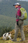
A selfie with Tomlike Mtn in the background!! :lol:
IMG_2114-S.jpg
When I turned around and started down, was pretty thankful that I had the trusty GPS with me, wasn't positive I could find the track in this maze of trees. Did find it OK, but was a comfort knowing that the GPS had that little track line on the map.
IMG_2115-S.jpg
On the way down, the clouds were flying through this gap, at least 30MPH, but again, on the ground was quite. Notice that the bear grass stems aren't blurred in the picture.
IMG_2116-S.jpg
Got back to the truck, stripped off my wet jacket, rain pants & boots, and tossed them in the back of the truck. Turned around and started down. OH MY, didn't recall this stretch of water on the way up, I think the creeks, they are arisin'!!
IMG_2118-S.jpg
Uneventful drive back down to the CG2000 Rock Creek Road. Had a little time left, so drove up to see the Steep Creek Falls. They were really ripping!
IMG_2120-S.jpg
Finally turned around and headed downhill to the lodge in time for the buffet.
Turns out this buffet came in a brown bag. It was still good.

My walk was only about 1 1/4 miles, 530 ft.
If one was to park at the 5 way intersection, would add about 3 miles & 700 ft.
Kelly
There is no shortcut to anyplace worth going to.

PM me about the soon to be released:
Skamania 231
"How to really get off the beaten path in Skamania County"

User avatar
awildman
Posts: 918
Joined: June 6th, 2009, 5:20 pm
Location: Portland

Re: Birkenfeld Mountain

Post by awildman » September 29th, 2013, 11:14 am

Nice little jaunt... I love this photo.

Image

What day was this?
Rambling on at Allison Outside

User avatar
K.Wagner
Posts: 652
Joined: June 2nd, 2013, 1:25 pm
Location: Vancouver, WA

Re: Birkenfeld Mountain

Post by K.Wagner » September 29th, 2013, 11:43 am

It was yesterday, Saturday.

I just about got blown of the road on the way back, by that storm that came through!
Kelly
There is no shortcut to anyplace worth going to.

PM me about the soon to be released:
Skamania 231
"How to really get off the beaten path in Skamania County"

User avatar
Peder
Posts: 3401
Joined: May 28th, 2008, 10:02 pm
Location: Lake Oswego

Re: Birkenfeld Mountain

Post by Peder » September 29th, 2013, 3:23 pm

As adventure goes, with the driving, rain and a 1.00 pm appointment in Stevenson, this is right at the "Don" end of the scale! A worthy ascent of Birkenfeld Mountain!
Some people are really fit at eighty; thankfully I still have many years to get into shape…

User avatar
Guy
Posts: 3333
Joined: May 10th, 2009, 4:42 pm
Location: The Foothills of Mt Hood
Contact:

Re: Birkenfeld Mountain

Post by Guy » September 29th, 2013, 5:30 pm

What Peder said! :)
hiking log & photos.
Ad monte summa aut mors

User avatar
Sean Thomas
Posts: 1647
Joined: February 25th, 2012, 11:33 pm

Re: Birkenfeld Mountain

Post by Sean Thomas » September 29th, 2013, 8:36 pm

Warm food after a soggy hike is always the best. I know Van Marmot likes Birkenfeld a lot too and has spent quite a bit of time exploring around up there.

User avatar
K.Wagner
Posts: 652
Joined: June 2nd, 2013, 1:25 pm
Location: Vancouver, WA

Re: Birkenfeld Mountain

Post by K.Wagner » September 30th, 2013, 6:21 pm

Guy,

Just found your TR from June, 2010. Loved this picture of Don Nelson trying to find the on switch!
884175179_bTTSS-M.jpg
This picture made my day! Found myself laughing every time I thought about it!

Have seen other pictures of the rails & car artifacts around Birkenfeld. Do I read your TR correctly that it is all directly downslope of the log platform?

Also read on one of Don's posts on Summit Post that to drive the road up to the N ridge: "4WD an absolute necessity". Well I just proved that not to be the case. Proved that the only thing that is an absolute necessity is an absolute immunity to common sense!
Kelly
There is no shortcut to anyplace worth going to.

PM me about the soon to be released:
Skamania 231
"How to really get off the beaten path in Skamania County"

Post Reply