This was another of our sort'a bi-annual visits to this great park. This year we divided out time between Many Glacier on the E side and Lake McDonald on the W side, with the idea of doing some of the trails we'd missed before (or which had been closed due to bear activity). There were fires S near Missoula and the air was thick as we entered the park, but, thanks to a front that passed overnight, it was almost clear (there was still a faint red tinge in the air) by the next morning.
Hike #1
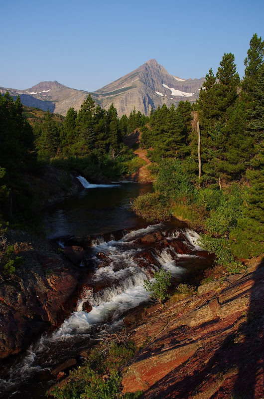
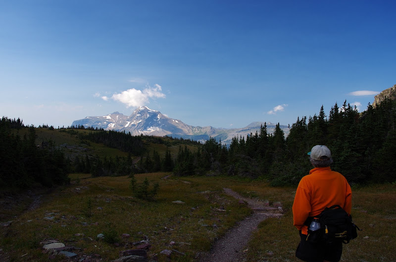
Our first hike was up to Swiftcurrent Pass from Many Glacier (13.2 mi RT, 2300' EG) - something we hadn't been able to do in previous years because of foraging bears. But this year the bears were busy elsewhere so we were off early,
up the Swiftcurrent valley,
and past Redrock Falls.
The trail is almost level until it reaches the head of the valley,
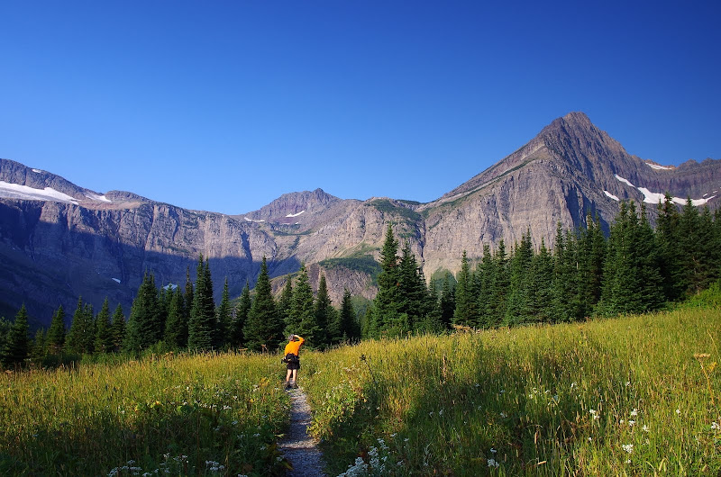
then it starts up the ridge to the right.
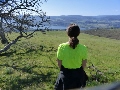
Fortunately, the loved one has no fear of heights,
given that this trail is a real cliff-clinger at this spot (arrow) where she's standing.
But you do get a great view of the Swiftcurrent valley
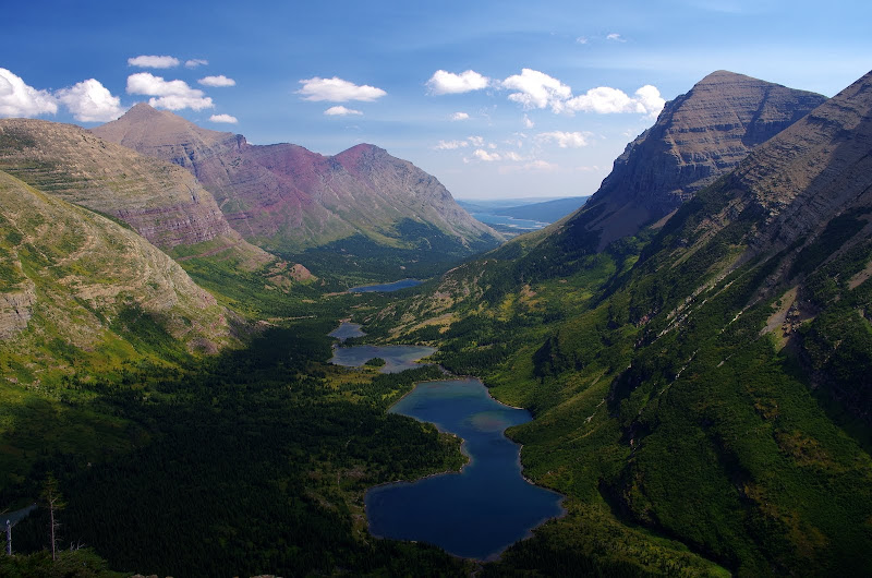
and of the Swiftcurrent Glacier below Mt. Grinnell from here.
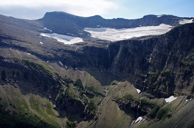
From the pass,
it's possible to see W to Heavens Peak (8987') across the McDonald Ck valley.
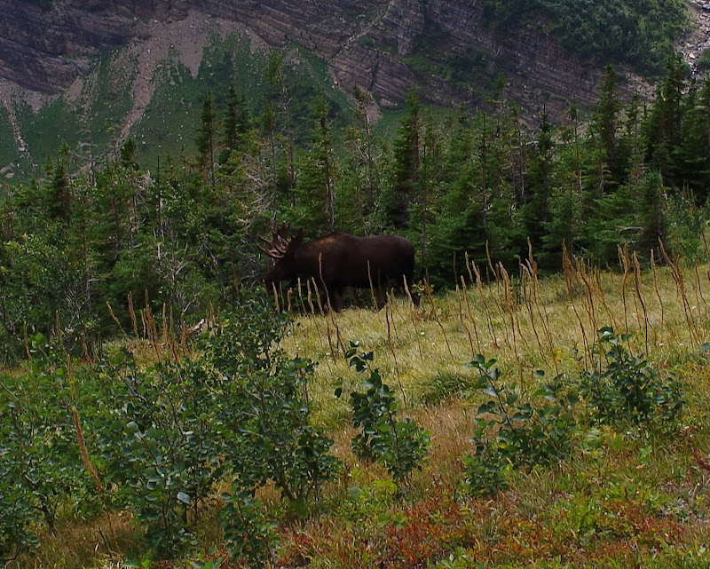
The hike back was enlivened by two moose who browsed their way across the trail at the head of the valley (didn't see any bears this year).
Hike #2
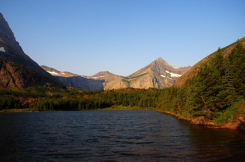
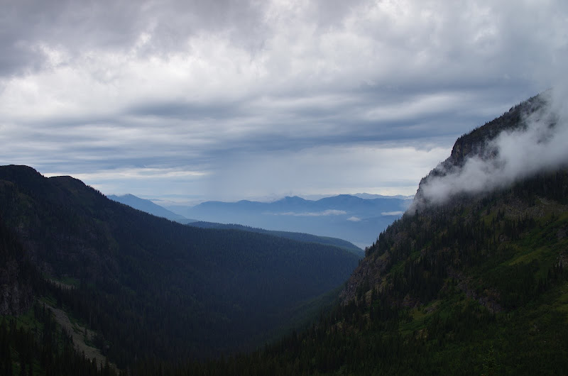
Our second hike was NE on the Redgap Pass trail toward Poia Lk, which give good views of the lower Swiftcurrent valley.
But there was a foraging grizzly near Poia Lk, so we called the hike at Swiftcurrent Ridge Lk,
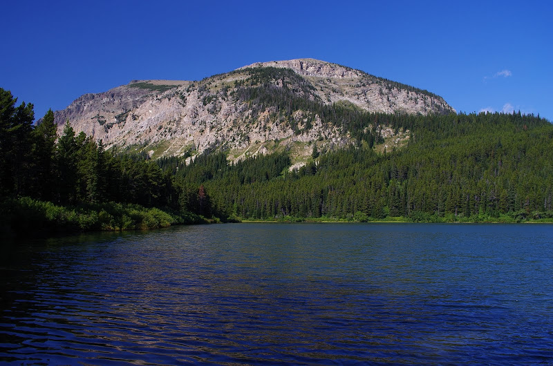
with its views of the Yellow Mtn complex.
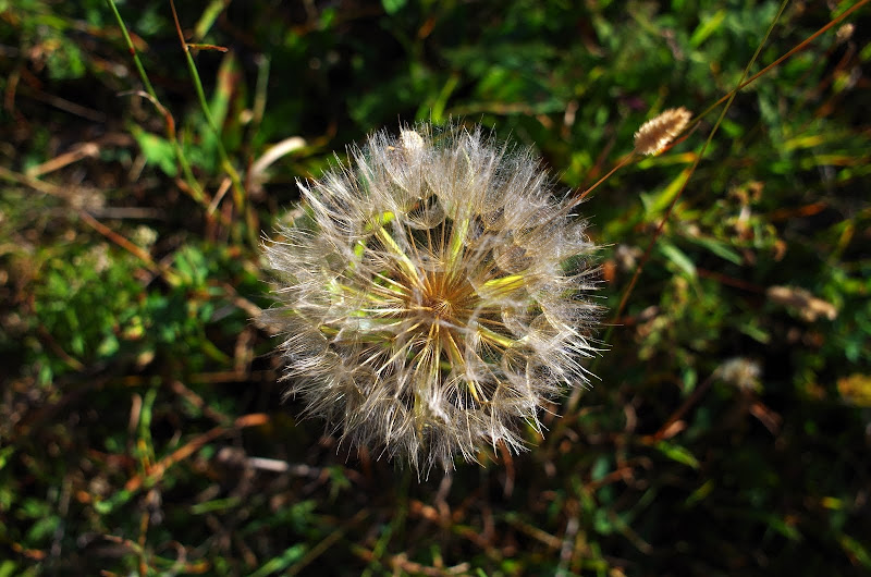
Then, after a quick smell of the flowers, it was back to the TH (7.2 mi RT, 1000' EG).
Hike #3
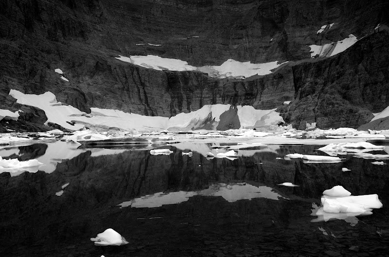
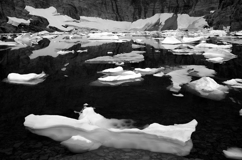
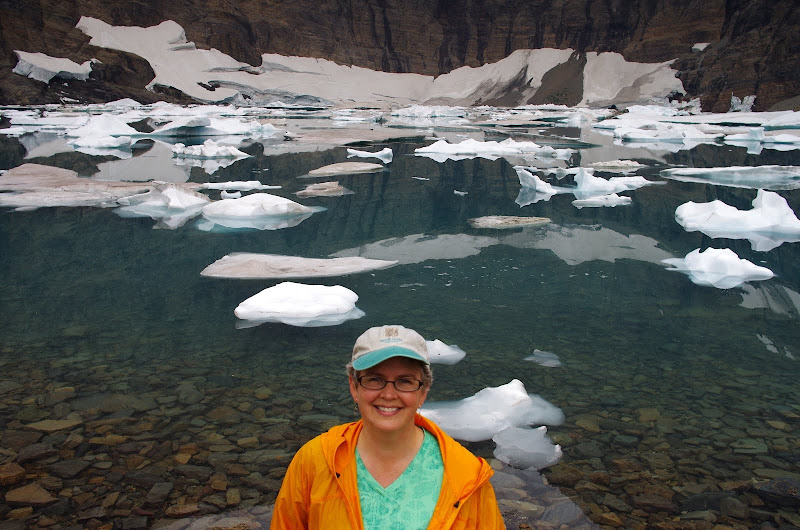
After two days of great weather, a front moved in, putting something of a damper on our hike to Iceberg Lk (9.4 mi RT, 1200' EG). The lake sits in a large E-facing cirque that keeps conditions there on the cool side.
So, as promised, the lake is filled with bergs.
Colder, but still smiling, we headed back.
It was good we left early because, despite the gloomy weather, we passed 40+ hikers on our way back (this must be one of the most popular hikes in the park).
Hike #4
We spent a day (of nice weather) getting settled at Lake MacDonald, thereby allowing yet another front to push in for our planned hike to see Sperry Chalet (12.8 mi RT, 3400' EG). The loved one decided that staying in the lodge would be more fun than hiking in the rain, so I headed off for the chalet solo, in less than cheery weather.
The trail climbs so gradually and smoothly that I hardly noticed the gain and was soon at the chalet,
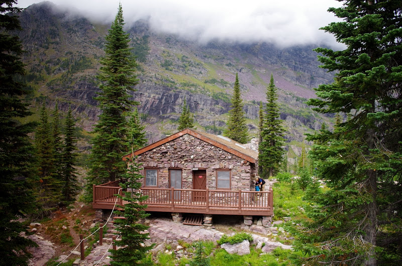
which is at a crossroads of various trails,
and commands a great view (on a clear day) of the Lake McDonald valley from its front porch. It managed to rain only while I was in the chalet enjoying a quick snack!
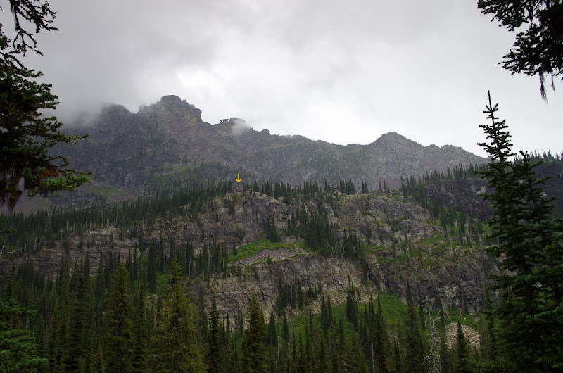
On the way back, I had to look hard (arrow) to actually see where the chalet is perched on the cliff.
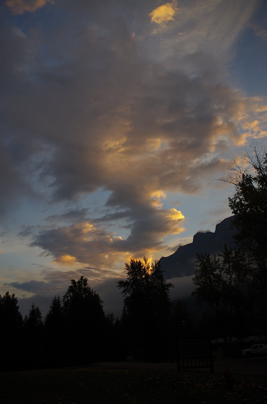
As is sometimes the case, by the time I got back to the TH, the clouds were parting
and by evening of this, our last day in the park, sunny skies were enroute for our journey home.
But, there are still trails we haven't hiked and chalets we haven't stayed in, so we'll be back....
Glacier National Park August 2013
- renegadepilgrim
- Posts: 585
- Joined: October 15th, 2010, 8:11 pm
- Contact:
Re: Glacier National Park August 2013
Great pics! Glacier was quite amazing this year...if you think some of these trails were busy you should have been on the Highline Trail Loop in mid-August...it was a highway of hikers until about the 5 mile mark, and even up to the Granite Park Chalet, it was still a steady stream of hikers. We had our trail legs from already doing 38+ miles in the backcountry, so we did the whole thing in about 4 hours (11+ miles) but there were some people who had started much earlier and were finishing at the same time as us. I enjoyed our time in the backcountry...frontcountry hiking is reserved for after Labor Day next time...
Travel and Outdoor Adventure Website: http://www.renegadepilgrim.com
Instagram/Tumblr/Twitter: renegadepilgrim
Re: Glacier National Park August 2013
Beautiful pictures!
Re: Glacier National Park August 2013
Van Marmot - sounds like you've been many times. What hwy route do you take to get there? Any tips on the drive?
Re: Glacier National Park August 2013
What a neat place captured so nicely in these photos.
How do you determine the state of foraging bears? Is this done visually or is it posted?
Thx,
--Paul
How do you determine the state of foraging bears? Is this done visually or is it posted?
Thx,
--Paul
The future's uncertain and the end is always near.
Re: Glacier National Park August 2013
Love the B+W shots of the Bergs! Those should make for some good prints!
Re: Glacier National Park August 2013
I'm not VanMarmot, but I was just at Glacier 2 weeks ago not 3 years so I'll add to the conversation.
Pablo- Rangers post closures online and at the trailhead to inform hikers.
Jazz Cover- I think the main way from Portland is 84, 82, 395, 90.
From I-90 it seemed there were several routes to Glacier. We went MT 135 from 90, then MT 200 west and MT 28 to US 93. We drove through Kalispell to US 2 to the park. Pretty scenic and not too windy route. Possibly the fastest route.
The way home we stayed on 93 all the way to MT 200 and then to MT 135. Not as scenic and rural, but more Montana towns to check out. That way we got to drive south along the continental divide for a couple hours which was pretty cool. Next time I want to try MT 35 on the east side of Flathead Lake. Right between the lake and the mountains.
We also made a stop at the Route of the Hiawatha on our way back which was super cool for people interested in railroads or bike trails.
Iceberg Lake still had some bergs when we were there, but not as many. Go to Glacier soon! Some displays in the park said all the glaciers will be melted by 2020 other signs said 2030.
I've been wandering early and late, from New York City to the Golden Gate, and it don't look like I'll ever stop my wandering.
-James Taylor
-James Taylor