The weather forecasts weren't promising - rain, wind - but they were also wrong. Cloudy but not rainy, not too cold, little wind, and some of Oregon's famous "sunbreaks." Parked at Yeon State Park and walked the frontage road W to Ainsworth State Park where I availed myself of their excellent restroom facilities - ah, my tax dollars at work. Then thru the campsites and up to the 400 trail,
past Horsetail Falls,
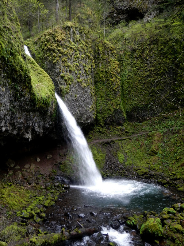
and up to the top of Horsetail Ridge thru a maze of human, animal, animal/human, human/anumal use trails - many more than when I was here just two years ago. There's a use trail on top of the ridge,
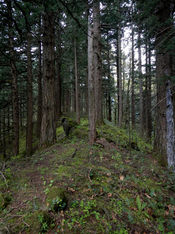
which took me past a keyhole,
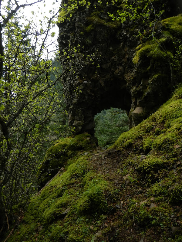
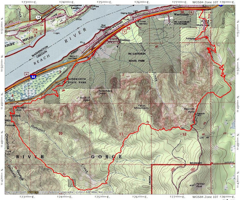
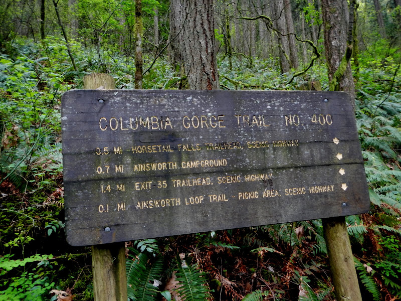
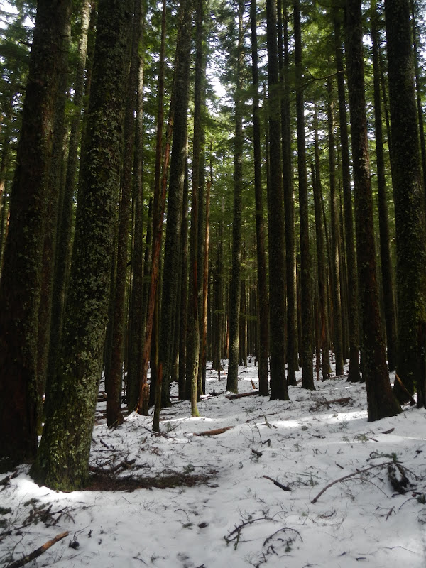
and on up to the Horsetail Trail (425). Once you get on the ridge, it's a pretty mellow way to get to the plateau drained by the various tributaries of Horsetail Creek. I took the 425 E toward Nesmith Point. First creek crossing was interesting - but there was a log available to ease the crossing. There was no snow until the S side of Yeon Mtn and it grew to 1-2' deep on the back side of Nesmith.
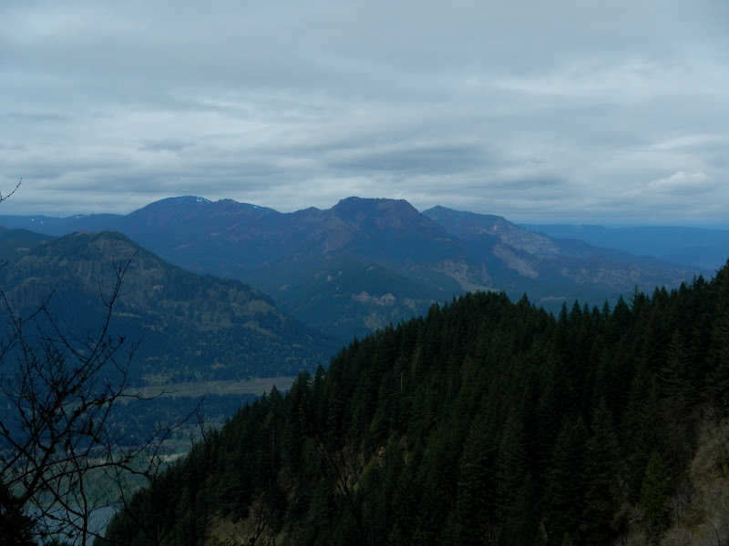
This is not a hike plagued by too many views, but there are a couple of good ones that the 425 passes on its way to Nesmith - of Hamilton and Hardy,
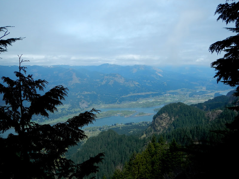
and Table and Birkenfeld. On a clear day - remember those? - you can see Adams.
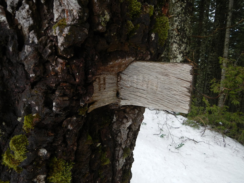
The trail eventually disappeared into the snow, so I went XC uphill to the "summit" of Nesmith with its ever so slowly disappearing sign.
Then directly down the ridge to the Nesmith Point Tr (428) - snowfree below 3200' - and so back to the car. A good loop - 14 mi RT, 3800' - but not totally great due to the few views.
Horsetail Ridge - Nesmith Point Loop 18-Apr-2013
Re: Horsetail Ridge - Nesmith Point Loop 18-Apr-2013
Bruce - Yes, a nice loop but (as you say) a bit short on views, plus there is are a few miles on the road... Interesting how the number of use trails to the Horsetail Ridge are increasing.
Some people are really fit at eighty; thankfully I still have many years to get into shape…
- Splintercat
- Posts: 8334
- Joined: May 28th, 2008, 10:03 pm
- Location: Portland
- Contact:
Re: Horsetail Ridge - Nesmith Point Loop 18-Apr-2013
If we ever do see the 400 trail completed through that section, it would be nice if it hovered at the 400-500 foot level --- some great views of the big monoliths to be had there! Nice, lonely view of Ponytail, too, Van -- without the usual mob of flip-floppers crowding the cave and sliding down into the creek!
So, is Horsetail Ridge the same as the Russ Jolley Trail?
Tom
So, is Horsetail Ridge the same as the Russ Jolley Trail?
Tom
Re: Horsetail Ridge - Nesmith Point Loop 18-Apr-2013
No. My understanding is that the Russ Jolly runs up Horsetail Ck canyon itself, to the E of the ridge. This may be why the use trail from the 400 back to above the falls is so obvious.Splintercat wrote:
So, is Horsetail Ridge the same as the Russ Jolley Trail?
Tom
Re: Horsetail Ridge - Nesmith Point Loop 18-Apr-2013
Tom - Below is Lurch's GoogleEarth rendition of the area with trails, bushwhacks and worse. Lurch has previously posted this "map" on our site. The Horsetail Ridge is the green line right of center. Across the Horsetail Creek, to the east, the yellow line indicates the Rock of Ages trail. The green line going up the Horsetail Creek basin is the Russ Jolley trail. The second half, going up to the Rock of Ages trail, is "officially" named the Mindolovich Trail (I see this name used, for example in the Gorge Classic Climbs (map on page 25). Most of us seem to find it easier to call the whole thing Russ Jolley.
The complete post where the above Mindolovich posting was taken from, as well as another version of the Lurch map, can be found here.
Some people are really fit at eighty; thankfully I still have many years to get into shape…
Re: Horsetail Ridge - Nesmith Point Loop 18-Apr-2013
Thx for the report - I like the loop you did here - from the photos you took looks to me like you had plenty of views - for me it is all good. On this route, going up Rock of Ages might lend some comfort to the view deprived hiker.
You think there is a route up to Horsetail Ridge on the west side from the 400? That east side approach is really beat-up and I recall a faint track headed down going west last time I was up there.
Thx again,
--Paul
You think there is a route up to Horsetail Ridge on the west side from the 400? That east side approach is really beat-up and I recall a faint track headed down going west last time I was up there.
Thx again,
--Paul
The future's uncertain and the end is always near.
Re: Horsetail Ridge - Nesmith Point Loop 18-Apr-2013
Yes, the E side "trail" is pretty heavily used now, obviously more so than just 2-3 years ago. I haven't tried gaining Horsetail Ridge from the W (yet) but my guess is that there's probably a way there - maybe right around the corner of the ridge toward Oneonta Ck. Worth a try...pablo wrote: You think there is a route up to Horsetail Ridge on the west side from the 400? That east side approach is really beat-up and I recall a faint track headed down going west last time I was up there.
--Paul
Re: Horsetail Ridge - Nesmith Point Loop 18-Apr-2013
Nice loop; I too have no compunctions about using a road if it ties things together.
I'm pretty sure you can find your way up to the crest of Horseshoe Ridge from the cliff viewpoint area on the 400 trail west of Ponytail Falls although, going back a couple of decades when I was doing a lot of these kinds of hikes in the west Gorge, I can't for the life of me remember if I ever did it that way.
Re: Horsetail Ridge - Nesmith Point Loop 18-Apr-2013
Yes we came down the west side just about where Bobcat described. As someone told me last year the chutes coming off of the East side make it dangerous for hikers on the normal trail below if rock fall happens.
I find it interesting that both the Rock of Ages and the Horse Creek Ridge Keyholes (?) are about the same elevation.
Also noticed in your 6 photo, what I believe is the Island. Planning on going up that one in a few weeks. Eric Peterson and I did it last year or was it longer.
One last thing, The money spent for that horrendous trail (bikeway?) from john b. Yeon to Moffet creek would of been better spent re-opening that section of the 400 trail that SplinterCat referred to.
- Eric Peterson
- Posts: 4097
- Joined: May 11th, 2009, 5:39 am
- Location: Oregon
- Contact:
Re: Horsetail Ridge - Nesmith Point Loop 18-Apr-2013
Rick, the rock arch over on the ROA TRAIL is not called Rock of Ages.
Rock of Ages is a point of interest west of St. Peters Dome, IIRC.
Nice to see you posting on PH
Rock of Ages is a point of interest west of St. Peters Dome, IIRC.
Nice to see you posting on PH