To Nesmith Point and BEYOND? 04-Feb-2013
Posted: February 3rd, 2013, 11:11 am
In 1962, a young philosophy professor decided to climb Everest. While he had mountaineering experience, what he lacked was a permit. The ones for that year had already been assigned and, had any been available, they would have been prohibitively expensive. Undaunted by such administrative details, he organized a four person “trek” to Everest Base Camp (then not the small town it is today). From there the now “expedition” (and technically the first American one to Everest) snuck out of camp, went over the Nup La into Chinese-controlled Tibet, and made an attempt on Everest’s North Face. They were forced back from their high point of 25,500’ by exhaustion, lack of food, and an accident. Everyone returned safely and the young professor continued teaching (and occasionally climbing) until his passing in 2002. He never did climb Everest. W. W. Sayre
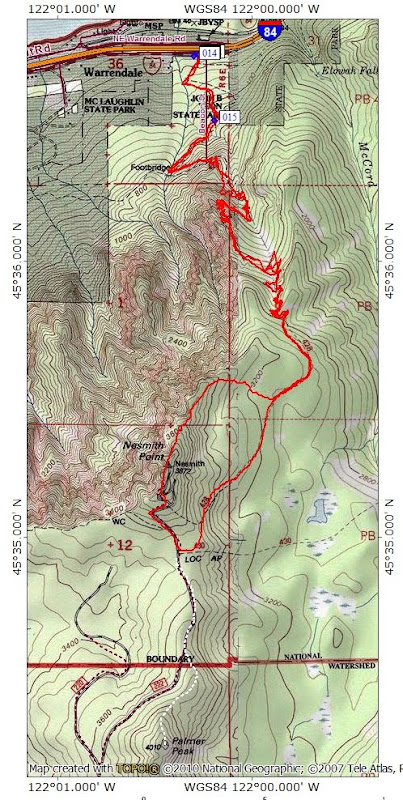
Saturday dawned clear and bright – the full bluebird experience. There was wind along I-84 but very little at the Nesmith Point TH. The Nesmith trail isn’t noted for its views but there are spots where Hamilton and Hardy come into view (briefly),
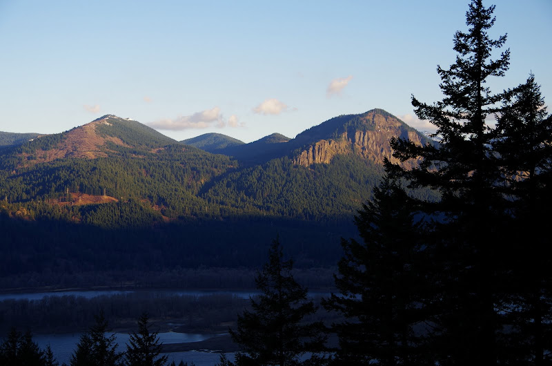
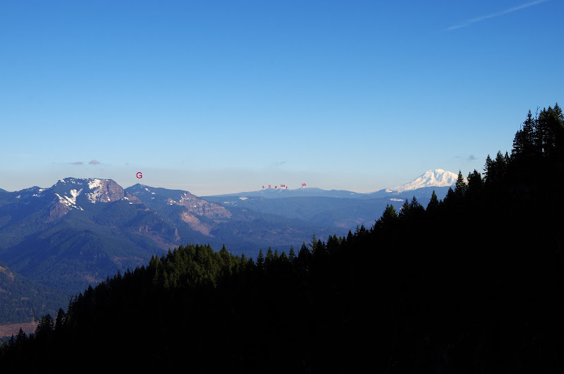
and then later, Table, Greenleaf (G), (and in Indian Heaven), Sawtooth (s), Bird (b), East Crater (e), Berry (be), Red (r), and Sleeping Beauty (sb), then Adams.
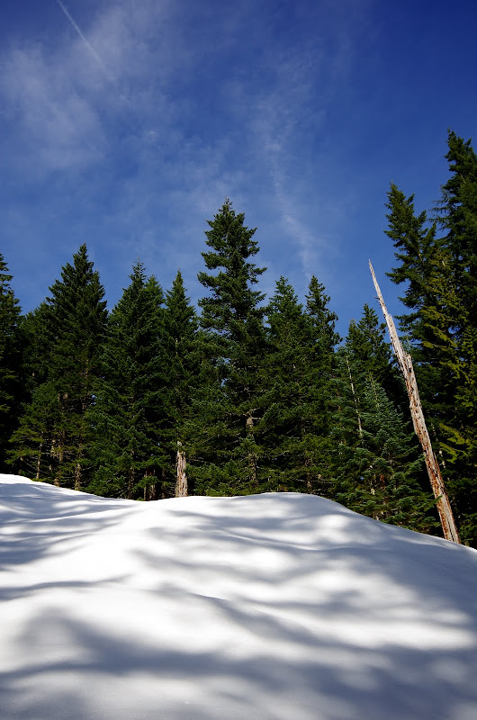
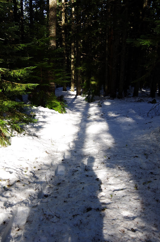
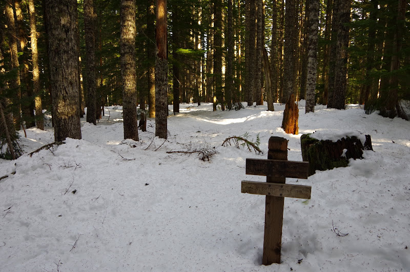
The trail was clear up to about 2000’ but was slippery enough to make using microspikes a plus. It was boots and spikes to the ridge at 2800’ and snowshoes from then on. My tracks were the only ones past this point today. On the way back, I could see from the appearance of extra tracks that several folks had gotten as far as the ridge but then been turned back by the snow.

The sun was out the whole day – no ducking and weaving with clouds, mist, drizzle, etc. Bluebird!
I continued on up to the old road (Rd 222) on the saddle between Nesmith and Palmer Peak.
If one were to turn right (S) here, the snow-covered Moffett Creek trail would eventually materialize,
followed shortly thereafter by the boundary of the Forbidden Zone. If one were to continue – again speaking purely hypothetically – S for a half mile or so over untrodden snow and up a gentle slope, one could – and this is pure conjecture – reach the summit of 4,010’ Palmer Mtn. This, of course, can’t happen because that would be trespassing and the BOW’s security forces would be on you faster and thicker than ticks at Catherine Ck in the Spring.
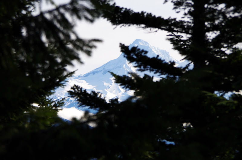
However, if one’s aversion to authority was such that one actually reached Palmer’s summit, one might find (as illustrated by these simulated, re-constructed, hypothetical images from a conceptual summit in an ecosystem not unlike – but not necessarily the same as – that found in the Gorge), an obscured (CGI simulated) view of Hood,
and an OK view of Tanner Butte (also simulated), with Chinidere Mtn (yes, also "simulated") beyond. Different, but probably not much to write home about - hypothetically speaking, of course.

But, after making a law-abiding R turn on the road, I got to the edge of Nesmith, which gives a good view of Portland to the W,

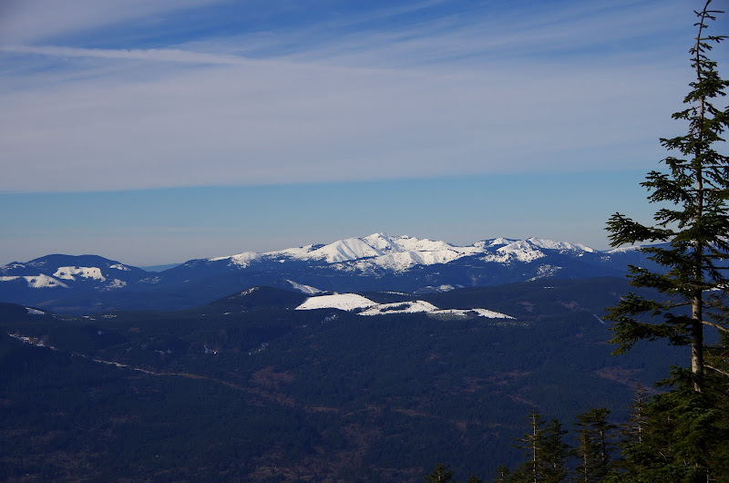
and shortly thereafter reached the “summit”, with a great view of Silver Star to the N.
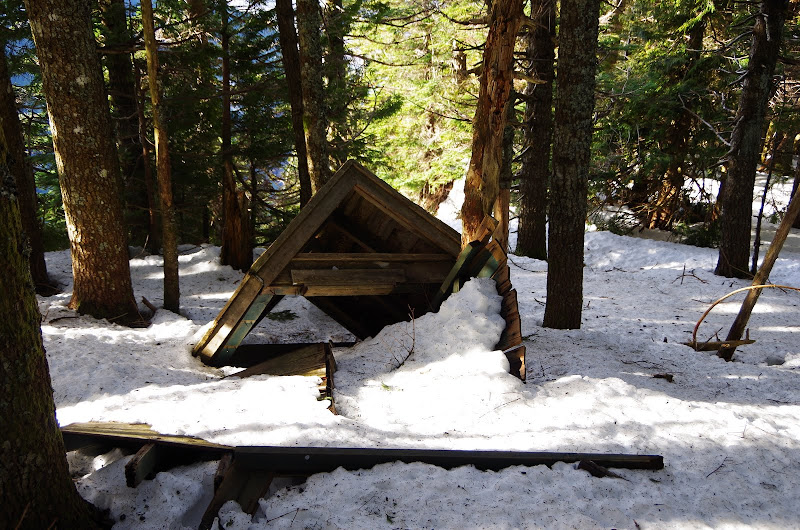
After a brief stop to contemplate one of the fallen glories of past waste management practices,
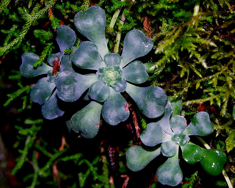
it was straight down the ridge to intersect Trail 428 and back to the TH, stopping along the way to admire the highly complex little ecologies growing on a rock wall near the old 400 trail crossing.
Great day, great hike! (9.8 mi RT, 3800’ EG to Nesmith {11.5 mi, 4100’ EG were one tempted to deviate from the path of righteousness
  }).
}).
Saturday dawned clear and bright – the full bluebird experience. There was wind along I-84 but very little at the Nesmith Point TH. The Nesmith trail isn’t noted for its views but there are spots where Hamilton and Hardy come into view (briefly),
and then later, Table, Greenleaf (G), (and in Indian Heaven), Sawtooth (s), Bird (b), East Crater (e), Berry (be), Red (r), and Sleeping Beauty (sb), then Adams.
The trail was clear up to about 2000’ but was slippery enough to make using microspikes a plus. It was boots and spikes to the ridge at 2800’ and snowshoes from then on. My tracks were the only ones past this point today. On the way back, I could see from the appearance of extra tracks that several folks had gotten as far as the ridge but then been turned back by the snow.
The sun was out the whole day – no ducking and weaving with clouds, mist, drizzle, etc. Bluebird!
I continued on up to the old road (Rd 222) on the saddle between Nesmith and Palmer Peak.
If one were to turn right (S) here, the snow-covered Moffett Creek trail would eventually materialize,
followed shortly thereafter by the boundary of the Forbidden Zone. If one were to continue – again speaking purely hypothetically – S for a half mile or so over untrodden snow and up a gentle slope, one could – and this is pure conjecture – reach the summit of 4,010’ Palmer Mtn. This, of course, can’t happen because that would be trespassing and the BOW’s security forces would be on you faster and thicker than ticks at Catherine Ck in the Spring.
However, if one’s aversion to authority was such that one actually reached Palmer’s summit, one might find (as illustrated by these simulated, re-constructed, hypothetical images from a conceptual summit in an ecosystem not unlike – but not necessarily the same as – that found in the Gorge), an obscured (CGI simulated) view of Hood,
and an OK view of Tanner Butte (also simulated), with Chinidere Mtn (yes, also "simulated") beyond. Different, but probably not much to write home about - hypothetically speaking, of course.
But, after making a law-abiding R turn on the road, I got to the edge of Nesmith, which gives a good view of Portland to the W,
and shortly thereafter reached the “summit”, with a great view of Silver Star to the N.
After a brief stop to contemplate one of the fallen glories of past waste management practices,
it was straight down the ridge to intersect Trail 428 and back to the TH, stopping along the way to admire the highly complex little ecologies growing on a rock wall near the old 400 trail crossing.
Great day, great hike!