Last year, beginning 6/30/11, Hiker Chris and I attempted to backpack the Irish Mountain/Mink Lake loop, as described in the Douglas Lorain book “100 Classic Hikes in Oregon”. This loop, located in the SW corner of the Three Sisters Wilderness in Central Oregon, is described in the book as being 37 miles with 1500’ of elevation gain – very easy when the trails are clear. However, due to the large amount of late spring snow last year, we were only able to traverse a 13 mile section, as much of the trail was covered in snow.
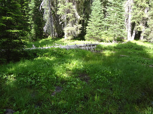
Picture from the trip last year:

Being that the snow pack melt is about one month ahead of last year and it would be 20 calendar days later in the year, Chris and I thought we should try the loop again, beginning 7/20/12. While I love exploring new places, there’s something to be said for going back to a place I’ve been before. For one thing, I don’t have to do all the research about directions, routes, trails, campsites, water sources, etc.
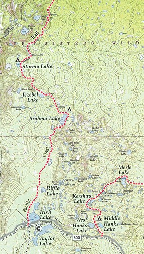
The loop, which looks like a popped balloon on the map, can start out at two different locations. Either at the Winopee Lake TH at the NE end of Cultus Lake, or down a bumpy and rough forest road 600 to the PCT TH at Irish Lake. Starting out at the PCT TH would take almost 6 miles off the mileage, but this trip was not about saving miles. As we did last year, we began our trip at the Winopee Lake TH (4700'). Now the question was: clockwise or counter-clockwise? We didn’t make a decision until we were on the trail, and the decision was counter-clockwise.
The trail starts out going west following Cultus Lake for 3 miles before turning north into the Three Sisters Wilderness.
Here are some facts about Cultus Lake:
• Formed by a glacier.
• 211 feet deep at its deepest point. 2 miles long. 790 acres in size. 4700’ in elevation.
• The name Cultus is Chinook for either bad, worthless or vain.
• Open to high speed motorized watercraft, water skiing and fishing.
• Has a good USFS campground on the east side with an amphitheater for Ranger-led nature programs.
• Has a nice resort on the SE side with cabins, rentals, groceries and a restaurant.
• Has at least 2 campsites accessible only by boat or by foot.
• Mountain biking is allowed on the trail immediately next to the lake, but not in the wilderness. I ran into a mountain biker on the trail when I was on this same trail within the wilderness a couple of weeks ago. I blocked the trail and advised him that mountain biking was not allowed on that trail. He pleaded ignorance, but I knew he was lying. If we hikers don’t protect our wilderness areas, no one else will.
Cultus Mountain from Cultus Lake:
Soon after going into the Three Sisters Wilderness, we were passing one lake after another.
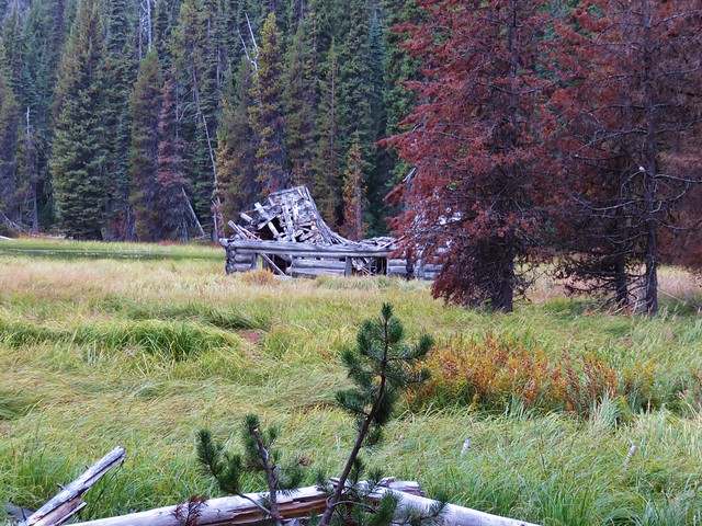
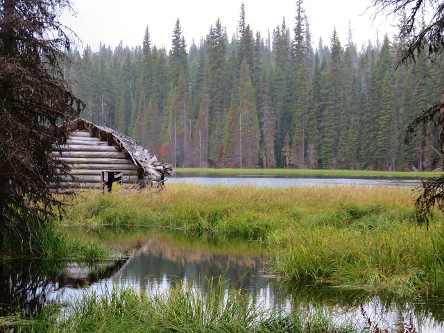
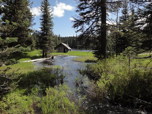
The first was Muskrat Lake (4880') with its old cabin. The cabin was built around 1920 by a man who attempted to raise muskrats there. It is falling apart and not suitable as a shelter. Due to the high water last year, Chris and I could not reach the cabin, but this time we were. There is a nice campsite here across the inlet creek.
Cabin at Mink Lake:
The next lake was Winopee Lake (4970'). This is a large, marshy, irregularly shaped lake with at least one campsite.
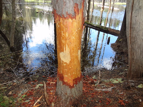
Porcupine Nibbled tree At Winopee Lake:
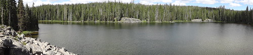
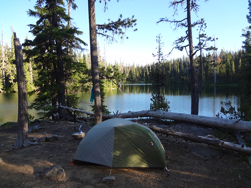
After that was Snowshoe Lake (5060'), where we stayed the first night of our trip last year. The campsite there is outstanding, with a fantastic view of the lake from a rocky outcropping.
Snowshoe Lake:
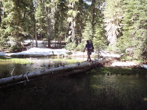
Up next was Upper Snowshoe Lake (5125'). Before getting to it though, a creek must be crossed. Last year, there was so much snow, we could not locate the designated creek crossing, so we just crossed the wide creek on a log. This time, not only could we find the proper crossing point, but the creek was barely a trickle. We were amazed at the difference.
Last year crossing the creek just before Upper Snowshoe Lake:
This year the creek was barely a trickle:
The next lakes were Long Lake (5165') and Puppy Lake (5195'). Nothing extraordinary about them, but they were pretty nonetheless.
Earlier that day, Chris and I had decided to make Mink Lake (5074') that day's destination. To get there, we had to meet up with the Pacific Crest Trail (PCT), follow that for almost a half mile, take the Mink Lake turn-off, then another mile and a half down to the lake.
Mink Lake was where we stayed the second night of our trip last year, so we knew what to expect.
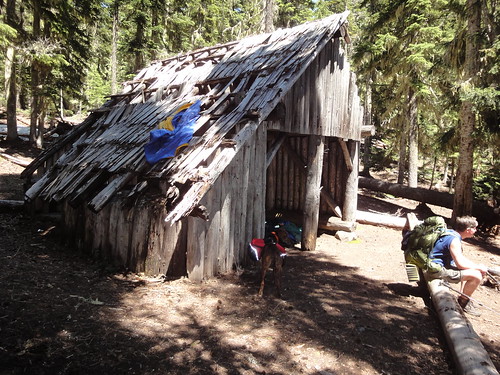
Mink Lake is a large lake with many campsites. It also has a great view of Packsaddles Mountain (6144'), as well as an old log shelter that looks like it will collapse one of these snowy winters.
Shelter at Mink Lake (taken last year):
We promptly headed for the campsite on the north shore on a rocky outcropping jutting out into the lake. Finding it unoccupied, we set up camp and enjoyed the rest of the evening.
Chris relaxing at Mink Lake:
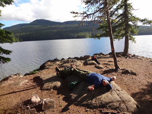
I have to say, this particular campsite is one of the best I have camped at. It is large, remote and right on the lake. The view is hard to describe, so see for yourself.
Campsite at Mink Lake:
That night before going to sleep, I heard something outside my tent. It was large and it was getting closer! Then I heard it walking through the bushes right next to my tent. I made some noise and shook my tent to make it go away, which it did not. I think it was a deer I saw shortly before going to bed. Then I heard two distinctively separate noises. That made me feel a little better because deer travel together much more often than bear or cougars. So I drifted off to sleep.
I think every backpacker has had at least one experience with noises outside their tent in the dark. This was not my first.
Not too long after falling asleep, I had a dream that something was making noise outside my tent. In my dream, I tried to yell at it and shake my tent to make it go away. But I had sleep paralysis and could not do so in my dream. I woke up to hear something still outside my tent. I yelled at it and shook my tent to make it go away, and it did. I must have heard it while I was asleep and it made its way into my dream. It's funny how the mind works.
The next morning, after getting up at 5 AM, we decided to deviate from the loop described in the Douglas Lorain book. Rather than heading back east to explore the lakes east of Mink Lake, we planned to hike to the top of Packsaddle Mountain.
Morning sun on Packsaddle Mountain and Mink Lake:
What I wasn't aware of, however, was that the trail leading to the Packsaddle Mountain cut-off trail loses several hundred feet of elevation. I hate losing elevation, just to gain it right back again. Oh well, what's another few hundred feet?
According to two of my map sources, the cut-off trail was supposed to be on the left shortly after where the main trail bottoms out and starts gaining elevation again. We were looking and looking, but never found the cut-off trail up to Packsaddle Mountain. Sometimes trails don't get used and gradually fade back into the forest.
It wasn't a complete loss. The trail we were on was quite lovely and did lead back to the PCT.
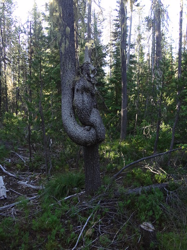
Gnarly tree:
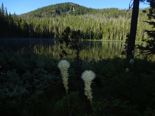
Top Lake/Little Roundtop Mountain:
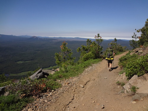
Once we joined up with the PCT, we headed south. As was the previous day, we passed one lake after another - too many to list all of them.
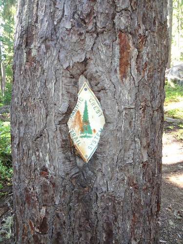
Old school PCT trail marker:
Several were noteworthy.
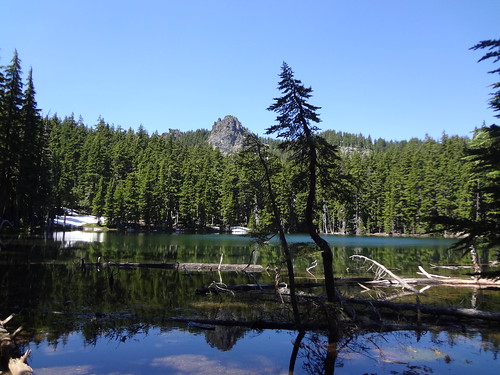
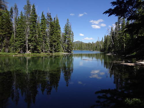
Stormy Lake (6045'), which was our high elevation point on the PCT, has a large campsite and a great view, with Irish Mountain serving as the backdrop.
Stormy Lake/Irish Mountain:
Jezebel Lake also has a campsite and a view of Irish Mountain
Brahma Lake (5657') also had some campsites and a view of the top of Irish Mountain.
It was here Chris pointed out that we were only about two miles as the crow flies from that day's destination, Merle Lake. By trail it was about eight miles. Jokingly, I asked him if he was making a suggestion. We both know that taking a bushwhack shortcut can often times take much longer than following the trail.
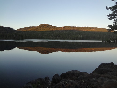
Soon we were at where the PCT crosses FS road 600. Near this spot are Irish Lake and Taylor Lake. These are both large lakes with good campsites, accessible by high-clearance 4WD vehicles.
To continue on the loop, we walked east on FS road 600 for almost two miles to the Many Lakes Trail. This trail is aptly named. At times it seemed like every turn of the trail brought us to another lake.
Scan of part of the map showing the many lakes:
Middle Hanks Lake with Cultus Mountain way in the back:
The trail meanders all over the place, somewhat frustrating to us at that point. That's because we were tired and wanted to get to our destination, Merle Lake.
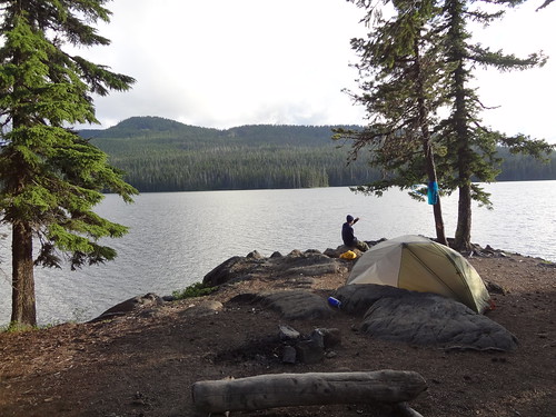
After 20.2 miles that day, we finally made it to Merle Lake at 4:30 PM. We were hoping there was a campsite there - and there was. It was a very nice one right on the lake.
Campsite at Merle Lake:
After setting up camp, we lazed around before retiring early. The next day would be another early one.
The next morning, after getting up at 5 AM again, we quickly packed and hit the trail. Like the previous day, we wanted to get in as many miles as we could during the cool of the morning.
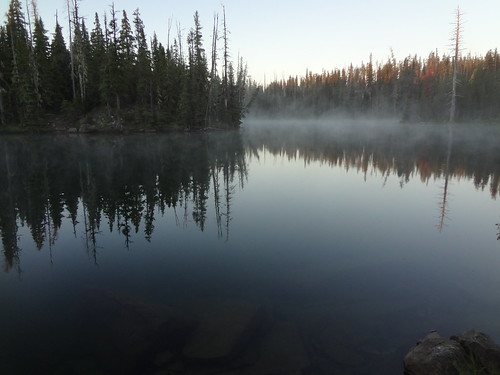
Morning fog on Merle Lake:
This was especially so because we planned a side trip to Cultus Mountain (6759') before finishing up the loop that day. The way to the top of Cultus Mountain was via a very rough and rocky road, suitable for only the most rugged high clearance 4WD vehicle. The road was so rough that I saw a spark plug on the ground, undoubtedly jarred loose from some unlucky vehicle.
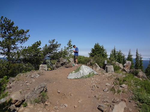
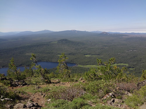
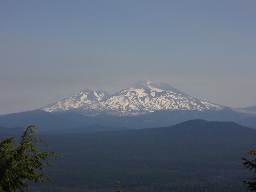
Once we started climbing, it seemed like the progress was excruciatingly slow. On one of our rest breaks, I figured we had gained well over 1000’. Chris checked his GPS and it showed we had only gained 500’. We both exclaimed the view better be worth the effort. After finally making it to the top, we were rewarded with views in all directions. Cascade peaks we could see were Mt. Washington, Mt. Jefferson, the Three Sisters, Broken Top, Mt. Bachelor, the top of Mt. McLaughlin, the tippy top of Diamond Peak, Irish Mountain and Packsaddle Mountain. Among the lakes we could see were Cultus Lake, Sparks Lake, Crane Prairie Reservoir, Wickiup Reservoir, Davis Lake, Little Cultus Lake and numerous other smaller lakes. What I thought would be a relatively easy side trip ending up being about 12 miles and nearly 2000’ elevation gain.
Former lookout site at the top of Cultus Mountain:
View from the top of Cultus Mountain:
The Three Sisters from the top of Cultus Mountain:
The road to the top of Cultus Mountain:
The remaining hike back to the Winopee Lake trailhead was relatively straightforward. We passed a very busy and loud boat-in campsite at the west end of Cultus Lake. Don’t expect any peace and quiet if you camp there. We were both happy to be back at my truck and ready to head home.
Final notes:
• Trip stats: 11.8 1st day / 20.2 miles 2nd day / 21 miles 3rd day / 53 miles total / 6000’ elevation gain
• We saw only two people on day one. On the second day, we saw 12 people, all on the PCT. The third day we saw no one until reaching the Cultus Lake boat-in camp.
• We spoke to one PCT thru-hiker on 7/21/12, who had started at the southern Oregon border. He said the parts going through the Diamond Peak and Mt. Thielson areas were still snowed in pretty good, but the other parts were either completely or mostly snow free.
• The mosquitoes were very aggressive and numerous at times. I ended up with 10 bites. Not too bad considering how many there were.
• The trails we hiked on were all in very good condition. The only snow encountered were small patches near Stormy Lake. None on Cultus Mountain at all.
Here is a link to all the pics on Flickr:
http://www.flickr.com/photos/54959080@N ... 720233996/
Good Hiking,
Brad