General discussions on hiking in Oregon and the Pacific Northwest
-
-Q-
- Posts: 1433
- Joined: July 5th, 2008, 10:42 pm
Post
by -Q- » May 6th, 2016, 7:34 pm
kepPNW wrote:I've been beaten more than I'd like to say, trying to get up to Observation Peak too early in the year.

Haha, yup, me too.
My worst mountain nemesis though is salmon butte

-
drm
- Posts: 6152
- Joined: May 28th, 2008, 10:03 pm
- Location: The Dalles, OR
-
Contact:
Post
by drm » May 8th, 2016, 8:01 am
I hiked up to Soda Peaks Lake yesterday. Patchy snow started at the top of the ridge at about 3300 feet, but full coverage only started on the flats less than a quarter mile from the lake. The lake itself was mostly covered still with only a 20 foot wide section of open water on the shore. The day-use area was mostly melted and I didn't check the camping sites. There are lots of down trees. A couple required groveling underneath and there were a couple of those conflagrations, where a falling tree takes down a mess of other stuff, creating a mess 20 or 30 feet wide that must be negotiated. Does anybody know of a more standard name for this kind of tree-fall?
-
romann
- Posts: 2417
- Joined: May 28th, 2008, 10:03 pm
- Location: Vancouver, WA
Post
by romann » May 10th, 2016, 5:31 pm
The road to Thomas Lake trailhead in Indian Heaven was 100% melted out as of Saturday 5/7. That's just over 4000 feet. One minor washout 1.7 miles to trailhead, cars with clearance will have no issue. 50-60% snow on trail to Thomas Lake, after that - some deep drifts, finally all snow above 4400' but the depth varied from 1-2 feet to about 5-7, depending on the slope.
I'll try to post a TR later tonight.
-
romann
- Posts: 2417
- Joined: May 28th, 2008, 10:03 pm
- Location: Vancouver, WA
Post
by romann » May 10th, 2016, 5:56 pm
Surprise Lakes station north of IH shows 75% depth of normal, with melt about 2 weeks ahead of schedule - should hit zero inches by 6/1 unless we get La Nina onset.
 Viewed 4431 times")
- note the chart is for snow water equivalent, not snow depth
Only Mt. Adams and Mt. Rainier look close to average (
link to map)
-
sprengers4jc
- Posts: 1036
- Joined: October 22nd, 2013, 11:35 am
- Location: Vancouver, WA
Post
by sprengers4jc » June 12th, 2016, 5:43 pm
Vista Ridge is melted out to 5,400 feet (about 2.3 miles one way). The trail beyond that was mostly snow covered.
'We travel not to escape life but for life to not escape us.'
-Unknown
-
Paul2
- Posts: 84
- Joined: March 2nd, 2014, 11:02 pm
Post
by Paul2 » June 12th, 2016, 7:20 pm
I biked McKenzie Pass this week. First patches of snow at 4800' partial coverage in the trees at 5200' and only in the cracks at the pass. None ever on the road.
I hiked Tidbets Mountain, only one patch on the trail on the north side at 5000'.
I've been wandering early and late, from New York City to the Golden Gate, and it don't look like I'll ever stop my wandering.
-James Taylor
-
Walkin' Fool
- Posts: 78
- Joined: July 7th, 2014, 10:03 am
Post
by Walkin' Fool » June 21st, 2016, 11:04 am
Hiked up Killen Creek Trl Sunday, June 19, to a bit under 8,000' on the north side of Mt Adams, just checking out the N Ridge approach for the future. Intermittent snow at about 5,400, consistent snow by the time you hit the Killen Creek/PCT junction (6,100'-ish).
If continuing on towards Adams from the PCT junction, I'd recommend crampons for the steeper snow slopes right now. Snowshoes were not used. Ice axes were not used but would have been if the snow was firmer. Road to Killen Creek from Trout Lake is not the greatest, but there was a Prius at the TH, so.....
-
retired jerry
- Posts: 14417
- Joined: May 28th, 2008, 10:03 pm
Post
by retired jerry » June 21st, 2016, 3:11 pm
That would make a good bike backpack to McKenzie Pass before they open it.
-
woodswalker
- Posts: 835
- Joined: November 25th, 2012, 4:51 pm
Post
by woodswalker » June 24th, 2016, 8:50 am
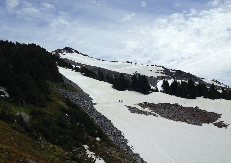
The long route around to McNeil Point has a few small patches of snow on the Timberline Trail past the climbers route cutoff. A few large patches with clear bootpaths starting near the Mazama jct with the TT. Snow coverage about 50% once you hit the turnoff to McNeil from the TT. The top layer is melting and slippery. I was happy to have microspikes, but most folks weren't using them.
This snowfield was not the most slippery one. Although it's the one I always wonder about.
 7
7


