
Parkdale Lava Flow
Parkdale Lava Flow
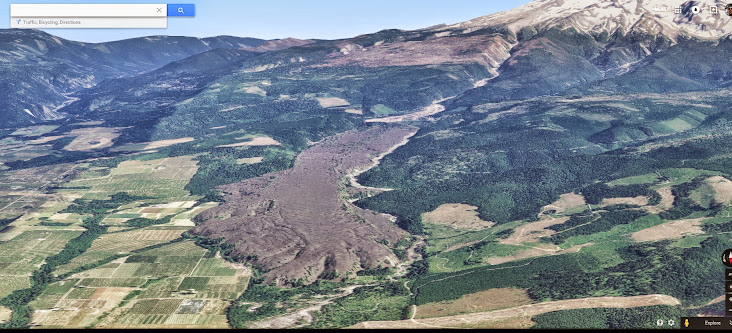
Was messing around on Google Earth and saw this large outflow from Mt Hood. Pretty spectacular! It looks like a headwall of lava, perhaps over 100' high. Anyone familiar with this, or hiked around it?
Last edited by miah66 on May 11th, 2015, 1:09 pm, edited 1 time in total.
"The top...is not the top" - Mile...Mile & a Half
Instagram @pdxstrider
Instagram @pdxstrider
Re: Parkdale Lava Flow
The Parkdale Lava flow is right in my backyard, so to speak. It is about 7,000 years old I think. We have explored it on the southern end where you can actually find one of the vents. I don't have co-ordinates for the vent but it is clearly visible on Lidar. When we last went there, we approached it from Laurance Lake road. We walked across the debris from the last flood to get there. The north and east sides are mostly on private property. I think Splintercat did an article on it in his Wy'East blog. Anyway, it is a very interesting place. Apparently there are a bunch of caves in it but they are on the private property. I don't know if there are any caves on the west side, not sure how accessible that side is because of the river.

Re: Parkdale Lava Flow
cool photo Miah,
From what I understand the entire flow comes from the vent located just off the road to Laurance Lake. The vent isnt really visible on even modern topo maps so its been overlooked I suppose all these years but lidar imagery clearly shows it. The vent is pretty small for all that lava so its really cool to see the imagery show it all come from that single vent...
here is a map of its location:
lightweight, cheap, strong... pick 2
-
greenjello85
- Posts: 554
- Joined: July 31st, 2014, 1:31 pm
Re: Parkdale Lava Flow
This is a really neat find, Thanks Miah!
-
adamschneider

- Posts: 3716
- Joined: May 28th, 2008, 10:02 pm
- Location: SE Portland
- Contact:
Re: Parkdale Lava Flow
I've always been amazed at how little information is out there about this lava flow. It's painfully obvious on topo maps and aerial photos, but there are no trails, no plaques, no nothing.
-
justpeachy
- Posts: 3067
- Joined: May 28th, 2008, 10:03 pm
- Location: Portland, OR
- Contact:
Re: Parkdale Lava Flow
My sister and I recently tried to see how close we could get to this from the Parkdale side. We drove out Lava Bed Road, but it ended at private property. A wall of lava rises up in their backyard, so we could see it from the road, but we couldn't access it.
Re: Parkdale Lava Flow
The Lava Bed Nursery on Culbertson Drive used to allow access to a trail that runs through the lava beds. Don't know if they still do though. I know the trail used to be on a geology tour many years ago. Access from Laurance Lake road is still probably your best option.
Re: Parkdale Lava Flow
I'm heading off to work but if you happen to have a copy of Hiking Mt Hood Nat'l Forest 31 Scenic Hikes by Marcia Sinclair laying around Parkdale Lava Beds is Hike 15.