
Original report here: Subject: New road interrupts trail
My update to that:
kepPNW wrote: ↑May 14th, 2018, 3:01 pmWow! I kind of shrugged, and didn't think a whole lot about this, until I got there on Saturday. That trailhead is basically obliterated! If I hadn't know where the trail was, up above, from a previous visit/track it would've been more than a bit difficult, if not impossible, to locate.Sugar Pine wrote: ↑February 11th, 2018, 7:38 amWhen we were a few switchbacks from W-2000 road and Three Corner Rock TH the trail abruptly ended at a ~15 foot drop down to a new road. It appeared too steep, so we bushwhacked up a bit, seeing what looked like a drainage on our GPS. Not much of a drainage, but there was a place we could slide down the hill to the road.
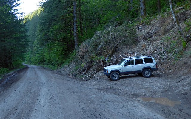
I parked at what I knew as the old trailhead, which was maybe 1/8 mile before the large pullout on the left/west of W2000. That other spot was entirely filled with very large construction vehicles (graders, dump trucks, bulldozers, etc).
Where the Stebbins Creek trail used to hit the road.
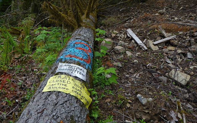
Didn't look all that bad, so I decided to give it a go straight from there. First thing I see:
Not cool. But it's a Saturday, so no active road building today! WTH...
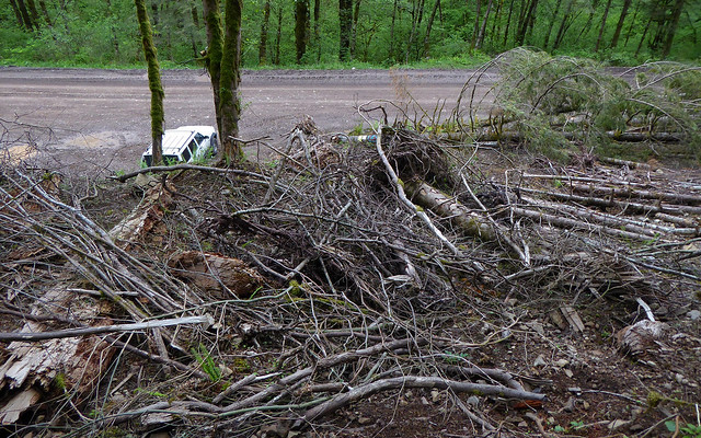
Scrambling up from the old TH was fraught with irritants, as it was basically crawling through a brush pile. To me, this just seemed like gratuitous hazards, placed there to piss off hikers not willing to read and obey the sign.
Looking down from the beginning of the first scramble.
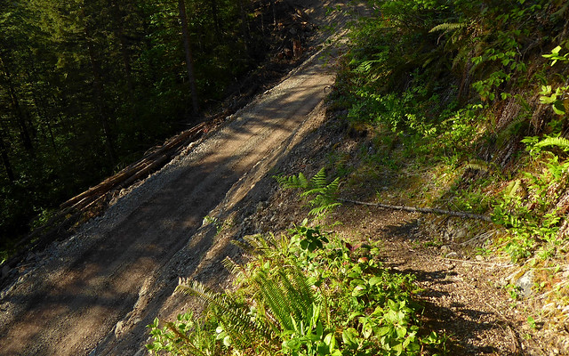
Climbed up another 200' or so through all sorts of downed trees and limbs, before hitting a brand new road! OMG... Looking across it, I see what the real issue is going to be. That climb up is steep! And totally unconsolidated. I wandered back and forth a bit, looking for a good option. Tried two, each of which started the hillside sliding my general direction before I was halfway up, before finding a third route that was stable enough for me to manage reaching some wayward roots to pull myself the rest of the way up with. What a nightmare!
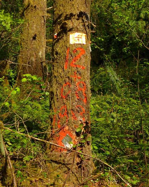
There was a bit of a groove here to walk up. Look for markings on tree above.
That route may, probably will give way, but you can find it looking for the paint on this tree:
Head up and to the right from directly below this one.
As it turned out, getting up was FAR easier than coming back down. Oh my goodness! Finding the right spot to drop down from above was a royal PITA, especially after more than 20 trail miles and just wanting to be done. This is what you see when you hit the end of the trail:
Sliding down here would HURT! Serious.
All you can do then is back up 50 feet or so, bushwhack uphill then to the left/north, checking every so often for a chance to descend. Even when I found the place I initially went up, there was no way to get over the edge other than butt-sliding on down, bringing a cascade of rocks along with me.
Meanwhile, the trail itself is taking on all appearances of simply being abandoned. What a shame!

