So not seeing a TR on it I thought I'd go take a look-see. Target was the high point of the vent at the south end and possibly good views of the lava field to the north then down the edge of the vent out to the lava field proper for some boulder hopping.
There is a nice pullout just before crossing the Elliot Branch on the way to Laurance Lake to use as a trailhead. The way to the vent is strewn with boulders of all sizes but there is always a nice sandy path and travel is easy. In the photo below the vent is in the center, the higher ridges on either side formed the boundary of the lava flow. The high point of the vent is only 1-200 feet above the base of the flow so appears as just a line of trees.
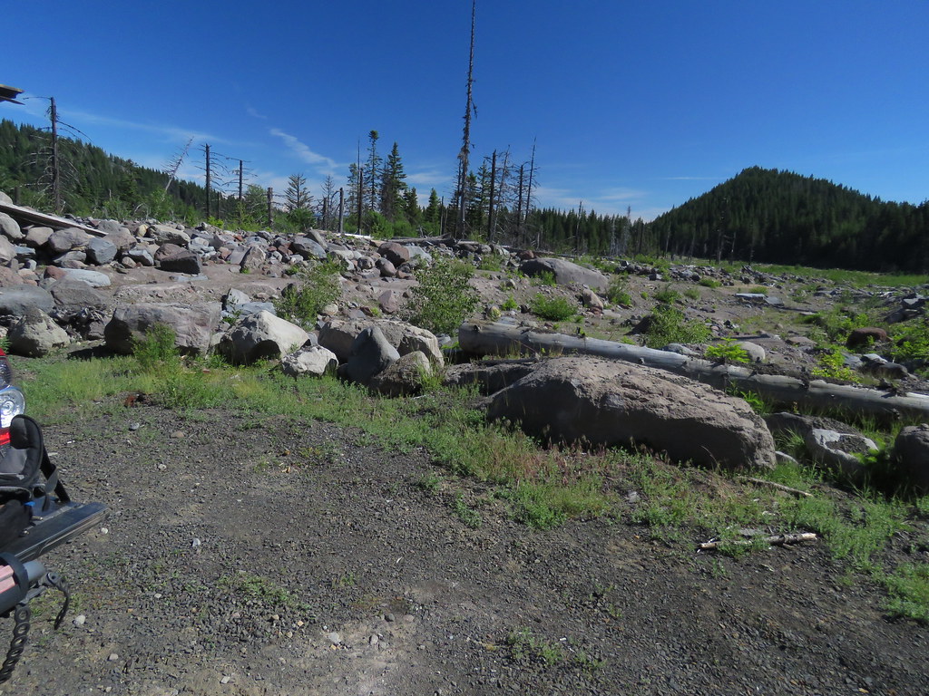 DebrisFlow by pauljess999, on Flickr
Once across the debris flow I headed up to the high point of the vent and this is where the problems started. There's lots of blowdown (I think due to shallow soils) and the brush in the understory is semi-dense mountain laurel which is pretty unpleasant to bushwhack through. There is an easier route but I did not locate this until after some pain and suffering on the return trip. Once at the high point the views were a little disappointing. How was soil formed that supports all these trees? I guess I have to assume 7000 years is enough time for this amount of soil formation to happen.
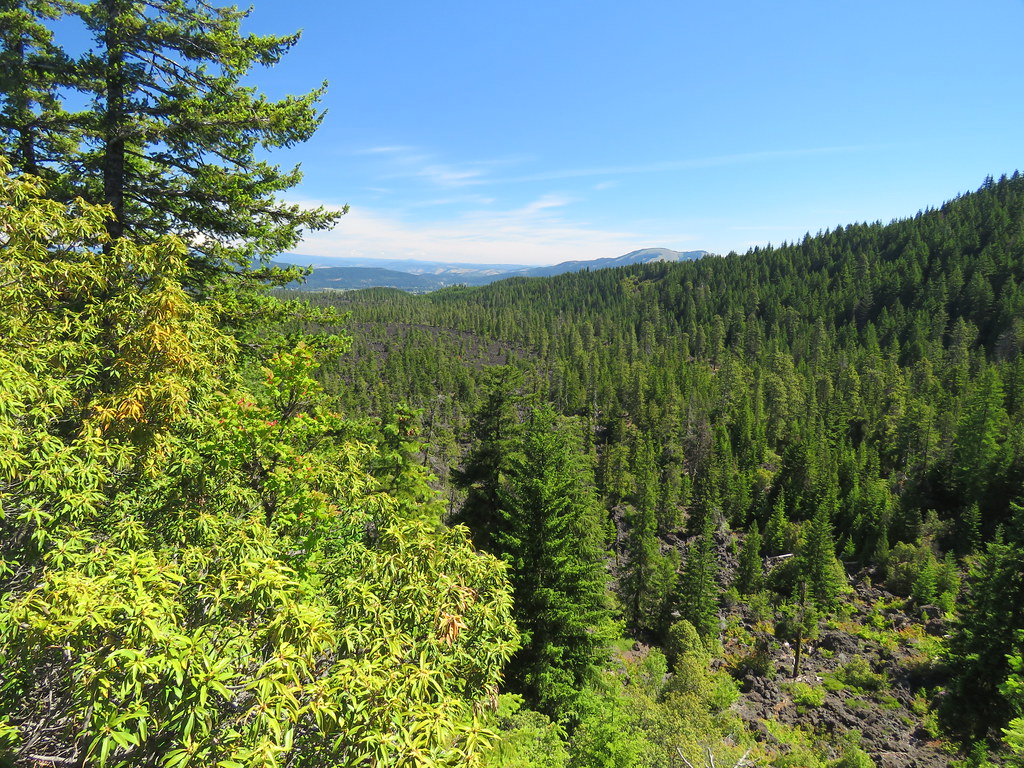 FromVent0 by pauljess999, on Flickr
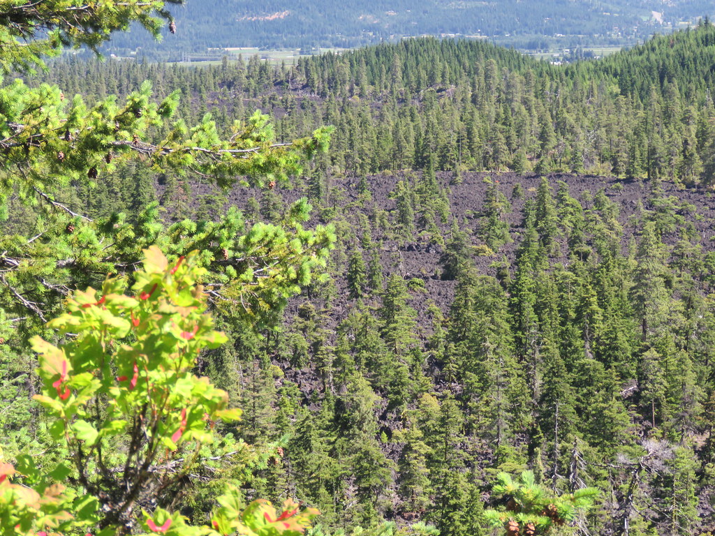 FromVent1 by pauljess999, on Flickr
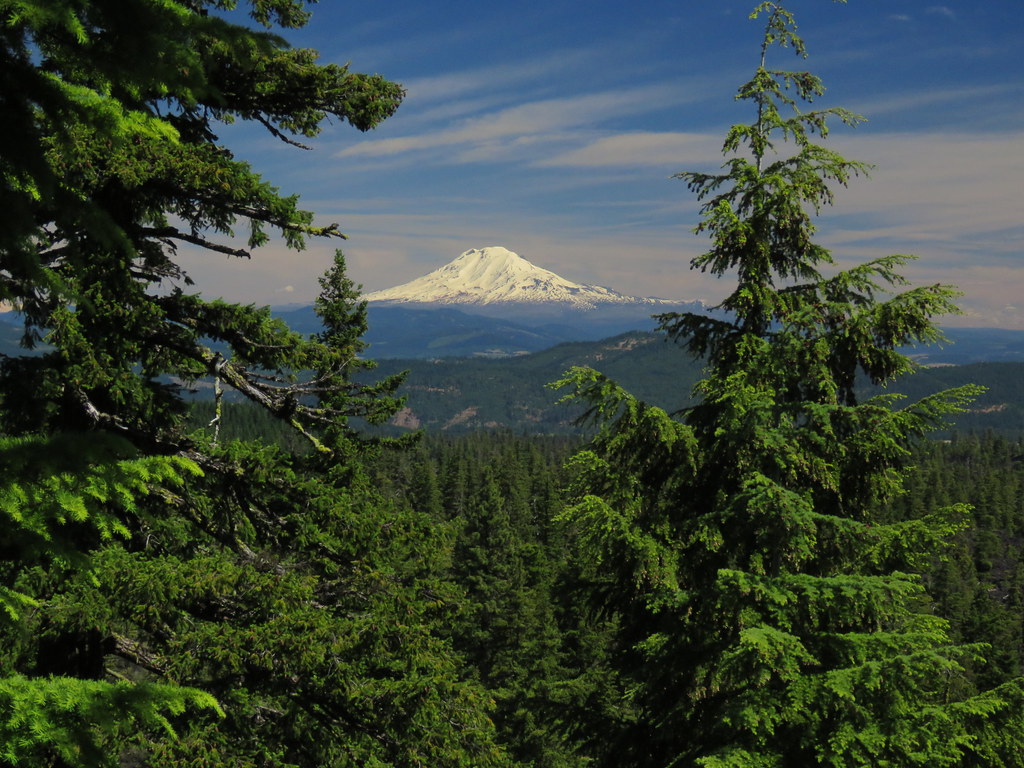 FromVent2 by pauljess999, on Flickr
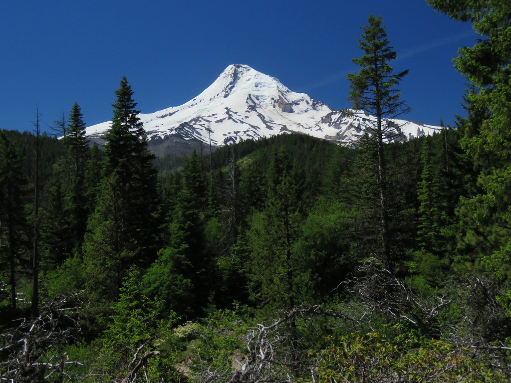 FromVent3 by pauljess999, on Flickr
There is a ammo box/geocache at the highpoint of the vent. I made my mark in the summit log and rummaged around the cache, nothing worth taking except maybe that plastic dinosaur but since I'm not a geocacher I just left it.
The bushwhack was bad enough I decided to call it a day and head back to the truck. Given how bad the way up was I went back by a slightly different route as what could possibly be worse? Fortuitous as on the way back I ran into a trail. Now I'm sure it is game trail but seldom have I seen such nice and directed tread formed by even-toed ungulates. I'm sure human travelers use this trail when they run into it. That said I saw no evidence that people have been here apart from the geocache. Very obvious tread. So rather than head south back to the truck I followed this northbound tread that eventually took me into the lava field. Nice.
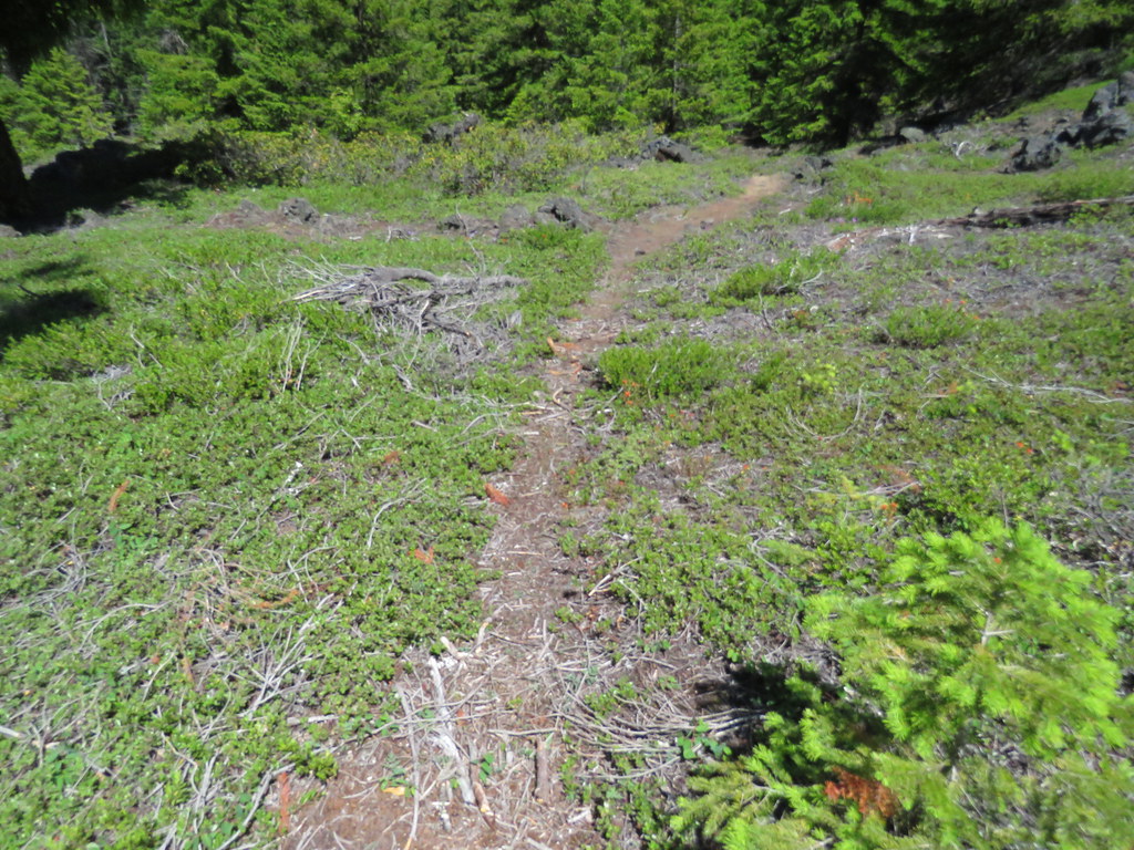 GameTrail by pauljess999, on Flickr
Not only was the tread nice but all the problems I had going up vanished and I was left wandering this game trail in a park-like setting - a wonderful experience. Here is a sample.
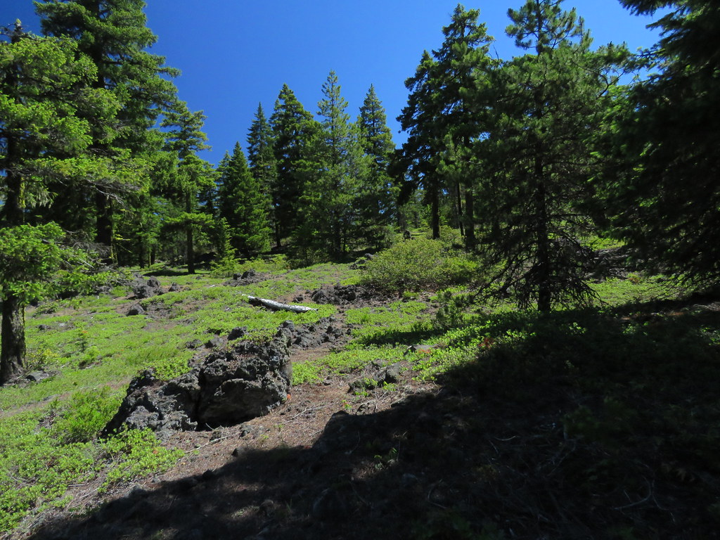 OpenAreaWest by pauljess999, on Flickr
I see now that taking this game trail around the west side of the vent would have been a much nicer route to take to the vent high-point. The bushwhack would have been much easier (but still challenging). Easy access to the lava field too.
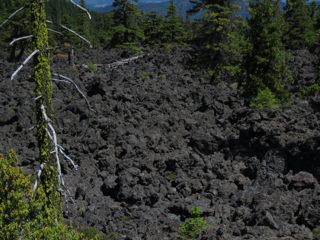
The lava field is what you would expect, basically boulder hopping everywhere you go with occasional breaks by paths formed from local soil generation. I don't have much patience for that kind of travel. The N/S expanse is something like 3-4 miles and you might be able to do the whole thing in a day but it would be pretty unpleasant and very repetitive.
A little beyond the end of tread and I was into the lava field proper. Lots of deep holes in the lava that Sinclair sez be careful not to disturb because of bats and.other creatures that inhabit these parts.
 LavaField3 by pauljess999, on Flickr
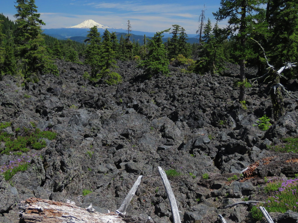 LavaField1 by pauljess999, on Flickr
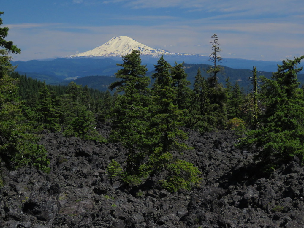 LavaField0 by pauljess999, on Flickr
Amazing how soil is being formed in the flow as in addition to the widely spaced Doug Fir trees there are lots of flowers like this salmonberry.
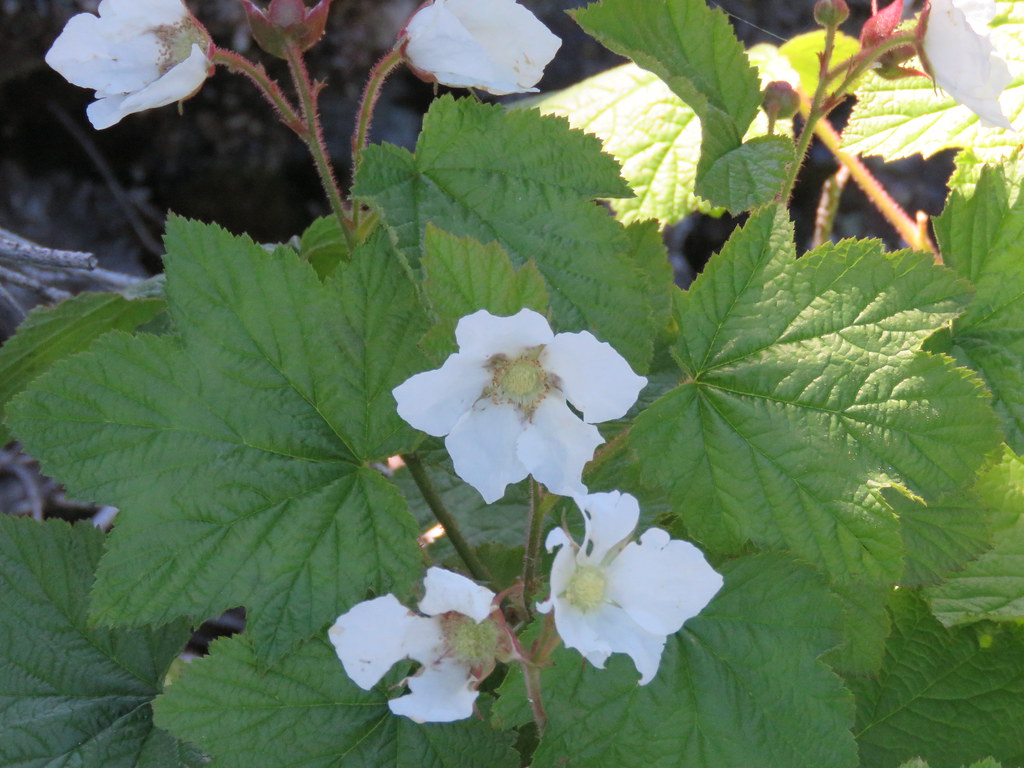 SalmonBerry by pauljess999, on Flickr
To sum, this would make for a nice little stop-over on the way to the trails emanating from the Laurance Lake area - the west side of the vent is really nice. As I had time, I did a little bit of Pinnacle Ridge just to fill out the day.
I doubt I did more than 3-4 miles and EG was negligible. Here's a Google Earth rendering of the route. The milky Elliot Branch runs down the middle of the image.
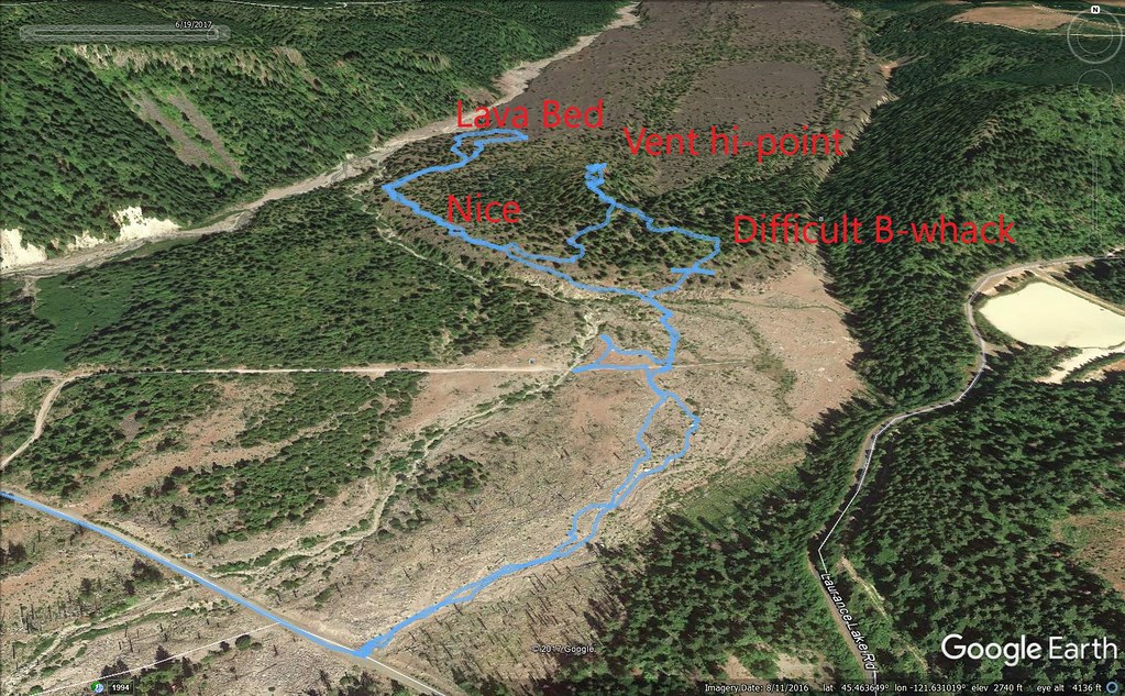 GEImage by pauljess999, on Flickr

