The notion for this hike originated from viewing the Bull Run watershed boundary through a kml file posted by Lurch back in June of 2011 that can still be found here. While viewing this kml file in Google Earth (GE), I noticed a little piece of a ridge running NE from Mt Talapus was not in the management unit and that in GE the ridge looked fairly clear with wide ranging views and even a look at the large lake below Mt Talapus. I let this finding stew for a while and this year decided to take a stab at hiking up this ridge to see what I could see. It proved to be a challenging venture.
Recon, Tanner Cutoff trail, March 24, 2013.
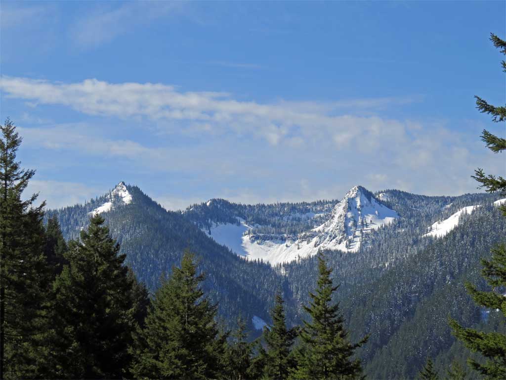
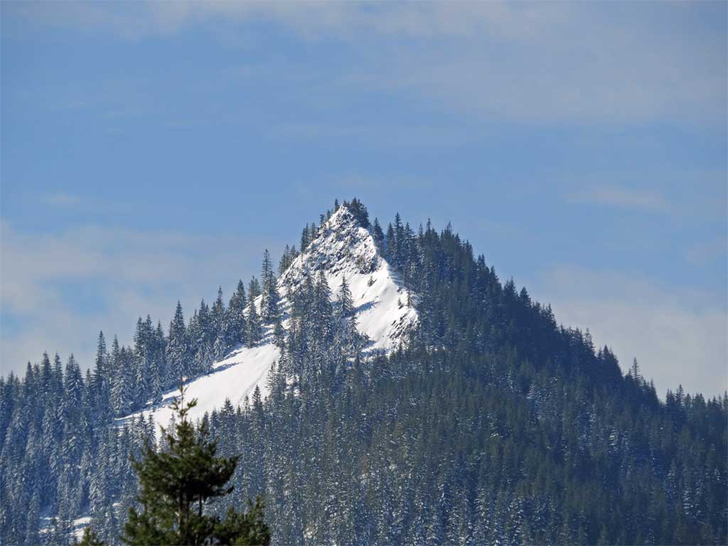
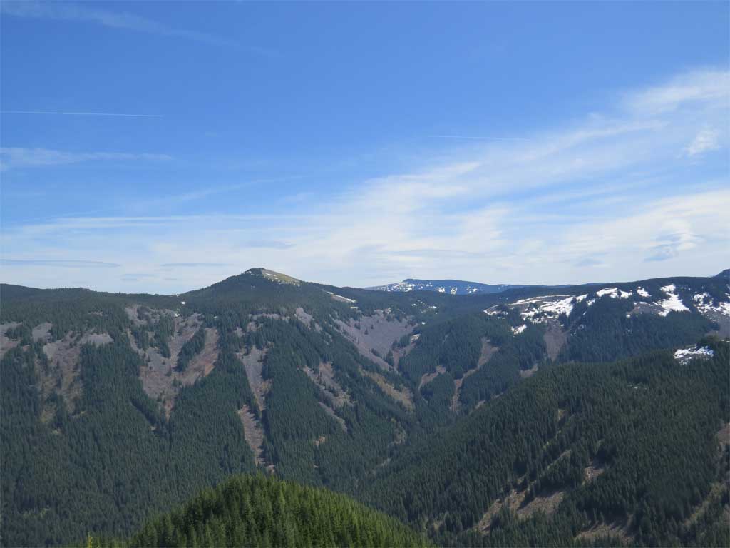
Mt Talapus from the Tanner Cutoff Trail - Mt Talapus is the point right of center, my target is the near point left of center.
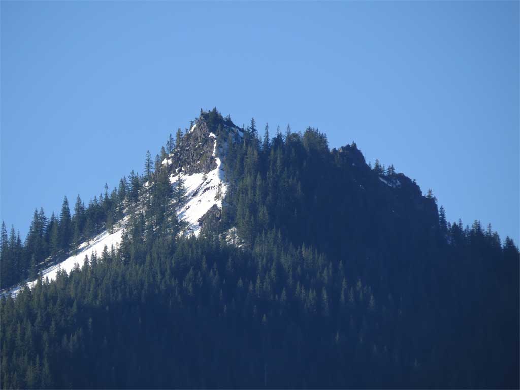
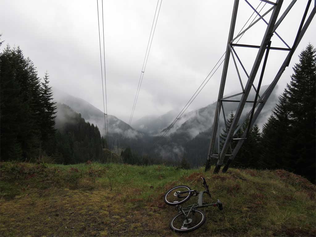
To see what I was attempting from the ground, at the end of March I did a hike up the Tanner Cutoff Trail to check on feasibility. From one of the power-line tower clearings I was able to get a clear picture of the point, all covered in snow. Looks possible, is the snow a good thing or a bad thing? A long ridge to a clear top.
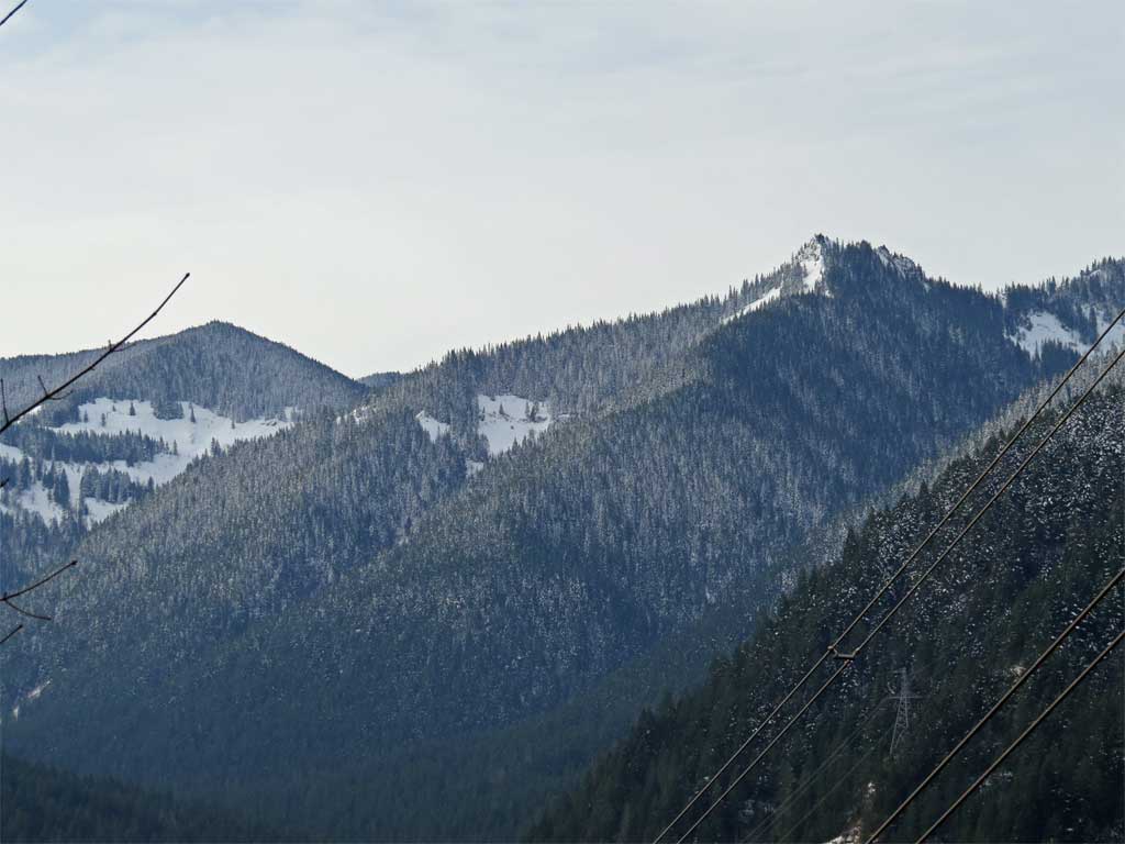
Zoom on point from tower landing.
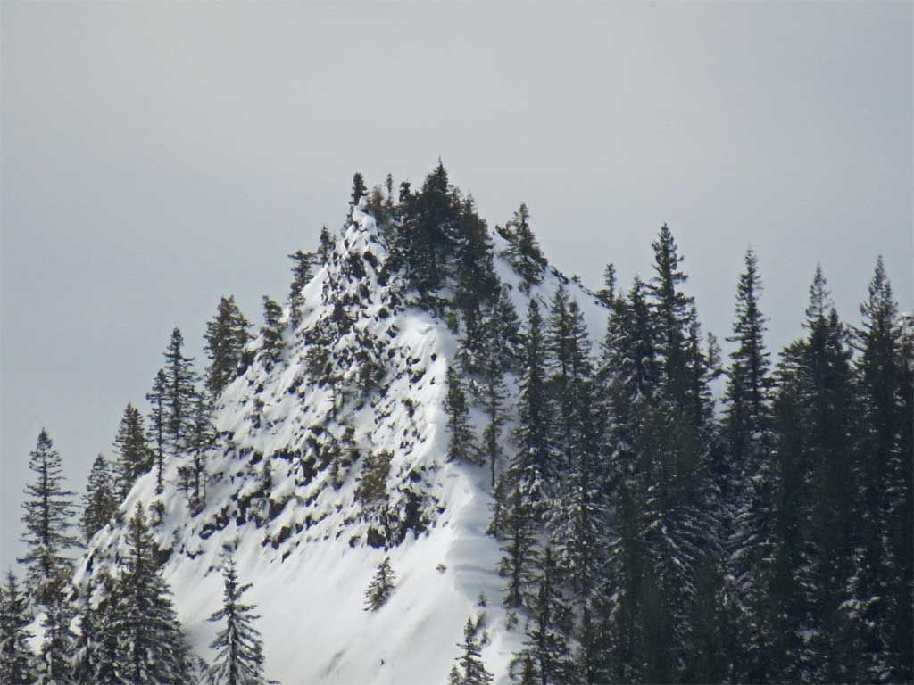
Zoom on point from Tanner Cutoff Trail
I decided it look possible, so I started preparations for an attempt.
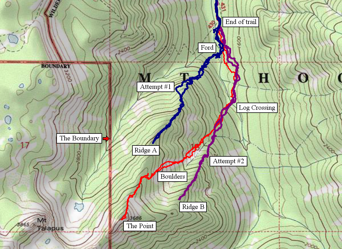
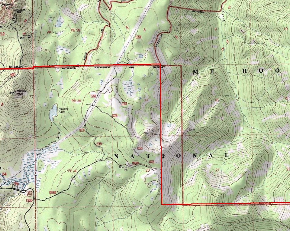
Usually I post the map at the end of a report but for context, I'm posting the annotated map here. The blue is attempt #1, the purple is attempt#2, and the red is the final and successful attempt.
Attempt #1, March 30, 2013
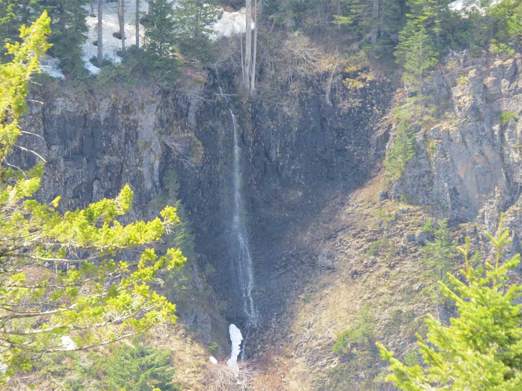
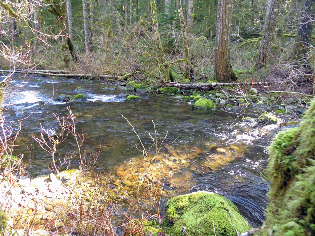
There are a couple of candidate ridges for gaining the point originating from Tanner Creek. Attempt 1 focused on the ridge nearest the end of the Tanner Creek trail. There are a couple of obstacles that one must confront in making this journey, the first is the long approach on the 777 road just to get to the Tanner Creek Trail and the other is Tanner Creek itself which at this time of year can be difficult to cross. I figured if I went far enough upstream I could cross a much reduced Tanner Creek with or without a log. I'm not a big fan of crossing slick logs so I packed the Keens for a ford and an ice ax for the final approach. At the top tower landing I took a check on snow conditions
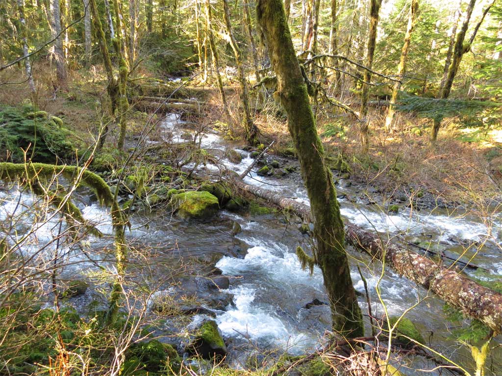
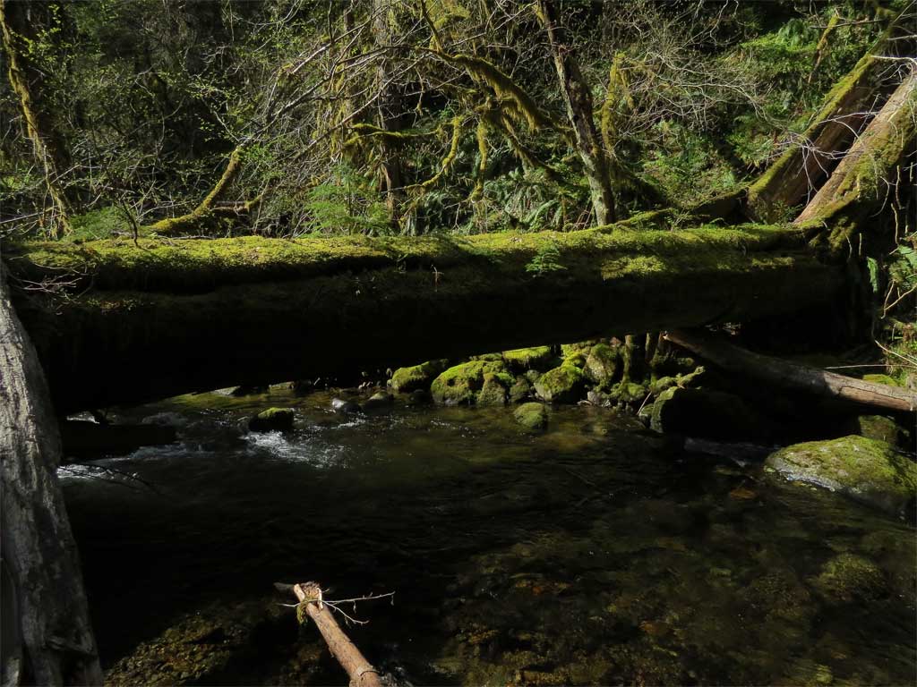
After hiking down the 777, past the end of the Tanner Creek Trail I arrived at the point where the unnamed stream draining the unnamed lake below Talapus entered Tanner Creek. Here we are, the stream from the lake is coming down from the top of the photo and Tanner Creek goes from left to right - yes, in the lower right that is a log that goes across Tanner Creek, too steep, slick, and skinny for me:
I went a little beyond the confluence of the 2 streams and located a deep but slow moving section of the creek and made a successful crossing in thigh-high frigid water.
From there I proceeded up the near ridge - it started out nice enough but then rock walls cropped up that had to be routed around and once beyond the cliffs I hit the rhododendron zone. The ridge narrowed nicely but the brush became really bad. I made it to the 3000' level with nothing but brush in front of me and I hit my turn around time well short of the goal. Obviously this was going to take a little more effort and a lot more time.
Attempt #2 April 21, 2013
For attempt #2 I called on the indomitable Carlos Masters as I do when the challenge is slightly beyond what I think I can do myself. Attempt number #2 was to pull out all the stops, we'd start early, end late, and use bicycles for negotiating the long approach on the 777 road - the bikes turned out to be a huge win knocking 1-2 hours off the approach. And after all this preparation, I couldn't have picked a worse day for this attempt. The weather forecast had been very changeable all week with sometimes sun, showers and rain. But on the day of the attempt I hoped that by the time we got near the top the clouds would break and there'd be glorious sunshine. Never happened, socked in the entire day, rained on, miserable conditions - can't even see the silly thing.
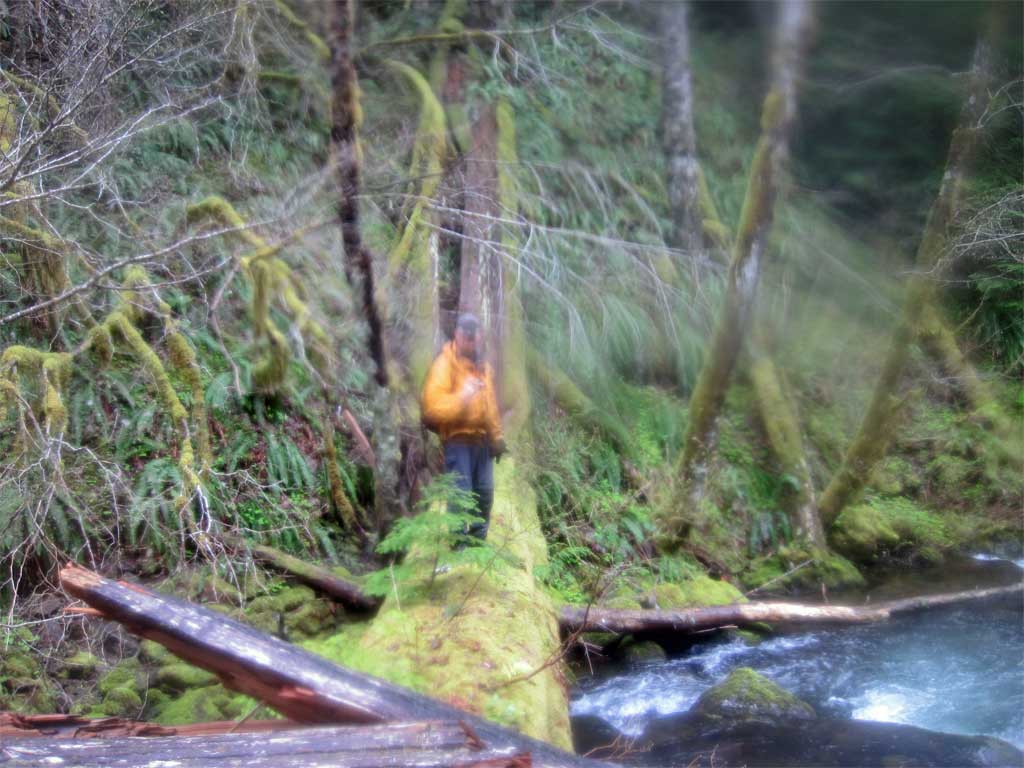
We made it to a rocky opening around the 3000' level on a ridge south of the ridge used in attempt 1. The views from there would have been fantastic had visibility been greater than a couple hundred feet. We did make a discovery that made possible attempt #3 and that was a very large cedar bridge across Tanner Creek making for an easy crossing.
Carlos on the crossing:
We also learned that this ridge had a brushy rhododendron problem just like its neighbor to the north. Obviously another route needed to be found.
Turn around point for attempt #2, would have been great.
Attempt #3: April 27, 2013
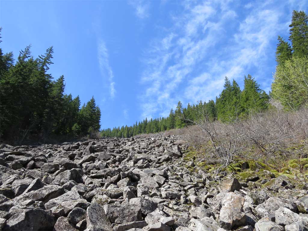
With some trepidation I launched another venture but this time, due to scheduling conflicts, I'd have to do it without Carlos. Last week I reviewed with Carlos the results so far, bikes good, early start, crossing Tanner on the log bridge but ridges were tough. In a review of GE imagery the long boulder field between the ridges might provide the best route to gaining elevation and avoiding the brush. So it was decided the next attempt would utilize the boulder field.
An early start: I departed Eagle Creek TH around 6:00AM on bike, up the stairway to the viaduct around Tooth Rock. Glassy surface on the Columbia.
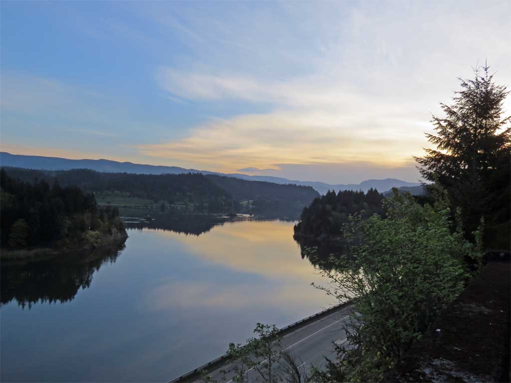
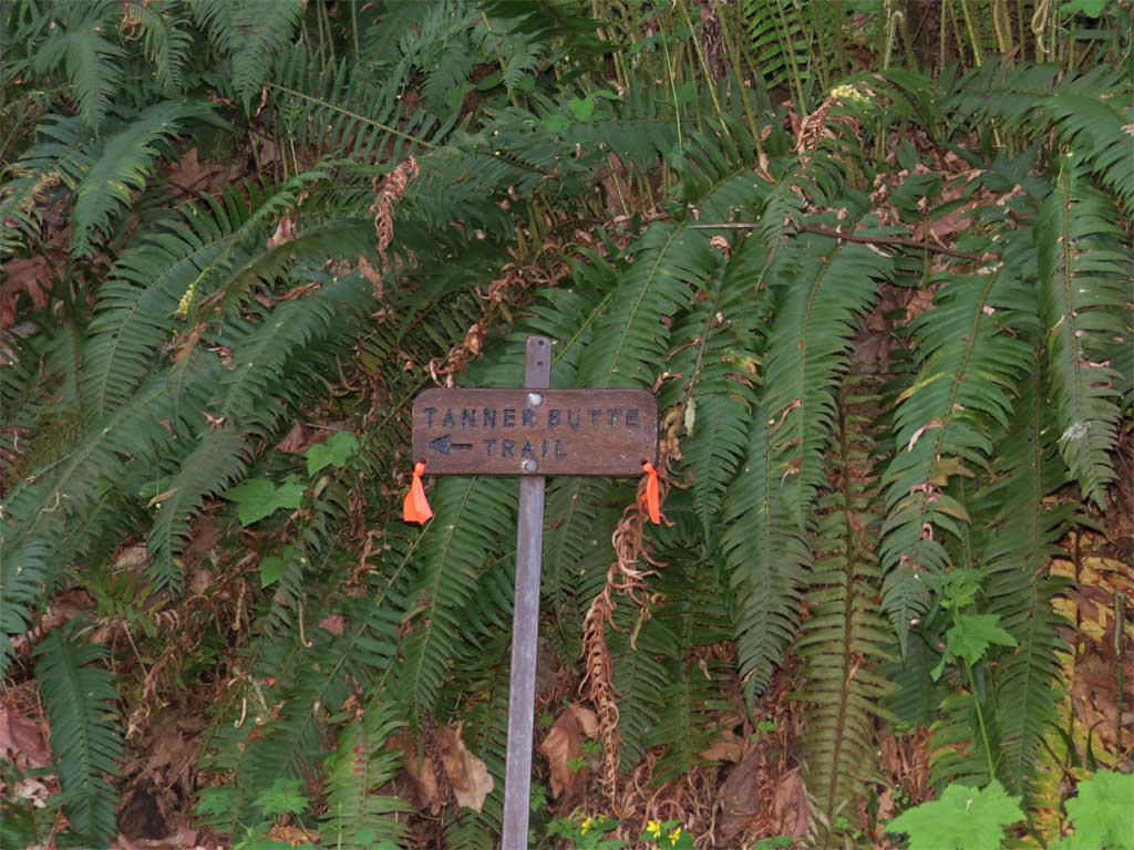
I climbed the stairway to get on the old CR highway viaduct and turned off at the wagon road - now signed with as the way to 'Tanner Butte Trail' and pushed the bike up the trail to the intersection with the 777 road.
From here it was basically push the bike up to the 1700' level and then coast down (wheeee!) to the Tanner Creek Trailhead - arriving around 8:00AM.
I lit out on the Tanner Creek Trail under clear blue skies and out to the campsite and fire ring at the end of the trail.
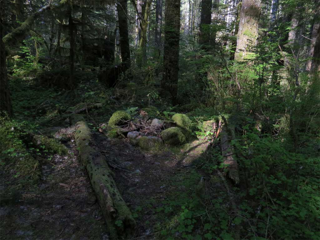
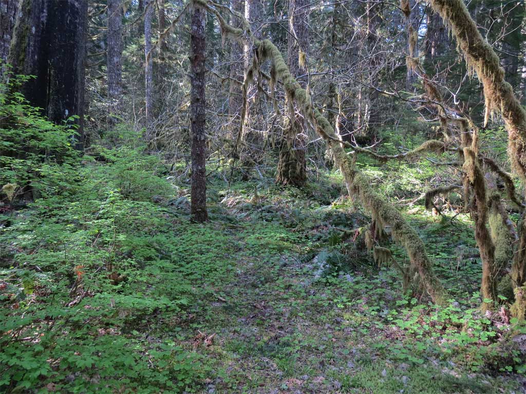
The bushwhack from here to the log crossing went nicely - at this time of year the Devils Club has yet to leaf out (and there is lots of it) so route finding was a little easier. On attempt #2 Carlos found what looked like trail beyond the old camp - game trail or fragments of the Tanner Creek Trail that once was? I have on the 1963 MHNF map the #431 trail going on up Tanner Creek to end on a road in Bull Run.
I made it to the log crossing around around 9:45 - right on schedule.
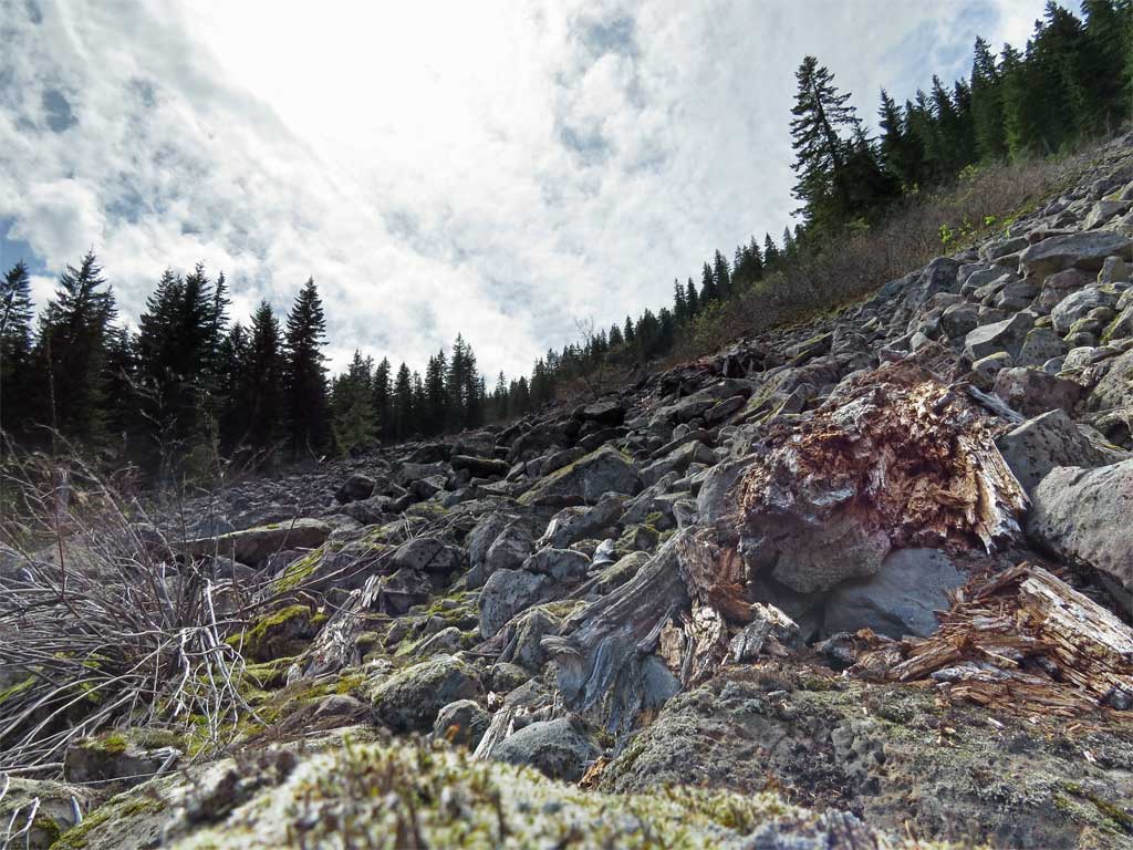
Did the easy crossing and headed up the hill to the boulder field. And here was another piece of knowledge gained from attempt #2 - the side hill of ridge 'A' was fairly brush free and loaded with good game trail. This made gaining the boulder field easy - a mere 30-40 minutes after crossing the creek. The boulder field itself was a marvel. like the Elevator Shaft but no moss and far more stable rock.
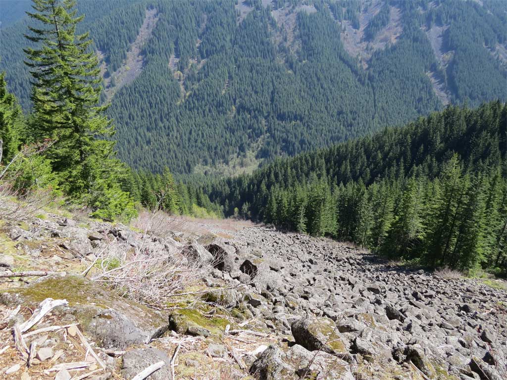
I ascended on the boulder field like a 1000' staircase - after an hour and a half on this, I was headed for the top of the ridge that had defeated me on my 1st attempt. Looking back:
From the boulder field I could see where Carlos and I had turned back on ridge 'B'.
Now I was into the brush, but brush of less density than I had confronted in my 1st attempt on ridge 'A'. The brush would come and go until I found myself at the base of the cliff below the point. Looking up:
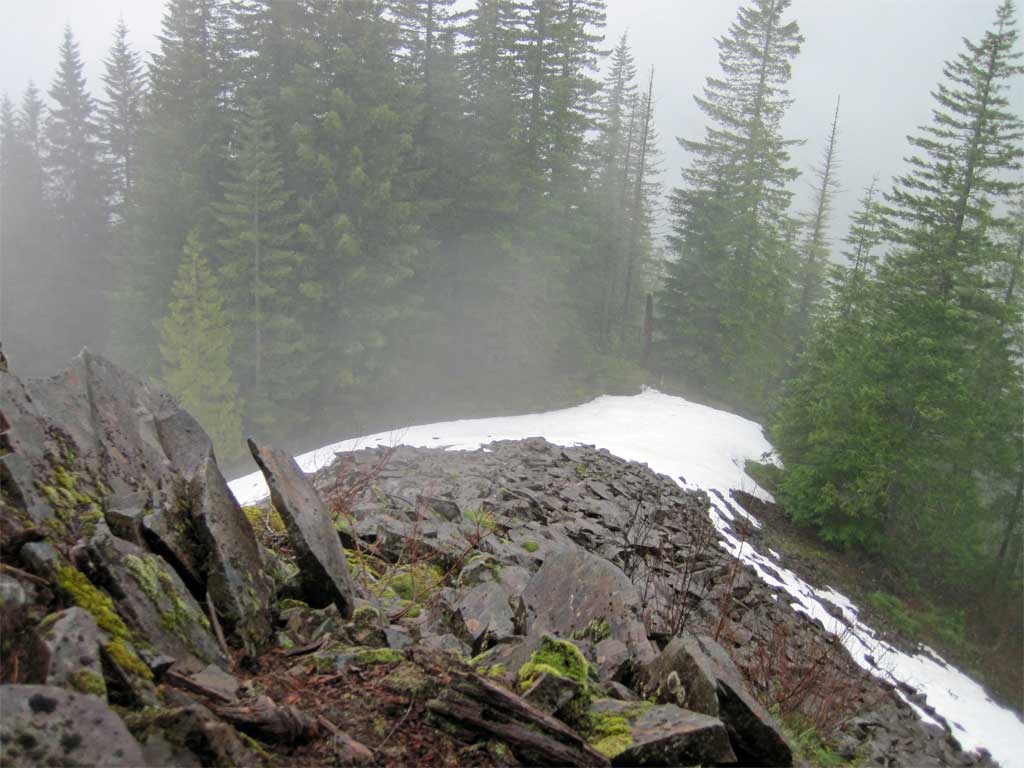
The slope steepened considerably and now, besides the brush, late spring snow simultaneously provided additional aid and obstacles. Aid by covering the brush and an obstacle when nearing exposed parts of the final climb.
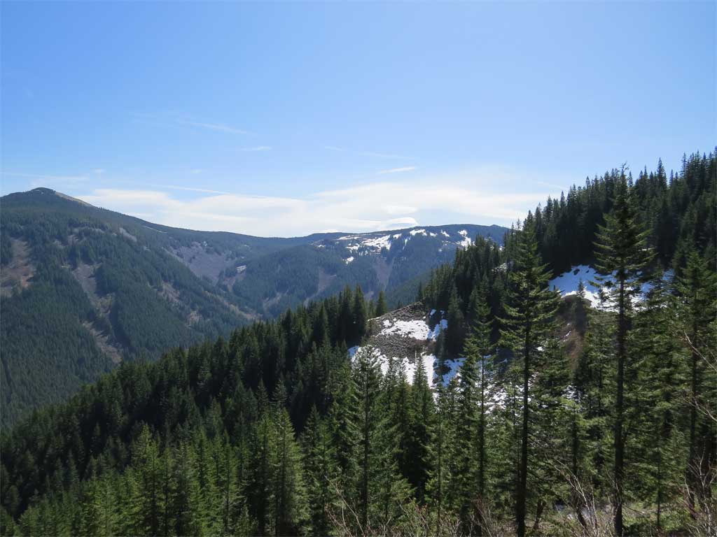
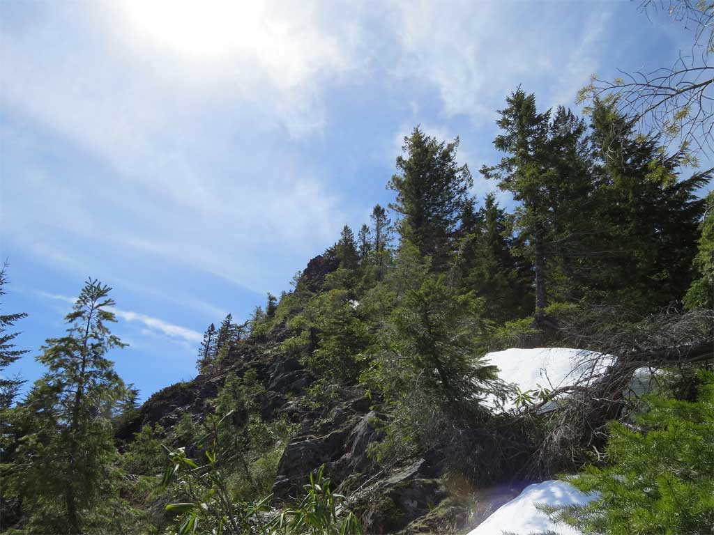
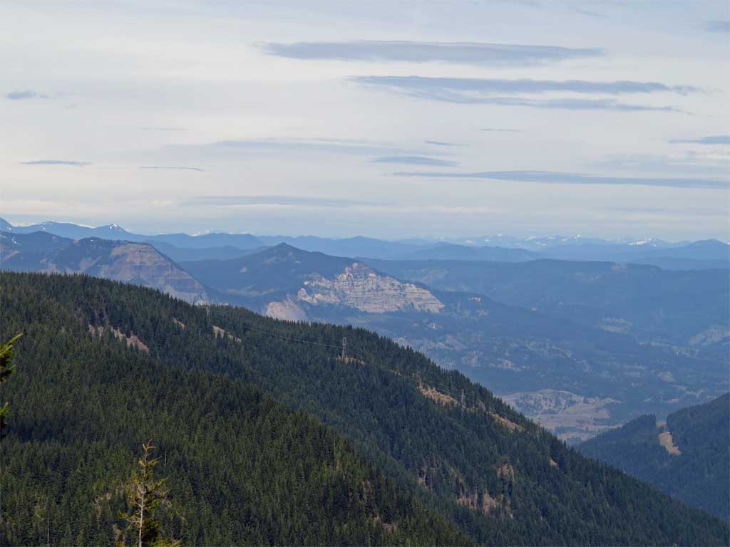
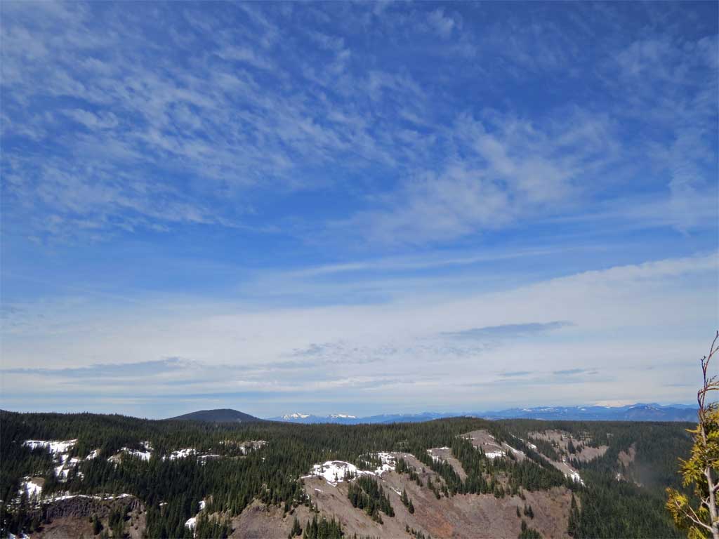
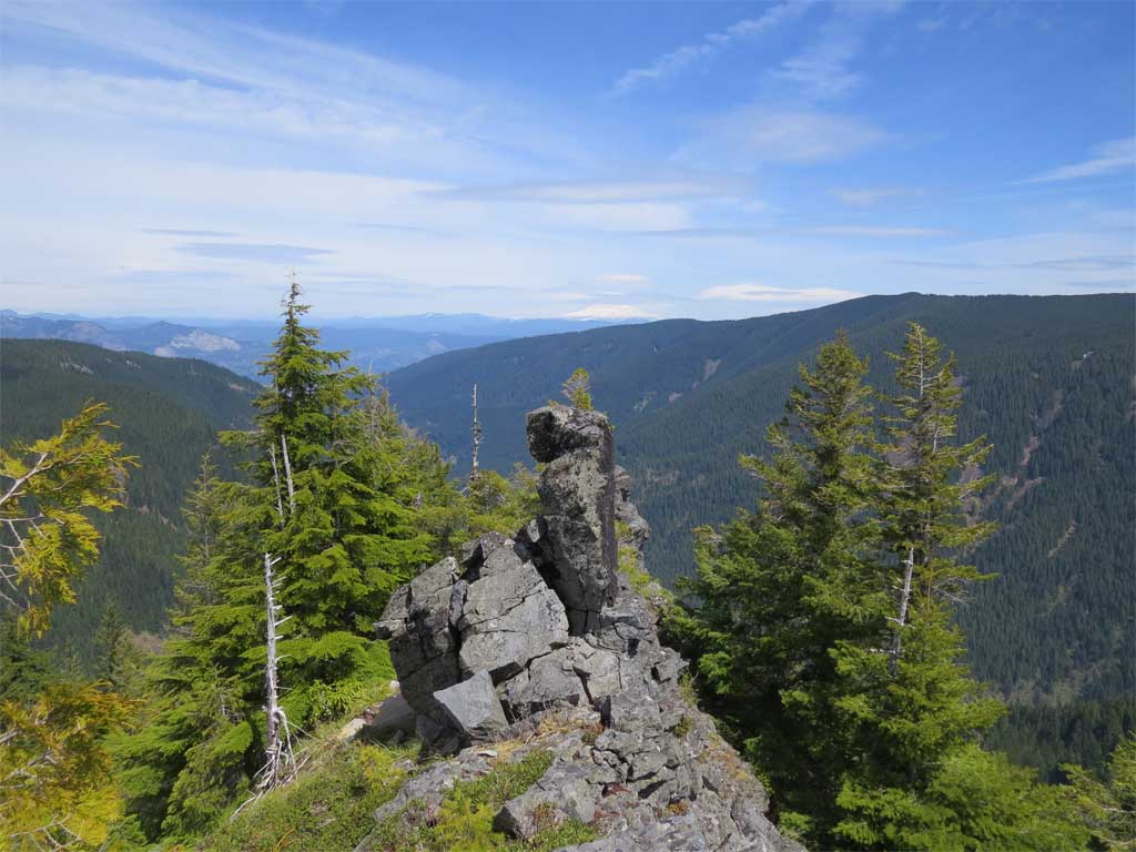
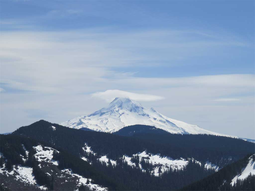
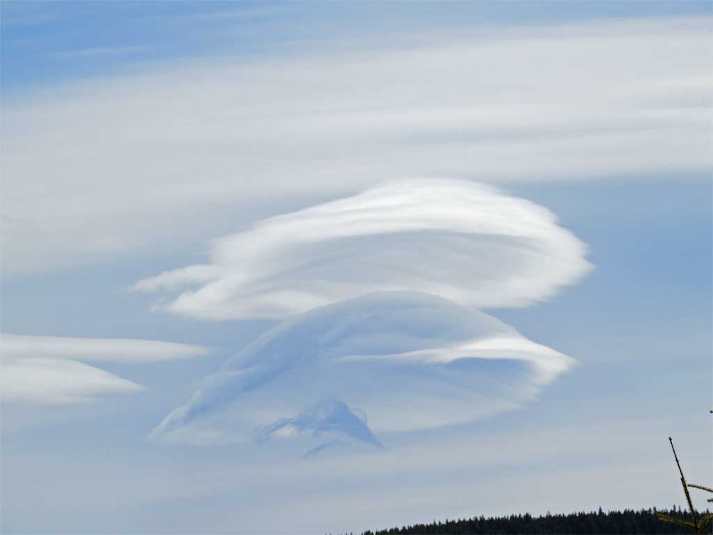
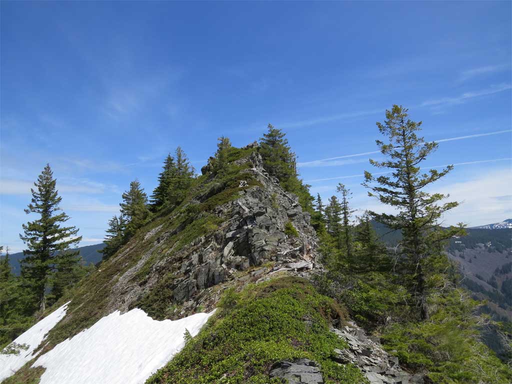
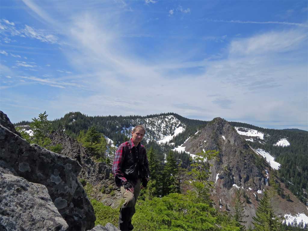
Rather than go directly to the top I stayed a little back from the edge and did a switchback affair to gain the top of the ridge proper. All the world opened up before me. A 360' view. Looked straight at Mt Talapus as equals.
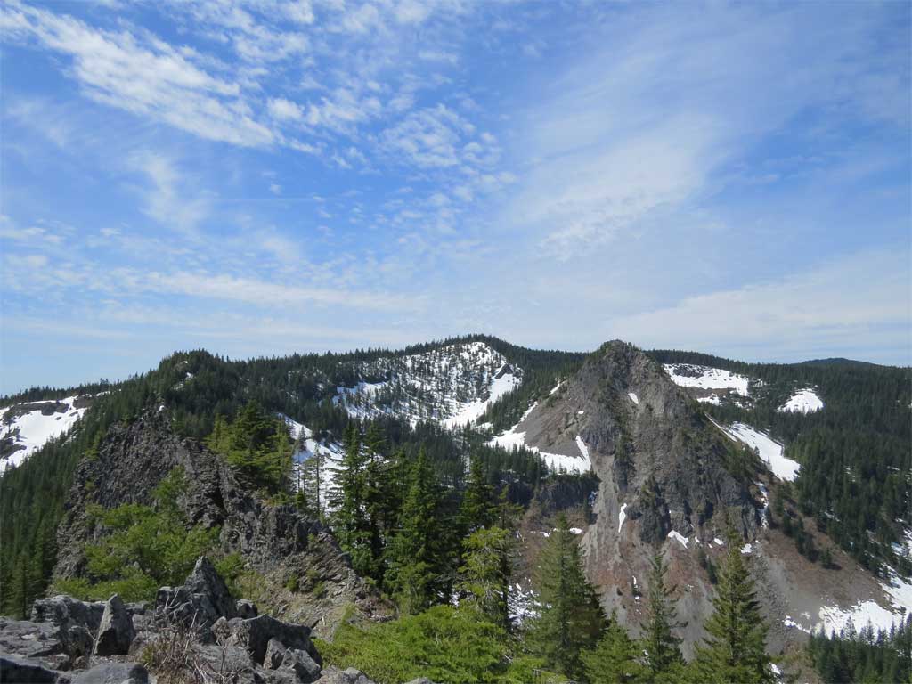
I'll let the photos speak for themselves:
On the return I looked back up the boulder field, it was a good day:
I was not able to view the lake so there is still work to be done on this. I did not want to push the boundary much but GE shows had I gone just a little further west the lake would be in view without violating the exclusion zone. Best to do this without snow around mid-May or early June.
The mileage for the final attempt was around 20, elevation gain around 1 mile, I was on bike and hiking for just about 12 hours.
Here is a .kmz file of the final attempt for viewing in Google Earth
 TalapusFinal.kmz
- (45.7 KiB) Downloaded 305 times
In the course of doing research for this adventure I ran into a couple of things that need clarification from the Forest Service about what is the actual boundary of the Bull Run Watershed Management Unit. I downloaded a shapefile from the MHNF web site call bullrunwsh_mu.zip - you can find it at:
http://www.fs.fed.us/r6/data-library/gi ... wsh_mu.zip
There is FGDC metadata with a POC at:
http://www.fs.fed.us/r6/data-library/gi ... tadata.htm
Here is a KML file of the shapefile for viewing in GE:
- bullrunwsh_mu.kmz
- (14.91 KiB) Downloaded 281 times
I did call both Bull Run and USFS to request the actual definition of the BRWS MU as they are required by law to make this map available to the public. According to laws establishing the MU the FS district 6 office is the official keeper of the map but to get an actual look at an 'official' map or definition is likely a journey that would make Franz Kafka weep.
The forest service shapefile is intriguing to say the least.