Whale Creek Falls + Barrier Falls (merged)
Posted: October 10th, 2011, 12:53 am
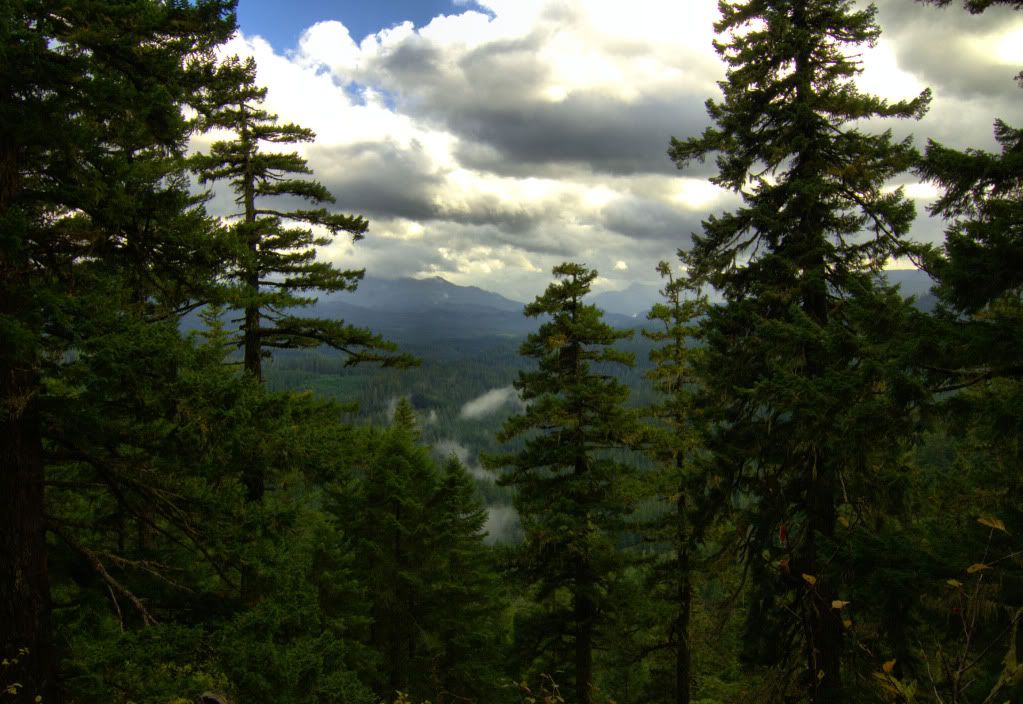
Been awhile since I'd been out exploring, so I decided to re-find Barrier Falls on the Oak Grove Fork of the Clackamas River with a friend. It's located a mile or so downstream of Harriet Lake
When I went to pack my DSLR, I found that I had left it turned on by the computer, and the battery was dead, doh! So, it was gonna have to be an iPhone kind of day. Never-the-less it ended up successful.
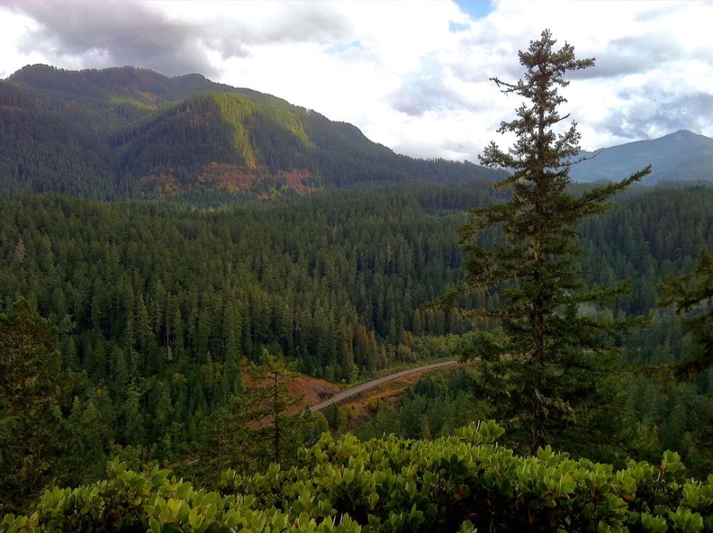
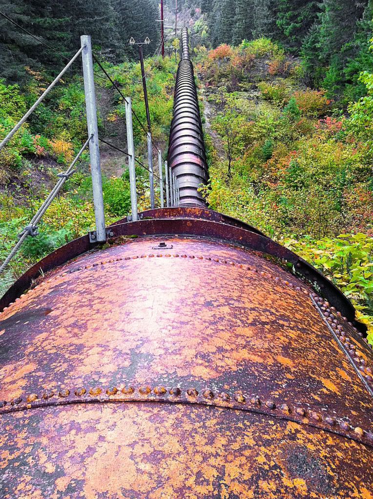
After finding the pull-over on FR4630 that's straight up the hill from the falls, we set out down the steep canyon. First we had to cross the Harriet Dam pipeline.
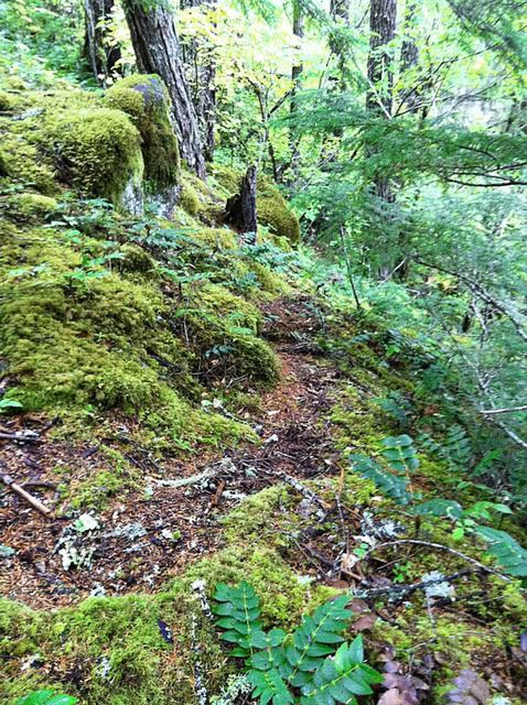
Climbing down the hill, there's a convenient game trail for part of it.
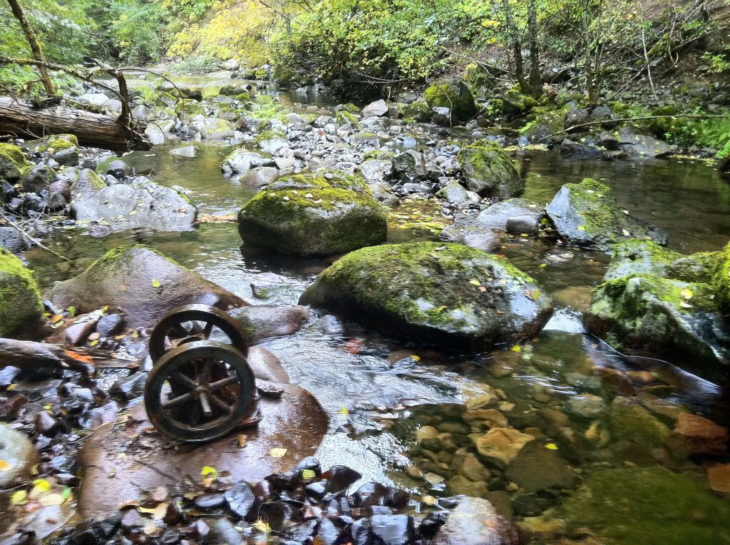
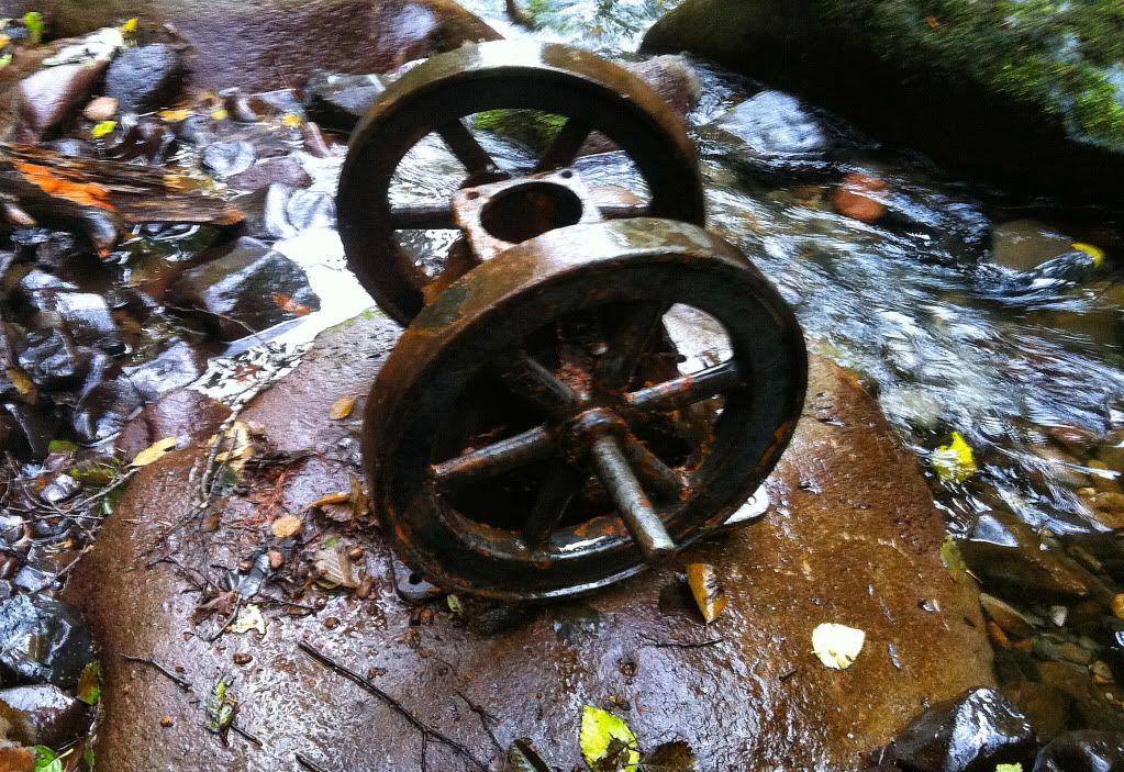
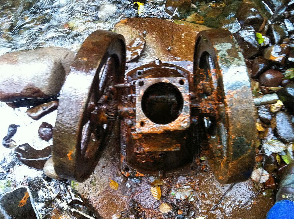
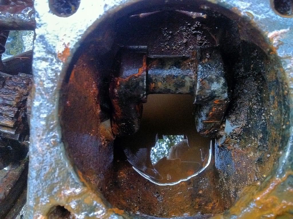
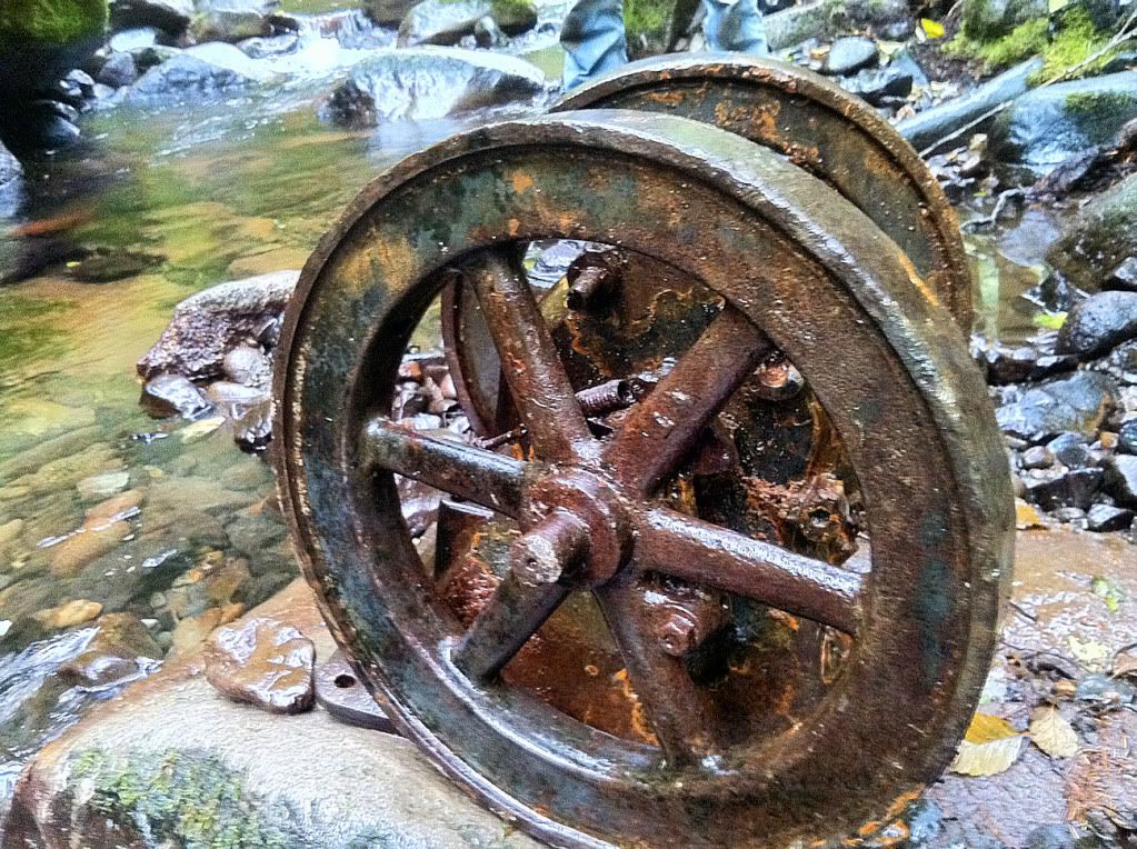
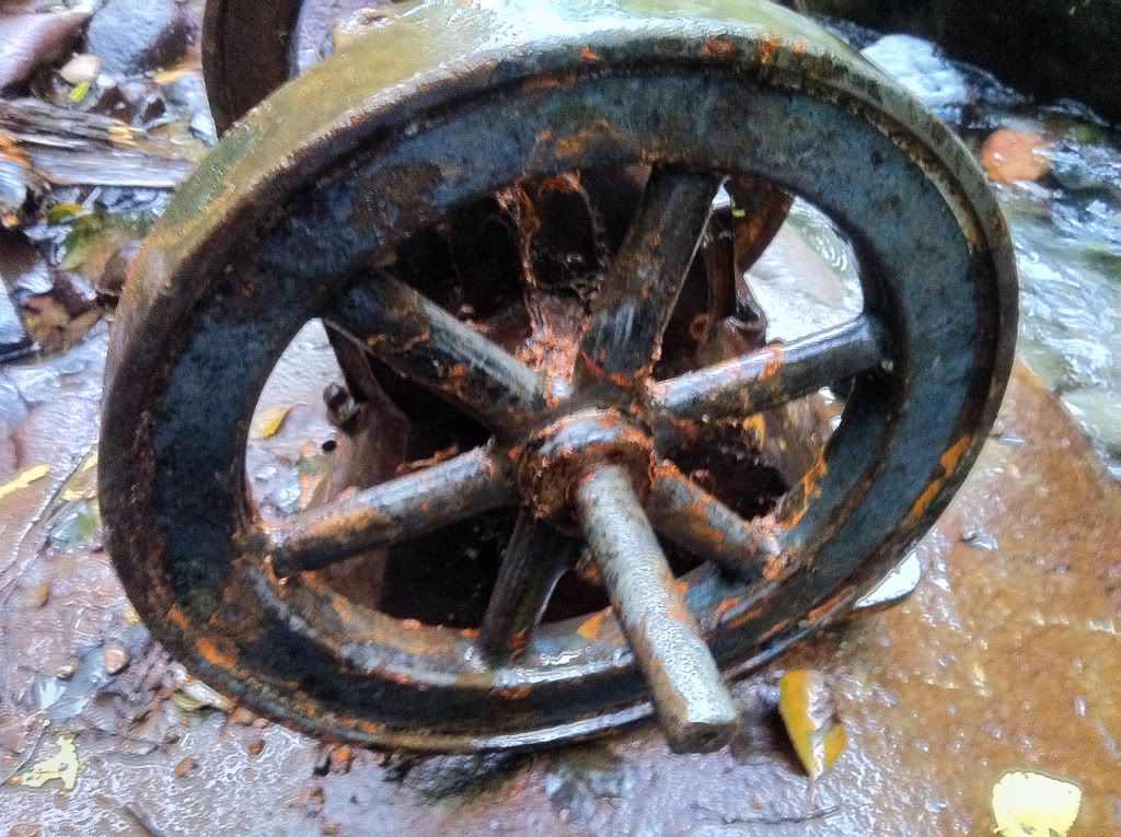
Now for the big surprise. When we reached the river, I spied what looked like a metal wheel poking just above the water. Upon further inspection, it appeared to have a body attached to an axle, with another wheel buried under the rocks. We decided to dig it up. This ended up being an hour-long undertaking, as it had been there for quite some time. Once we got it un-buried, it was all me and my friend could do to move it over onto a rock, it easily weighted over 200 lbs. Here it is, it has a crank and a cylinder like it used to be a motor of some kind. I assume it was from the dam construction upstream. Any ideas what this is??
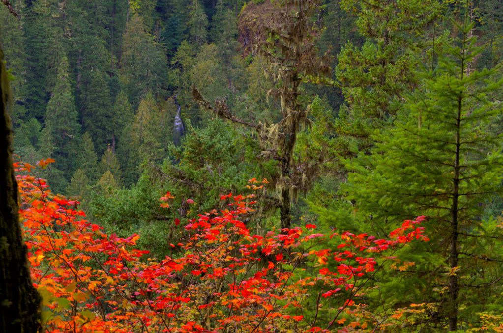
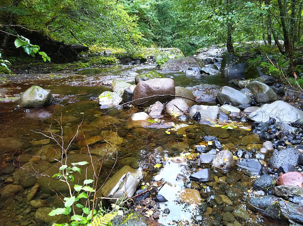
After admiring the old relic, we headed downstream towards Barrier Falls. It was only about 800 feet away. Here's the view as we were approaching the brink.
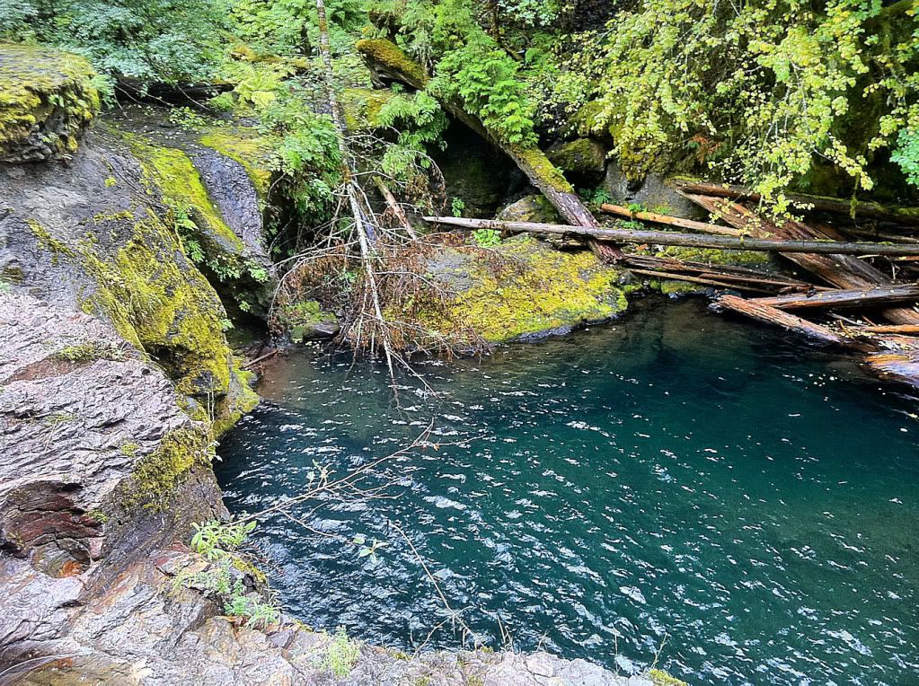
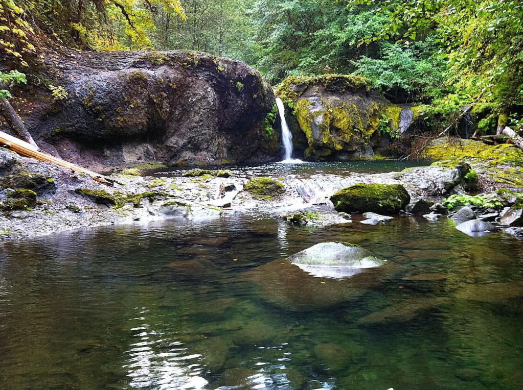
Here's looking over the cliff into the large/deep pool below.
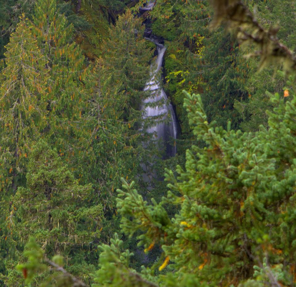
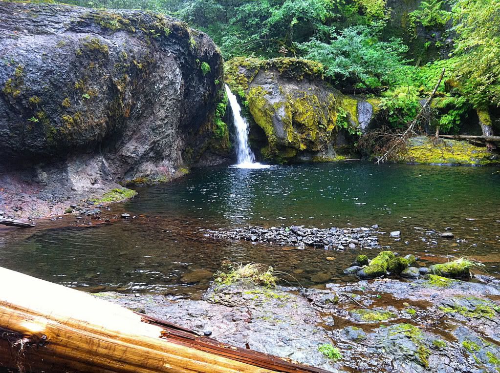
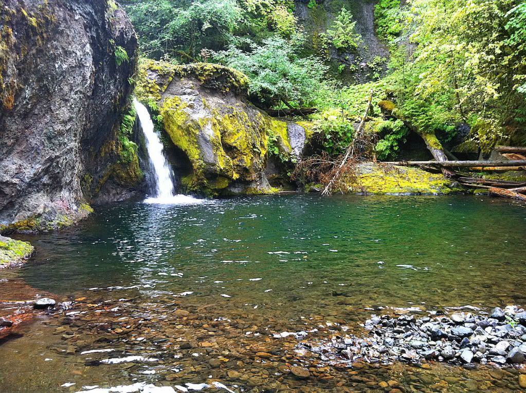
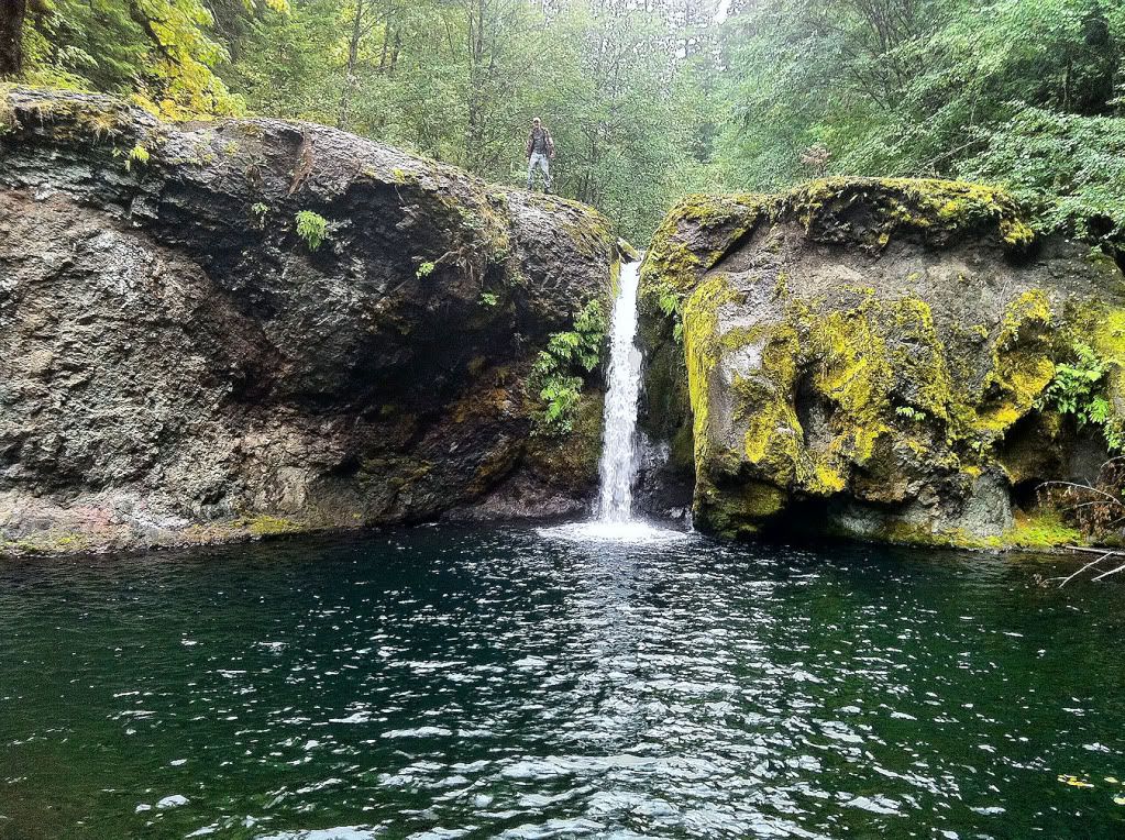
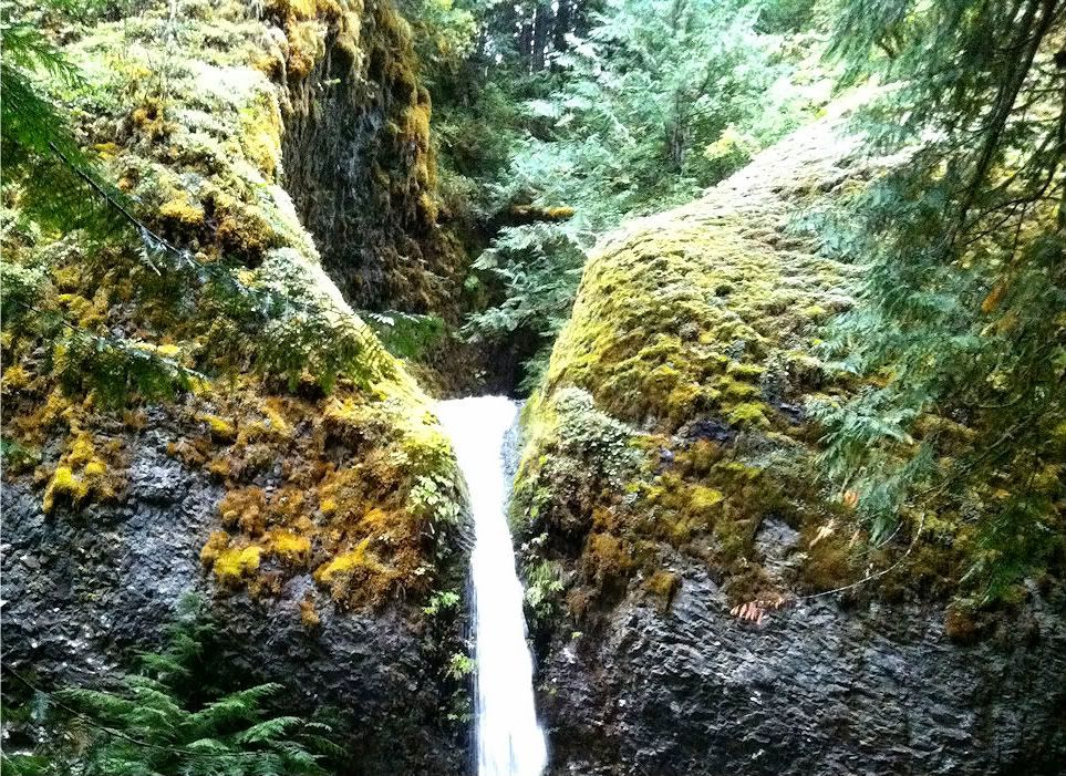
Here it is, Barrier Falls
My friend for scale:
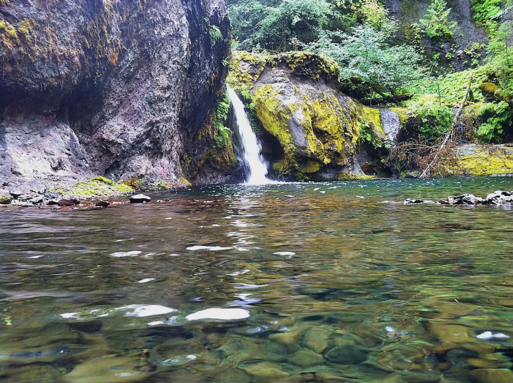
Last one
The falls were a beauty, with the autumn leaves and deep green water, a very peaceful sight. I could've stayed there all day, it was hard to leave.
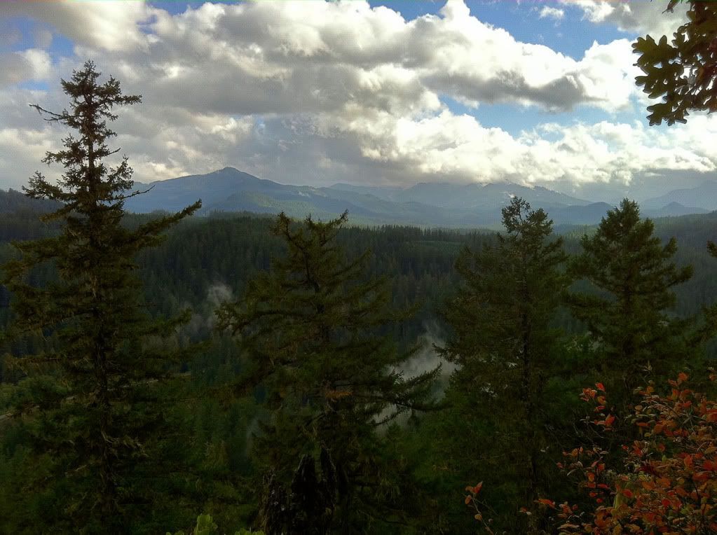
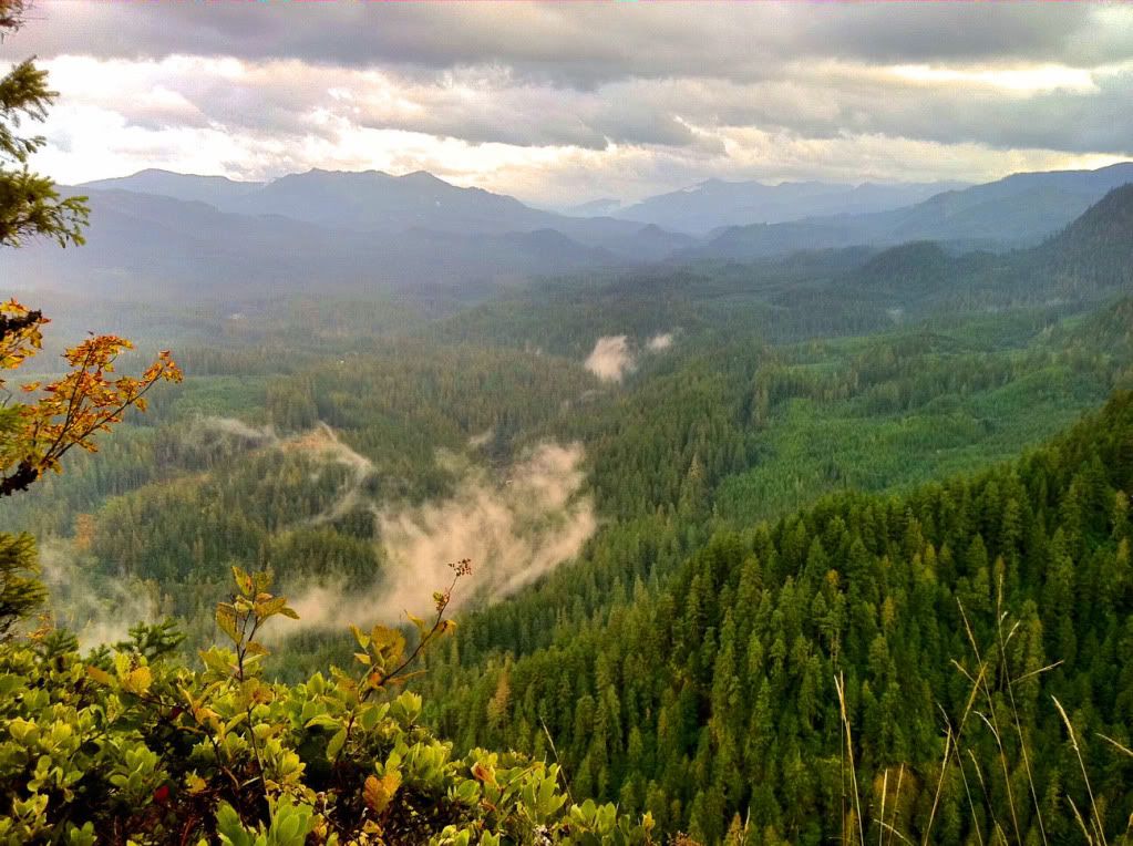
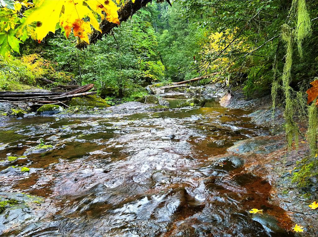
But, there was still stuff on the agenda, so I took one last shot downriver before heading up the near-vertical slope back to the truck.
Whale Creek
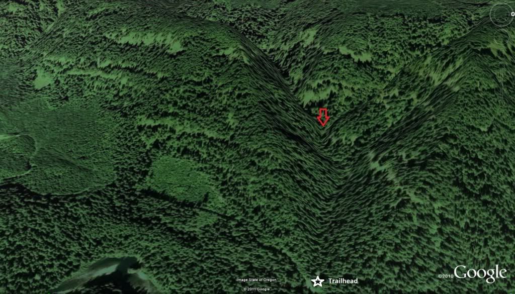
Whale Creek has been a facination of mine for a couple years. It looks too good on the topo to not have a waterfall or two of some sort along its path. The upper trailhead of the Clackamas River Trail is right next to Whale Creek, in fact the parking area is at the mouth of the steep canyon, which worked out perfect.
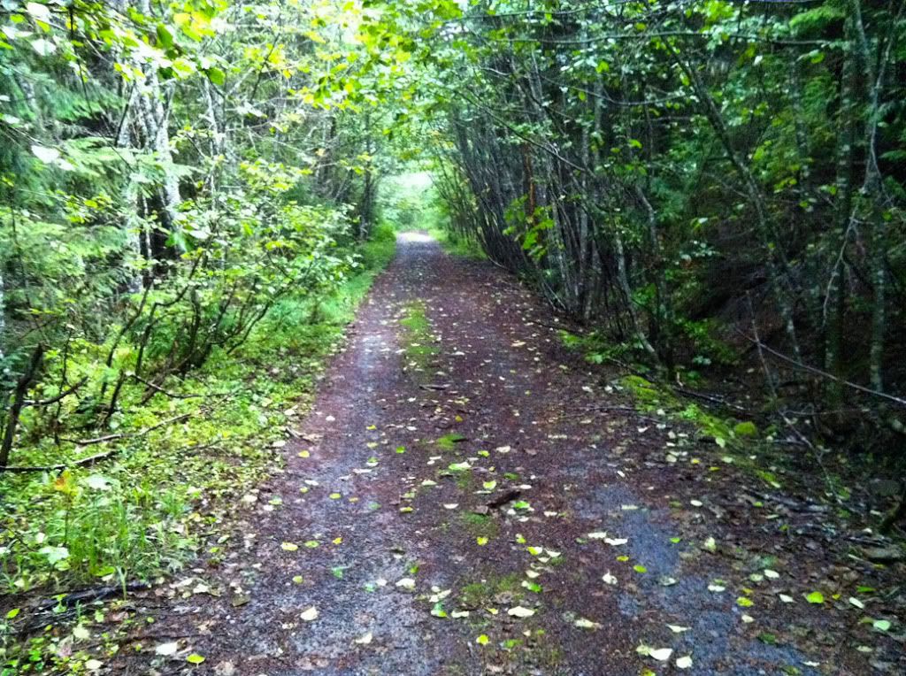
The hike begins on a user trail that is very beat in starting right from the parking lot, can't miss it. We hiked up this trail for a good 20 minutes before it began to fade. Then the real adventure began. The canyon narrows with cliffs on both sides, and there's a legendary amount of old growth trees laying on each other on the narrow canyon floor. Very slow going.
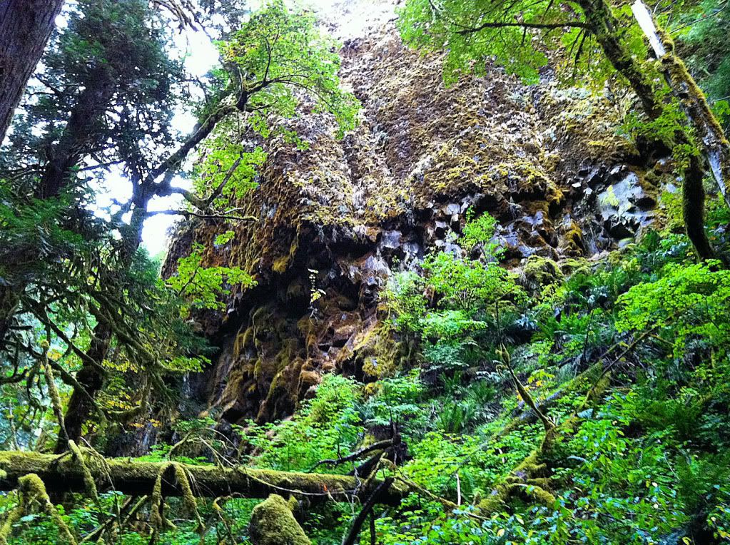
Here's the west-side headwall that towers over the creek.
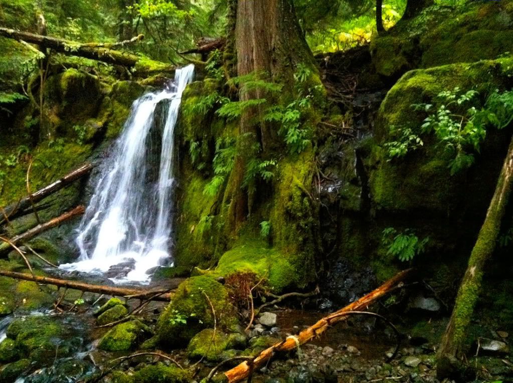
After almost an hour of trudging up the creek, we came to a 40-foot cascade. We almost bailed at this point cause the creek was getting nearly impassibly steep and wooded.
This is the top 10 feet of the cascade, right behind me is a very big drop off with water cascading down over boulders.

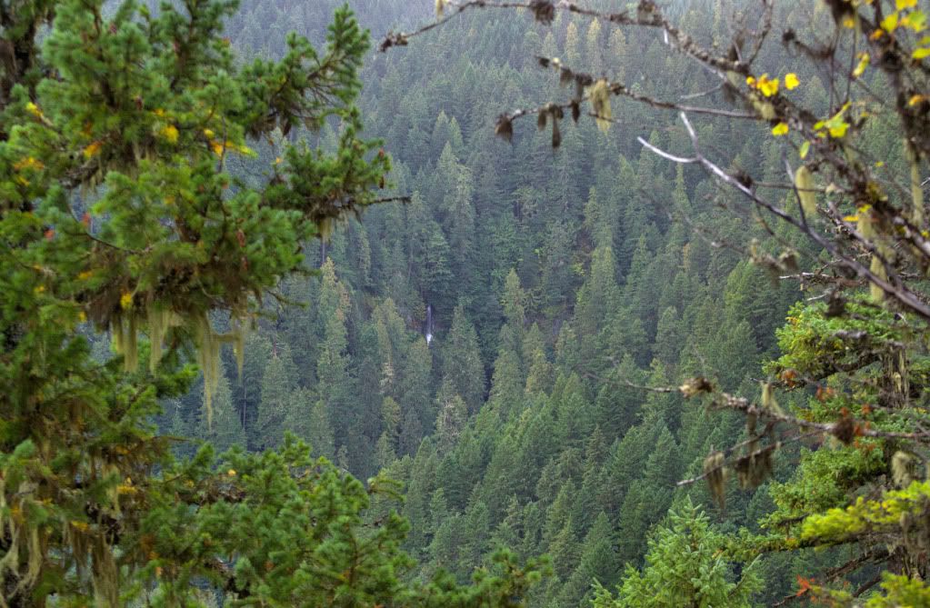
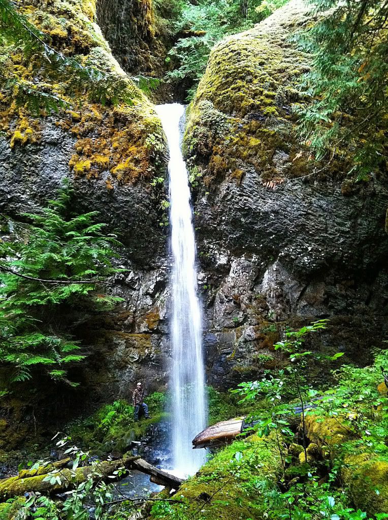
My friend decided to peek around the corner, and got a glimpse of a waterfall. As we got closer, it was clear it was a nice one. It looked about 60-ft tall, with a 10+ ft tier tucked above.
The approach, I put an arrow on the upper tier.
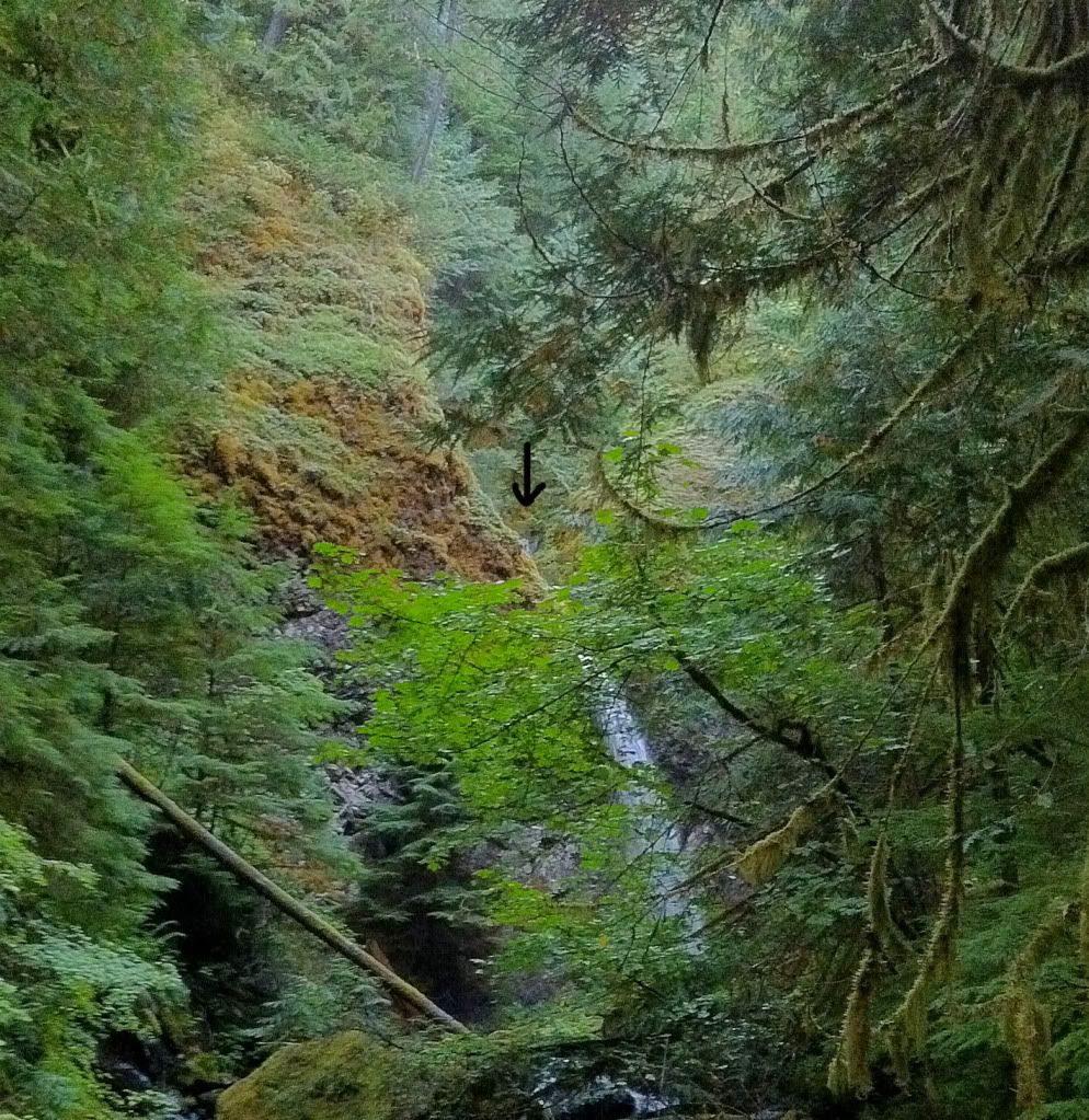
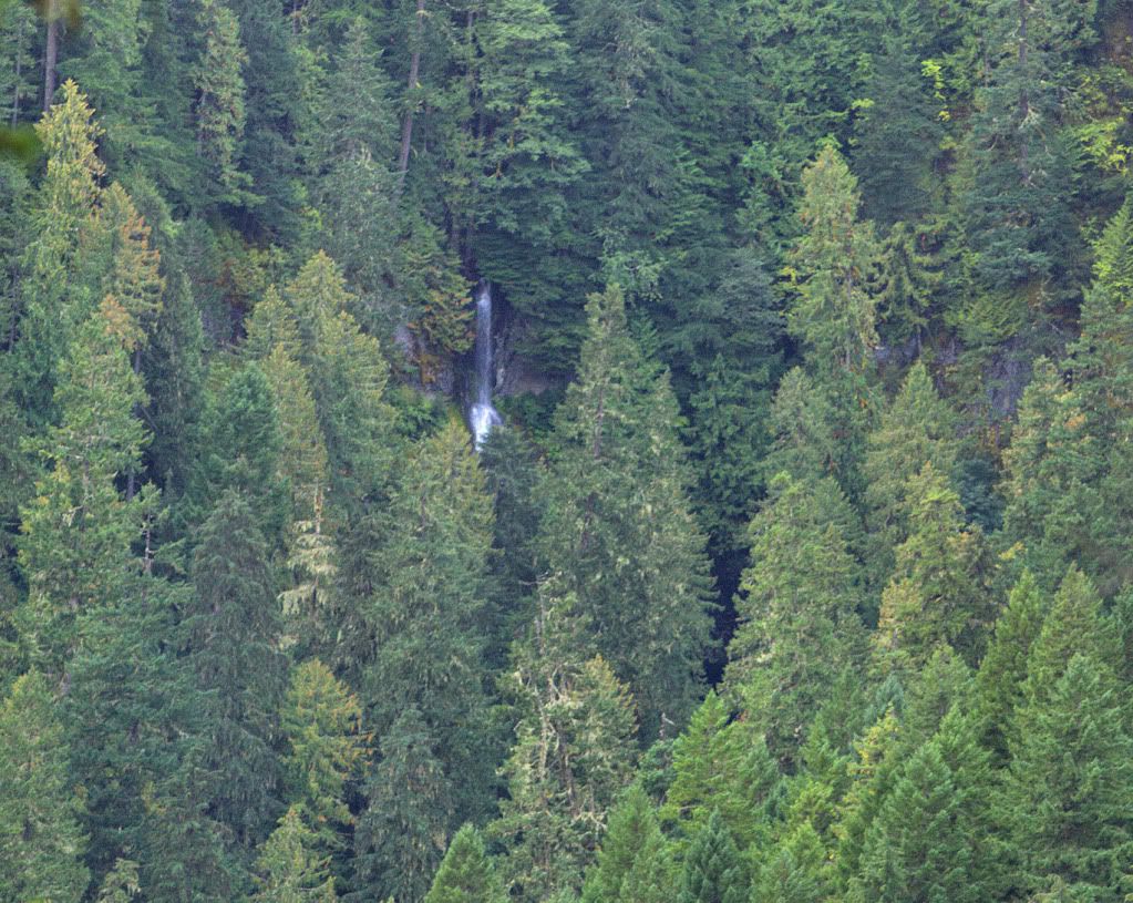
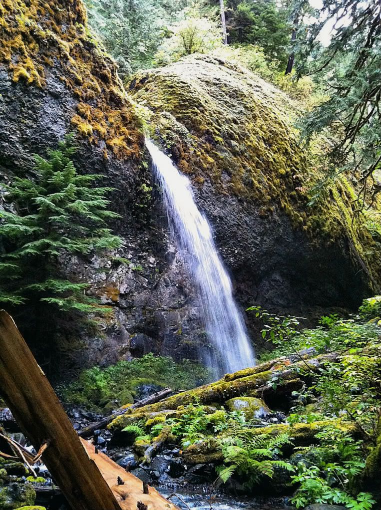
Whale Creek Falls
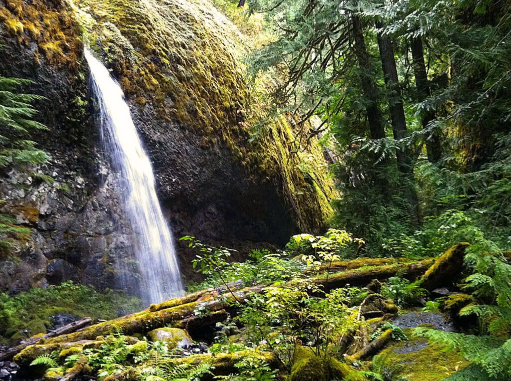
Just above it is a nice channel in the basalt
My friend for scale
First attempt at a cell phone video in 720P
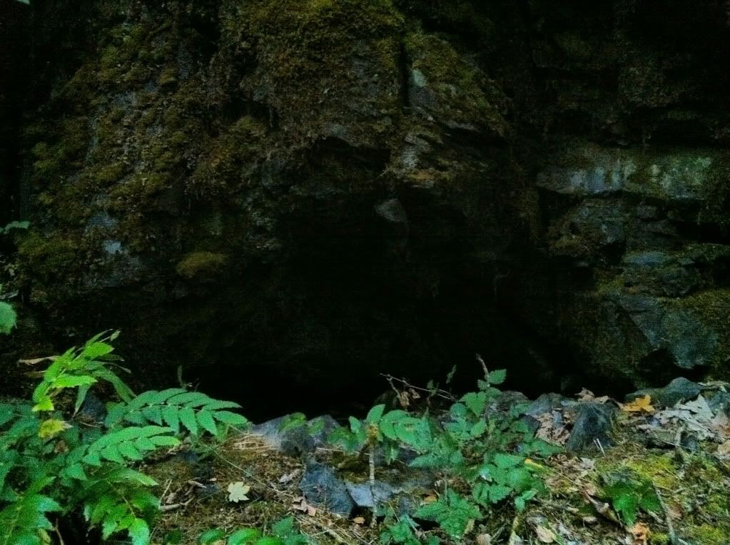
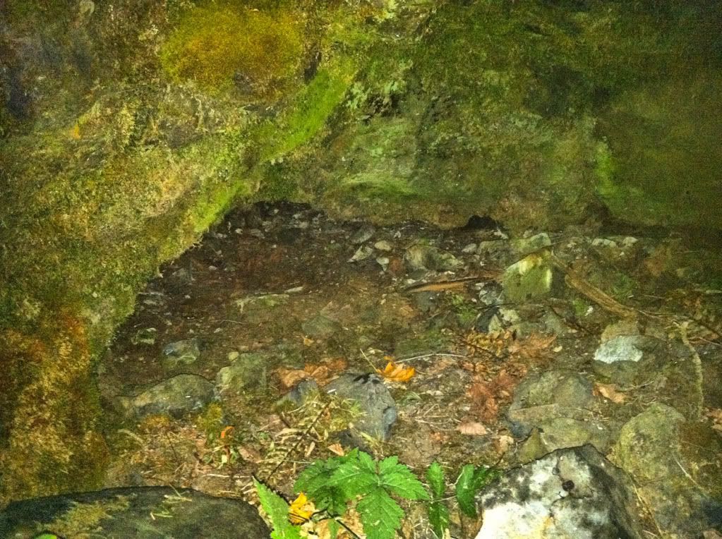
After that, we headed down. We decided to sidehill on the west side, at the bottom of the headwall, to avoid that creekbed. It ended up working out well that way. Along the bottom of the cliff, there were two caves. The deepest was 10-12 feet deep, and almost tall enough to stand in.
Right at dark we made it back to the trailhead and the truck.
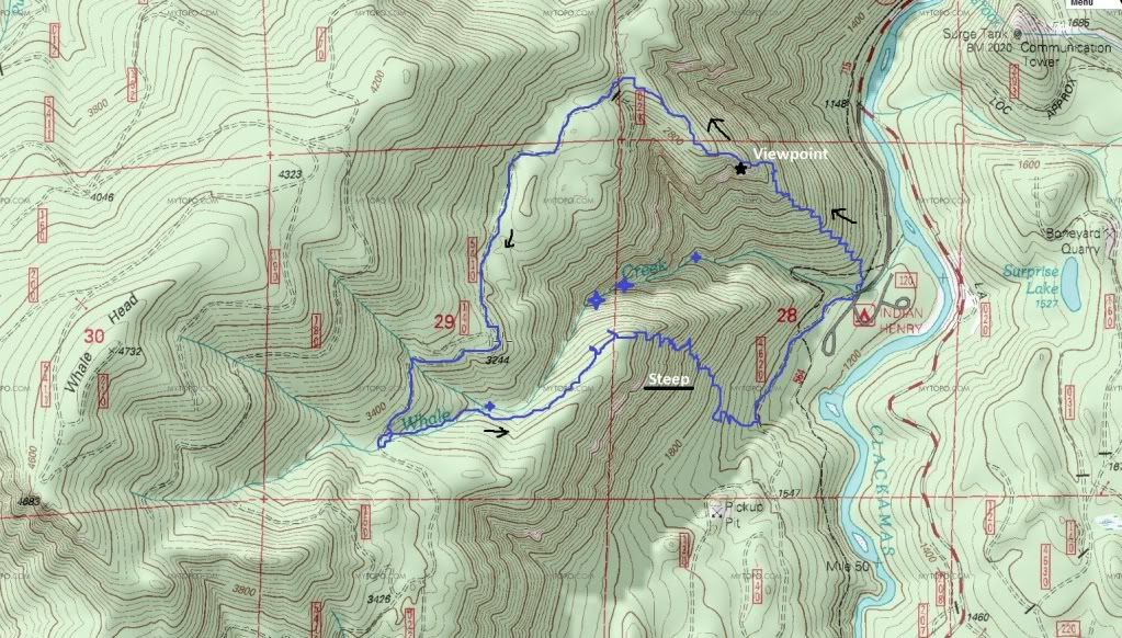
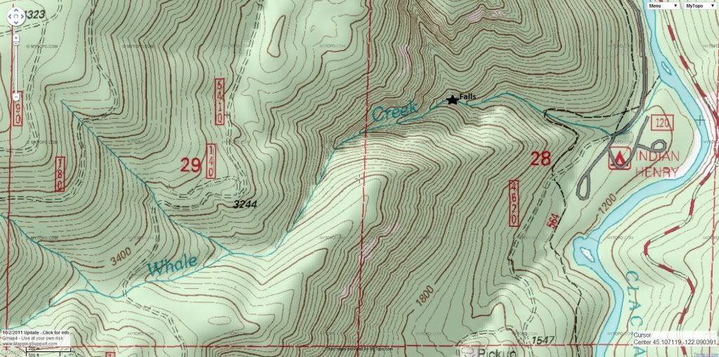
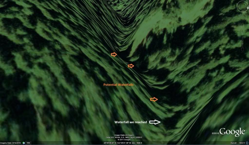
Here's some maps of Whale Creek. It looks like there's more falls upstream of the one we found.
Thanks for looking
.
When I went to pack my DSLR, I found that I had left it turned on by the computer, and the battery was dead, doh! So, it was gonna have to be an iPhone kind of day. Never-the-less it ended up successful.
After finding the pull-over on FR4630 that's straight up the hill from the falls, we set out down the steep canyon. First we had to cross the Harriet Dam pipeline.
Climbing down the hill, there's a convenient game trail for part of it.
Now for the big surprise. When we reached the river, I spied what looked like a metal wheel poking just above the water. Upon further inspection, it appeared to have a body attached to an axle, with another wheel buried under the rocks. We decided to dig it up. This ended up being an hour-long undertaking, as it had been there for quite some time. Once we got it un-buried, it was all me and my friend could do to move it over onto a rock, it easily weighted over 200 lbs. Here it is, it has a crank and a cylinder like it used to be a motor of some kind. I assume it was from the dam construction upstream. Any ideas what this is??
After admiring the old relic, we headed downstream towards Barrier Falls. It was only about 800 feet away. Here's the view as we were approaching the brink.
Here's looking over the cliff into the large/deep pool below.
Here it is, Barrier Falls
My friend for scale:
Last one
The falls were a beauty, with the autumn leaves and deep green water, a very peaceful sight. I could've stayed there all day, it was hard to leave.
But, there was still stuff on the agenda, so I took one last shot downriver before heading up the near-vertical slope back to the truck.
Whale Creek
Whale Creek has been a facination of mine for a couple years. It looks too good on the topo to not have a waterfall or two of some sort along its path. The upper trailhead of the Clackamas River Trail is right next to Whale Creek, in fact the parking area is at the mouth of the steep canyon, which worked out perfect.
The hike begins on a user trail that is very beat in starting right from the parking lot, can't miss it. We hiked up this trail for a good 20 minutes before it began to fade. Then the real adventure began. The canyon narrows with cliffs on both sides, and there's a legendary amount of old growth trees laying on each other on the narrow canyon floor. Very slow going.
Here's the west-side headwall that towers over the creek.
After almost an hour of trudging up the creek, we came to a 40-foot cascade. We almost bailed at this point cause the creek was getting nearly impassibly steep and wooded.
This is the top 10 feet of the cascade, right behind me is a very big drop off with water cascading down over boulders.
My friend decided to peek around the corner, and got a glimpse of a waterfall. As we got closer, it was clear it was a nice one. It looked about 60-ft tall, with a 10+ ft tier tucked above.
The approach, I put an arrow on the upper tier.
Whale Creek Falls
Just above it is a nice channel in the basalt
My friend for scale
First attempt at a cell phone video in 720P
After that, we headed down. We decided to sidehill on the west side, at the bottom of the headwall, to avoid that creekbed. It ended up working out well that way. Along the bottom of the cliff, there were two caves. The deepest was 10-12 feet deep, and almost tall enough to stand in.
Right at dark we made it back to the trailhead and the truck.
Here's some maps of Whale Creek. It looks like there's more falls upstream of the one we found.
Thanks for looking
.