
Some of the older maps show trails in the Goat Rocks and Mount Adams that don't show up on maps anymore. There used to be an alternate route on the PCT rather than going over Cispus Pass, there are two old sections of the PCT on Mount Adams' west flank, and there seems to have been official trails to Lake Corral and Gertrude Lake in the Goat Rocks. Their tread still shows up in Google's satellite imagery but they don't show up on maps anymore.
http://gpsfly.org/g/5156
EDIT:
Here is an updated gpx file. I accidentally left out the Dry Creek Trail in the Bird Creek Meadows area.
 All Mount Adams Trails GPS File-23008.gpx
- (292.81 KiB) Downloaded 232 times
Here is a screenshot of all the trails on Mount Adams, including abandoned, unofficial, and "lost" trails.
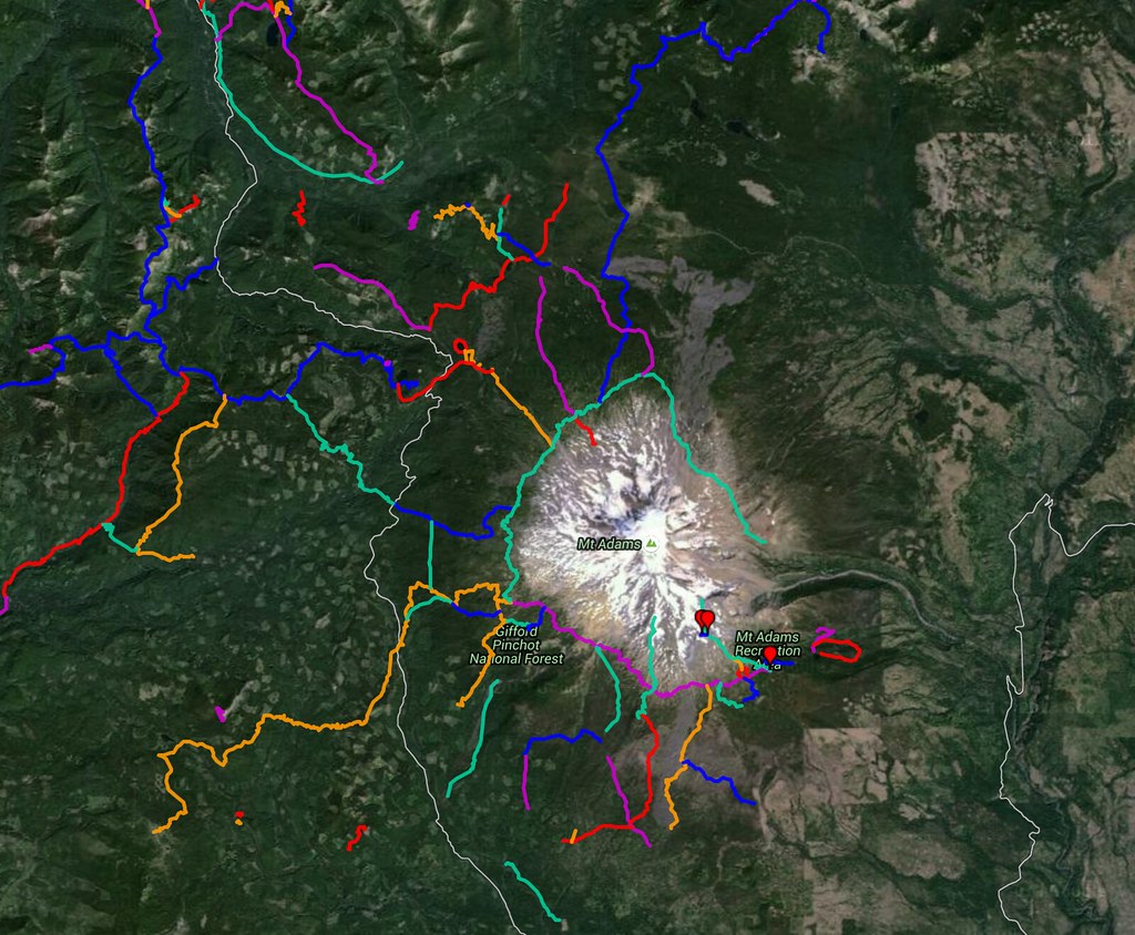
All of Mount Adams' Trails, both official and abandoned or "lost"
Here are two treads of the PCT that are clearly visible on Google Maps' satellite imagery.
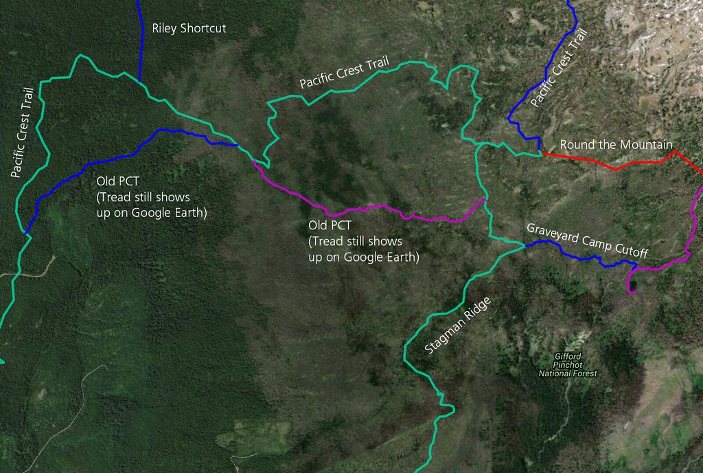
Old Pacific Crest on Mt Adams
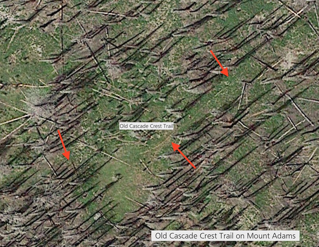
Old Cascade Crest Trail on Mt. Adams
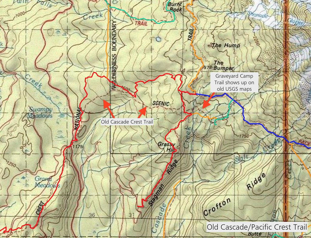
Old Cascade Crest Trail and Graveyard Camp Trail on Mt. Adams
Are any of these old Cascade Crest Trails still traversable? Has anyone hiked them? They would make for some good loop hikes, I think; especially since loops on Mount Adams are a rarity.
The Takh Takh Meadows Shortcut Trail and the spur trail to the actual Takh Takh Meadows.
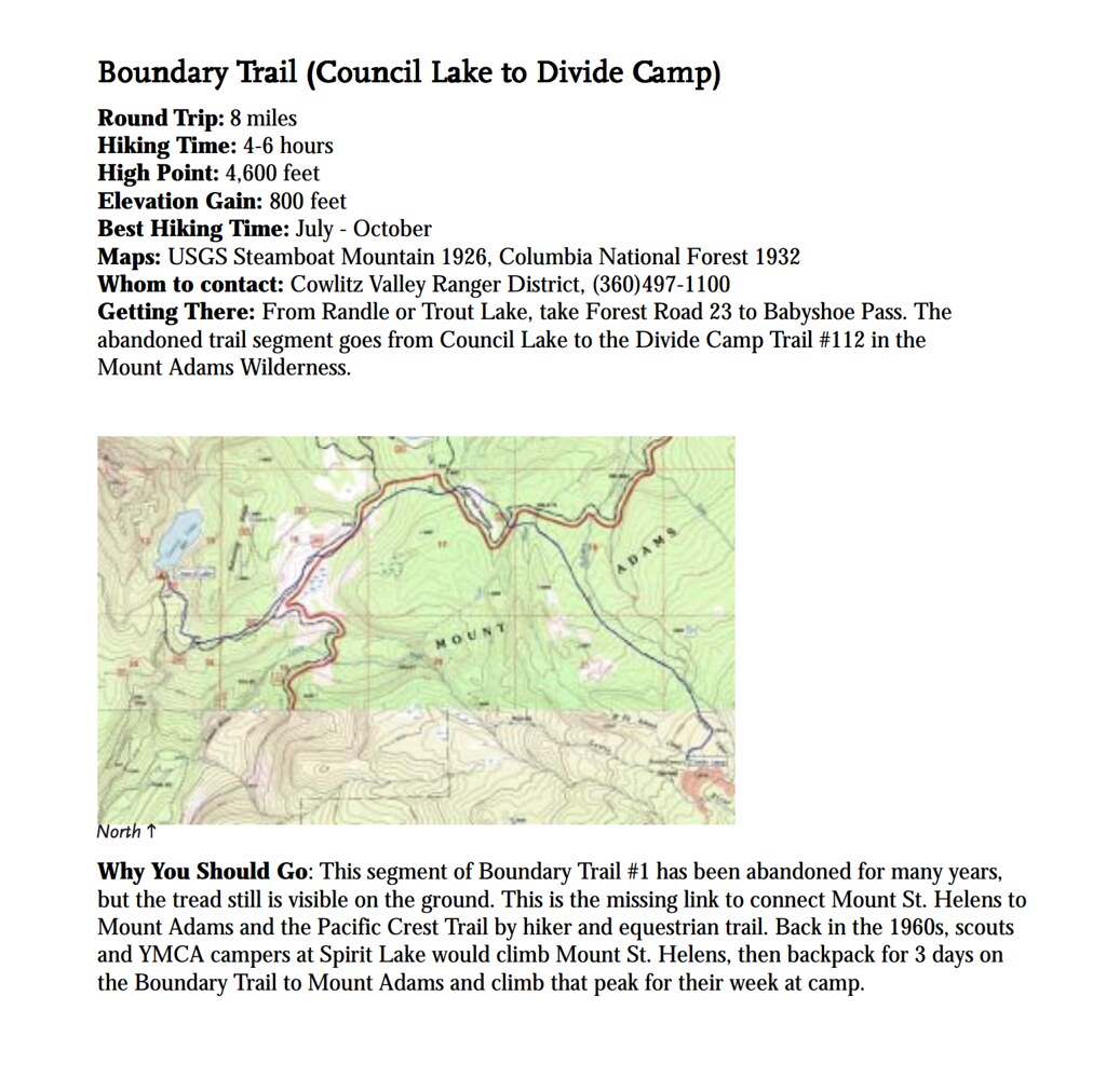
Also, there appears to be an old segment of the Boundary Trail that connected Council Lake to the Divide Camp Trail. I discovered this in one of WTA's annual PDF reports on "Lost Trails." (PDF link: https://www.wta.org/trail-news/publicat ... ls2003.pdf
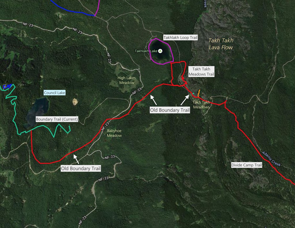
Old Boundary Trail on Mt. Adams
This is the lower segment of the Killen Creek Trail that is signed, but doesn't appear on any maps.
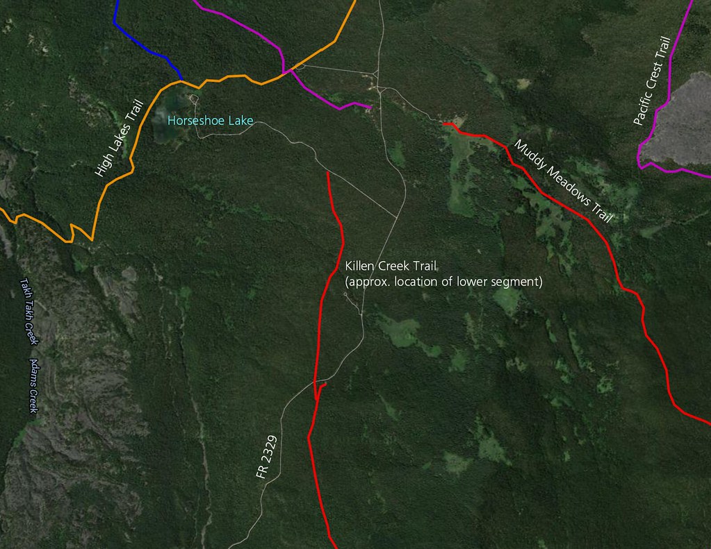
Lower Killen Creek Tr
Here is a trail referred to as Trail #14 on old USGS maps. After some close investigation on Google Maps, I could see evidence of the trail showing up in clearings between the trees or in burned areas. I think this is what's called the Morrison Creek Trail.
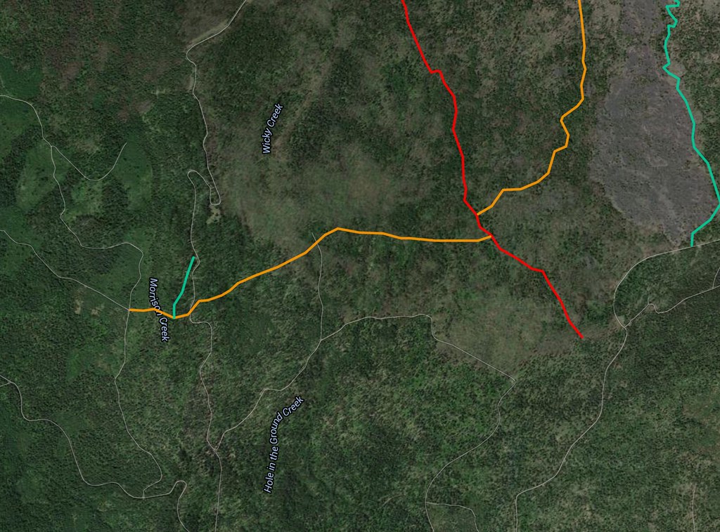
Trail #14 (Morrison Creek (?) Trail
The green trail on the lower right corner of the map is the North Cleaver climbing route. Its tread shows up on Google Maps, but I would suppose it is steep, slippery, and with scrambles.
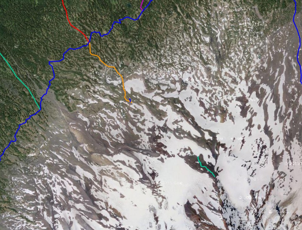
North Cleaver "Trail" Route

