Yellowjacket Viewpoint Hike
From Oregon Hikers Field Guide
- Start point: Oak Ridge Trailhead
- End point: Yellowjacket Viewpoint
- Hike Type: Out and Back
- Distance: 7.0 miles round trip
- Elevation gain: 2195 feet
- High point: 4,195 feet
- Difficulty: Moderate
- Seasons: Late spring into fall
- Family Friendly: Yes, for older kids
- Backpackable: No
- Crowded: No
|
|
Contents |
Hike Description
Most hikers use the 2.3 mile climb up the Oak Ridge Trail to reach Bald Butte and its wildflower meadows with expansive views. On this shorter hike, you'll turn south, instead of north, on the Surveyors Ridge Trail to a little-visited viewpoint above the Yellowjacket Creek drainage. While from here the only visible snow-capped peak is Mount Hood, you can see across the Hood River Valley to Mount Defiance, and the rocky viewpoint has a wildflower display all of its own. Obviously, you can also make the Yellowjacket Viewpoint an addition to the Bald Butte Hike, turning the excursion into 10.6 miles round-trip for the day.
The hike begins on Hood River County property and travels on Oak Ridge Trail #688A through a former clearcut with young ponderosa pines, oaks and shrubs, such as serviceberry and flowering currant. Cross a road and switchback up three times in woods, make a traverse and switchback again. There’s another switchback at a meadow and then four more switchbacks in oak-fringed meadows. The trail enters Douglas-fir, ponderosa pine, and oak woodland. Keep rising, and enter an open area with a view of Mount Hood. Balsamroot and Columbia desert parsley bloom here in the spring. There are several short switchbacks as you continue up the slope and enter mixed forest again. Pass a wooden gate and a fence line, and then switchback five more times into an open area with another full-on view of Mount Hood. Traverse up and switchback three more times in a forest of Douglas-fir, grand fir, and ponderosa pine with a carpet of Oregon grape. You will see the gray-green clumps of mistletoe on some of the branches. The trail crosses the 640 spur road, and reaches the Surveyors Ridge-Oak Ridge Trail Junction.
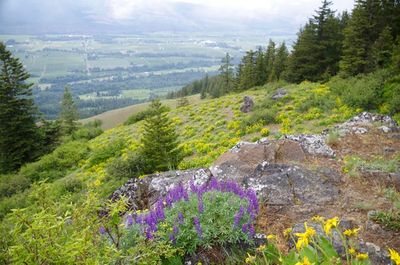
Make a right here: it's only 1.2 miles to the Yellowjacket Viewpoint. The trail slowly rises in Douglas-fir, grand fir, and silver fir woods. In mid-spring, trilliums and toothwort begin to bloom along the path. These woods are dry, with quite a few diseased trees and lots of blowdown. The trail keeps winding up gradually and reaches an unsigned junction under a canopy of tall Douglas-firs (The small sign that used to be here has fallen down). Go right, and walk out to the Yellowjacket Viewpoint. Here rest awhile above an andesite palisade with meadows tumbling below you. At the beginning of May, spring beauty, kittentails, Columbia desert parsley and glacier lilies will be blooming. Later in the month, balsamroot will carpet the slope. Mount Hood dominates the skyline to the southwest, and the Hood River Valley spreads below you.
Maps
- Maps: Hike Finder
- Oak Ridge Trail #688A (USFS)
- Surveyor's Ridge Trail #688 (USFS)
- Green Trails Maps: Hood River, OR #430
- Adventure Maps: Mt. Hood Area
- Adventure Maps: Hood River, Oregon, Trail Map
- Adventure Maps: 44 Trails Area plus the best of the G.P.N.F.
- Geo-Graphics: Mount Hood Wilderness Map
- U.S. Department of Agriculture, Forest Service: Mt. Hood National Forest
- Discover Your Northwest: Mt. Hood National Forest North: Trail Map & Hiking Guide
- U.S. Department of Agriculture, Forest Service: Hood River Ranger District
- National Geographic Trails Illustrated Map: Mount Hood
Regulations or Restrictions, etc.
- Share Surveyors Ridge Trail with mountain bikers
Trip Reports
- Search Trip Reports for Yellowjacket Viewpoint Hike
Related Discussions / Q&A
- Search Trail Q&A for Yellowjacket Viewpoint Hike
Guidebooks that cover this hike
- Off the Beaten Trail by Matt Reeder
More Links
Contributors
- bobcat (creator)


